

Portillo Storm Snowfall Total Passes 5m / 17 Feet
A snow storm that has now continued for nine days has taken Chilean ski resort Portillo to a snowfall total of 5.2 metres (17 feet) so far, with more snow forecast.

Next 3 days weather summary:Light rain (total 5.0mm), mostly falling on Tue night. Warm (max 21°C on Thu afternoon, min 13°C on Tue night). Wind will be generally light. | Days 4-6 weather summary:Moderate rain (total 13.0mm), heaviest on Fri night. Warm (max 21°C on Fri afternoon, min 14°C on Fri night). Wind will be generally light. | ||||||||||||||||
Tue 28 | Wednesday 29 | Thursday 30 | Friday 31 | Saturday 1 | Sunday 2 | ||||||||||||
PM | night | AM | PM | night | AM | PM | night | AM | PM | night | AM | PM | night | AM | PM | night | |
clear | rain shwrs | clear | clear | clear | clear | clear | some clouds | clear | t-storm risk | mod. rain | rain shwrs | some clouds | rain shwrs | some clouds | clear | rain shwrs | |
km/h | |||||||||||||||||
Snow map |  |  |  |  |  |  | |||||||||||
— | — | — | — | — | — | — | — | — | — | — | — | — | — | — | — | — | |
mm | — | 5 | — | — | — | — | — | — | — | 1 | 6 | 1 | — | 3 | — | — | 2 |
max °C | 18 | 16 | 16 | 18 | 17 | 19 | 21 | 20 | 19 | 21 | 15 | 17 | 19 | 18 | 18 | 20 | 17 |
min °C | 18 | 13 | 14 | 18 | 15 | 16 | 20 | 16 | 17 | 19 | 14 | 14 | 19 | 14 | 16 | 19 | 15 |
chill °C | 18 | 13 | 14 | 18 | 15 | 16 | 20 | 16 | 17 | 19 | 14 | 14 | 19 | 14 | 16 | 19 | 15 |
Humid % | 58 | 80 | 61 | 41 | 33 | 29 | 27 | 48 | 36 | 44 | 62 | 47 | 43 | 54 | 42 | 46 | 51 |
Freeze m | 4750 | 4500 | 4450 | 4700 | 4750 | 4700 | 4850 | 4800 | 4750 | 4800 | 4650 | 4550 | 4700 | 4700 | 4750 | 4900 | 4700 |
— | — | 6:13 | — | — | 6:13 | — | — | 6:15 | — | — | 6:16 | — | — | 6:16 | — | — | |
— | 9:06 | — | — | 9:05 | — | — | 9:04 | — | — | 9:02 | — | — | 9:00 | — | — | 9:00 | |
Go pro and carve into:
Avalanche information: European Avalanche Warning Services (EAWS)
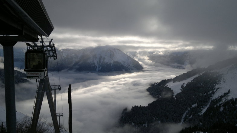
Latest snow reports near Champagny:
No information received. Another glorious day. from La Giettaz en Aravis
| Top snow depth: | — |
|---|---|
| Bottom snow depth: | — |
| Fresh snowfall depth: | — |
| Last snowfall: | 4 Jun 2026 |
| Snow Alerts | Create Alert |
0.0 | Bluebird Powder days Fresh snow, mostly sunny, light wind. |
|---|---|
0.0 | Powder days Fresh snow, limited sun, any wind. |
0.0 | Bluebird days Average snow, mostly sunny, light wind. |

The above table gives the weather forecast for Champagny at the specific elevation of 2286 m. Our sophisticated weather models allow us to provide snow forecasts for the top, middle and bottom ski stations of Champagny. To access the weather forecasts for the other elevations, use the tab navigation above the table. For a wider view of the weather, check out the Weather Map of France.
Click here to read further information on freezing levels and how we forecast our temperatures.
Overall 4.1 Based on 10 votes and 5 reviews
My 72 year old wife and I went skiing again this January, 2025, after a 20 year hiatus. We chose Champagny en Vanoise, staying at Club Alpina, as our starting point for the first week and then went to Les Deux Alps for the second week. What a difference! Champagny was relatively quiet and delightful whereas Les Deux Alps was crowded and rowdy with pushy snowboarders rushing past as if they owned the slopes. So, therefore we're going back to Champagny this coming January, 2026, and now staying both weeks there. We're looking forward to it very much. Just loved the place. Hope it hasn't changed.
Hjalmar from United Kingdom writes:
My 72 year old wife and I went skiing again this January, 2025, after a 20 year hiatus. We chose Champagny en Vanoise, staying at Club Alpina, as our starting point for the first week and then went to Les Deux Alps for the second week. What a difference! Champagny was relatively quiet and delightful whereas Les Deux Alps was crowded and rowdy with pushy snowboarders rushing past as if they owned the slopes.
So, therefore we're going back to Champagny this coming January, 2026, and now staying both weeks there. We're looking forward to it very much. Just loved the place. Hope it hasn't changed.


 Nearest