I really enjoyed Champagny. I visited in 2009 1st week in April!. Plenty of snow above 2000m and amazing sunshine, spent most of the days over at La Plagne, did buy a week pass to Les Arcs to (Paradiski domain). However, only managed to go over there once or twice and so unless your in a fast group I'd recommend the Paradiski discovery which is cheaper but allows one day over the other side of the valley... there is so much in La Plagne and Champagny that one day in Les Arcs is more than enough! It was reasonable on the slopes despite being a school holiday (Les Arcs seemed rammed) and at the end of the day you ski back on the Champagny side in the setting sun which is amazing and visibility is that little bit better than the shadow side. So far it's the most enjoyable skiing I've done (over Tignes, Contamines, Val d'Isere etc).
Depending on your ability I wouldn't pay too much attention to the colour grading... especially the reds and blues.
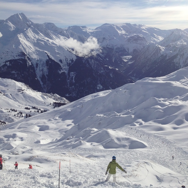
One amazing red from the glacier is super narrow (about 7 foot wide with a drop next to it) but not steep and has few corners... then opens out into an amazing piste through a valley for miles and miles... at the bottom you cant go anywhere other than back up and down a different way but many of our group missed out on this run because of its skill requirement and opening stage however it was easy and amazing to play on.
Some blues are very wide but steep in places (as much or more so than the reds) where as many reds are very wide and easy to ski with a short steep section or two... all in all its well suited to a group of intermediate skiers with some blacks thrown in for those seeking more skill or thrills.
The skate park is great and has a beginner section so you can learn and an airbag for pushing the learning limit in a safer way before you try a move on the slope. There is also a huge half pipe down to Plagne Central and a party on new years eve called "La nuit de la Pom Pom Rouge" (you can see this on youtube) which is set to rival Tignes own "fire mix party!".
In the evening there is a great choice of places to eat in the village and in the surrounding villages (for those with cars) and a shuttle bus service to move you between. On the La Plagne side there is an ice climbing tower and also the bob sled run where you can be a passenger in a 5 man box or on a caged one man luge which is amazing!
Accommodation is very affordable (I stayed previously in Les Aplages de Champagny which is one of the best large scale chalets around with spa and pool area and underground parking plus free taxi shuttle to the lifts and back every 15 minutes. This time I'm in a smaller apartment on the top level which is 3 bedroom for Christmas and new years at £900 self catering! Again Club Alpina comes highly recommended with some of our group staying there also.
When flying to the Alps, Grenoble is close by. Lyon and Geneva are equal distance and time to Champagny although Lyon is no where near as busy, flights are sometimes half and car hire is also cheaper. One thing to note: if your flying in or out on the general change over days always assume traffic will be bad from Grenoble to Albertville or Geneva to Albertville, shortly after it splits in different ways and then speeds up. Make sure you allow plenty of time to get back to the airport when leaving!
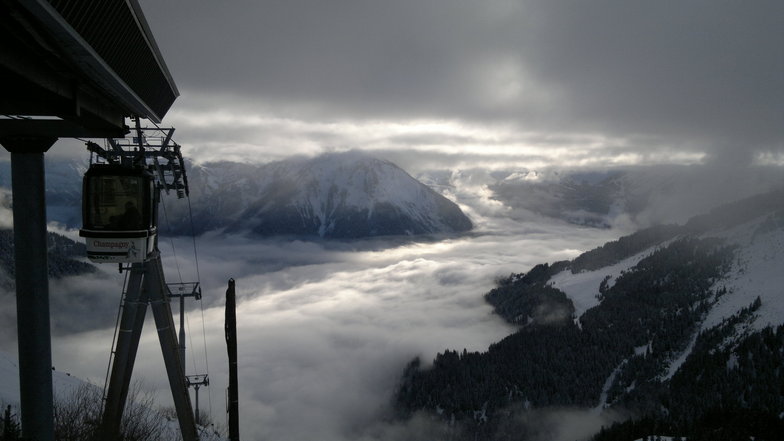
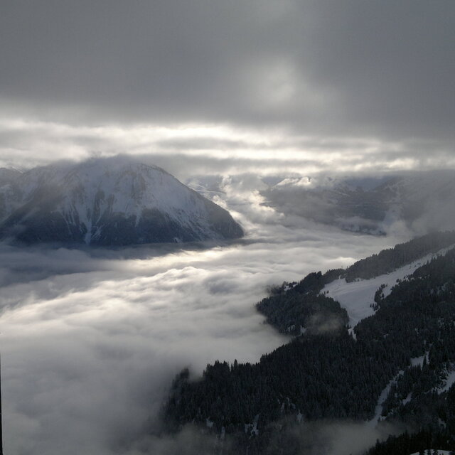
The best thing about Champagny is that although the Village is at 1200m the pistes mainly run from 2000-3400 inc la Plagne so snow is often a safe bet. down from the 2000m mark there are 2 (or possibly 3) roads down which you can ski although they get very slushy at the end of the season but most people take the bubble down anyway after leaving the kit in lockers.
Apres-ski is lively as the few bars are located at the bottom of the lifts and accommodate the whole village in a small area. La Plagne is 1:15 away by car if you want to head over there, you can also get to Tignes Le Lac in 1:30 by car!
A really great place to stay where you are able to benefit from anything you want to do. If partying is top of your list, stay in La Plagne, if your like me and want to ski first, party second, eat third, relax and sleep last then Champagny and it's relaxed village environment is perfect for you.


 Nearest