The above table gives the weather forecast for Brides Les Bains at the specific elevation of 2950 m. Our sophisticated weather models allow us to provide snow forecasts for the top, middle and bottom ski stations of Brides Les Bains. To access the weather forecasts for the other elevations, use the tab navigation above the table. For a wider view of the weather, check out the Weather Map of France.
Click here to read further information on freezing levels and how we forecast our temperatures.
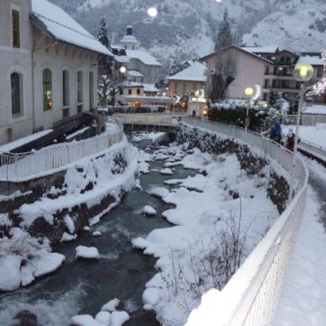
I have just come back from Brides Les Bains with Directski, a very good company which offered a remarkably good deal for a week's skiing. I agree with the reviewers who say it is a cheap way to experience the Three Valleys ski area.
We had a self-catering apartment but ate out a few times in the town. There was not a lot of choice in restaurants but the best for a bit of buzz, friendly staff and half-decent food at a reasonable price is La Petite Auberge.
We were VERY disappointed with our set menu dinner in Les Cerisiers, which you will pass as you walk down to the village from the lift station. The bar next door is comfortable and welcoming and you can sit out on the terrace and have a drink apres-ski but I would warn people about eating in the restaurant. We complained to the manager and although he apologised, the meal was so poor, we deserved a refund.
Free Snow-Forecast.com weather widget for your website
Embed the Brides Les Bains weather widget on your site for free. It provides a weekly snapshot of snow and rain conditions across all elevations. Follow the two quick steps to grab your custom code and paste it into your site. Choose between metric or imperial units. Click here to get the code.


 Nearest