


A New Largest Ski Area in New Zealand?
The Remarkables is hoping to overtake Cardrona as New Zealand’s largest ski area under a major NZD 150 million‑plus expansion proposal lodged by owner NZSki.

Next 4 days weather summary:Heavy rain (total 44.0mm), heaviest during Fri night. Warm (max 23°C on Sat afternoon, min 13°C on Fri night). Wind will be generally light. | Days 5-7 weather summary:Heavy rain (total 35.0mm), heaviest during Sat night. Warm (max 22°C on Sun afternoon, min 15°C on Sun night). Wind will be generally light. | |||||||||||||||
Thursday 25 | Friday 26 | Saturday 27 | Sunday 28 | Monday 29 | ||||||||||||
night | AM | PM | night | AM | PM | night | AM | PM | night | AM | PM | night | AM | PM | night | |
rain shwrs | clear | t-storm risk | t-storm risk | rain shwrs | t-storm risk | rain shwrs | clear | t-storm risk | rain shwrs | t-storm risk | t-storm risk | t-storm risk | t-storm risk | t-storm risk | rain shwrs | |
km/h | ||||||||||||||||
Snow map |  |  |  |  |  |  | ||||||||||
— | — | — | — | — | — | — | — | — | — | — | — | — | — | — | — | |
mm | 7 | — | 1 | 11 | 1 | 4 | 17 | — | 3 | 12 | 1 | 3 | 11 | 2 | 3 | 2 |
max °C | 16 | 20 | 22 | 20 | 20 | 22 | 17 | 21 | 23 | 17 | 20 | 22 | 18 | 19 | 20 | 18 |
min °C | 15 | 17 | 21 | 15 | 17 | 20 | 13 | 18 | 22 | 16 | 18 | 22 | 15 | 16 | 20 | 15 |
chill °C | 14 | 17 | 21 | 15 | 17 | 20 | 12 | 18 | 22 | 16 | 18 | 22 | 15 | 16 | 20 | 15 |
Humid % | 66 | 48 | 52 | 71 | 56 | 65 | 58 | 45 | 51 | 63 | 55 | 50 | 71 | 59 | 54 | 72 |
Freeze m | 4500 | 4400 | 4450 | 4400 | 4500 | 4500 | 4600 | 4550 | 4700 | 4700 | 4450 | 4550 | 4450 | 4400 | 4350 | 4300 |
— | 5:46 | — | — | 5:46 | — | — | 5:46 | — | — | 5:47 | — | — | 5:47 | — | — | |
— | — | — | 9:25 | — | — | 9:25 | — | — | 9:25 | — | — | 9:25 | — | — | 9:25 | |
Go pro and carve into:
Avalanche information: European Avalanche Warning Services (EAWS)
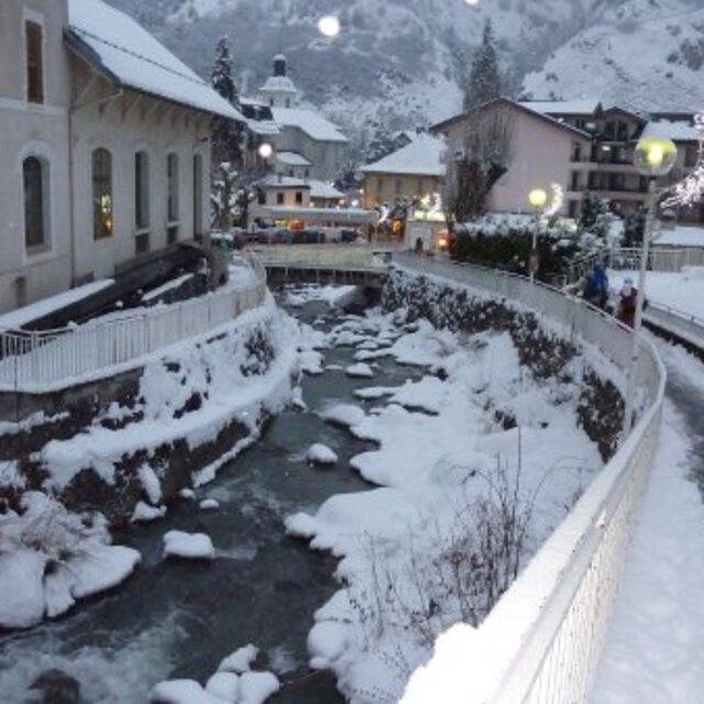
Latest snow reports near Brides Les Bains:
| Top snow depth: | — |
|---|---|
| Bottom snow depth: | — |
| Fresh snowfall depth: | — |
| Last snowfall: | 16 May 2026 |
| Snow Alerts | Create Alert |
0.0 | Bluebird Powder days Fresh snow, mostly sunny, light wind. |
|---|---|
0.0 | Powder days Fresh snow, limited sun, any wind. |
0.0 | Bluebird days Average snow, mostly sunny, light wind. |
The above table gives the weather forecast for Brides Les Bains at the specific elevation of 1775 m. Our sophisticated weather models allow us to provide snow forecasts for the top, middle and bottom ski stations of Brides Les Bains. To access the weather forecasts for the other elevations, use the tab navigation above the table. For a wider view of the weather, check out the Weather Map of France.
Click here to read further information on freezing levels and how we forecast our temperatures.
Overall 3.9 Based on 3 votes and 17 reviews
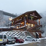
Just returned from a week's snowboarding over Christmas; booked with Direct Ski. Firstly, would definitely recommend them as a company. Excellent reps who went above and beyond to help (my luggage was lost by the airline, our rep, Lucy, sorted it all out for me, translated the French paperwork, contacted the airport and arranged for it to be couriered, providing regular updates by text & visiting our apartment with info and advice on buying essentials and contacting our insurance company. My luggage eventually arrived 4 days late but thanks to her excellent service it didn't put a downer on the holiday at all (she even lent me her own phone charger for the week so I could charge my phone and have it on the hill). We stayed at Lagrange Residence Cybeles and it was a lovely apartment. When you only pay £350 for a week at Xmas (before lift pass) you could be forgiven for thinking you were going to be staying in a bit of a dump; not at all. The studio we stayed in was the perfect size for 2 people, was very warm and cosy and had everything we needed. I have seen a few reviews that have been negative regarding its location as you need to get the gondola up into Meribel to ski. For us it wasn't a problem at all. It's a 10min walk to the gondola, we never used the bus once although there is a free shuttle for those who maybe have kids or don't want to walk in ski boots. The gondola opened at 8.30am but most days they let you on early if you were there and we didn't queue once in the 6 days we were on the slopes. Yes, it takes 25 mins but it's a nice ride up and the main lifts in Meribel didn't open till 9am anyway so if you're one of these people who wants to be first on the slopes, staying in Brides doesn't impact on your ski time at all as actually, the timing works out perfectly. Brides, itself, doesn't have a massive amount of shops etc (bit of a struggle when you have no luggage but then Meribel doesn't either (and what it does have is extremely expensive anyway). We ate several times at the restaurant opposite the apartments; lovely staff, very nice food although not a huge choice and reasonably priced; burger & chips for 10euro. The apartments do have a pool and jacuzzi although we didn't actually use them; we attempted to once but with 6 adults already in the jacuzzi and a group of kids playing with a ball in the pool we walked straight back out again. The changing area was a bit dirty if I'm honest but many apartment blocks don't have those facilities so if you time it right you should be fine. As you need to take your shoes off at the door and place them in pigeon holes you can actually tell whether it's worth going to get changed by counting the pairs of shoes already there as that will tell you how many people are in! We had a Xmas dinner at Hotel Verseau (top end of town) organised by Direct Ski. English run hotel, very nice traditional English Xmas dinner. We also ate once at a restaurant along the Main Street (can't remember its name but It has a pub attached to it and the sign outside actually says restaurant in vertical and pub in horizontal) - steak and chips for 14euro, again would recommend. All in all, our stay in Brides was great. Yes, it would have been handier to be in Meribel but it also would have been a lot more expensive and probably a lot nosier/busier. It's a great accommodation option if you don't want to pay over the odds for your holiday, prefer somewhere a bit quieter and don't mind being a little bit out the way. The staff were very friendly and helpful, reception isn't open all day every day but we never found that an issue. So far they haven't rung me to say I need to pay the cleaning charge so that's a bonus as I'd read about people saying they had been charged even though they felt they had cleaned it well enough. All in all, a great holiday; visited all of the 3 valley resorts and never felt like we missed out on anything because we weren't on the doorstep of Meribel.
Kat from United Kingdom writes:
Just returned from a week's snowboarding over Christmas; booked with Direct Ski. Firstly, would definitely recommend them as a company. Excellent reps who went above and beyond to help (my luggage was lost by the airline, our rep, Lucy, sorted it all out for me, translated the French paperwork, contacted the airport and arranged for it to be couriered, providing regular updates by text & visiting our apartment with info and advice on buying essentials and contacting our insurance company. My luggage eventually arrived 4 days late but thanks to her excellent service it didn't put a downer on the holiday at all (she even lent me her own phone charger for the week so I could charge my phone and have it on the hill).
We stayed at Lagrange Residence Cybeles and it was a lovely apartment. When you only pay £350 for a week at Xmas (before lift pass) you could be forgiven for thinking you were going to be staying in a bit of a dump; not at all. The studio we stayed in was the perfect size for 2 people, was very warm and cosy and had everything we needed. I have seen a few reviews that have been negative regarding its location as you need to get the gondola up into Meribel to ski. For us it wasn't a problem at all. It's a 10min walk to the gondola, we never used the bus once although there is a free shuttle for those who maybe have kids or don't want to walk in ski boots. The gondola opened at 8.30am but most days they let you on early if you were there and we didn't queue once in the 6 days we were on the slopes. Yes, it takes 25 mins but it's a nice ride up and the main lifts in Meribel didn't open till 9am anyway so if you're one of these people who wants to be first on the slopes, staying in Brides doesn't impact on your ski time at all as actually, the timing works out perfectly.
Brides, itself, doesn't have a massive amount of shops etc (bit of a struggle when you have no luggage but then Meribel doesn't either (and what it does have is extremely expensive anyway). We ate several times at the restaurant opposite the apartments; lovely staff, very nice food although not a huge choice and reasonably priced; burger & chips for 10euro.
The apartments do have a pool and jacuzzi although we didn't actually use them; we attempted to once but with 6 adults already in the jacuzzi and a group of kids playing with a ball in the pool we walked straight back out again. The changing area was a bit dirty if I'm honest but many apartment blocks don't have those facilities so if you time it right you should be fine. As you need to take your shoes off at the door and place them in pigeon holes you can actually tell whether it's worth going to get changed by counting the pairs of shoes already there as that will tell you how many people are in!
We had a Xmas dinner at Hotel Verseau (top end of town) organised by Direct Ski. English run hotel, very nice traditional English Xmas dinner. We also ate once at a restaurant along the Main Street (can't remember its name but It has a pub attached to it and the sign outside actually says restaurant in vertical and pub in horizontal) - steak and chips for 14euro, again would recommend.
All in all, our stay in Brides was great. Yes, it would have been handier to be in Meribel but it also would have been a lot more expensive and probably a lot nosier/busier.
It's a great accommodation option if you don't want to pay over the odds for your holiday, prefer somewhere a bit quieter and don't mind being a little bit out the way. The staff were very friendly and helpful, reception isn't open all day every day but we never found that an issue. So far they haven't rung me to say I need to pay the cleaning charge so that's a bonus as I'd read about people saying they had been charged even though they felt they had cleaned it well enough.
All in all, a great holiday; visited all of the 3 valley resorts and never felt like we missed out on anything because we weren't on the doorstep of Meribel.


 Nearest