

Banff Sunshine Village Opening for Summer Skiing
Banff Sunshine Village has confirmed it will reopen for a fortnight of summer skiing, from this weekend. The only ski area in Canada to be open into July.

Next 4 days weather summary:Heavy rain (total 20.0mm), heaviest during Sun night. Mild temperatures (max 7°C on Tue afternoon, min 4°C on Sun night). Winds increasing (calm on Mon afternoon, fresh winds from the S by Wed afternoon). | Days 5-7 weather summary:Heavy rain (total 20.0mm), heaviest during Thu morning. Mild temperatures (max 6°C on Wed night, min 3°C on Wed night). Winds decreasing (strong winds from the S on Thu afternoon, calm by Fri night). | |||||||||||||||
Monday 22 | Tuesday 23 | Wednesday 24 | Thursday 25 | Friday 26 | ||||||||||||
night | AM | PM | night | AM | PM | night | AM | PM | night | AM | PM | night | AM | PM | night | |
light rain | rain shwrs | light rain | cloudy | cloudy | cloudy | light rain | light rain | light rain | rain shwrs | rain shwrs | rain shwrs | mod. rain | light rain | light rain | cloudy | |
km/h | ||||||||||||||||
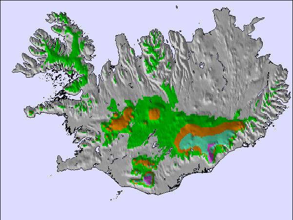
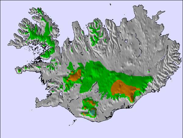
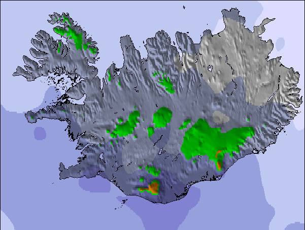
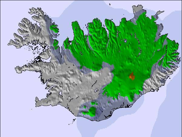
Snow map | 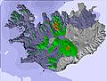 | 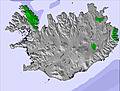 | 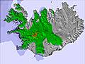 | 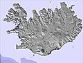 | 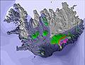 | 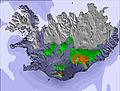 | ||||||||||
— | — | — | — | — | — | — | — | — | — | — | — | — | — | — | — | |
mm | 4 | 2 | 2 | — | — | — | 5 | 3 | 4 | 4 | 3 | 4 | 6 | 2 | 1 | — |
max °C | 5 | 5 | 5 | 5 | 6 | 7 | 6 | 6 | 6 | 6 | 4 | 4 | 3 | 4 | 4 | 5 |
min °C | 4 | 4 | 5 | 4 | 5 | 6 | 6 | 6 | 6 | 3 | 4 | 4 | 3 | 4 | 4 | 4 |
chill °C | 2 | 0 | 2 | 1 | 2 | 5 | 3 | 2 | 2 | -3 | -2 | -2 | -3 | -1 | 2 | 4 |
Humid % | 88 | 87 | 78 | 75 | 82 | 81 | 94 | 95 | 95 | 94 | 78 | 89 | 95 | 80 | 82 | 79 |
Freeze m | 1350 | 1250 | 1250 | 1350 | 1450 | 1650 | 1950 | 1600 | 1650 | 1350 | 1200 | 1200 | 1100 | 1150 | 1200 | 1250 |
— | 2:58 | — | — | 2:58 | — | — | 2:59 | — | — | 3:00 | — | — | 3:00 | — | — | |
— | — | — | 11:59 | — | — | 11:59 | — | — | 11:59 | — | — | 11:58 | — | — | 11:57 | |
Go pro and carve into:
Latest snow reports near Bláfjöll:
| Top snow depth: | — |
|---|---|
| Bottom snow depth: | — |
| Fresh snowfall depth: | — |
| Last snowfall: | 8 May 2026 |
| Snow Alerts | Create Alert |
0.0 | Bluebird Powder days Fresh snow, mostly sunny, light wind. |
|---|---|
0.0 | Powder days Fresh snow, limited sun, any wind. |
0.0 | Bluebird days Average snow, mostly sunny, light wind. |
The above table gives the weather forecast for Bláfjöll at the specific elevation of 700 m. Our sophisticated weather models allow us to provide snow forecasts for the top, middle and bottom ski stations of Bláfjöll. To access the weather forecasts for the other elevations, use the tab navigation above the table. For a wider view of the weather, check out the Weather Map of Iceland.
Click here to read further information on freezing levels and how we forecast our temperatures.
Resort name is also written as Blafjoll.
Overall 2.8 Based on 4 votes and 2 reviews
Great site, close to Reykjavik, staff are really helpful, never been skiing before, staff were great, full of advise and tips, small cafe, skiers and snowboarders, saw toddlers to older people, roads to site keep clear.
mary from United Kingdom writes:
Great site, close to Reykjavik, staff are really helpful, never been skiing before, staff were great, full of advise and tips, small cafe, skiers and snowboarders, saw toddlers to older people, roads to site keep clear.

 Nearest