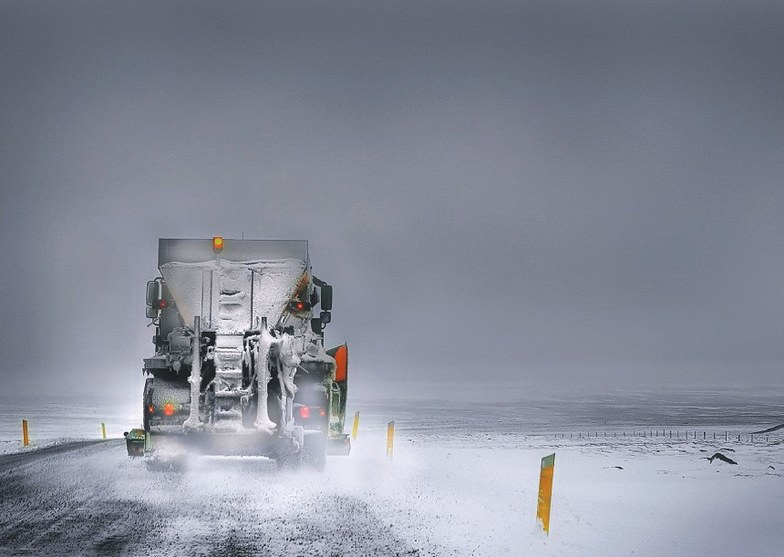


Portillo Storm Snowfall Total Passes 5m / 17 Feet
A snow storm that has now continued for nine days has taken Chilean ski resort Portillo to a snowfall total of 5.2 metres (17 feet) so far, with more snow forecast.

Next 3 days weather summary:Mostly dry. Very mild (max 12°C on Sun afternoon, min 6°C on Tue night). Wind will be generally light. | Days 4-6 weather summary:Light rain (total 2.0mm), mostly falling on Fri morning. Very mild (max 12°C on Wed afternoon, min 5°C on Thu night). Winds increasing (calm on Wed morning, fresh winds from the N by Thu night). | |||||||||||||||||
Sunday 26 | Monday 27 | Tuesday 28 | Wednesday 29 | Thursday 30 | Friday 31 | |||||||||||||
AM | PM | night | AM | PM | night | AM | PM | night | AM | PM | night | AM | PM | night | AM | PM | night | |
clear | clear | some clouds | clear | cloudy | cloudy | clear | some clouds | some clouds | some clouds | cloudy | some clouds | some clouds | cloudy | cloudy | light rain | cloudy | cloudy | |
km/h | ||||||||||||||||||
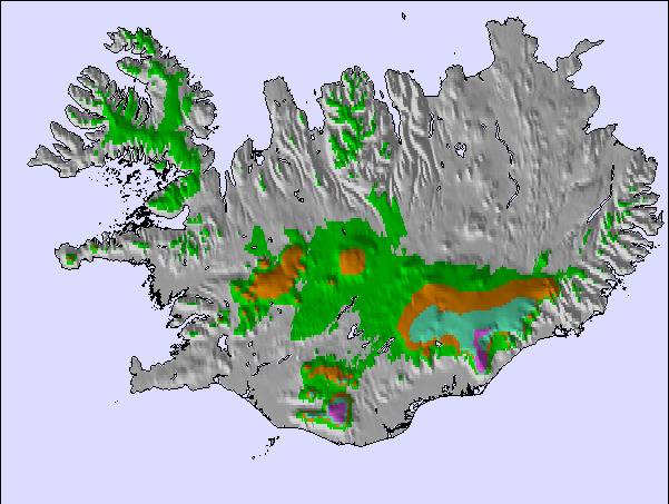
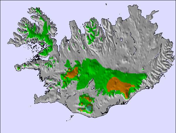
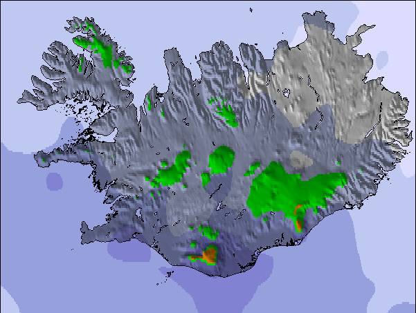
Snow map | 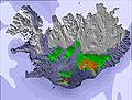 |  | 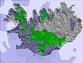 | 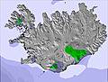 | 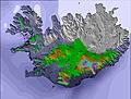 | 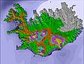 | ||||||||||||
— | — | — | — | — | — | — | — | — | — | — | — | — | — | — | — | — | — | |
mm | — | — | — | — | — | — | — | — | — | — | — | — | — | — | — | 2 | — | — |
max °C | 10 | 12 | 11 | 12 | 12 | 10 | 11 | 11 | 9 | 11 | 12 | 10 | 11 | 12 | 8 | 6 | 6 | 6 |
min °C | 8 | 12 | 7 | 10 | 11 | 7 | 10 | 11 | 6 | 9 | 11 | 7 | 9 | 11 | 5 | 5 | 6 | 5 |
chill °C | 6 | 12 | 7 | 9 | 10 | 4 | 9 | 9 | 5 | 9 | 10 | 6 | 7 | 8 | 1 | 1 | 2 | 1 |
Humid % | 53 | 52 | 61 | 50 | 56 | 71 | 50 | 50 | 71 | 59 | 60 | 69 | 46 | 53 | 72 | 87 | 80 | 79 |
Freeze m | 1900 | 1750 | 1900 | 1800 | 1800 | 1750 | 1750 | 1550 | 1750 | 2000 | 1850 | 2050 | 2100 | 1800 | 1650 | 1150 | 1600 | 1800 |
4:15 | — | — | 4:18 | — | — | 4:20 | — | — | 4:24 | — | — | 4:26 | — | — | 4:31 | — | — | |
— | — | 10:49 | — | — | 10:45 | — | — | 10:43 | — | — | 10:38 | — | — | 10:36 | — | — | 10:32 | |
Go pro and carve into:
Latest snow reports near Bláfjöll:
| Top snow depth: | — |
|---|---|
| Bottom snow depth: | — |
| Fresh snowfall depth: | — |
| Last snowfall: | 8 May 2026 |
| Snow Alerts | Create Alert |
0.0 | Bluebird Powder days Fresh snow, mostly sunny, light wind. |
|---|---|
0.0 | Powder days Fresh snow, limited sun, any wind. |
0.0 | Bluebird days Average snow, mostly sunny, light wind. |
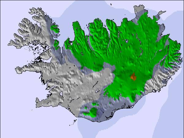
The above table gives the weather forecast for Bláfjöll at the specific elevation of 430 m. Our sophisticated weather models allow us to provide snow forecasts for the top, middle and bottom ski stations of Bláfjöll. To access the weather forecasts for the other elevations, use the tab navigation above the table. For a wider view of the weather, check out the Weather Map of Iceland.
Click here to read further information on freezing levels and how we forecast our temperatures.
Resort name is also written as Blafjoll.
Overall 2.8 Based on 4 votes and 2 reviews
Great site, close to Reykjavik, staff are really helpful, never been skiing before, staff were great, full of advise and tips, small cafe, skiers and snowboarders, saw toddlers to older people, roads to site keep clear.
mary from United Kingdom writes:
Great site, close to Reykjavik, staff are really helpful, never been skiing before, staff were great, full of advise and tips, small cafe, skiers and snowboarders, saw toddlers to older people, roads to site keep clear.

 Nearest