


Niseko Announce New Gondola
Niseko Village has confirmed a major lift expansion that will reshape access on the southern side of the Niseko United ski area, with a new gondola scheduled to open next winter and a second stage planned for 2027–28.

Next 4 days weather summary:Moderate rain (total 10.0mm), heaviest on Wed night. Very mild (max 13°C on Thu afternoon, min 8°C on Fri night). Wind will be generally light. | Days 5-7 weather summary:Heavy rain (total 30.0mm), heaviest during Mon afternoon. Very mild (max 16°C on Tue afternoon, min 9°C on Sun night). Winds increasing (light winds from the NW on Sat night, fresh winds from the WNW by Tue afternoon). | |||||||||||||||
Thursday 2 | Friday 3 | Saturday 4 | Sunday 5 | Monday 6 | ||||||||||||
night | AM | PM | night | AM | PM | night | AM | PM | night | AM | PM | night | AM | PM | night | |
light rain | clear | clear | some clouds | light rain | rain shwrs | rain shwrs | clear | clear | clear | some clouds | cloudy | mod. rain | mod. rain | mod. rain | rain shwrs | |
km/h | ||||||||||||||||
Snow map |  |  |  |  | 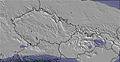 | 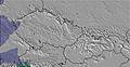 | ||||||||||
— | — | — | — | — | — | — | — | — | — | — | — | — | — | — | — | |
mm | 4 | — | — | — | 2 | 3 | 1 | — | — | — | — | — | 8 | 6 | 8 | 4 |
max °C | 9 | 11 | 13 | 12 | 9 | 9 | 10 | 10 | 12 | 11 | 12 | 14 | 13 | 9 | 10 | 11 |
min °C | 9 | 9 | 13 | 11 | 9 | 9 | 8 | 8 | 12 | 10 | 11 | 14 | 9 | 9 | 10 | 10 |
chill °C | 7 | 8 | 12 | 9 | 7 | 7 | 6 | 6 | 11 | 8 | 9 | 12 | 7 | 6 | 8 | 8 |
Humid % | 81 | 62 | 54 | 68 | 93 | 85 | 59 | 50 | 47 | 56 | 48 | 56 | 91 | 85 | 86 | 68 |
Freeze m | 3100 | 3400 | 3750 | 3500 | 3450 | 3500 | 3350 | 3300 | 3350 | 3350 | 3350 | 3400 | 3400 | 3150 | 3250 | 3350 |
— | 5:13 | — | — | 5:15 | — | — | 5:15 | — | — | 5:16 | — | — | 5:16 | — | — | |
— | — | — | 9:08 | — | — | 9:07 | — | — | 9:07 | — | — | 9:07 | — | — | 9:07 | |
Go pro and carve into:
Avalanche information: European Avalanche Warning Services (EAWS)
Latest snow reports near Berchtesgaden:
| Top snow depth: | 0 cm |
|---|---|
| Bottom snow depth: | 0 cm |
| Fresh snowfall depth: | — |
| Last snowfall: | 16 May 2026 |
| Snow Alerts | Create Alert |
0.0 | Bluebird Powder days Fresh snow, mostly sunny, light wind. |
|---|---|
0.0 | Powder days Fresh snow, limited sun, any wind. |
0.0 | Bluebird days Average snow, mostly sunny, light wind. |
The above table gives the weather forecast for Berchtesgaden at the specific elevation of 1800 m. Our sophisticated weather models allow us to provide snow forecasts for the top, middle and bottom ski stations of Berchtesgaden. To access the weather forecasts for the other elevations, use the tab navigation above the table. For a wider view of the weather, check out the Weather Map of Germany.
Click here to read further information on freezing levels and how we forecast our temperatures.
Overall 4.0 Based on 11 votes and 2 reviews
One of the best resorts in Germany! (maybe the Alps). When me and my family went to Berchtesgaden in February I was looking forward to the holiday but it surpassed even my expectations! I realised when I got there many people and websites had common misconception about Berchtesgaden, thinking it was mainly a cross-country ski resort. Well, you would be very wrong. I realised that although many websites state that there are only a few lifts, that is only one of the areas in the resort. There are 5 main areas in the resort (Jenner, Rossfeld, Hochschwarzeck, Gotschen (world cup area) and Gutshof/Obersalzburg ) all of these equal a huge ski area which has an incredible 30 lifts! Yes, they may not be linked but still are within 20 mins drive of each other. This means it rivals even Garmisch (24 lifts) in size. Although people may say the skiing is low altitude and therefore bad snow this is simply not true. nearly all the slopes are north facing and when we were there in February there was not a worry of too little snow but too much, having, when we got there, 3 metres of snow on the ground making great powder conditions! This is because Berchtesgaden is more inland than many alpine resorts so does not get as much warm Mediterranean blasts in a bad season. So next time when thinking of a ski resort in the Alps, think Berchtesgaden for a great family holiday for skiers and non-skiers alike for a great time to rival even mighty resorts like Val d'Isere and St Anton!
will from United Kingdom writes:
One of the best resorts in Germany! (maybe the Alps). When me and my family went to Berchtesgaden in February I was looking forward to the holiday but it surpassed even my expectations! I realised when I got there many people and websites had common misconception about Berchtesgaden, thinking it was mainly a cross-country ski resort. Well, you would be very wrong. I realised that although many websites state that there are only a few lifts, that is only one of the areas in the resort. There are 5 main areas in the resort (Jenner, Rossfeld, Hochschwarzeck, Gotschen (world cup area) and Gutshof/Obersalzburg ) all of these equal a huge ski area which has an incredible 30 lifts! Yes, they may not be linked but still are within 20 mins drive of each other. This means it rivals even Garmisch (24 lifts) in size. Although people may say the skiing is low altitude and therefore bad snow this is simply not true. nearly all the slopes are north facing and when we were there in February there was not a worry of too little snow but too much, having, when we got there, 3 metres of snow on the ground making great powder conditions! This is because Berchtesgaden is more inland than many alpine resorts so does not get as much warm Mediterranean blasts in a bad season. So next time when thinking of a ski resort in the Alps, think Berchtesgaden for a great family holiday for skiers and non-skiers alike for a great time to rival even mighty resorts like Val d'Isere and St Anton!


 Nearest