


Niseko Announce New Gondola
Niseko Village has confirmed a major lift expansion that will reshape access on the southern side of the Niseko United ski area, with a new gondola scheduled to open next winter and a second stage planned for 2027–28.

Next 4 days weather summary:Moderate rain (total 11.0mm), heaviest on Wed night. Very mild (max 17°C on Thu afternoon, min 11°C on Fri night). Wind will be generally light. | Days 5-7 weather summary:Heavy rain (total 30.0mm), heaviest during Mon afternoon. Warm (max 21°C on Tue afternoon, min 12°C on Sun night). Wind will be generally light. | |||||||||||||||
Thursday 2 | Friday 3 | Saturday 4 | Sunday 5 | Monday 6 | ||||||||||||
night | AM | PM | night | AM | PM | night | AM | PM | night | AM | PM | night | AM | PM | night | |
light rain | clear | clear | some clouds | light rain | rain shwrs | rain shwrs | clear | clear | clear | some clouds | cloudy | mod. rain | mod. rain | mod. rain | rain shwrs | |
km/h | ||||||||||||||||
Snow map |  |  |  |  | 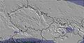 | 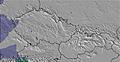 | ||||||||||
— | — | — | — | — | — | — | — | — | — | — | — | — | — | — | — | |
mm | 4 | — | — | — | 3 | 3 | 1 | — | — | — | — | — | 8 | 6 | 8 | 4 |
max °C | 12 | 15 | 17 | 16 | 13 | 13 | 13 | 14 | 17 | 15 | 17 | 19 | 17 | 13 | 14 | 14 |
min °C | 12 | 13 | 17 | 15 | 13 | 12 | 11 | 12 | 16 | 13 | 14 | 18 | 12 | 13 | 13 | 14 |
chill °C | 11 | 13 | 17 | 14 | 12 | 11 | 10 | 12 | 16 | 12 | 13 | 18 | 11 | 12 | 12 | 14 |
Humid % | 79 | 60 | 53 | 63 | 93 | 87 | 70 | 51 | 45 | 63 | 43 | 49 | 91 | 84 | 84 | 70 |
Freeze m | 3100 | 3400 | 3750 | 3500 | 3450 | 3500 | 3350 | 3300 | 3350 | 3350 | 3350 | 3400 | 3400 | 3150 | 3250 | 3350 |
— | 5:13 | — | — | 5:15 | — | — | 5:15 | — | — | 5:16 | — | — | 5:16 | — | — | |
— | — | — | 9:08 | — | — | 9:07 | — | — | 9:07 | — | — | 9:07 | — | — | 9:07 | |
Go pro and carve into:
Avalanche information: European Avalanche Warning Services (EAWS)
Latest snow reports near Berchtesgaden:
| Top snow depth: | 0 cm |
|---|---|
| Bottom snow depth: | 0 cm |
| Fresh snowfall depth: | — |
| Last snowfall: | 16 May 2026 |
| Snow Alerts | Create Alert |
0.0 | Bluebird Powder days Fresh snow, mostly sunny, light wind. |
|---|---|
0.0 | Powder days Fresh snow, limited sun, any wind. |
0.0 | Bluebird days Average snow, mostly sunny, light wind. |
The above table gives the weather forecast for Berchtesgaden at the specific elevation of 1252 m. Our sophisticated weather models allow us to provide snow forecasts for the top, middle and bottom ski stations of Berchtesgaden. To access the weather forecasts for the other elevations, use the tab navigation above the table. For a wider view of the weather, check out the Weather Map of Germany.
Click here to read further information on freezing levels and how we forecast our temperatures.
Overall 4.0 Based on 11 votes and 2 reviews
When I went to Berchtesgaden in February I was very pleased with the skiing indeed. Many people believe Berchtesgaden is a cross-country resort at heart but this is simply not true! Many websites only post information of one of the ski areas surrounding the town, this is an complete mistake! There are 5 main ski areas (Jenner, Rossfeld, Hochschwarzeck, Gotschen, Gutshof/Obersalzburg) surrounding the resort which are only 10 minutes apart but yes there are drag lifts which may be a drawback. With a total of an incredible 30 lifts and tonnes of slopes added together this surpasses what many people believe is Germany's only contribution to downhill skiing; Garmisch-Partenkirchen which has a less amazing 24 lifts. Now many people believe Berchtesgaden's low altitude is a major drawback as this may indicate bad snow cover and to say the truth I was even anxious going to the resorts Jenner ski area for the first time but that was all wiped out in one blow when I saw 3 metres on beautiful pristine snow lining the ground and on top powder which came up to your knees! Truly incredible! So next time you consider an alpine ski holiday look to Berchtesgaden to fulfil your needs for both skiers and non-skiers alike. A true alpine hidden downhill skiing gem!
Will from United Kingdom writes:
When I went to Berchtesgaden in February I was very pleased with the skiing indeed. Many people believe Berchtesgaden is a cross-country resort at heart but this is simply not true! Many websites only post information of one of the ski areas surrounding the town, this is an complete mistake! There are 5 main ski areas (Jenner, Rossfeld, Hochschwarzeck, Gotschen, Gutshof/Obersalzburg) surrounding the resort which are only 10 minutes apart but yes there are drag lifts which may be a drawback. With a total of an incredible 30 lifts and tonnes of slopes added together this surpasses what many people believe is Germany's only contribution to downhill skiing; Garmisch-Partenkirchen which has a less amazing 24 lifts. Now many people believe Berchtesgaden's low altitude is a major drawback as this may indicate bad snow cover and to say the truth I was even anxious going to the resorts Jenner ski area for the first time but that was all wiped out in one blow when I saw 3 metres on beautiful pristine snow lining the ground and on top powder which came up to your knees! Truly incredible! So next time you consider an alpine ski holiday look to Berchtesgaden to fulfil your needs for both skiers and non-skiers alike. A true alpine hidden downhill skiing gem!


 Nearest