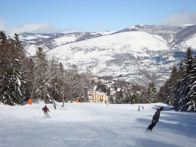


Global Weekly Snow Roundup #320
Weekly Snow News for the world, updated 25 June 2026: Chile and New Zealand's seasons proper set to begin, Tignes and Sunshine reopen for summer skiing. weekend as Riksgransen ends its 2026 season.

Next 3 days weather summary:Light rain (total 9.0mm), mostly falling on Sun night. Warm (max 24°C on Sat afternoon, min 13°C on Sun night). Wind will be generally light. | Days 4-6 weather summary:Moderate rain (total 17.0mm), heaviest on Mon night. Very mild (max 19°C on Mon afternoon, min 12°C on Tue morning). Wind will be generally light. | |||||||||||||||||
Friday 26 | Saturday 27 | Sunday 28 | Monday 29 | Tuesday 30 | Wednesday 1 | |||||||||||||
AM | PM | night | AM | PM | night | AM | PM | night | AM | PM | night | AM | PM | night | AM | PM | night | |
clear | some clouds | clear | clear | clear | clear | clear | t-storm risk | t-storm risk | t-storm risk | t-storm risk | rain shwrs | some clouds | t-storm risk | rain shwrs | clear | clear | clear | |
km/h | ||||||||||||||||||
Snow map | 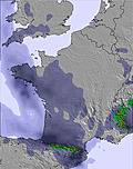 | 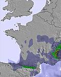 | 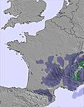 |  |  |  | ||||||||||||
— | — | — | — | — | — | — | — | — | — | — | — | — | — | — | — | — | — | |
mm | — | — | — | — | — | — | — | 1 | 8 | 1 | 4 | 9 | — | 2 | 1 | — | — | — |
max °C | 21 | 23 | 22 | 21 | 24 | 22 | 21 | 22 | 19 | 17 | 19 | 15 | 14 | 17 | 15 | 15 | 17 | 16 |
min °C | 17 | 23 | 17 | 17 | 23 | 17 | 18 | 20 | 13 | 15 | 17 | 13 | 12 | 16 | 12 | 12 | 16 | 12 |
chill °C | 17 | 23 | 17 | 17 | 23 | 17 | 18 | 20 | 13 | 15 | 17 | 13 | 12 | 16 | 11 | 11 | 15 | 11 |
Humid % | 35 | 33 | 43 | 24 | 30 | 36 | 41 | 55 | 90 | 62 | 73 | 84 | 78 | 70 | 80 | 50 | 34 | 44 |
Freeze m | 4650 | 4700 | 4650 | 4650 | 4800 | 4750 | 4700 | 4700 | 4500 | 4400 | 4400 | 4500 | 4350 | 4400 | 4250 | 4300 | 4450 | 4550 |
6:15 | — | — | 6:16 | — | — | 6:16 | — | — | 6:16 | — | — | 6:16 | — | — | 6:18 | — | — | |
— | — | 9:34 | — | — | 9:34 | — | — | 9:34 | — | — | 9:34 | — | — | 9:34 | — | — | 9:34 | |
Go pro and carve into:
Avalanche information: European Avalanche Warning Services (EAWS)
Latest snow reports near Ax 3 Domaines:
| Top snow depth: | 0 cm |
|---|---|
| Bottom snow depth: | 0 cm |
| Fresh snowfall depth: | — |
| Last snowfall: | 17 May 2026 |
| Snow Alerts | Create Alert |
0.0 | Bluebird Powder days Fresh snow, mostly sunny, light wind. |
|---|---|
0.0 | Powder days Fresh snow, limited sun, any wind. |
0.0 | Bluebird days Average snow, mostly sunny, light wind. |
The above table gives the weather forecast for Ax 3 Domaines at the specific elevation of 1900 m. Our sophisticated weather models allow us to provide snow forecasts for the top, middle and bottom ski stations of Ax 3 Domaines. To access the weather forecasts for the other elevations, use the tab navigation above the table. For a wider view of the weather, check out the Weather Map of France.
Click here to read further information on freezing levels and how we forecast our temperatures.
Resort name is also written as Ax-les-Thermes.
Overall 4.0 Based on 22 votes and 13 reviews
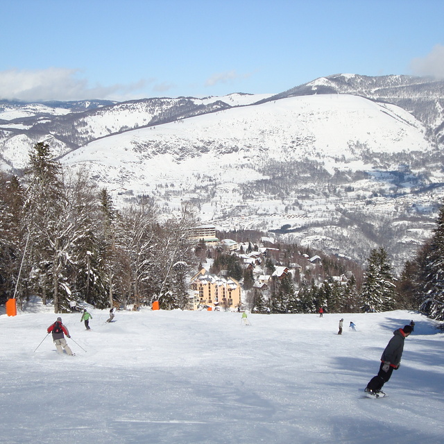
Ax les Thermes is an excellent resort for all levels of skiers, with some challenging terrain for the advanced, and good for beginners too. The pistes are mostly wide and well groomed, and there are trees for the cloudy days. This season, 25-26, is bumpier year for snow and with 2,40m of snow and 40 cms of fresh snow expected this week the April Fool is the station that is already closed, instead of staying open for the Easter holiday. The whole skiing ethic being betrayed presumably by administrative constraints.
Caroline from France writes:
Ax les Thermes is an excellent resort for all levels of skiers, with some challenging terrain for the advanced, and good for beginners too. The pistes are mostly wide and well groomed, and there are trees for the cloudy days.
This season, 25-26, is bumpier year for snow and with 2,40m of snow and 40 cms of fresh snow expected this week the April Fool is the station that is already closed, instead of staying open for the Easter holiday. The whole skiing ethic being betrayed presumably by administrative constraints.


 Nearest