The above table gives the weather forecast for Abtenau at the specific elevation of 712 m. Our sophisticated weather models allow us to provide snow forecasts for the top, middle and bottom ski stations of Abtenau. To access the weather forecasts for the other elevations, use the tab navigation above the table. For a wider view of the weather, check out the Weather Map of Austria.
Click here to read further information on freezing levels and how we forecast our temperatures.
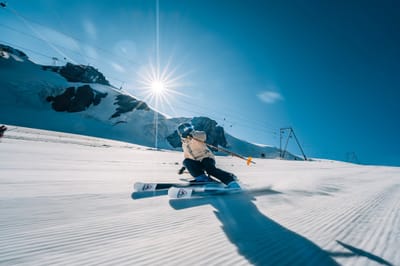
We have been in Abtenau for a one week holiday for almost ten years, following some previous two visits years back. It's a place worth visiting and staying if you look for the quality vacation; no noise, minimum pollution, decent services and prices, far from the hubbub of fashionable resorts. People are forthcoming, the trails are well kept and accessible for every age, weight or physical condition, the sights are breathtaking within minutes of hiking and if you get bored in the evening, drive to Salzburg and spice your vacation with whatever you like.
We have been in Abtenau for a one week holiday for almost ten years, following some previous two visits years back. It's a place worth visiting and staying if you look for the quality vacation; no noise, minimum pollution, decent services and prices, far from the hubbub of fashionable resorts. People are forthcoming, the trails are well kept and accessible for every age, weight or physical condition, the sights are breathtaking within minutes of hiking and if you get bored in the evening, drive to Salzburg and spice your vacation with whatever you like.
Free Snow-Forecast.com weather widget for your website
Embed the Abtenau weather widget on your site for free. It provides a weekly snapshot of snow and rain conditions across all elevations. Follow the two quick steps to grab your custom code and paste it into your site. Choose between metric or imperial units. Click here to get the code.


 Nearest