

Global Weekly Snow Roundup #314
Weekly Global Snow News, updated 14 May 2026: Fresh snowfall in Argentina, Australia and Lesotho signals winter’s approach, while Japan maintains the world’s deepest snowpack.

Next 3 days weather summary:A light fall of snow, heaviest on Sat morning. Turning milder with light rain (total 9.0mm) on Mon night. Freeze-thaw conditions (max 5°C on Mon afternoon, min -4°C on Sat morning). Wind will be generally light. | Days 4-6 weather summary:Moderate rain (total 15.0mm), heaviest on Wed morning. Freeze-thaw conditions (max 9°C on Thu afternoon, min 0°C on Tue morning). Wind will be generally light. | |||||||||||||||||
Saturday 16 | Sunday 17 | Monday 18 | Tuesday 19 | Wednesday 20 | Thursday 21 | |||||||||||||
AM | PM | night | AM | PM | night | AM | PM | night | AM | PM | night | AM | PM | night | AM | PM | night | |
mod. snow | light snow | snow shwrs | some clouds | rain shwrs | snow shwrs | rain shwrs | risk thun- der | mod. snow | cloudy | some clouds | light rain | light rain | light rain | light rain | rain shwrs | rain shwrs | rain shwrs | |
km/h | ||||||||||||||||||
Snow map |  |  |  |  |  |  | ||||||||||||
7 | 1 | — | — | — | — | — | — | 8 | — | — | — | — | — | — | — | — | — | |
— | — | — | — | 1 | — | 1 | 4 | 3 | — | — | 1 | 3 | 2 | 4 | 2 | 2 | 1 | |
max °C | -3 | -2 | -2 | 0 | 3 | 2 | 4 | 5 | 3 | 2 | 5 | 4 | 5 | 6 | 6 | 7 | 9 | 7 |
min °C | -4 | -3 | -4 | -2 | 2 | 0 | 2 | 5 | -1 | 0 | 4 | 2 | 2 | 5 | 4 | 4 | 9 | 6 |
-9 | -7 | -4 | -2 | 2 | -2 | 2 | 4 | -3 | 0 | 4 | 0 | 0 | 3 | 2 | 2 | 7 | 4 | |
98 | 92 | 92 | 68 | 68 | 78 | 73 | 78 | 98 | 78 | 69 | 92 | 79 | 73 | 89 | 67 | 63 | 72 | |
1550 | 1650 | 1450 | 2000 | 2350 | 2050 | 2450 | 2650 | 1850 | 2350 | 2600 | 2450 | 2650 | 2850 | 2650 | 2850 | 3000 | 3100 | |
5:31 | — | — | 5:30 | — | — | 5:28 | — | — | 5:28 | — | — | 5:26 | — | — | 5:26 | — | — | |
— | — | 8:38 | — | — | 8:39 | — | — | 8:40 | — | — | 8:42 | — | — | 8:44 | — | — | 8:45 | |
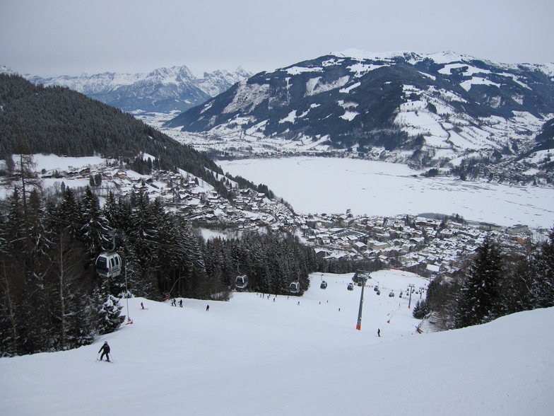
Latest snow reports near Zell am See:
| Top snow depth: | 0 cm |
|---|---|
| Bottom snow depth: | 0 cm |
| Fresh snowfall depth: | 24 cm |
| Last snowfall: | 15 May 2026 |
| Snow Alerts | Create Alert |
0.0 | Bluebird Powder days Fresh snow, mostly sunny, light wind. |
|---|---|
0.4 | Powder days Fresh snow, limited sun, any wind. |
0.0 | Bluebird days Average snow, mostly sunny, light wind. |
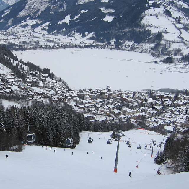
The above table gives the weather forecast for Zell am See at the specific elevation of 2000 m. Our sophisticated weather models allow us to provide snow forecasts for the top, middle and bottom ski stations of Zell am See. To access the weather forecasts for the other elevations, use the tab navigation above the table. For a wider view of the weather, check out the Weather Map of Austria.
Click here to read further information on freezing levels and how we forecast our temperatures.
Overall 4.1 Based on 27 votes and 25 reviews
Was in Zell for the first time just as Covid came. Weren't blessed with great weather, couple of near whiteout days, but plenty of skiing including a day at the glacier, another at MariaAlm, and the links to Saalbach means there's ample variety to keep a reasonable intermediate busy for a full week. But there's more to Zell than just its pistes. Its stunning lakeside location, pretty streets and alleyways and ample apres-ski life make it perhaps the best all-round ski destination I've ever visited. And it's Austria, and they know how to party in a way that no other European destination does. I'll definitely return.
peter from United Kingdom writes:
Was in Zell for the first time just as Covid came. Weren't blessed with great weather, couple of near whiteout days, but plenty of skiing including a day at the glacier, another at MariaAlm, and the links to Saalbach means there's ample variety to keep a reasonable intermediate busy for a full week. But there's more to Zell than just its pistes. Its stunning lakeside location, pretty streets and alleyways and ample apres-ski life make it perhaps the best all-round ski destination I've ever visited. And it's Austria, and they know how to party in a way that no other European destination does. I'll definitely return.


 Nearest