
Ski Lessons by SkiBro
BOOK NOW
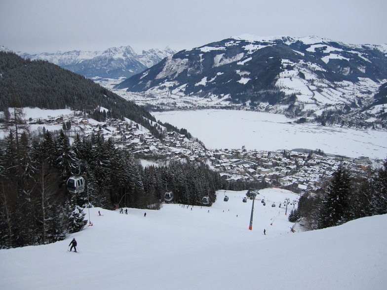
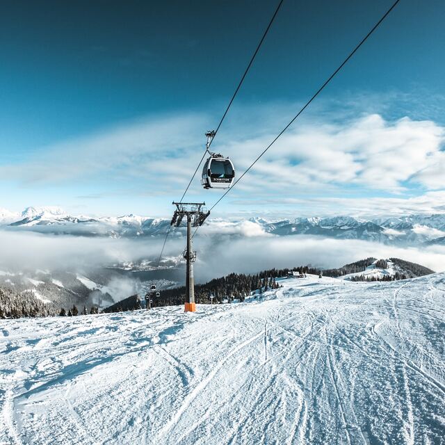
Ski lessons in Zell am See
Book now

Zell am See Weather (Next 3 days): The snow forecast for Zell am See is: A moderate fall of snow, heaviest on Fri night. Temperatures will be below freezing (max 0°C on Fri night, min -5°C on Sat night). Wind will be generally light.
Zell am See Weather (Days 4-6): A light covering of new snow, mostly falling on Mon night. Becoming milder with light rain (total 2.0mm) on Thu afternoon. Freeze-thaw conditions (max 5°C on Thu afternoon, min -4°C on Mon night). Wind will be generally light.
| Resort | Snow Depth | Temp. (°C) | Wind (km/h) | Weather | ||
|---|---|---|---|---|---|---|
| Top Lift: | 0.0 m | -4 | ||||
| Middle Lift: | 0 | |||||
| Bottom Lift: | 0.0 m | 4 |
Latest snow reports near Zell am See:
Intermittent light rain reported from Bischofshofen at 550 metres elevation 8 kms S of Werfenweng but it is forecast cold enough for snow at the ski area from Werfenweng
Continuous moderate rain reported from Lofer at 622 metres elevation one km E of Lofer but it is forecast cold enough for snow at higher elevations in the ski area from Lofer
Intermittent light rain reported from Krimml at 1000 metres elevation one km N of Krimml but it is forecast cold enough for snow at the ski area from Krimml

Saturday 20 | Sunday 21 | Monday 22 | Tuesday 23 | Wednesday 24 | Thursday 25 | ||||||||||||||
night | AM | PM | night | AM | PM | night | AM | PM | night | AM | PM | night | AM | PM | night | AM | PM | night | |
mod. snow | light snow | light snow | light snow | light snow | light snow | light snow | light snow | light snow | light snow | light snow | light snow | light snow | light snow | light snow | light snow | some clouds | light rain | light snow | |
km/h | |||||||||||||||||||
Snow map |  |  |  |  |  |  |  | ||||||||||||
6 | 2.0 | 2.0 | 2.0 | — | 2.0 | 1.0 | — | 1.0 | 3 | 1.0 | 1.0 | 2.0 | 1.0 | 1.0 | — | — | — | 3 | |
— | — | — | — | — | — | — | — | — | — | — | — | — | — | — | — | — | 2.0 | — | |
max°C | 0 | -1 | -1 | -3 | -2 | -1 | -3 | -2 | 0 | -2 | -1 | 0 | -2 | 0 | 1 | -2 | 3 | 5 | 2 |
min°C | -3 | -2 | -1 | -5 | -4 | -1 | -5 | -5 | 0 | -4 | -3 | 0 | -3 | -2 | 1 | -4 | -1 | 5 | -1 |
-6 | -5 | -4 | -5 | -4 | -4 | -5 | -5 | -2 | -4 | -5 | -3 | -3 | -4 | -1 | -7 | -1 | 4 | -1 | |
97 | 75 | 81 | 99 | 75 | 81 | 92 | 70 | 84 | 97 | 84 | 85 | 98 | 78 | 76 | 84 | 66 | 76 | 90 | |
1250 | 1200 | 1200 | 600 | 1150 | 1200 | 450 | 1100 | 1350 | 850 | 1200 | 1350 | 950 | 1350 | 1550 | 800 | 1800 | 2000 | 1300 | |
— | 6:09 | — | — | 6:07 | — | — | 6:07 | — | — | 6:05 | — | — | 6:03 | — | — | 6:01 | — | — | |
— | — | — | 8:05 | — | — | 8:06 | — | — | 8:07 | — | — | 8:08 | — | — | 8:10 | — | — | 8:12 | |
A moderate fall of snow, heaviest on Fri night. Temperatures will be below freezing (max 0°C on Fri night, min -5°C on Sat night). Wind will be generally light.
A light covering of new snow, mostly falling on Mon night. Becoming milder with light rain (total 2.0mm) on Thu afternoon. Freeze-thaw conditions (max 5°C on Thu afternoon, min -4°C on Mon night). Wind will be generally light.
Latest snow reports near Zell am See:
Intermittent light rain reported from Bischofshofen at 550 metres elevation 8 kms S of Werfenweng but it is forecast cold enough for snow at the ski area from Werfenweng
Continuous moderate rain reported from Lofer at 622 metres elevation one km E of Lofer but it is forecast cold enough for snow at higher elevations in the ski area from Lofer
Intermittent light rain reported from Krimml at 1000 metres elevation one km N of Krimml but it is forecast cold enough for snow at the ski area from Krimml
| Top snow depth: | 0 cm |
|---|---|
| Bottom snow depth: | 0 cm |
| Fresh snowfall depth: | 10 cm |
| Last snowfall: | 18 Apr 2024 |
| Snow Alerts | Create Alert |
0.2 | Bluebird Powder days Fresh snow, mostly sunny, light wind. |
|---|---|
0.3 | Powder days Fresh snow, limited sun, any wind. |
0.1 | Bluebird days Average snow, mostly sunny, light wind. |
The above table gives the weather forecast for Zell am See at the specific elevation of 1379 m. Our sophisticated weather models allow us to provide snow forecasts for the top, middle and bottom ski stations of Zell am See. To access the weather forecasts for the other elevations, use the tab navigation above the table. For a wider view of the weather, check out the Weather Map of Austria.
Click here to read further information on freezing levels and how we forecast our temperatures.
Overall 4.1 Based on 16 votes and 25 reviews
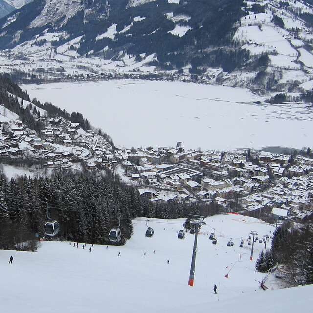
A beautiful Austrian town with the added benefit of a beautiful lake with views of it whilst skiing. Spent a week here mid January 2023. We skied Zell, Saalbach and Kaprun. Sadly, the pistes most of the week in Zell had not been pisted which made the skiing quite challenging to say the least. Kaprun, lower down, had been pisted which was better. It’s a shame as it was a lovely resort and I would have expected better of such a well known resort. The rep told us it was pisted every night but I would dispute this. Not once did we see a pisten bully all week at any time. I don’t expect perfect conditions when skiing as that is rare. However, this was another level! I have skied many resorts and many different conditions over the years but to be honest this spoilt the week for me. I would think again before going to Zell again and this is the only reason for this. Although also it was extremely busy and made it quite dangerous at times. I dread to think what it would be like in half term.
Alison O’Meara from United Kingdom writes:
A beautiful Austrian town with the added benefit of a beautiful lake with views of it whilst skiing. Spent a week here mid January 2023. We skied Zell, Saalbach and Kaprun. Sadly, the pistes most of the week in Zell had not been pisted which made the skiing quite challenging to say the least. Kaprun, lower down, had been pisted which was better. It’s a shame as it was a lovely resort and I would have expected better of such a well known resort. The rep told us it was pisted every night but I would dispute this. Not once did we see a pisten bully all week at any time. I don’t expect perfect conditions when skiing as that is rare. However, this was another level! I have skied many resorts and many different conditions over the years but to be honest this spoilt the week for me. I would think again before going to Zell again and this is the only reason for this. Although also it was extremely busy and made it quite dangerous at times. I dread to think what it would be like in half term.
The Zell am See skiing weather widget is available to embed on external websites free of charge. It provides a daily summary of our Zell am See snow forecast and current weather conditions. Simply go to the feed configuration page and follow the 3 simple steps to grab the custom html code snippet and paste it into your own site. You can choose the snow forecast elevation (summit, mid-mountain or bottom lift) and metric/imperial units for the snow forecast feed to suit your own website…. Click here to get the code.
View detailed snow forecast for Zell am See at:
snow-forecast.com


 Nearest