

Global Weekly Snow Roundup #314
Weekly Global Snow News, updated 14 May 2026: Fresh snowfall in Argentina, Australia and Lesotho signals winter’s approach, while Japan maintains the world’s deepest snowpack.

Next 3 days weather summary:A light covering of new snow, mostly falling on Mon afternoon. Temperatures will be below freezing (max 0°C on Sun afternoon, min -9°C on Sat morning). Wind will be generally light. | Days 4-6 weather summary:Mostly dry. Freeze-thaw conditions (max 8°C on Thu afternoon, min -1°C on Tue morning). Wind will be generally light. | |||||||||||||||||
Saturday 16 | Sunday 17 | Monday 18 | Tuesday 19 | Wednesday 20 | Thursday 21 | |||||||||||||
AM | PM | night | AM | PM | night | AM | PM | night | AM | PM | night | AM | PM | night | AM | PM | night | |
snow shwrs | light snow | snow shwrs | some clouds | light snow | light snow | light snow | light snow | light snow | cloudy | light snow | cloudy | clear | some clouds | clear | clear | some clouds | clear | |
km/h | ||||||||||||||||||
Snow map |  |  |  |  |  |  | ||||||||||||
— | — | — | — | — | 1 | — | 2 | 1 | — | — | — | — | — | — | — | — | — | |
— | — | — | — | — | — | — | — | — | — | — | — | — | — | — | — | — | — | |
max °C | -8 | -6 | -4 | -3 | 0 | -2 | -3 | -2 | -2 | -1 | 0 | 2 | 3 | 5 | 5 | 7 | 8 | 8 |
min °C | -9 | -7 | -6 | -3 | -1 | -3 | -3 | -2 | -3 | -1 | 0 | 1 | 2 | 4 | 5 | 6 | 8 | 7 |
-16 | -12 | -10 | -5 | -3 | -5 | -5 | -5 | -6 | -3 | -2 | -3 | -1 | 1 | 2 | 4 | 7 | 6 | |
81 | 88 | 49 | 64 | 90 | 94 | 89 | 90 | 95 | 87 | 93 | 61 | 56 | 72 | 42 | 20 | 44 | 21 | |
1650 | 2000 | 1550 | 2450 | 2600 | 2250 | 2400 | 2450 | 2250 | 2600 | 2800 | 3100 | 3150 | 3350 | 3700 | 3750 | 3850 | 4100 | |
6:03 | — | — | 6:01 | — | — | 6:01 | — | — | 6:00 | — | — | 5:58 | — | — | 5:58 | — | — | |
— | — | 8:55 | — | — | 8:57 | — | — | 8:58 | — | — | 9:00 | — | — | 9:00 | — | — | 9:01 | |
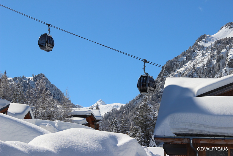
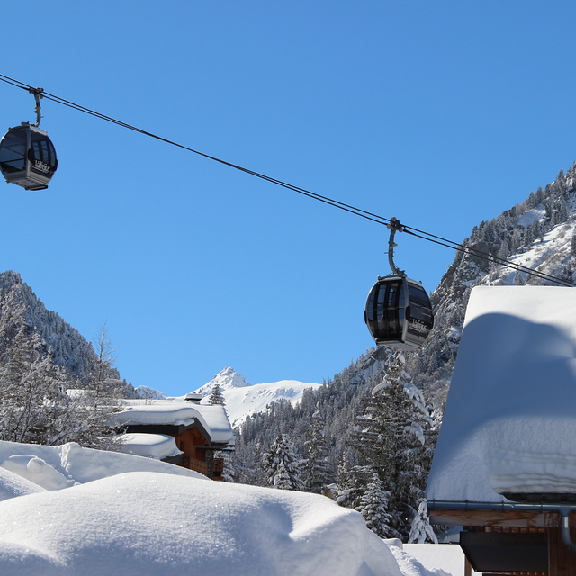
Latest snow reports near Valfrejus:
| Top snow depth: | — |
|---|---|
| Bottom snow depth: | — |
| Fresh snowfall depth: | 7 cm |
| Last snowfall: | 15 May 2026 |
| Snow Alerts | Create Alert |
0.2 | Bluebird Powder days Fresh snow, mostly sunny, light wind. |
|---|---|
0.8 | Powder days Fresh snow, limited sun, any wind. |
0.4 | Bluebird days Average snow, mostly sunny, light wind. |

The above table gives the weather forecast for Valfrejus at the specific elevation of 2737 m. Our sophisticated weather models allow us to provide snow forecasts for the top, middle and bottom ski stations of Valfrejus. To access the weather forecasts for the other elevations, use the tab navigation above the table. For a wider view of the weather, check out the Weather Map of France.
Click here to read further information on freezing levels and how we forecast our temperatures.
Overall 3.5 Based on 59 votes and 49 reviews
My tenth year of multiple visits (new year, Feb half term and Easter) but will be my last. I know what to expect regarding state of pistes and lack of care for them but have got round that by visiting other resorts using Valfrejus as a base. This year I have to comment on the noise and rowdiness of locals in the bars below our apartment until 2am every day and it seems they all have dogs that they allow to roam and deficate all over the place; no exaggeration I viewed 7 dogs one evening whilst standing on my balcony all using the area by the gondola and adjacent to children's play park as a toilet. Their owners get drunk every night, shout and scream which then starts the dogs barking. Bar owners should put a lid on this but they don't care.
Mick from United Kingdom writes:
My tenth year of multiple visits (new year, Feb half term and Easter) but will be my last. I know what to expect regarding state of pistes and lack of care for them but have got round that by visiting other resorts using Valfrejus as a base. This year I have to comment on the noise and rowdiness of locals in the bars below our apartment until 2am every day and it seems they all have dogs that they allow to roam and deficate all over the place; no exaggeration I viewed 7 dogs one evening whilst standing on my balcony all using the area by the gondola and adjacent to children's play park as a toilet. Their owners get drunk every night, shout and scream which then starts the dogs barking. Bar owners should put a lid on this but they don't care.


 Nearest