

Global Weekly Snow Roundup #314
Weekly Global Snow News, updated 14 May 2026: Fresh snowfall in Argentina, Australia and Lesotho signals winter’s approach, while Japan maintains the world’s deepest snowpack.

Next 3 days weather summary:Mild with moderate rain (total 19.0mm) on Sat morning, Becoming colder with a light covering of snow, mostly falling on Sat night. Temperatures will be slightly above freezing (max 4°C on Mon night, min 1°C on Sat night). Wind will be generally light. | Days 4-6 weather summary:Moderate rain (total 10.0mm), heaviest on Thu morning. Mild temperatures (max 7°C on Tue afternoon, min 4°C on Tue morning). Wind will be generally light. | |||||||||||||||||
Saturday 16 | Sunday 17 | Monday 18 | Tuesday 19 | Wednesday 20 | Thursday 21 | |||||||||||||
AM | PM | night | AM | PM | night | AM | PM | night | AM | PM | night | AM | PM | night | AM | PM | night | |
heavy rain | light rain | mod. snow | light snow | light snow | light snow | light snow | light rain | rain shwrs | cloudy | some clouds | clear | clear | some clouds | rain shwrs | risk thun- der | risk thun- der | rain shwrs | |
km/h | ||||||||||||||||||
Snow map |  |  |  | 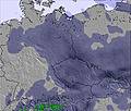 | 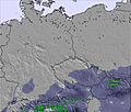 | 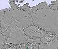 | ||||||||||||
— | — | 8 | 1 | — | — | — | — | — | — | — | — | — | — | — | — | — | — | |
13 | 4 | — | — | — | — | — | 1 | 1 | — | — | — | — | — | 1 | 3 | 4 | 2 | |
max °C | 3 | 3 | 1 | 1 | 1 | 2 | 2 | 3 | 4 | 5 | 7 | 5 | 6 | 7 | 6 | 6 | 7 | 7 |
min °C | 3 | 2 | 1 | 1 | 1 | 1 | 1 | 2 | 3 | 4 | 6 | 5 | 5 | 7 | 5 | 5 | 7 | 5 |
-2 | 1 | -2 | -4 | -3 | -3 | 1 | 2 | 3 | 2 | 5 | 3 | 2 | 4 | 2 | 2 | 5 | 2 | |
99 | 98 | 98 | 95 | 92 | 94 | 96 | 95 | 71 | 59 | 63 | 66 | 60 | 70 | 80 | 88 | 89 | 88 | |
2300 | 2200 | 2000 | 2050 | 2100 | 2250 | 2100 | 2250 | 2500 | 2550 | 2550 | 2700 | 2700 | 2700 | 2700 | 2650 | 2800 | 2950 | |
4:54 | — | — | 4:54 | — | — | 4:52 | — | — | 4:50 | — | — | 4:50 | — | — | 4:48 | — | — | |
— | — | 8:15 | — | — | 8:15 | — | — | 8:17 | — | — | 8:19 | — | — | 8:20 | — | — | 8:22 | |
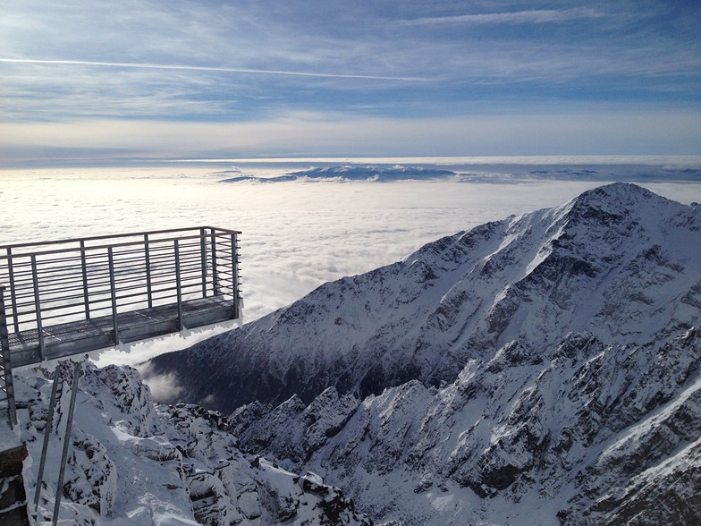
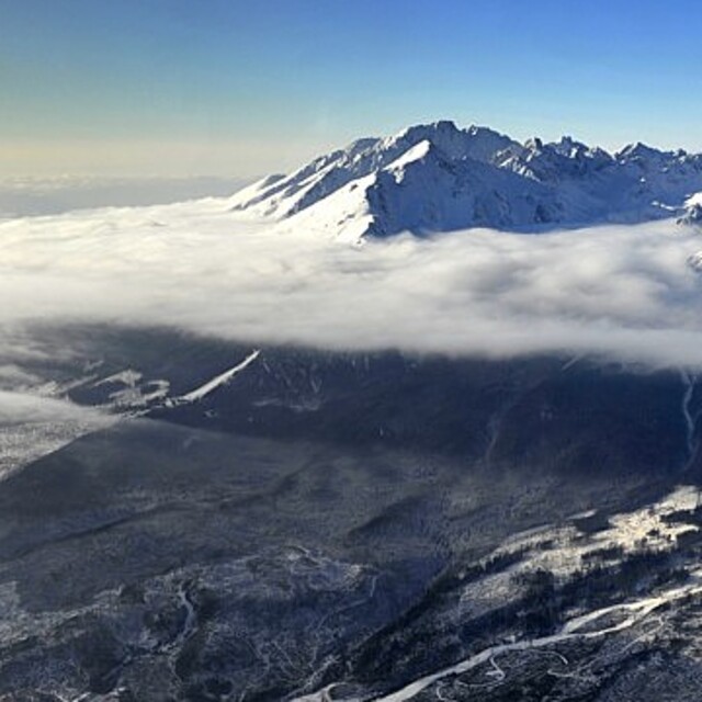
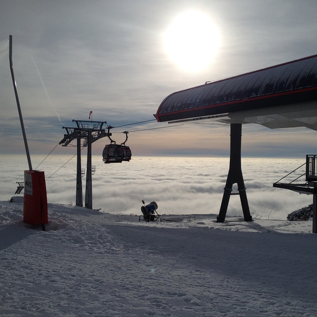
Latest snow reports near Tatranská Lomnica:
Continuous light snow reported from Lomnicky Stit (peak) at 2635 metres elevation 6 kms W of Tatranská Lomnica but it is probably falling as rain apart from near the top of the ski area from Tatranská Lomnica
Light rain and snow reported from Lomnicky Stit (peak) at 2635 metres elevation 6 kms W of Tatranská Lomnica but it is probably falling as rain apart from near the top of the ski area from Tatranská Lomnica
| Top snow depth: | — |
|---|---|
| Bottom snow depth: | — |
| Fresh snowfall depth: | — |
| Last snowfall: | 12 May 2026 |
| Snow Alerts | Create Alert |
0.1 | Bluebird Powder days Fresh snow, mostly sunny, light wind. |
|---|---|
0.1 | Powder days Fresh snow, limited sun, any wind. |
0.1 | Bluebird days Average snow, mostly sunny, light wind. |
The above table gives the weather forecast for Tatranská Lomnica at the specific elevation of 1761 m. Our sophisticated weather models allow us to provide snow forecasts for the top, middle and bottom ski stations of Tatranská Lomnica. To access the weather forecasts for the other elevations, use the tab navigation above the table. For a wider view of the weather, check out the Weather Map of Slovakia.
Click here to read further information on freezing levels and how we forecast our temperatures.
Resort name is also written as Tatranska Lomnica.
Overall 3.2 Based on 15 votes and 6 reviews
This may be one of the top resorts in Slovakia but that’s not really saying much. You pay around 30EUR for a days lift pass which gets you access to 7 lifts if, and that’s a big if, they decide to open them all. This is about the same as the Lecht. Due to exposure from lack of trees (terrible storm wiped away nearly all of them), the slopes at the top are often icy and snowfall doesn’t do much to change this. It is a good resort for beginners to intermediates on a budget. However, if you’re looking to ski varied terrain all day, this is not the place for you. The lift pass does give you access to Strbské Pleso, which is a little more picturesque. On a good day it provides some nice tree lines.
Alex Wright from United Kingdom writes:
This may be one of the top resorts in Slovakia but that’s not really saying much. You pay around 30EUR for a days lift pass which gets you access to 7 lifts if, and that’s a big if, they decide to open them all. This is about the same as the Lecht.
Due to exposure from lack of trees (terrible storm wiped away nearly all of them), the slopes at the top are often icy and snowfall doesn’t do much to change this.
It is a good resort for beginners to intermediates on a budget. However, if you’re looking to ski varied terrain all day, this is not the place for you.
The lift pass does give you access to Strbské Pleso, which is a little more picturesque. On a good day it provides some nice tree lines.


 Nearest