
Ski Hire by Intersport
Click here for discount

Radstadt/Altenmarkt Weather (Next 3 days): The snow forecast for Radstadt/Altenmarkt is: Some drizzle, heaviest during Fri afternoon. Freeze-thaw conditions (max 17°C on Sun afternoon, min -1°C on Fri night). Wind will be generally light.
Radstadt/Altenmarkt Weather (Days 4-6): Mostly dry. Warm (max 22°C on Tue afternoon, min 7°C on Wed night). Wind will be generally light.
| Resort | Snow Depth | Temp. (°C) | Wind (km/h) | Weather | ||
|---|---|---|---|---|---|---|
| Top Lift: | -4 | |||||
| Middle Lift: | -2 | |||||
| Bottom Lift: | -2 |
Latest snow reports near Radstadt/Altenmarkt:
Rain reported from Obertauern (automatic) at 1742 metres elevation one km N of Obertauern but it is forecast cold enough for snow at the ski area from Obertauern
Rain reported from Bischofshofen at 550 metres elevation 6 kms N of St Johann-Alpendorf but it is forecast cold enough for snow at higher elevations in the ski area from St Johann-Alpendorf
Rain reported from Bischofshofen at 550 metres elevation 6 kms N of St Johann-Alpendorf but it is forecast cold enough for snow at the ski area from St Johann-Alpendorf

Friday 26 | Saturday 27 | Sunday 28 | Monday 29 | Tuesday 30 | Wednesday 1 | Thursday 2 | |||||||||||||||
AM | PM | night | AM | PM | night | AM | PM | night | AM | PM | night | AM | PM | night | AM | PM | night | AM | PM | night | |
clear | light rain | some clouds | clear | clear | clear | some clouds | some clouds | some clouds | some clouds | clear | clear | clear | clear | some clouds | cloudy | cloudy | some clouds | clear | cloudy | rain shwrs | |
km/h | |||||||||||||||||||||
Snow map |  |  |  |  |  |  |  | ||||||||||||||
— | — | — | — | — | — | — | — | — | — | — | — | — | — | — | — | — | — | — | — | — | |
— | 1.0 | — | — | — | — | — | — | — | — | — | — | — | — | — | — | — | — | — | — | 1.0 | |
max°C | 7 | 10 | 4 | 10 | 13 | 6 | 13 | 17 | 11 | 17 | 21 | 13 | 19 | 22 | 15 | 19 | 21 | 13 | 17 | 18 | 13 |
min°C | 2 | 9 | -1 | 4 | 12 | 3 | 8 | 17 | 6 | 10 | 20 | 8 | 13 | 21 | 10 | 13 | 19 | 7 | 11 | 18 | 7 |
0 | 8 | -4 | 2 | 11 | 0 | 6 | 17 | 4 | 10 | 20 | 6 | 12 | 21 | 8 | 12 | 19 | 5 | 10 | 18 | 6 | |
60 | 63 | 84 | 56 | 60 | 88 | 61 | 54 | 84 | 42 | 37 | 67 | 35 | 30 | 66 | 43 | 45 | 87 | 52 | 45 | 85 | |
1850 | 2000 | 1300 | 2350 | 2550 | 2950 | 3300 | 3450 | 3500 | 3450 | 3250 | 3350 | 3300 | 3300 | 3300 | 3050 | 3100 | 3100 | 2900 | 2950 | 2700 | |
5:56 | — | — | 5:54 | — | — | 5:54 | — | — | 5:52 | — | — | 5:50 | — | — | 5:48 | — | — | 5:47 | — | — | |
— | — | 8:10 | — | — | 8:12 | — | — | 8:14 | — | — | 8:15 | — | — | 8:15 | — | — | 8:17 | — | — | 8:19 | |
Some drizzle, heaviest during Fri afternoon. Freeze-thaw conditions (max 17°C on Sun afternoon, min -1°C on Fri night). Wind will be generally light.
Mostly dry. Warm (max 22°C on Tue afternoon, min 7°C on Wed night). Wind will be generally light.
Latest snow reports near Radstadt/Altenmarkt:
Rain reported from Obertauern (automatic) at 1742 metres elevation one km N of Obertauern but it is forecast cold enough for snow at the ski area from Obertauern
Rain reported from Bischofshofen at 550 metres elevation 6 kms N of St Johann-Alpendorf but it is forecast cold enough for snow at higher elevations in the ski area from St Johann-Alpendorf
Rain reported from Bischofshofen at 550 metres elevation 6 kms N of St Johann-Alpendorf but it is forecast cold enough for snow at the ski area from St Johann-Alpendorf
| Top snow depth: | — |
|---|---|
| Bottom snow depth: | — |
| Fresh snowfall depth: | 12 cm |
| Last snowfall: | 24 Apr 2024 |
| Snow Alerts | Create Alert |
0.0 | Bluebird Powder days Fresh snow, mostly sunny, light wind. |
|---|---|
0.0 | Powder days Fresh snow, limited sun, any wind. |
0.0 | Bluebird days Average snow, mostly sunny, light wind. |
The above table gives the weather forecast for Radstadt/Altenmarkt at the specific elevation of 856 m. Our sophisticated weather models allow us to provide snow forecasts for the top, middle and bottom ski stations of Radstadt/Altenmarkt. To access the weather forecasts for the other elevations, use the tab navigation above the table. For a wider view of the weather, check out the Weather Map of Austria.
Click here to read further information on freezing levels and how we forecast our temperatures.
Overall 4.2 Based on 4 votes and 2 reviews
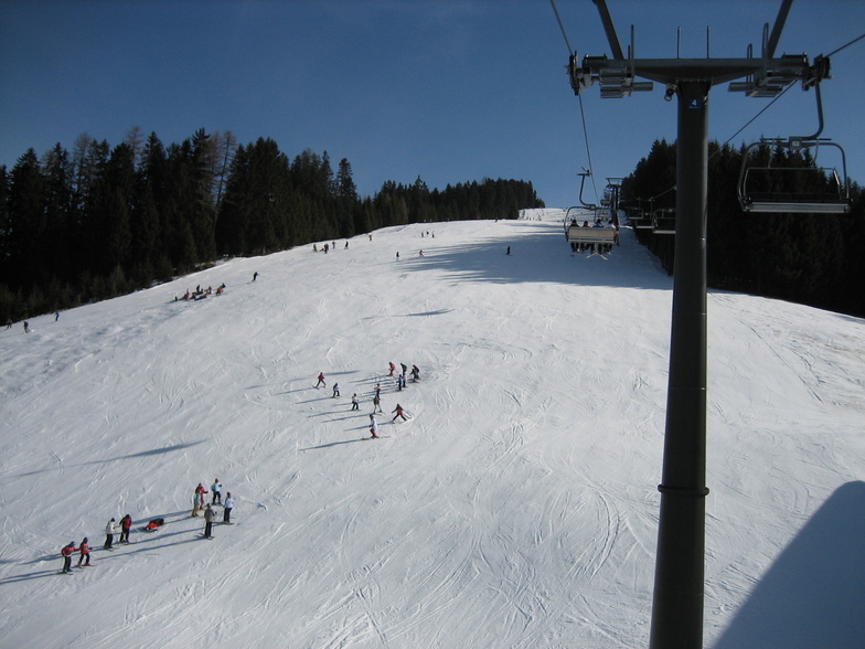
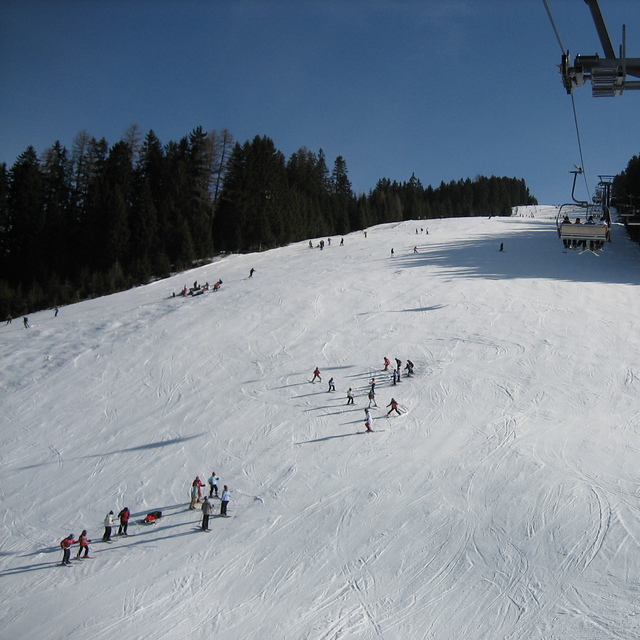
Radstadt is a small town with a few hotels, bars and restaurants, just over an hour from Salzburg. The ski area is fairly small, about 30kms of runs and 5 lifts. The runs are nice, tree lined and mostly red or blue. There is a fast gondola from the village and the other lifts are all quad chairs, fast and efficient. The lift pass covers the whole Salzburgerland ski area, so places like Flachau, Schladming, Zauchenzee, Filzmoos and Obertauern are included. So if you fancy a change just get the bus to the other local resorts, most are within 30min bus ride. A good tip is to get the gondola up, ski down the Altenmarkt side of the mountain and get the ski bus from there 15 minutes down the valley to the higher Zauchensee area which has guaranteed snow and about 20 lifts and links to Kleinarl. Although Radstadt ski area is low (900 - 1700m) it is mostly north facing so can survive warm weather. When I was there is was 18 degrees in mid March but most runs were still open and you could ski to the bottom despite the warmest and most snow-less winter for decades (2006-07). Would recommend Radstadt for good links, cheap accommodation and for families. If you want to party then go to Flachau or Schladming.
David Hosking from United Kingdom writes:
Radstadt is a small town with a few hotels, bars and restaurants, just over an hour from Salzburg. The ski area is fairly small, about 30kms of runs and 5 lifts. The runs are nice, tree lined and mostly red or blue. There is a fast gondola from the village and the other lifts are all quad chairs, fast and efficient. The lift pass covers the whole Salzburgerland ski area, so places like Flachau, Schladming, Zauchenzee, Filzmoos and Obertauern are included. So if you fancy a change just get the bus to the other local resorts, most are within 30min bus ride. A good tip is to get the gondola up, ski down the Altenmarkt side of the mountain and get the ski bus from there 15 minutes down the valley to the higher Zauchensee area which has guaranteed snow and about 20 lifts and links to Kleinarl. Although Radstadt ski area is low (900 - 1700m) it is mostly north facing so can survive warm weather. When I was there is was 18 degrees in mid March but most runs were still open and you could ski to the bottom despite the warmest and most snow-less winter for decades (2006-07). Would recommend Radstadt for good links, cheap accommodation and for families. If you want to party then go to Flachau or Schladming.
Read 1 more reviews of Radstadt/Altenmarkt or submit your own
The Radstadt/Altenmarkt skiing weather widget is available to embed on external websites free of charge. It provides a daily summary of our Radstadt/Altenmarkt snow forecast and current weather conditions. Simply go to the feed configuration page and follow the 3 simple steps to grab the custom html code snippet and paste it into your own site. You can choose the snow forecast elevation (summit, mid-mountain or bottom lift) and metric/imperial units for the snow forecast feed to suit your own website…. Click here to get the code.
View detailed snow forecast for Radstadt/Altenmarkt at:
snow-forecast.com


 Nearest