

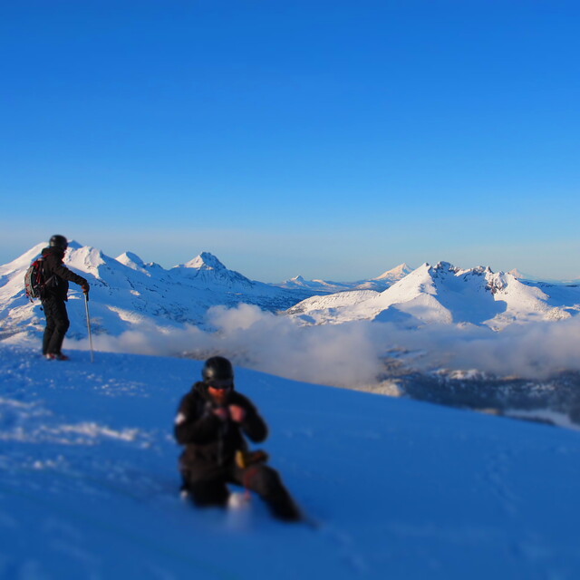
Global Weekly Snow Roundup #314
Weekly Global Snow News, updated 14 May 2026: Fresh snowfall in Argentina, Australia and Lesotho signals winter’s approach, while Japan maintains the world’s deepest snowpack.

Next 4 days weather summary:A light covering of new snow on Sat night turning to drizzle on Sun afternoon. Freeze-thaw conditions (max 7°C on Mon afternoon, min -7°C on Sat night). Wind will be generally light. | Days 5-7 weather summary:Mostly dry. Freeze-thaw conditions (max 16°C on Thu afternoon, min -1°C on Mon night). Wind will be generally light. | |||||||||||||||
Saturday 16 | Sunday 17 | Monday 18 | Tuesday 19 | Wednesday 20 | ||||||||||||
night | AM | PM | night | AM | PM | night | AM | PM | night | AM | PM | night | AM | PM | night | |
light snow | light snow | light snow | light snow | clear | light rain | some clouds | some clouds | clear | clear | clear | some clouds | some clouds | some clouds | clear | clear | |
km/h | ||||||||||||||||
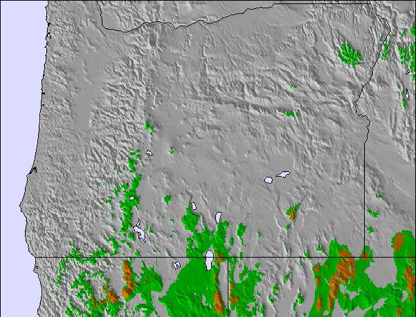
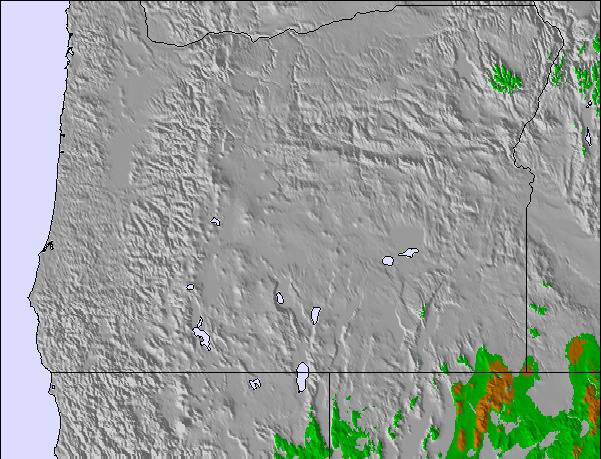
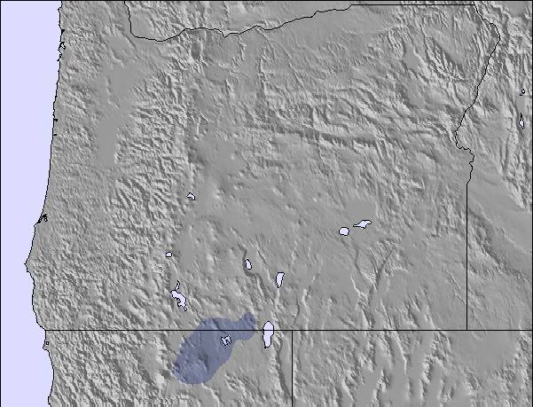
Snow map |  |  |  | 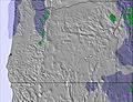 |  | 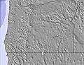 | ||||||||||
2 | 1 | 1 | 4 | — | — | — | — | — | — | — | — | — | — | — | — | |
— | — | — | — | — | 1 | — | — | — | — | — | — | — | — | — | — | |
max °C | 0 | -2 | 0 | -3 | 1 | 3 | 1 | 6 | 7 | 3 | 7 | 10 | 5 | 11 | 14 | 9 |
min °C | -3 | -4 | -1 | -7 | -4 | 3 | -2 | 3 | 7 | -1 | 3 | 9 | 1 | 5 | 14 | 5 |
-9 | -11 | -6 | -13 | -10 | -2 | -7 | 3 | 5 | -4 | 0 | 7 | -2 | 3 | 14 | 3 | |
96 | 77 | 91 | 93 | 57 | 62 | 61 | 45 | 50 | 76 | 50 | 47 | 80 | 42 | 39 | 54 | |
1500 | 1600 | 1750 | 1000 | 1950 | 2250 | 1800 | 2550 | 2650 | 2200 | 2750 | 3100 | 3250 | 3100 | 3500 | 3800 | |
— | 5:39 | — | — | 5:39 | — | — | 5:37 | — | — | 5:37 | — | — | 5:35 | — | — | |
— | — | — | 8:25 | — | — | 8:27 | — | — | 8:29 | — | — | 8:30 | — | — | 8:30 | |
Latest snow reports near Mt Bachelor:
| Top snow depth: | — |
|---|---|
| Bottom snow depth: | — |
| Fresh snowfall depth: | — |
| Last snowfall: | 13 May 2026 |
| Snow Alerts | Create Alert |
0.0 | Bluebird Powder days Fresh snow, mostly sunny, light wind. |
|---|---|
0.3 | Powder days Fresh snow, limited sun, any wind. |
0.0 | Bluebird days Average snow, mostly sunny, light wind. |
The above table gives the weather forecast for Mt Bachelor at the specific elevation of 1920 m. Our sophisticated weather models allow us to provide snow forecasts for the top, middle and bottom ski stations of Mt Bachelor. To access the weather forecasts for the other elevations, use the tab navigation above the table. For a wider view of the weather, check out the Weather Map of United States.
Click here to read further information on freezing levels and how we forecast our temperatures.
Overall 3.4 Based on 50 votes and 26 reviews
Don't buy their season pass or lift tickets and stay away until they can figure the parking situation out, It's a mess! Just canceled three passes for my family, wrote an email and messaged their text service with no response. This tells me they are understaffed and have no real plan in place. Hopefully, they are not as flakey (pun intended) as the snow there in refunding our money.
Jon M from United States writes:
Don't buy their season pass or lift tickets and stay away until they can figure the parking situation out, It's a mess! Just canceled three passes for my family, wrote an email and messaged their text service with no response. This tells me they are understaffed and have no real plan in place. Hopefully, they are not as flakey (pun intended) as the snow there in refunding our money.

 Nearest