

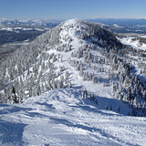
Global Weekly Snow Roundup #314
Weekly Global Snow News, updated 14 May 2026: Fresh snowfall in Argentina, Australia and Lesotho signals winter’s approach, while Japan maintains the world’s deepest snowpack.

Next 3 days weather summary:A light covering of new snow, mostly falling on Fri afternoon. Becoming milder with light rain (total 2.0mm) on Sun afternoon. Freeze-thaw conditions (max 7°C on Sun afternoon, min -2°C on Fri night). Wind will be generally light. | Days 4-6 weather summary:Moderate rain (total 11.0mm), heaviest on Mon afternoon. Mild temperatures (max 5°C on Mon afternoon, min 4°C on Mon night). Wind will be generally light. | ||||||||||||||||
Fri 15 | Saturday 16 | Sunday 17 | Monday 18 | Tuesday 19 | Wednesday 20 | ||||||||||||
PM | night | AM | PM | night | AM | PM | night | AM | PM | night | AM | PM | night | AM | PM | night | |
light snow | snow shwrs | snow shwrs | light snow | snow shwrs | clear | rain shwrs | light rain | cloudy | light rain | light rain | light rain | light rain | rain shwrs | some clouds | cloudy | cloudy | |
km/h | |||||||||||||||||
Snow map | 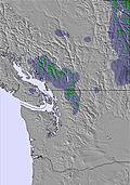 | 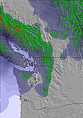 | 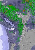 | 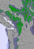 | 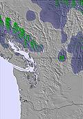 | 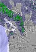 | |||||||||||
3 | 1 | — | 1 | — | — | — | — | — | — | — | — | — | — | — | — | — | |
— | — | — | — | — | — | 1 | 1 | — | 2 | 4 | 2 | 2 | 1 | — | — | — | |
max °C | 0 | -1 | 0 | 2 | 2 | 4 | 7 | 6 | 4 | 5 | 5 | 4 | 5 | 5 | 5 | 5 | 4 |
min °C | -1 | -2 | -1 | 1 | 1 | 3 | 7 | 4 | 3 | 5 | 4 | 4 | 5 | 4 | 4 | 4 | 4 |
-4 | -2 | -3 | -2 | -3 | 1 | 7 | 4 | 3 | 5 | 4 | 4 | 5 | 3 | 3 | 3 | 3 | |
95 | 93 | 83 | 72 | 66 | 65 | 67 | 83 | 84 | 94 | 95 | 93 | 93 | 92 | 89 | 91 | 96 | |
1250 | 1050 | 1350 | 1550 | 1700 | 2000 | 2300 | 2050 | 2000 | 2050 | 2050 | 2100 | 2200 | 2250 | 2600 | 2400 | 2450 | |
— | — | 5:35 | — | — | 5:33 | — | — | 5:31 | — | — | 5:31 | — | — | 5:30 | — | — | |
— | 8:59 | — | — | 9:00 | — | — | 9:01 | — | — | 9:02 | — | — | 9:04 | — | — | 9:06 | |
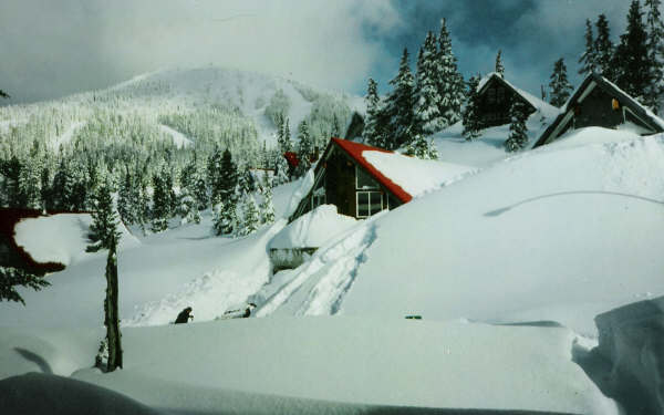
Latest snow reports near Mount Washington:
| Top snow depth: | — |
|---|---|
| Bottom snow depth: | — |
| Fresh snowfall depth: | 3 cm |
| Last snowfall: | 14 May 2026 |
| Snow Alerts | Create Alert |
0.1 | Bluebird Powder days Fresh snow, mostly sunny, light wind. |
|---|---|
0.3 | Powder days Fresh snow, limited sun, any wind. |
0.0 | Bluebird days Average snow, mostly sunny, light wind. |

The above table gives the weather forecast for Mount Washington at the specific elevation of 1336 m. Our sophisticated weather models allow us to provide snow forecasts for the top, middle and bottom ski stations of Mount Washington. To access the weather forecasts for the other elevations, use the tab navigation above the table. For a wider view of the weather, check out the Weather Map of Canada.
Click here to read further information on freezing levels and how we forecast our temperatures.
Overall 3.2 Based on 220 votes and 377 reviews
Big dump coming this weekend. Be there. MAR. 8-9.2025. [note from the editor: post will remain in place for a short time.)
CHICO from Canada writes:
Big dump coming this weekend. Be there. MAR. 8-9.2025.
[note from the editor: post will remain in place for a short time.)
Read 376 more reviews of Mount Washington or submit your own


 Nearest