

Global Weekly Snow Roundup #314
Weekly Global Snow News, updated 14 May 2026: Fresh snowfall in Argentina, Australia and Lesotho signals winter’s approach, while Japan maintains the world’s deepest snowpack.

Next 3 days weather summary:Light rain (total 4.0mm), mostly falling on Sat night. Very mild (max 18°C on Mon night, min 5°C on Sun night). Winds increasing (light winds from the WNW on Mon morning, near gales from the WSW by Mon night). | Days 4-6 weather summary:Moderate rain (total 19.0mm), heaviest on Tue night. Freeze-thaw conditions (max 18°C on Tue morning, min 0°C on Thu morning). Mainly strong winds. | |||||||||||||||||
Saturday 16 | Sunday 17 | Monday 18 | Tuesday 19 | Wednesday 20 | Thursday 21 | |||||||||||||
AM | PM | night | AM | PM | night | AM | PM | night | AM | PM | night | AM | PM | night | AM | PM | night | |
some clouds | cloudy | rain shwrs | clear | clear | some clouds | some clouds | clear | rain shwrs | light rain | some clouds | heavy rain | light rain | light rain | rain shwrs | some clouds | some clouds | clear | |
km/h | ||||||||||||||||||
Snow map |  |  |  |  |  |  | ||||||||||||
— | — | — | — | — | — | — | — | — | — | — | — | — | — | — | — | — | — | |
— | — | 3 | — | — | — | — | — | 1 | 2 | — | 11 | 2 | 3 | 1 | — | — | — | |
max °C | 12 | 13 | 11 | 8 | 9 | 7 | 9 | 13 | 18 | 18 | 14 | 15 | 13 | 11 | 10 | 3 | 6 | 4 |
min °C | 10 | 12 | 9 | 6 | 7 | 5 | 7 | 12 | 14 | 13 | 14 | 13 | 12 | 11 | 1 | 0 | 5 | 1 |
6 | 9 | 5 | 2 | 3 | 0 | 6 | 10 | 11 | 12 | 13 | 10 | 10 | 8 | -5 | -6 | 2 | -3 | |
55 | 72 | 80 | 68 | 40 | 33 | 32 | 55 | 82 | 83 | 83 | 94 | 97 | 96 | 85 | 61 | 44 | 50 | |
2800 | 3050 | 2500 | 1850 | 2250 | 2750 | 3400 | 3800 | 4150 | 3750 | 4100 | 3950 | 3750 | 3500 | 1200 | 1100 | 1550 | 1050 | |
5:05 | — | — | 5:03 | — | — | 5:03 | — | — | 5:01 | — | — | 5:00 | — | — | 4:58 | — | — | |
— | — | 8:12 | — | — | 8:14 | — | — | 8:15 | — | — | 8:15 | — | — | 8:16 | — | — | 8:17 | |
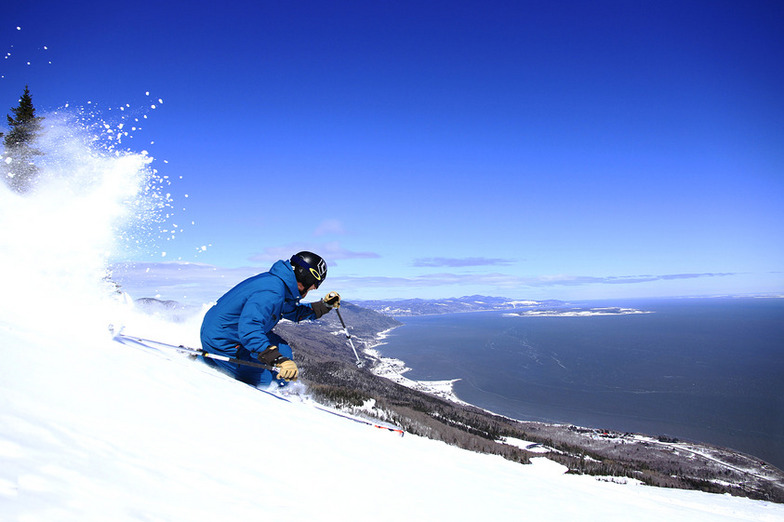
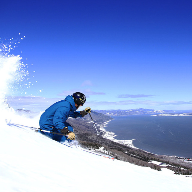
Latest snow reports near Le Massif de Charlevoix:
| Top snow depth: | 0 cm |
|---|---|
| Bottom snow depth: | 0 cm |
| Fresh snowfall depth: | — |
| Last snowfall: | 22 Apr 2026 |
| Snow Alerts | Create Alert |
0.1 | Bluebird Powder days Fresh snow, mostly sunny, light wind. |
|---|---|
0.1 | Powder days Fresh snow, limited sun, any wind. |
0.0 | Bluebird days Average snow, mostly sunny, light wind. |
The above table gives the weather forecast for Le Massif de Charlevoix at the specific elevation of 806 m. Our sophisticated weather models allow us to provide snow forecasts for the top, middle and bottom ski stations of Le Massif de Charlevoix. To access the weather forecasts for the other elevations, use the tab navigation above the table. For a wider view of the weather, check out the Weather Map of Canada.
Click here to read further information on freezing levels and how we forecast our temperatures.
Resort name is also written as Le Massif Ski Area.
Overall 4.1 Based on 13 votes and 6 reviews
I'm from New Hampshire and I would say that Lee Massif is a cross between Cannon mtn and Mad River Glenn in Vermont. It has the best snow and the best views in the east. Add that to awesome tree skiing and a great gondola and you have hit the jackpot.
Hatty from United States writes:
I'm from New Hampshire and I would say that Lee Massif is a cross between Cannon mtn and Mad River Glenn in Vermont. It has the best snow and the best views in the east. Add that to awesome tree skiing and a great gondola and you have hit the jackpot.
Read 5 more reviews of Le Massif de Charlevoix or submit your own


 Nearest