

Global Weekly Snow Roundup #314
Weekly Global Snow News, updated 14 May 2026: Fresh snowfall in Argentina, Australia and Lesotho signals winter’s approach, while Japan maintains the world’s deepest snowpack.

Next 3 days weather summary:A dusting of snow giving way to moderate rain (total 11.0mm) heaviest on Mon night. Freeze-thaw conditions (max 6°C on Sun afternoon, min -3°C on Sat morning). Wind will be generally light. | Days 4-6 weather summary:Light rain (total 4.0mm), mostly falling on Tue afternoon. Very mild (max 13°C on Thu afternoon, min 3°C on Tue morning). Wind will be generally light. | |||||||||||||||||
Saturday 16 | Sunday 17 | Monday 18 | Tuesday 19 | Wednesday 20 | Thursday 21 | |||||||||||||
AM | PM | night | AM | PM | night | AM | PM | night | AM | PM | night | AM | PM | night | AM | PM | night | |
snow shwrs | light snow | snow shwrs | some clouds | some clouds | some clouds | light rain | light rain | light rain | cloudy | light rain | rain shwrs | clear | some clouds | some clouds | some clouds | some clouds | clear | |
km/h | ||||||||||||||||||
Snow map |  |  |  |  |  |  | ||||||||||||
— | 1 | — | — | — | — | — | — | — | — | — | — | — | — | — | — | — | — | |
— | — | — | — | — | — | 2 | 4 | 5 | — | 3 | 1 | — | — | — | — | — | — | |
max °C | -1 | 1 | 1 | 3 | 6 | 5 | 3 | 5 | 4 | 4 | 4 | 5 | 7 | 11 | 10 | 10 | 13 | 12 |
min °C | -3 | -1 | 0 | 1 | 6 | 3 | 2 | 4 | 2 | 3 | 4 | 5 | 5 | 10 | 9 | 8 | 13 | 11 |
-3 | -4 | 0 | 1 | 5 | 0 | -1 | 1 | 0 | 1 | 2 | 4 | 5 | 9 | 9 | 8 | 13 | 11 | |
83 | 72 | 73 | 56 | 55 | 68 | 88 | 69 | 93 | 83 | 91 | 84 | 77 | 61 | 67 | 58 | 47 | 49 | |
1600 | 1900 | 1800 | 2250 | 2450 | 2300 | 2200 | 2350 | 2100 | 2450 | 2650 | 2700 | 2950 | 3200 | 3500 | 3700 | 3800 | 4050 | |
6:01 | — | — | 6:00 | — | — | 5:58 | — | — | 5:58 | — | — | 5:56 | — | — | 5:56 | — | — | |
— | — | 8:59 | — | — | 9:00 | — | — | 9:01 | — | — | 9:02 | — | — | 9:04 | — | — | 9:05 | |
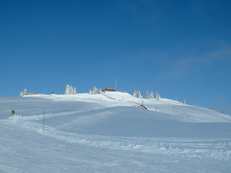
Latest snow reports near La Clusaz:
Moderate rain reported from Haute-Savoie Mont Blanc Airport/Aéroport Annecy/Meythet at 711 metres elevation only 3 kms WNW of Annecy-LeSemnoz but it is forecast cold enough for snow at the ski area from Annecy-LeSemnoz
Light rain reported from Haute-Savoie Mont Blanc Airport/Aéroport Annecy/Meythet at 711 metres elevation only 3 kms WNW of Annecy-LeSemnoz but it is forecast cold enough for snow at the ski area from Annecy-LeSemnoz
| Top snow depth: | — |
|---|---|
| Bottom snow depth: | — |
| Fresh snowfall depth: | 17 cm |
| Last snowfall: | 15 May 2026 |
| Snow Alerts | Create Alert |
0.0 | Bluebird Powder days Fresh snow, mostly sunny, light wind. |
|---|---|
0.3 | Powder days Fresh snow, limited sun, any wind. |
0.1 | Bluebird days Average snow, mostly sunny, light wind. |

The above table gives the weather forecast for La Clusaz at the specific elevation of 1742 m. Our sophisticated weather models allow us to provide snow forecasts for the top, middle and bottom ski stations of La Clusaz. To access the weather forecasts for the other elevations, use the tab navigation above the table. For a wider view of the weather, check out the Weather Map of France.
Click here to read further information on freezing levels and how we forecast our temperatures.
Overall 4.1 Based on 41 votes and 24 reviews
We went late March, which is always risky in terms of weather and conditions. It was warm and slushy, I'd recommend nothing later than mid March. This was a 4 day trip, we left Luton at 6am Sunday (cheap flight, half empty) and because of the short transfer, we were on the first gondola at 11.30am. That's the key attraction here, the short transfer from Geneva. Given the snow conditions, it's difficult to be fully objective, but a few things stand out. The lift system is generally old and slow, particularly the long and very slow chair at Baime, which does detract from the attraction of that area. Baime is the highest part of the resort and you can ski all the way from the top to the bottom (red and blue). None of the blacks are that steep and seem to be black because they are infrequently groomed. The piste bashers are quite small and narrow, judging from the 'tramlines' that they leave behind, which can make the pistes a bit rutted and uneven in places. Stayed at the Hotel Prestige Odalys, modern, good location. excellent pizzas at the tiny Pizza Minut right by the church. Conclusion: a decent place for a 3/4 day weekend trip, but best to go before mid March.
bradley from United Kingdom writes:
We went late March, which is always risky in terms of weather and conditions. It was warm and slushy, I'd recommend nothing later than mid March.
This was a 4 day trip, we left Luton at 6am Sunday (cheap flight, half empty) and because of the short transfer, we were on the first gondola at 11.30am. That's the key attraction here, the short transfer from Geneva.
Given the snow conditions, it's difficult to be fully objective, but a few things stand out. The lift system is generally old and slow, particularly the long and very slow chair at Baime, which does detract from the attraction of that area. Baime is the highest part of the resort and you can ski all the way from the top to the bottom (red and blue). None of the blacks are that steep and seem to be black because they are infrequently groomed.
The piste bashers are quite small and narrow, judging from the 'tramlines' that they leave behind, which can make the pistes a bit rutted and uneven in places.
Stayed at the Hotel Prestige Odalys, modern, good location. excellent pizzas at the tiny Pizza Minut right by the church.
Conclusion: a decent place for a 3/4 day weekend trip, but best to go before mid March.


 Nearest