

America’s Next Indoor Snow Centre Takes Shape
Construction of a new indoor snow centre for skiers, boarders and tubers appears to be making good progress at Heritage Farm in Wayne County, West Virginia.

Next 3 days weather summary:Light rain (total 6.0mm), mostly falling on Sat night. Warm (max 27°C on Sat afternoon, min 12°C on Thu night). Wind will be generally light. | Days 4-6 weather summary:Moderate rain (total 10.0mm), heaviest on Sun afternoon. Warm (max 27°C on Tue afternoon, min 13°C on Sun night). Wind will be generally light. | |||||||||||||||||
Thursday 23 | Friday 24 | Saturday 25 | Sunday 26 | Monday 27 | Tuesday 28 | |||||||||||||
AM | PM | night | AM | PM | night | AM | PM | night | AM | PM | night | AM | PM | night | AM | PM | night | |
some clouds | clear | clear | clear | clear | clear | some clouds | clear | mod. rain | t-storm risk | t-storm risk | rain shwrs | clear | clear | clear | clear | clear | some clouds | |
km/h | ||||||||||||||||||
Snow map |  |  |  |  |  |  | ||||||||||||
— | — | — | — | — | — | — | — | — | — | — | — | — | — | — | — | — | — | |
mm | — | — | — | — | — | — | — | — | 6 | 2 | 6 | 2 | — | — | — | — | — | — |
max °C | 19 | 23 | 19 | 20 | 24 | 20 | 25 | 27 | 22 | 20 | 21 | 19 | 20 | 24 | 20 | 23 | 27 | 24 |
min °C | 15 | 22 | 12 | 15 | 23 | 15 | 19 | 26 | 14 | 16 | 21 | 13 | 15 | 23 | 15 | 18 | 27 | 20 |
chill °C | 15 | 22 | 12 | 15 | 23 | 15 | 19 | 26 | 14 | 16 | 21 | 13 | 15 | 23 | 15 | 18 | 27 | 20 |
Humid % | 47 | 33 | 56 | 47 | 31 | 38 | 30 | 33 | 67 | 59 | 58 | 57 | 63 | 50 | 69 | 56 | 44 | 56 |
Freeze m | 3700 | 3550 | 4100 | 4400 | 4450 | 4400 | 4400 | 4250 | 3900 | 3650 | 3750 | 3800 | 4250 | 4250 | 4750 | 4650 | 4700 | 4600 |
6:05 | — | — | 6:07 | — | — | 6:07 | — | — | 6:09 | — | — | 6:09 | — | — | 6:11 | — | — | |
— | — | 9:14 | — | — | 9:13 | — | — | 9:12 | — | — | 9:10 | — | — | 9:09 | — | — | 9:08 | |
Go pro and carve into:
Avalanche information: European Avalanche Warning Services (EAWS)
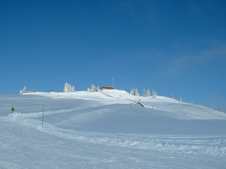
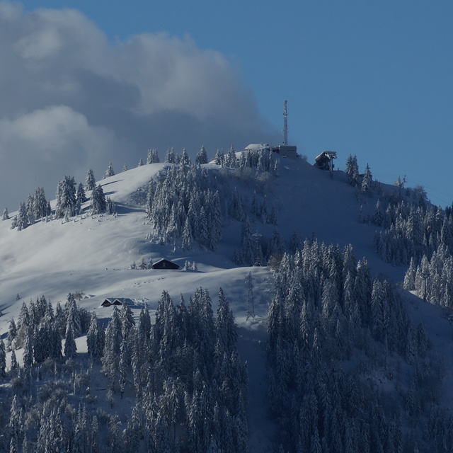
Latest snow reports near La Clusaz:
| Top snow depth: | 0 cm |
|---|---|
| Bottom snow depth: | 0 cm |
| Fresh snowfall depth: | — |
| Last snowfall: | 16 May 2026 |
| Snow Alerts | Create Alert |
0.0 | Bluebird Powder days Fresh snow, mostly sunny, light wind. |
|---|---|
0.0 | Powder days Fresh snow, limited sun, any wind. |
0.0 | Bluebird days Average snow, mostly sunny, light wind. |

The above table gives the weather forecast for La Clusaz at the specific elevation of 984 m. Our sophisticated weather models allow us to provide snow forecasts for the top, middle and bottom ski stations of La Clusaz. To access the weather forecasts for the other elevations, use the tab navigation above the table. For a wider view of the weather, check out the Weather Map of France.
Click here to read further information on freezing levels and how we forecast our temperatures.
Overall 4.1 Based on 41 votes and 24 reviews
Actually under the name "La Clusaz" there are five interconnected ski centers with the same ticket: Balme, Aiguille, Etale, Beauregard and Manigod. Last year I visited Beauregard and Manigod. This year I skied Aiguille and Balme. So I am still missing Etale. I stayed in Annecy. It is about 30km far away from La Clusaz and an hour bus drive. I took the offer from Annecy bus station. At 40€ per person a lift ticket and bus transfer are included. Really good price! The bus leaves from Annecy at 09:30 and returns at 17:00. I skied on Friday, 16th February 2018. What a fantastic ski day. I was really worried about rain that had fallen the last day. However, the rain caused no problem. Temperature was at about 6C in the base and around freezing level at the top of the mountains (approximately 2.500m). I rented good ski equipment at 27€/day. I started skiing in Auguille. The only piste in not so good condition was Merle, because there were too many people skiing on it. However, and despite the fact it was French winter school holidays and the ski center was really busy, there were almost no queues at the lifts. Snow coverage was really good: 40 cm at the base and more than 3 meters on the top. Not a single stone in the whole ski center. The weather was very changeable. In the lower slopes, there was little rain. In some slopes there was sun. On the top of the mountains (Aiguille and Balme as well) there was dense fog. On the top of Balme (piste Blanchot) it was snowing heavily. What a weather mixture in one single day and a single ski center! In my opinion, the best mountain is Balme. You do not need to take the gondola from Aiguille. I skied down the red piste La Fernuy. It was written that the piste was not prepared and the snow was heavy. Well, this was not true. Fernuy was pretty nice and the view from there was fantastic. Furthermore, Balme was much quiter than Aiguille and a lot more enjoyable, as the mountain was virtually empty from skiers. The red Blanchot, Torchere and Lachat were really good. Up on the top, in the beginning and the middle of Blanchot, it was snowing heavily. Down further, the weather cleared. I skied the red Lachat, which is a big red piste, totally alone! La Clusaz consists mostly of blue and red pistes. It is the paradise of the interemediate skier. You need at least three full days to visit all the five interconnected ski centers. Overall, it was one the best skiing experiences ever from all the aspects. La Clusaz is totally recommended!
Derion from Greece writes:
Actually under the name "La Clusaz" there are five interconnected ski centers with the same ticket: Balme, Aiguille, Etale, Beauregard and Manigod. Last year I visited Beauregard and Manigod. This year I skied Aiguille and Balme. So I am still missing Etale. I stayed in Annecy. It is about 30km far away from La Clusaz and an hour bus drive. I took the offer from Annecy bus station. At 40€ per person a lift ticket and bus transfer are included. Really good price! The bus leaves from Annecy at 09:30 and returns at 17:00. I skied on Friday, 16th February 2018. What a fantastic ski day. I was really worried about rain that had fallen the last day. However, the rain caused no problem. Temperature was at about 6C in the base and around freezing level at the top of the mountains (approximately 2.500m). I rented good ski equipment at 27€/day. I started skiing in Auguille. The only piste in not so good condition was Merle, because there were too many people skiing on it. However, and despite the fact it was French winter school holidays and the ski center was really busy, there were almost no queues at the lifts. Snow coverage was really good: 40 cm at the base and more than 3 meters on the top. Not a single stone in the whole ski center. The weather was very changeable. In the lower slopes, there was little rain. In some slopes there was sun. On the top of the mountains (Aiguille and Balme as well) there was dense fog. On the top of Balme (piste Blanchot) it was snowing heavily. What a weather mixture in one single day and a single ski center! In my opinion, the best mountain is Balme. You do not need to take the gondola from Aiguille. I skied down the red piste La Fernuy. It was written that the piste was not prepared and the snow was heavy. Well, this was not true. Fernuy was pretty nice and the view from there was fantastic. Furthermore, Balme was much quiter than Aiguille and a lot more enjoyable, as the mountain was virtually empty from skiers. The red Blanchot, Torchere and Lachat were really good. Up on the top, in the beginning and the middle of Blanchot, it was snowing heavily. Down further, the weather cleared. I skied the red Lachat, which is a big red piste, totally alone! La Clusaz consists mostly of blue and red pistes. It is the paradise of the interemediate skier. You need at least three full days to visit all the five interconnected ski centers. Overall, it was one the best skiing experiences ever from all the aspects. La Clusaz is totally recommended!


 Nearest