

Global Weekly Snow Roundup #314
Weekly Global Snow News, updated 14 May 2026: Fresh snowfall in Argentina, Australia and Lesotho signals winter’s approach, while Japan maintains the world’s deepest snowpack.

Next 3 days weather summary:A dusting of snow turning to light rain (total 3.0mm) on Sun afternoon. Freeze-thaw conditions (max 6°C on Sun afternoon, min -2°C on Sat morning). Wind will be generally light. | Days 4-6 weather summary:Light rain (total 6.0mm), mostly falling on Tue afternoon. Very mild (max 10°C on Wed afternoon, min 2°C on Tue morning). Wind will be generally light. | |||||||||||||||||
Saturday 16 | Sunday 17 | Monday 18 | Tuesday 19 | Wednesday 20 | Thursday 21 | |||||||||||||
AM | PM | night | AM | PM | night | AM | PM | night | AM | PM | night | AM | PM | night | AM | PM | night | |
light snow | light snow | snow shwrs | clear | rain shwrs | some clouds | cloudy | rain shwrs | light rain | light rain | light rain | rain shwrs | clear | some clouds | some clouds | clear | some clouds | cloudy | |
km/h | ||||||||||||||||||
Snow map | 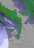 | 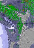 | 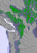 | 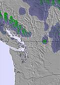 | 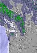 | 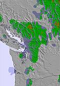 | ||||||||||||
2 | 1 | — | — | — | — | — | — | — | — | — | — | — | — | — | — | — | — | |
— | — | — | — | 1 | — | — | 1 | 1 | 2 | 3 | 1 | — | — | — | — | — | — | |
max °C | -2 | 0 | 0 | 2 | 6 | 5 | 3 | 5 | 4 | 2 | 3 | 4 | 6 | 10 | 10 | 8 | 10 | 10 |
min °C | -2 | -1 | 0 | 1 | 5 | 3 | 3 | 4 | 3 | 2 | 3 | 3 | 4 | 9 | 8 | 8 | 9 | 7 |
-6 | -5 | -2 | -2 | 5 | 0 | 0 | 1 | 0 | -2 | 0 | 3 | 4 | 9 | 7 | 6 | 7 | 5 | |
98 | 96 | 92 | 86 | 74 | 69 | 77 | 82 | 76 | 100 | 92 | 89 | 81 | 65 | 54 | 63 | 67 | 71 | |
1150 | 1300 | 1300 | 1700 | 2250 | 2000 | 1800 | 2000 | 2000 | 1750 | 1950 | 2100 | 2450 | 3000 | 3350 | 3300 | 3150 | 2800 | |
5:22 | — | — | 5:20 | — | — | 5:20 | — | — | 5:18 | — | — | 5:18 | — | — | 5:16 | — | — | |
— | — | 8:45 | — | — | 8:46 | — | — | 8:47 | — | — | 8:49 | — | — | 8:51 | — | — | 8:52 | |
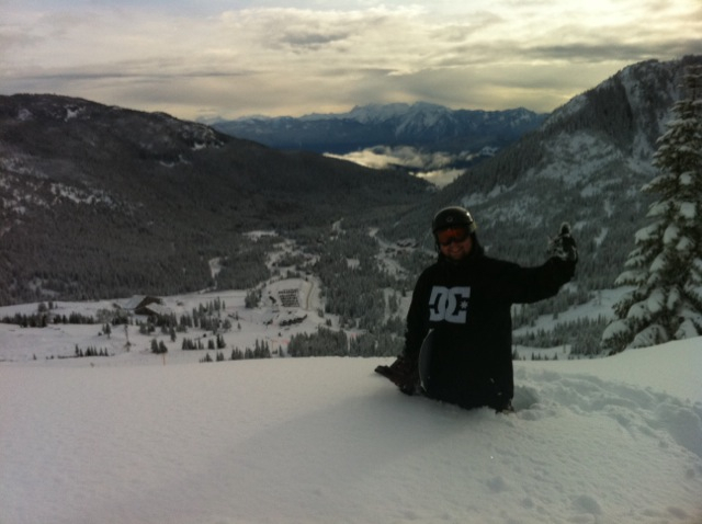
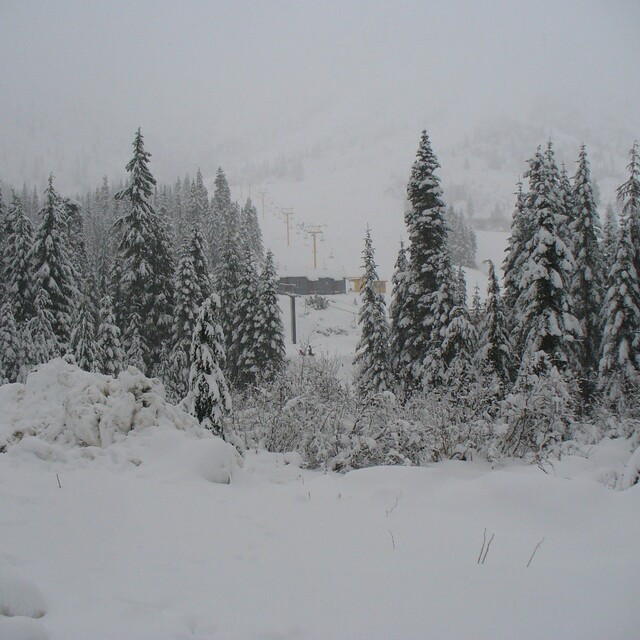
Latest snow reports near Sasquatch Mountain Resort:
| Top snow depth: | — |
|---|---|
| Bottom snow depth: | — |
| Fresh snowfall depth: | 13 cm |
| Last snowfall: | 15 May 2026 |
| Snow Alerts | Create Alert |
0.0 | Bluebird Powder days Fresh snow, mostly sunny, light wind. |
|---|---|
0.1 | Powder days Fresh snow, limited sun, any wind. |
0.0 | Bluebird days Average snow, mostly sunny, light wind. |
The above table gives the weather forecast for Sasquatch Mountain Resort at the specific elevation of 1372 m. Our sophisticated weather models allow us to provide snow forecasts for the top, middle and bottom ski stations of Sasquatch Mountain Resort. To access the weather forecasts for the other elevations, use the tab navigation above the table. For a wider view of the weather, check out the Weather Map of Canada.
Click here to read further information on freezing levels and how we forecast our temperatures.
Resort name is also written as Hemlock Resort.
Overall 3.5 Based on 47 votes and 36 reviews
No snow at Christmas break was so sad for us as we had to keep our grand kids entertained, but that's not the mountain's fault. But on the weekend of opening the grooming on Timber Cruiser, Big Foot, Weaver, Abobinal and Roddy's was horrible. The only one who enjoyed the slopes were out by the outriggers (black). This was a total of 2 people from 8 of us out of 8 people. 3 paid full price and the rest have Gold passes. We realize that the snow was problematic but the grooming should have been pristine, not just one swipe on 2 runs. Also, went in for lunch at 12:30 and received our food by 2pm. That left, after eating, only an hour to ski those awful groomed runs.
Snow Bear from Canada writes:
No snow at Christmas break was so sad for us as we had to keep our grand kids entertained, but that's not the mountain's fault. But on the weekend of opening the grooming on Timber Cruiser, Big Foot, Weaver, Abobinal and Roddy's was horrible. The only one who enjoyed the slopes were out by the outriggers (black). This was a total of 2 people from 8 of us out of 8 people. 3 paid full price and the rest have Gold passes. We realize that the snow was problematic but the grooming should have been pristine, not just one swipe on 2 runs. Also, went in for lunch at 12:30 and received our food by 2pm. That left, after eating, only an hour to ski those awful groomed runs.
Read 35 more reviews of Sasquatch Mountain Resort or submit your own


 Nearest