

Global Weekly Snow Roundup #314
Weekly Global Snow News, updated 14 May 2026: Fresh snowfall in Argentina, Australia and Lesotho signals winter’s approach, while Japan maintains the world’s deepest snowpack.

Next 3 days weather summary:A dusting of snow turning to light rain (total 7.0mm) on Mon afternoon. Freeze-thaw conditions (max 5°C on Sun afternoon, min -4°C on Sat morning). Wind will be generally light. | Days 4-6 weather summary:Light rain (total 8.0mm), mostly falling on Tue afternoon. Very mild (max 13°C on Thu afternoon, min 2°C on Tue morning). Wind will be generally light. | |||||||||||||||||
Saturday 16 | Sunday 17 | Monday 18 | Tuesday 19 | Wednesday 20 | Thursday 21 | |||||||||||||
AM | PM | night | AM | PM | night | AM | PM | night | AM | PM | night | AM | PM | night | AM | PM | night | |
snow shwrs | light snow | snow shwrs | some clouds | light rain | rain shwrs | light snow | light rain | light snow | light rain | light rain | rain shwrs | some clouds | rain shwrs | some clouds | some clouds | some clouds | clear | |
km/h | ||||||||||||||||||
Snow map |  |  |  |  |  |  | ||||||||||||
— | 1 | — | — | — | — | — | — | — | — | — | — | — | — | — | — | — | — | |
— | — | — | — | 1 | 1 | — | 4 | 1 | 1 | 3 | 3 | — | 1 | — | — | — | — | |
max °C | -2 | -1 | 0 | 2 | 5 | 3 | 2 | 3 | 3 | 4 | 4 | 4 | 7 | 10 | 8 | 10 | 13 | 11 |
min °C | -4 | -2 | -4 | 0 | 4 | 0 | 2 | 2 | 1 | 2 | 4 | 3 | 4 | 9 | 6 | 7 | 13 | 8 |
-4 | -4 | -4 | 0 | 4 | -2 | 0 | -1 | 0 | 1 | 3 | 3 | 4 | 8 | 6 | 7 | 13 | 8 | |
81 | 78 | 84 | 52 | 69 | 86 | 91 | 89 | 94 | 78 | 96 | 92 | 70 | 64 | 74 | 49 | 55 | 61 | |
1650 | 1850 | 1100 | 2300 | 2500 | 2000 | 2200 | 2250 | 2100 | 2500 | 2600 | 2600 | 2900 | 3050 | 3400 | 3550 | 3500 | 3950 | |
5:56 | — | — | 5:54 | — | — | 5:54 | — | — | 5:52 | — | — | 5:52 | — | — | 5:50 | — | — | |
— | — | 8:58 | — | — | 8:59 | — | — | 9:00 | — | — | 9:00 | — | — | 9:02 | — | — | 9:04 | |
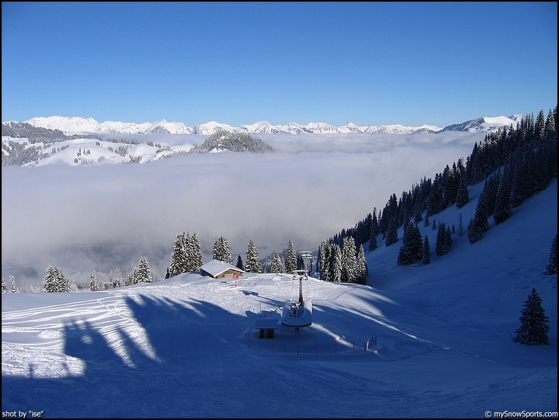
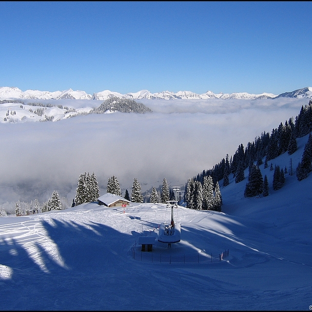
Latest snow reports near Gstaad - Schönried - Saanenmöser:
| Top snow depth: | — |
|---|---|
| Bottom snow depth: | — |
| Fresh snowfall depth: | 21 cm |
| Last snowfall: | 15 May 2026 |
| Snow Alerts | Create Alert |
0.1 | Bluebird Powder days Fresh snow, mostly sunny, light wind. |
|---|---|
0.3 | Powder days Fresh snow, limited sun, any wind. |
0.1 | Bluebird days Average snow, mostly sunny, light wind. |
The above table gives the weather forecast for Gstaad - Schönried - Saanenmöser at the specific elevation of 1900 m. Our sophisticated weather models allow us to provide snow forecasts for the top, middle and bottom ski stations of Gstaad - Schönried - Saanenmöser. To access the weather forecasts for the other elevations, use the tab navigation above the table. For a wider view of the weather, check out the Weather Map of Switzerland.
Click here to read further information on freezing levels and how we forecast our temperatures.
Resort name is also written as Gstaad - Schonried - Saanenmoser.
Overall 4.6 Based on 4 votes and 1 review
Gstaad - Schönried - Saanenmöser is a gem of a resort, not so much for the pricey Gstaad end but for the pretty, varied and 'authentic' Saanenmoser end. On-slope refreshments are found in small, cosy and friendly cabins, some with spectacular views. There are also great vistas from interesting and sometimes challenging runs over several peaks accessed by fast and reliable chairs, gondolas and a few drags. Saanenmoser has great late season snow too - having been in March/April for each of the last 7 years, I've never found a problem, even if some of the warmer slopes have become less attractive. With a direct rail link to Montreux and thereon to Geneva, Gstaad - Schönried - Saanenmöser is a great alternative to some of the better known resorts. And for variety, Glacier 3000 - Les Diablerets - is a short drive away.
Keith B from United Kingdom writes:
Gstaad - Schönried - Saanenmöser is a gem of a resort, not so much for the pricey Gstaad end but for the pretty, varied and 'authentic' Saanenmoser end. On-slope refreshments are found in small, cosy and friendly cabins, some with spectacular views. There are also great vistas from interesting and sometimes challenging runs over several peaks accessed by fast and reliable chairs, gondolas and a few drags. Saanenmoser has great late season snow too - having been in March/April for each of the last 7 years, I've never found a problem, even if some of the warmer slopes have become less attractive. With a direct rail link to Montreux and thereon to Geneva, Gstaad - Schönried - Saanenmöser is a great alternative to some of the better known resorts. And for variety, Glacier 3000 - Les Diablerets - is a short drive away.
Click here to submit your own review of Gstaad - Schönried - Saanenmöser


 Nearest