The above table gives the weather forecast for Gerlos at the specific elevation of 1872 m. Our sophisticated weather models allow us to provide snow forecasts for the top, middle and bottom ski stations of Gerlos. To access the weather forecasts for the other elevations, use the tab navigation above the table. For a wider view of the weather, check out the Weather Map of Austria.
Click here to read further information on freezing levels and how we forecast our temperatures.
Small Austrian resort towns tick a lot of boxes for me, and when I came across this one online, I was surprised I hadn't heard of it, since it has great credentials. The reason is that it attracts lots of Dutch, but few Brits. This is fine by me! Mayrhofen, in the next valley, is party central for the English, but Gerlos has plenty of advantages. It's small and pretty, with lovely traditional chalet architecture. There is a good selection of bars and restaurants, and an abundance of 4* hotels. Best of all, the 2 lifts in the village are within a 5 minute walk of nearly all the accommodation, and you can ski right into the village centre as well.
As for the skiing, well it is rather good, especially for covering the miles as intermediates. Gerlos is in the centre of the Zillertal ski area, and is fine. The Zell sector really stands out though, with an extensive, fairly high altitude section (2000-2500m ) and really lovely blues and reds through the trees lower down. Konigsleiten, at the other end of the system is also recommended. The setting of this purpose built little village, which seems to consist almost entirely of chalets, is lovely indeed. Situated at the top of a pass, this resort feels quite high and remote, and looks to be pretty much all ski in-ski out.
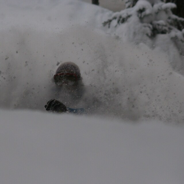
Overall, there are very few black runs, and the one or two we did find we felt were little different from the reds, so it is not the place for expert thrill seekers. Having said that, the quantity of off-piste and its easy accessibility right by the side of the pistes, is a big plus.
The mountain restaurants and very plentiful and very good.
Other pluses: very short transfer (70 minutes from Innsbruck, we got a rare ski session on the first afternoon), significantly lower prices than France (30% less here for hotel, food, drink) and better mountain food. There is a better resort atmosphere as well, and it is good to feel like you are a person, not just a digit in a constantly churning mega ski factory. And the views are glorious in every direction.
Small Austrian resort towns tick a lot of boxes for me, and when I came across this one online, I was surprised I hadn't heard of it, since it has great credentials. The reason is that it attracts lots of Dutch, but few Brits. This is fine by me! Mayrhofen, in the next valley, is party central for the English, but Gerlos has plenty of advantages. It's small and pretty, with lovely traditional chalet architecture. There is a good selection of bars and restaurants, and an abundance of 4* hotels. Best of all, the 2 lifts in the village are within a 5 minute walk of nearly all the accommodation, and you can ski right into the village centre as well.
As for the skiing, well it is rather good, especially for covering the miles as intermediates. Gerlos is in the centre of the Zillertal ski area, and is fine. The Zell sector really stands out though, with an extensive, fairly high altitude section (2000-2500m ) and really lovely blues and reds through the trees lower down. Konigsleiten, at the other end of the system is also recommended. The setting of this purpose built little village, which seems to consist almost entirely of chalets, is lovely indeed. Situated at the top of a pass, this resort feels quite high and remote, and looks to be pretty much all ski in-ski out.
Overall, there are very few black runs, and the one or two we did find we felt were little different from the reds, so it is not the place for expert thrill seekers. Having said that, the quantity of off-piste and its easy accessibility right by the side of the pistes, is a big plus.
The mountain restaurants and very plentiful and very good.
Other pluses: very short transfer (70 minutes from Innsbruck, we got a rare ski session on the first afternoon), significantly lower prices than France (30% less here for hotel, food, drink) and better mountain food. There is a better resort atmosphere as well, and it is good to feel like you are a person, not just a digit in a constantly churning mega ski factory. And the views are glorious in every direction.
Free Snow-Forecast.com weather widget for your website
Embed the Gerlos weather widget on your site for free. It provides a weekly snapshot of snow and rain conditions across all elevations. Follow the two quick steps to grab your custom code and paste it into your site. Choose between metric or imperial units. Click here to get the code.


 Nearest