

Global Weekly Snow Roundup #314
Weekly Global Snow News, updated 14 May 2026: Fresh snowfall in Argentina, Australia and Lesotho signals winter’s approach, while Japan maintains the world’s deepest snowpack.

Next 3 days weather summary:A dusting of snow. Milder later with heavy rain (total 24.0mm) on Sat morning. Very mild (max 12°C on Mon afternoon, min 2°C on Sat morning). Wind will be generally light. | Days 4-6 weather summary:Heavy rain (total 35.0mm), heaviest during Thu morning. Very mild (max 12°C on Thu afternoon, min 7°C on Tue morning). Wind will be generally light. | |||||||||||||||||
Saturday 16 | Sunday 17 | Monday 18 | Tuesday 19 | Wednesday 20 | Thursday 21 | |||||||||||||
AM | PM | night | AM | PM | night | AM | PM | night | AM | PM | night | AM | PM | night | AM | PM | night | |
light snow | light rain | light rain | rain shwrs | rain shwrs | clear | clear | risk thun- der | mod. rain | light rain | light rain | mod. rain | light rain | light rain | rain shwrs | mod. rain | rain shwrs | rain shwrs | |
km/h | ||||||||||||||||||
Snow map |  |  |  |  |  |  | ||||||||||||
2 | — | — | — | — | — | — | — | — | — | — | — | — | — | — | — | — | — | |
3 | 4 | 5 | 1 | 1 | — | — | 3 | 7 | 1 | 2 | 7 | 5 | 3 | 2 | 8 | 3 | 4 | |
max °C | 2 | 3 | 4 | 6 | 9 | 8 | 10 | 12 | 10 | 8 | 11 | 9 | 9 | 9 | 9 | 8 | 12 | 11 |
min °C | 2 | 3 | 3 | 4 | 8 | 6 | 8 | 12 | 6 | 7 | 10 | 8 | 8 | 9 | 8 | 8 | 10 | 9 |
-2 | 0 | 1 | 3 | 8 | 6 | 8 | 12 | 4 | 7 | 10 | 8 | 6 | 7 | 6 | 6 | 9 | 9 | |
98 | 98 | 92 | 75 | 60 | 64 | 55 | 68 | 98 | 86 | 77 | 98 | 93 | 88 | 92 | 97 | 81 | 89 | |
1350 | 1600 | 1650 | 1900 | 2150 | 2250 | 2400 | 2550 | 2200 | 2250 | 2550 | 2450 | 2400 | 2550 | 2500 | 2500 | 2750 | 2750 | |
5:26 | — | — | 5:24 | — | — | 5:24 | — | — | 5:22 | — | — | 5:20 | — | — | 5:20 | — | — | |
— | — | 8:37 | — | — | 8:37 | — | — | 8:38 | — | — | 8:39 | — | — | 8:42 | — | — | 8:43 | |
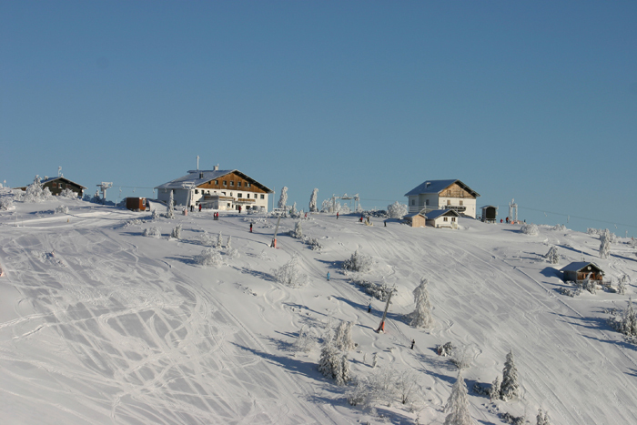
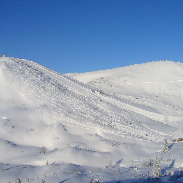
Latest snow reports near Ebensee am Traunsee:
| Top snow depth: | 0 cm |
|---|---|
| Bottom snow depth: | 0 cm |
| Fresh snowfall depth: | 1 cm |
| Last snowfall: | 15 May 2026 |
| Snow Alerts | Create Alert |
0.0 | Bluebird Powder days Fresh snow, mostly sunny, light wind. |
|---|---|
0.0 | Powder days Fresh snow, limited sun, any wind. |
0.0 | Bluebird days Average snow, mostly sunny, light wind. |
The above table gives the weather forecast for Ebensee am Traunsee at the specific elevation of 1070 m. Our sophisticated weather models allow us to provide snow forecasts for the top, middle and bottom ski stations of Ebensee am Traunsee. To access the weather forecasts for the other elevations, use the tab navigation above the table. For a wider view of the weather, check out the Weather Map of Austria.
Click here to read further information on freezing levels and how we forecast our temperatures.
Overall 3.2 Based on 10 votes and 1 review
Ebensee am Traunsee is a great ski area for intermediates for a day trip. The ski pass for Dachstein West can be used here which is great. They have invested heavily in a new cable car and a couple of 6 seater lifts. The views of the Traunsee and surrounding area are fantastic. 2-3 good red runs including a steep red (almost a black). Local restaurant has very good food and value.
Simon Gwynn from United Kingdom writes:
Ebensee am Traunsee is a great ski area for intermediates for a day trip. The ski pass for Dachstein West can be used here which is great. They have invested heavily in a new cable car and a couple of 6 seater lifts. The views of the Traunsee and surrounding area are fantastic. 2-3 good red runs including a steep red (almost a black). Local restaurant has very good food and value.


 Nearest