

Global Weekly Snow Roundup #314
Weekly Global Snow News, updated 14 May 2026: Fresh snowfall in Argentina, Australia and Lesotho signals winter’s approach, while Japan maintains the world’s deepest snowpack.

Next 3 days weather summary:A light covering of new snow, mostly falling on Mon night. Temperatures will be below freezing (max -1°C on Mon afternoon, min -10°C on Sat morning). Wind will be generally light. | Days 4-6 weather summary:Mostly dry. Freeze-thaw conditions (max 7°C on Thu afternoon, min -1°C on Tue morning). Wind will be generally light. | |||||||||||||||||
Saturday 16 | Sunday 17 | Monday 18 | Tuesday 19 | Wednesday 20 | Thursday 21 | |||||||||||||
AM | PM | night | AM | PM | night | AM | PM | night | AM | PM | night | AM | PM | night | AM | PM | night | |
snow shwrs | light snow | snow shwrs | some clouds | snow shwrs | light snow | light snow | light snow | light snow | light snow | light snow | light snow | cloudy | some clouds | some clouds | some clouds | some clouds | clear | |
km/h | ||||||||||||||||||
Snow map |  |  |  |  |  |  | ||||||||||||
— | 1 | — | — | — | — | — | 2 | 2 | — | — | — | — | — | — | — | — | — | |
— | — | — | — | — | — | — | — | — | — | — | — | — | — | — | — | — | — | |
max °C | -9 | -7 | -5 | -3 | -2 | -3 | -2 | -1 | -2 | -1 | 0 | 0 | 0 | 1 | 4 | 6 | 7 | 7 |
min °C | -10 | -8 | -7 | -4 | -2 | -4 | -3 | -2 | -3 | -1 | 0 | -1 | -1 | 1 | 2 | 5 | 7 | 7 |
-16 | -12 | -11 | -6 | -4 | -4 | -5 | -5 | -6 | -3 | -3 | -4 | -4 | -2 | -1 | 3 | 6 | 6 | |
84 | 92 | 56 | 44 | 87 | 90 | 81 | 91 | 92 | 96 | 96 | 88 | 71 | 86 | 40 | 31 | 41 | 28 | |
1550 | 1850 | 1300 | 2300 | 2450 | 2150 | 2400 | 2500 | 2250 | 2550 | 2800 | 2550 | 2700 | 2900 | 3450 | 3700 | 3750 | 3950 | |
6:01 | — | — | 6:01 | — | — | 6:00 | — | — | 5:58 | — | — | 5:58 | — | — | 5:56 | — | — | |
— | — | 8:57 | — | — | 8:58 | — | — | 8:59 | — | — | 9:00 | — | — | 9:01 | — | — | 9:02 | |
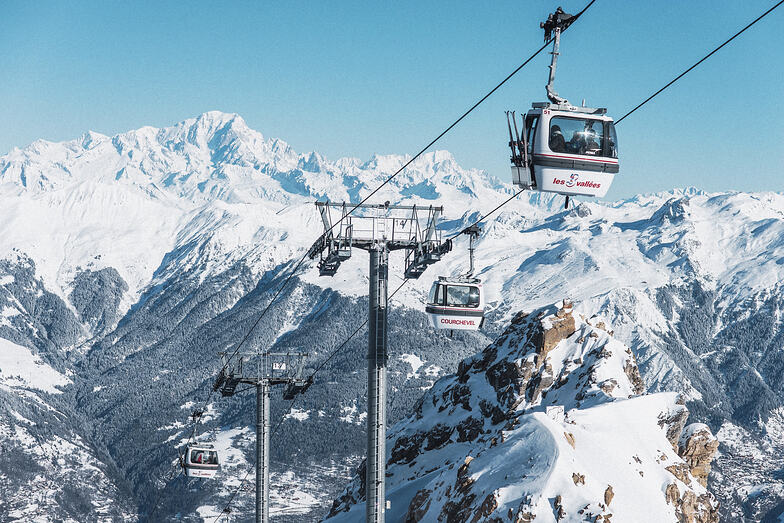
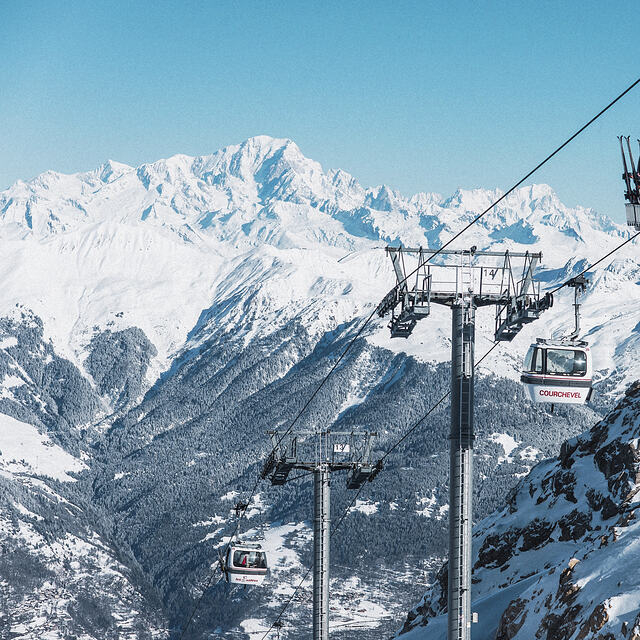
Latest snow reports near Courchevel:
| Top snow depth: | — |
|---|---|
| Bottom snow depth: | — |
| Fresh snowfall depth: | 13 cm |
| Last snowfall: | 15 May 2026 |
| Snow Alerts | Create Alert |
0.4 | Bluebird Powder days Fresh snow, mostly sunny, light wind. |
|---|---|
0.7 | Powder days Fresh snow, limited sun, any wind. |
0.5 | Bluebird days Average snow, mostly sunny, light wind. |
The above table gives the weather forecast for Courchevel at the specific elevation of 2738 m. Our sophisticated weather models allow us to provide snow forecasts for the top, middle and bottom ski stations of Courchevel. To access the weather forecasts for the other elevations, use the tab navigation above the table. For a wider view of the weather, check out the Weather Map of France.
Click here to read further information on freezing levels and how we forecast our temperatures.
Overall 4.3 Based on 68 votes and 68 reviews
I have been going to Courchevel every year for the last 12 years. I go at the end of December/ very early January. Often there is very little snow on 1650 and medium snow on 1850. This creates over-crowding on the limited slopes open at that time of the year. Snow is coming later and later in the season - ...?climate change. If you are going to Courchevel, I suggest you go mid-January onwards. If you go earlier, there is likely to be limited number of slopes open; lots of slopes but half of them mud and grass at the end of December. Val Thorens for me this winter.
Jonah from United Kingdom writes:
I have been going to Courchevel every year for the last 12 years. I go at the end of December/ very early January. Often there is very little snow on 1650 and medium snow on 1850. This creates over-crowding on the limited slopes open at that time of the year. Snow is coming later and later in the season - ...?climate change. If you are going to Courchevel, I suggest you go mid-January onwards. If you go earlier, there is likely to be limited number of slopes open; lots of slopes but half of them mud and grass at the end of December.
Val Thorens for me this winter.


 Nearest