

Portillo Storm Snowfall Total Passes 5m / 17 Feet
A snow storm that has now continued for nine days has taken Chilean ski resort Portillo to a snowfall total of 5.2 metres (17 feet) so far, with more snow forecast.

Next 4 days weather summary:Light rain (total 5.0mm), mostly falling on Tue night. Warm (max 29°C on Thu afternoon, min 16°C on Tue night). Wind will be generally light. | Days 5-7 weather summary:Moderate rain (total 15.0mm), heaviest on Mon afternoon. Warm (max 28°C on Sun afternoon, min 16°C on Mon afternoon). Wind will be generally light. | |||||||||||||||
Wednesday 29 | Thursday 30 | Friday 31 | Saturday 1 | Sunday 2 | ||||||||||||
night | AM | PM | night | AM | PM | night | AM | PM | night | AM | PM | night | AM | PM | night | |
t-storm risk | clear | clear | clear | clear | clear | rain shwrs | some clouds | t-storm risk | cloudy | some clouds | some clouds | clear | clear | some clouds | rain shwrs | |
km/h | ||||||||||||||||
Snow map |  |  |  |  |  |  | ||||||||||
— | — | — | — | — | — | — | — | — | — | — | — | — | — | — | — | |
mm | 3 | — | — | — | — | — | 1 | — | 1 | — | — | — | — | — | — | 2 |
max °C | 22 | 24 | 27 | 23 | 27 | 29 | 25 | 27 | 28 | 23 | 25 | 27 | 23 | 26 | 28 | 20 |
min °C | 16 | 19 | 26 | 17 | 20 | 29 | 19 | 21 | 25 | 19 | 20 | 26 | 18 | 20 | 28 | 17 |
chill °C | 16 | 19 | 26 | 17 | 20 | 29 | 19 | 21 | 25 | 19 | 20 | 26 | 18 | 20 | 28 | 17 |
Humid % | 78 | 51 | 31 | 40 | 23 | 23 | 49 | 34 | 44 | 50 | 43 | 34 | 55 | 32 | 27 | 50 |
Freeze m | 4500 | 4450 | 4700 | 4700 | 4650 | 4850 | 4750 | 4700 | 4550 | 4650 | 4550 | 4700 | 4650 | 4600 | 4750 | 4650 |
— | 6:13 | — | — | 6:13 | — | — | 6:15 | — | — | 6:16 | — | — | 6:16 | — | — | |
— | — | — | 9:05 | — | — | 9:04 | — | — | 9:02 | — | — | 9:01 | — | — | 9:00 | |
Go pro and carve into:
Avalanche information: European Avalanche Warning Services (EAWS)
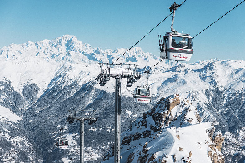
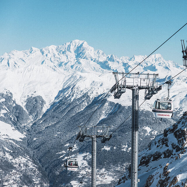
Latest snow reports near Courchevel:
| Top snow depth: | 0 cm |
|---|---|
| Bottom snow depth: | 0 cm |
| Fresh snowfall depth: | — |
| Last snowfall: | 18 May 2026 |
| Snow Alerts | Create Alert |
0.0 | Bluebird Powder days Fresh snow, mostly sunny, light wind. |
|---|---|
0.0 | Powder days Fresh snow, limited sun, any wind. |
0.0 | Bluebird days Average snow, mostly sunny, light wind. |
The above table gives the weather forecast for Courchevel at the specific elevation of 1338 m. Our sophisticated weather models allow us to provide snow forecasts for the top, middle and bottom ski stations of Courchevel. To access the weather forecasts for the other elevations, use the tab navigation above the table. For a wider view of the weather, check out the Weather Map of France.
Click here to read further information on freezing levels and how we forecast our temperatures.
Overall 4.3 Based on 68 votes and 68 reviews
We stayed in Courchevel 1650 (Moriond) and had a great time. It's at the far left end of the piste map and with very changeable weather we didn't make it as far as Val Thorens or Les Minueires but we did have one run down to St Martin. If you are planning a big ranging day from 1650, it's worth getting one of the very regular buses up to 1850 where the Verdons then Viselle or Saulire lifts will drop you over Meribel really quickly. Otherwise, 1650s ageing Arondinaz bubble will slowly get you above some lifts to take you to the same place. The skiing above 1650 is great with gentle wide blues, a few greens and a few good reds; all with great views. One thing to note, the Vallee des Avals accessible from here with a short hike is a great adventure but quite a serious avalanche risk (the clue's in the name) so take a guide if unsure. It's also got a longish hike at the bottom back to the lifts. The rest of the skiing in Courchevel and the 3 vallees is as good as everyone says. We went in the last of the French half term weeks and found a fair bit of piste-side powder although it was snowing a lot! Queues in the Courchevel valley were very short but the Chaudanne in Meribel was really packed at times. Mottaret seemed easier to get through. The village itself is cute enough but not Austrian chocolate box perfection. There are some good bars and our favourite was the Schuss Bar over the road from the bubble. Prices in 1650 are fairly high (7 euros for a pint) but not as bad as we'd feared. It's definitely not going after the same brash loaded crowd as 1850.
Martin Dore from United Kingdom writes:
We stayed in Courchevel 1650 (Moriond) and had a great time. It's at the far left end of the piste map and with very changeable weather we didn't make it as far as Val Thorens or Les Minueires but we did have one run down to St Martin. If you are planning a big ranging day from 1650, it's worth getting one of the very regular buses up to 1850 where the Verdons then Viselle or Saulire lifts will drop you over Meribel really quickly. Otherwise, 1650s ageing Arondinaz bubble will slowly get you above some lifts to take you to the same place.
The skiing above 1650 is great with gentle wide blues, a few greens and a few good reds; all with great views. One thing to note, the Vallee des Avals accessible from here with a short hike is a great adventure but quite a serious avalanche risk (the clue's in the name) so take a guide if unsure. It's also got a longish hike at the bottom back to the lifts. The rest of the skiing in Courchevel and the 3 vallees is as good as everyone says. We went in the last of the French half term weeks and found a fair bit of piste-side powder although it was snowing a lot! Queues in the Courchevel valley were very short but the Chaudanne in Meribel was really packed at times. Mottaret seemed easier to get through.
The village itself is cute enough but not Austrian chocolate box perfection. There are some good bars and our favourite was the Schuss Bar over the road from the bubble. Prices in 1650 are fairly high (7 euros for a pint) but not as bad as we'd feared. It's definitely not going after the same brash loaded crowd as 1850.


 Nearest