

Portillo Re-Opens To Guests Arriving By Helicopter
Chile’s famous Portillo ski resort is reported to have re-opened to guests arriving by helicopter after being cut off by road for more than two weeks by over 6m/20 feet of snowfall.

Next 3 days weather summary:Moderate rain (total 18.0mm), heaviest on Tue night. Warm (max 21°C on Mon afternoon, min 12°C on Tue night). Wind will be generally light. | Days 4-6 weather summary:Moderate rain (total 13.0mm), heaviest on Thu afternoon. Very mild (max 18°C on Thu morning, min 12°C on Thu night). Wind will be generally light. | |||||||||||||||||
Monday 3 | Tuesday 4 | Wednesday 5 | Thursday 6 | Friday 7 | Saturday 8 | |||||||||||||
AM | PM | night | AM | PM | night | AM | PM | night | AM | PM | night | AM | PM | night | AM | PM | night | |
t-storm risk | t-storm risk | rain shwrs | clear | t-storm risk | rain shwrs | clear | rain shwrs | rain shwrs | some clouds | mod. rain | rain shwrs | clear | t-storm risk | rain shwrs | clear | clear | clear | |
km/h | ||||||||||||||||||
Snow map |  |  |  |  |  |  | ||||||||||||
— | — | — | — | — | — | — | — | — | — | — | — | — | — | — | — | — | — | |
mm | 1 | 1 | 3 | — | 3 | 7 | — | 1 | 2 | — | 6 | 5 | — | 1 | 1 | — | — | — |
max °C | 19 | 21 | 18 | 18 | 18 | 14 | 17 | 19 | 17 | 18 | 17 | 14 | 14 | 16 | 14 | 15 | 18 | 16 |
min °C | 16 | 18 | 14 | 15 | 18 | 12 | 14 | 18 | 15 | 15 | 14 | 12 | 12 | 16 | 12 | 13 | 17 | 14 |
chill °C | 16 | 18 | 14 | 15 | 18 | 12 | 14 | 18 | 15 | 15 | 14 | 12 | 12 | 16 | 12 | 13 | 17 | 14 |
Humid % | 48 | 57 | 68 | 50 | 58 | 73 | 57 | 58 | 66 | 48 | 80 | 83 | 63 | 66 | 76 | 59 | 47 | 49 |
Freeze m | 4500 | 4600 | 4500 | 4450 | 4450 | 4450 | 4350 | 4500 | 4450 | 4400 | 4400 | 4300 | 4300 | 4350 | 4400 | 4350 | 4350 | 4400 |
6:18 | — | — | 6:20 | — | — | 6:20 | — | — | 6:22 | — | — | 6:22 | — | — | 6:24 | — | — | |
— | — | 8:59 | — | — | 8:58 | — | — | 8:55 | — | — | 8:54 | — | — | 8:52 | — | — | 8:52 | |
Go pro and carve into:
Avalanche information: European Avalanche Warning Services (EAWS)
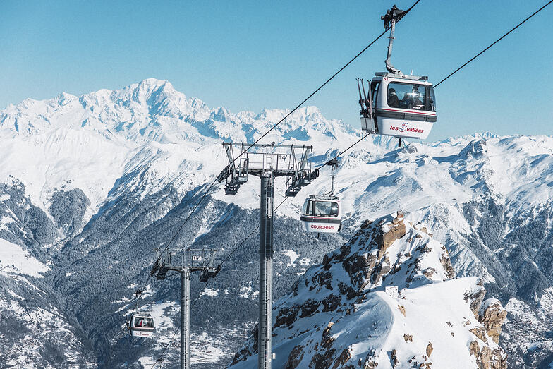
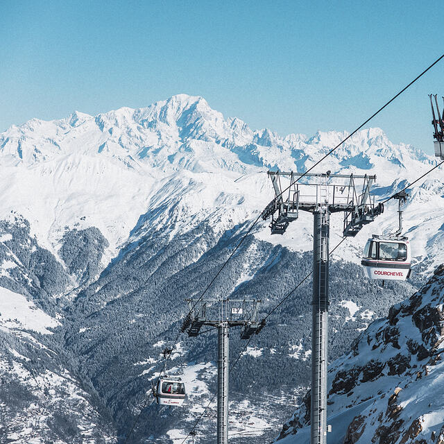
Latest snow reports near Courchevel:
| Top snow depth: | 0 cm |
|---|---|
| Bottom snow depth: | 0 cm |
| Fresh snowfall depth: | — |
| Last snowfall: | 18 May 2026 |
| Snow Alerts | Create Alert |
0.0 | Bluebird Powder days Fresh snow, mostly sunny, light wind. |
|---|---|
0.0 | Powder days Fresh snow, limited sun, any wind. |
0.0 | Bluebird days Average snow, mostly sunny, light wind. |
The above table gives the weather forecast for Courchevel at the specific elevation of 2038 m. Our sophisticated weather models allow us to provide snow forecasts for the top, middle and bottom ski stations of Courchevel. To access the weather forecasts for the other elevations, use the tab navigation above the table. For a wider view of the weather, check out the Weather Map of France.
Click here to read further information on freezing levels and how we forecast our temperatures.
Overall 4.3 Based on 68 votes and 68 reviews
Disagree with another reviewer. Last 3 seasons in 1650 have been great at the end of December over Christmas and New Year. The last 2 years being particularly good. The new Ariondaz lift (replaced for 2017 season) has close to doubled the capacity of the old lift and will get you over to Meribel or Val T in no time at all. But then you’ll hit the queues of hungover students in Val and wish you’d stayed in Courchevel.
Ian from United Kingdom writes:
Disagree with another reviewer. Last 3 seasons in 1650 have been great at the end of December over Christmas and New Year. The last 2 years being particularly good. The new Ariondaz lift (replaced for 2017 season) has close to doubled the capacity of the old lift and will get you over to Meribel or Val T in no time at all. But then you’ll hit the queues of hungover students in Val and wish you’d stayed in Courchevel.


 Nearest