

Global Weekly Snow Roundup #314
Weekly Global Snow News, updated 14 May 2026: Fresh snowfall in Argentina, Australia and Lesotho signals winter’s approach, while Japan maintains the world’s deepest snowpack.

Next 3 days weather summary:Heavy rain (total 44.0mm), heaviest during Sat night. Very mild (max 10°C on Mon afternoon, min 6°C on Sun morning). Wind will be generally light. | Days 4-6 weather summary:Moderate rain (total 12.0mm), heaviest on Thu morning. Very mild (max 16°C on Wed afternoon, min 9°C on Tue night). Wind will be generally light. | |||||||||||||||||
Saturday 16 | Sunday 17 | Monday 18 | Tuesday 19 | Wednesday 20 | Thursday 21 | |||||||||||||
AM | PM | night | AM | PM | night | AM | PM | night | AM | PM | night | AM | PM | night | AM | PM | night | |
heavy rain | light rain | heavy rain | light rain | light rain | light rain | light rain | light rain | rain shwrs | cloudy | clear | clear | clear | light rain | light rain | rain shwrs | risk thun- der | rain shwrs | |
km/h | ||||||||||||||||||
Snow map |  |  |  | 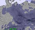 | 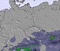 | 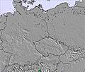 | ||||||||||||
— | — | — | — | — | — | — | — | — | — | — | — | — | — | — | — | — | — | |
12 | 3 | 17 | 5 | 2 | 1 | 2 | 1 | 1 | — | — | — | — | 1 | 2 | 3 | 3 | 3 | |
max °C | 9 | 9 | 7 | 6 | 6 | 6 | 7 | 10 | 10 | 13 | 15 | 12 | 15 | 16 | 13 | 14 | 15 | 13 |
min °C | 9 | 7 | 7 | 6 | 6 | 6 | 7 | 9 | 7 | 10 | 15 | 9 | 12 | 15 | 11 | 12 | 14 | 11 |
9 | 5 | 5 | 3 | 3 | 4 | 6 | 9 | 6 | 10 | 15 | 8 | 11 | 15 | 11 | 11 | 13 | 10 | |
98 | 98 | 99 | 97 | 97 | 98 | 97 | 89 | 83 | 54 | 54 | 78 | 56 | 65 | 87 | 81 | 85 | 95 | |
2200 | 2050 | 1950 | 1750 | 1850 | 2100 | 2000 | 2200 | 2400 | 2500 | 2600 | 2650 | 2650 | 2700 | 2700 | 2650 | 2750 | 2850 | |
4:54 | — | — | 4:54 | — | — | 4:52 | — | — | 4:50 | — | — | 4:50 | — | — | 4:48 | — | — | |
— | — | 8:16 | — | — | 8:17 | — | — | 8:19 | — | — | 8:21 | — | — | 8:22 | — | — | 8:22 | |
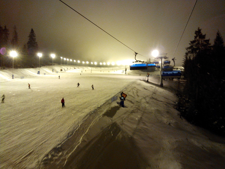
Latest snow reports near Białka Tatrzańska:
Continuous light snow reported from Lomnicky Stit (peak) at 2635 metres elevation 6 kms W of Tatranská Lomnica but it is probably falling as rain apart from near the top of the ski area from Tatranská Lomnica
Light rain and snow reported from Lomnicky Stit (peak) at 2635 metres elevation 6 kms W of Tatranská Lomnica but it is probably falling as rain apart from near the top of the ski area from Tatranská Lomnica
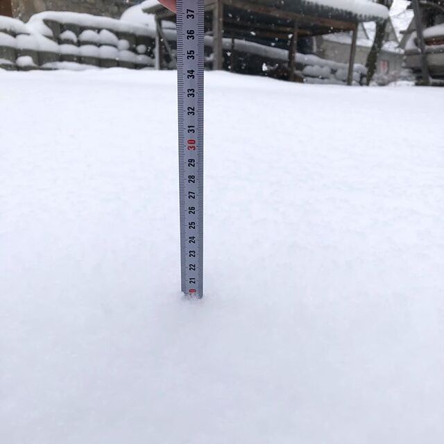
| Top snow depth: | 0 cm |
|---|---|
| Bottom snow depth: | 0 cm |
| Fresh snowfall depth: | — |
| Last snowfall: | 8 Apr 2026 |
| Snow Alerts | Create Alert |
0.0 | Bluebird Powder days Fresh snow, mostly sunny, light wind. |
|---|---|
0.0 | Powder days Fresh snow, limited sun, any wind. |
0.0 | Bluebird days Average snow, mostly sunny, light wind. |

The above table gives the weather forecast for Białka Tatrzańska at the specific elevation of 649 m. Our sophisticated weather models allow us to provide snow forecasts for the top, middle and bottom ski stations of Białka Tatrzańska. To access the weather forecasts for the other elevations, use the tab navigation above the table. For a wider view of the weather, check out the Weather Map of Poland.
Click here to read further information on freezing levels and how we forecast our temperatures.
Resort name is also written as Bialka Tatrzanska.
Overall 3.8 Based on 15 votes and 9 reviews
I planned to go to Bialka Tatrazanska in January 2019, but did not finally ski there. It was really such a disappointment, as the area is very beautiful and the snow was fantastic. The reason why I did not manage to ski is that I arrived very late due to the heavy traffic. Although the distance between Krakow and Bialka is a mere 120km, it took 4 hours! There was heavy traffic all the way from Krakow to the ski center. When I arrived, there were also big queues at the lift and the ski rentals, which was frustrating. For anyone who would like to ski there, I would recommend to stay overnight in Zakopane instead of Krakow, so that Bialka could be reached fast and easily.
DIONYSIOS from Greece writes:
I planned to go to Bialka Tatrazanska in January 2019, but did not finally ski there. It was really such a disappointment, as the area is very beautiful and the snow was fantastic. The reason why I did not manage to ski is that I arrived very late due to the heavy traffic. Although the distance between Krakow and Bialka is a mere 120km, it took 4 hours! There was heavy traffic all the way from Krakow to the ski center. When I arrived, there were also big queues at the lift and the ski rentals, which was frustrating. For anyone who would like to ski there, I would recommend to stay overnight in Zakopane instead of Krakow, so that Bialka could be reached fast and easily.


 Nearest