

Global Weekly Snow Roundup #314
Weekly Global Snow News, updated 14 May 2026: Fresh snowfall in Argentina, Australia and Lesotho signals winter’s approach, while Japan maintains the world’s deepest snowpack.

Next 3 days weather summary:A light covering of new snow, mostly falling on Sat morning. Becoming milder with light rain (total 9.0mm) on Mon afternoon. Freeze-thaw conditions (max 6°C on Mon morning, min -3°C on Sat morning). Wind will be generally light. | Days 4-6 weather summary:Moderate rain (total 11.0mm), heaviest on Tue night. Very mild (max 13°C on Thu afternoon, min 2°C on Tue morning). Wind will be generally light. | |||||||||||||||||
Saturday 16 | Sunday 17 | Monday 18 | Tuesday 19 | Wednesday 20 | Thursday 21 | |||||||||||||
AM | PM | night | AM | PM | night | AM | PM | night | AM | PM | night | AM | PM | night | AM | PM | night | |
light snow | light snow | snow shwrs | clear | some clouds | rain shwrs | rain shwrs | mod. rain | light snow | some clouds | light rain | light rain | light rain | rain shwrs | light rain | rain shwrs | some clouds | clear | |
km/h | ||||||||||||||||||
Snow map |  |  |  |  |  |  | ||||||||||||
2 | 1 | — | — | — | — | — | — | 3 | — | — | — | — | — | — | — | — | — | |
— | — | — | — | — | 1 | 1 | 7 | — | — | 1 | 5 | 1 | 2 | 1 | 1 | — | — | |
max °C | -2 | 0 | 0 | 2 | 5 | 5 | 6 | 6 | 2 | 5 | 7 | 5 | 6 | 10 | 8 | 10 | 13 | 10 |
min °C | -3 | 0 | -2 | -1 | 4 | 2 | 3 | 4 | 1 | 2 | 7 | 4 | 5 | 8 | 6 | 6 | 12 | 8 |
-7 | -2 | -4 | -3 | 4 | 0 | 3 | 2 | -1 | 2 | 7 | 3 | 3 | 7 | 5 | 6 | 11 | 8 | |
92 | 85 | 78 | 67 | 66 | 76 | 70 | 95 | 84 | 64 | 69 | 93 | 74 | 62 | 83 | 61 | 44 | 74 | |
1450 | 1800 | 1450 | 2000 | 2400 | 2200 | 2400 | 2350 | 2000 | 2500 | 2650 | 2500 | 2650 | 2900 | 2800 | 2950 | 3100 | 3450 | |
5:39 | — | — | 5:37 | — | — | 5:37 | — | — | 5:35 | — | — | 5:35 | — | — | 5:33 | — | — | |
— | — | 8:46 | — | — | 8:47 | — | — | 8:50 | — | — | 8:51 | — | — | 8:52 | — | — | 8:52 | |
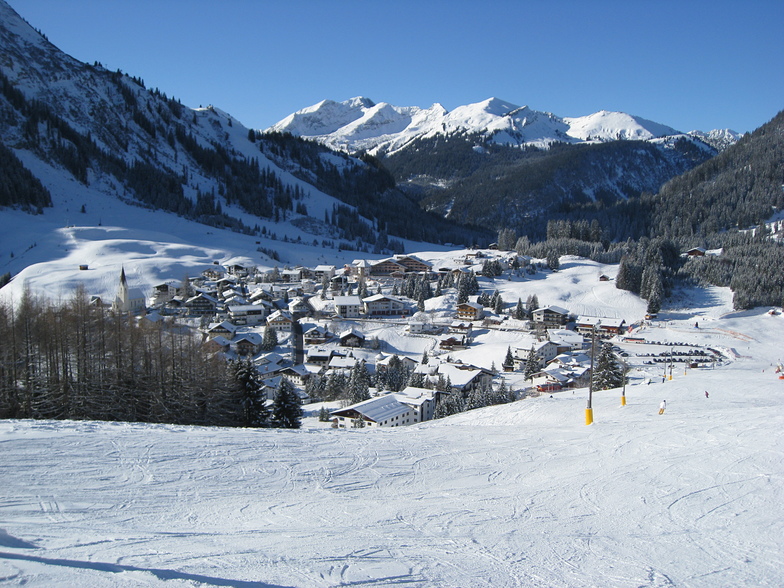
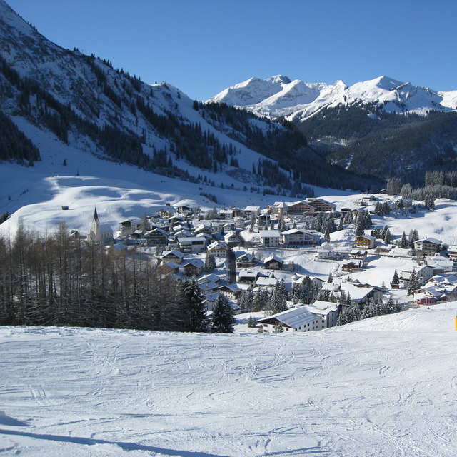
Latest snow reports near Berwang-Bichlbach-Rinnen:
| Top snow depth: | 0 cm |
|---|---|
| Bottom snow depth: | 0 cm |
| Fresh snowfall depth: | 14 cm |
| Last snowfall: | 15 May 2026 |
| Snow Alerts | Create Alert |
0.0 | Bluebird Powder days Fresh snow, mostly sunny, light wind. |
|---|---|
0.3 | Powder days Fresh snow, limited sun, any wind. |
0.0 | Bluebird days Average snow, mostly sunny, light wind. |
The above table gives the weather forecast for Berwang-Bichlbach-Rinnen at the specific elevation of 1740 m. Our sophisticated weather models allow us to provide snow forecasts for the top, middle and bottom ski stations of Berwang-Bichlbach-Rinnen. To access the weather forecasts for the other elevations, use the tab navigation above the table. For a wider view of the weather, check out the Weather Map of Austria.
Click here to read further information on freezing levels and how we forecast our temperatures.
Overall 3.7 Based on 11 votes and 1 review
Just back from a long weekend in Berwang. No wonder there are so few non locals, it's clearly a best kept secret. What a spot: stunning scenery, less than 2 hours from Munich, quaint, the friendliest folk in the Alps and a variety of runs that seems way more than the disclosed distances probably because they are so interesting! Superb food all over. Cake that will make me diabetic it's so good. Want long endless runs? Go to Courchevel. Want a ski holiday with local atmosphere? Come here. You will not regret it!
walter from South Africa writes:
Just back from a long weekend in Berwang. No wonder there are so few non locals, it's clearly a best kept secret. What a spot: stunning scenery, less than 2 hours from Munich, quaint, the friendliest folk in the Alps and a variety of runs that seems way more than the disclosed distances probably because they are so interesting! Superb food all over. Cake that will make me diabetic it's so good.
Want long endless runs? Go to Courchevel. Want a ski holiday with local atmosphere? Come here. You will not regret it!
Click here to submit your own review of Berwang-Bichlbach-Rinnen


 Nearest