
Solitude Sets Record-Breaking Season With 178 Days of Skiing
Updated April 30, 2025: North America holds strong with over 30 ski areas still spinning lifts—snowy peaks in the West, deep bases in the Midwest, and sunny spring turns coast to coast.
Please sign in with your Snow-Forecast account details below.

Berwang-Bichlbach-Rinnen Weather (Next 3 days): The snow forecast for Berwang-Bichlbach-Rinnen is: Moderate rain (total 16.0mm), heaviest on Sat night. Warm (max 20°C on Fri afternoon, min 10°C on Sat night). Wind will be generally light.
Berwang-Bichlbach-Rinnen Weather (Days 4-6): Mild with heavy rain (total 38.0mm), heaviest during Sun night. Becoming colder with a moderate fall of snow heaviest on Mon morning. Freeze-thaw conditions (max 12°C on Sun morning, min 0°C on Mon night). Wind will be generally light.
| Resort | Snow Depth | Temp. (°C) | Wind (km/h) | Weather | ||
|---|---|---|---|---|---|---|
| Top Lift: | 0.0 m | 9 | ||||
| Middle Lift: | 11 | |||||
| Bottom Lift: | 0.0 m | 12 |
Latest snow reports near Berwang-Bichlbach-Rinnen:

Thursday 1 | Friday 2 | Saturday 3 | Sunday 4 | Monday 5 | Tuesday 6 | Wednesday 7 | |||||||||||||||
AM | PM | night | AM | PM | night | AM | PM | night | AM | PM | night | AM | PM | night | AM | PM | night | AM | PM | night | |
clear | clear | clear | clear | clear | rain shwrs | light rain | risk thun- der | heavy rain | light rain | mod. rain | heavy rain | mod. snow | light snow | light snow | light snow | light snow | snow shwrs | some clouds | light rain | rain shwrs | |
km/h | |||||||||||||||||||||
Snow map |  |  |  |  |  |  |  | ||||||||||||||
— | — | — | — | — | — | — | — | — | — | — | — | 5 | 3 | 3 | — | 1.0 | — | — | — | — | |
— | — | — | — | — | 1.0 | 2.0 | 2.0 | 11 | 3 | 6 | 29 | — | — | — | — | — | — | — | 2.0 | 1.0 | |
max°C | 15 | 17 | 15 | 16 | 20 | 16 | 12 | 17 | 13 | 12 | 10 | 7 | 1 | 1 | 2 | 1 | 2 | 2 | 3 | 5 | 3 |
min°C | 11 | 17 | 11 | 12 | 19 | 13 | 11 | 17 | 10 | 10 | 9 | 3 | 1 | 1 | 0 | 0 | 1 | 2 | 2 | 5 | 0 |
11 | 17 | 11 | 12 | 19 | 13 | 11 | 17 | 9 | 9 | 8 | 2 | -1 | 0 | -2 | 0 | 1 | 2 | 2 | 5 | 0 | |
44 | 35 | 58 | 43 | 30 | 54 | 74 | 48 | 78 | 71 | 97 | 96 | 100 | 99 | 100 | 98 | 99 | 78 | 77 | 75 | 90 | |
3150 | 3300 | 3300 | 3300 | 3600 | 3550 | 3250 | 3450 | 3050 | 3000 | 3000 | 2500 | 1700 | 1700 | 1500 | 1600 | 1700 | 1850 | 2000 | 2050 | 1700 | |
6:01 | — | — | 5:58 | — | — | 5:58 | — | — | 5:56 | — | — | 5:54 | — | — | 5:52 | — | — | 5:52 | — | — | |
— | — | 8:27 | — | — | 8:29 | — | — | 8:30 | — | — | 8:30 | — | — | 8:32 | — | — | 8:34 | — | — | 8:35 | |
Moderate rain (total 16.0mm), heaviest on Sat night. Warm (max 20°C on Fri afternoon, min 10°C on Sat night). Wind will be generally light.
Mild with heavy rain (total 38.0mm), heaviest during Sun night. Becoming colder with a moderate fall of snow heaviest on Mon morning. Freeze-thaw conditions (max 12°C on Sun morning, min 0°C on Mon night). Wind will be generally light.
Latest snow reports near Berwang-Bichlbach-Rinnen:
| Top snow depth: | 0 cm |
|---|---|
| Bottom snow depth: | 0 cm |
| Fresh snowfall depth: | — |
| Last snowfall: | 18 Apr 2025 |
| Snow Alerts | Create Alert |
0.0 | Bluebird Powder days Fresh snow, mostly sunny, light wind. |
|---|---|
0.1 | Powder days Fresh snow, limited sun, any wind. |
0.0 | Bluebird days Average snow, mostly sunny, light wind. |
The above table gives the weather forecast for Berwang-Bichlbach-Rinnen at the specific elevation of 1408 m. Our sophisticated weather models allow us to provide snow forecasts for the top, middle and bottom ski stations of Berwang-Bichlbach-Rinnen. To access the weather forecasts for the other elevations, use the tab navigation above the table. For a wider view of the weather, check out the Weather Map of Austria.
Click here to read further information on freezing levels and how we forecast our temperatures.
Overall 3.8 Based on 1 vote and 1 review
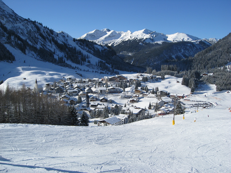
Just back from a long weekend in Berwang. No wonder there are so few non locals, it's clearly a best kept secret. What a spot: stunning scenery, less than 2 hours from Munich, quaint, the friendliest folk in the Alps and a variety of runs that seems way more than the disclosed distances probably because they are so interesting! Superb food all over. Cake that will make me diabetic it's so good. Want long endless runs? Go to Courchevel. Want a ski holiday with local atmosphere? Come here. You will not regret it!
walter from South Africa writes:
Just back from a long weekend in Berwang. No wonder there are so few non locals, it's clearly a best kept secret. What a spot: stunning scenery, less than 2 hours from Munich, quaint, the friendliest folk in the Alps and a variety of runs that seems way more than the disclosed distances probably because they are so interesting! Superb food all over. Cake that will make me diabetic it's so good.
Want long endless runs? Go to Courchevel. Want a ski holiday with local atmosphere? Come here. You will not regret it!
Click here to submit your own review of Berwang-Bichlbach-Rinnen
The Berwang-Bichlbach-Rinnen skiing weather widget is available to embed on external websites free of charge. It provides a daily summary of our Berwang-Bichlbach-Rinnen snow forecast and current weather conditions. Simply go to the feed configuration page and follow the 3 simple steps to grab the custom html code snippet and paste it into your own site. You can choose the snow forecast elevation (summit, mid-mountain or bottom lift) and metric/imperial units for the snow forecast feed to suit your own website…. Click here to get the code.
View detailed snow forecast for Berwang-Bichlbach-Rinnen at:
snow-forecast.com


 Nearest