WORLD SNOW ROUNDUP #272
Issued: 28th December 2022
By Patrick “Snowhunter” Thorne
World Overview
Stormy, rather than snowy weather, has been a factor for Christmas skiers on both sides of the Atlantic, although there has been a lot more snow for North America too. Here the huge Storm Elliot moved across the continent from west to east with its most marked features, gale force winds and bone-chillingly cold temperatures, closing resorts for several days. It did dump a lot of snow too. Unfortunately, that’s not the case in Europe where less dramatic winds led to resort closures at the end of last week. However, here it was warm, reaching double-digits above freezing. At best, snow depths are unchanged from a week ago, at worse they’re going in the wrong direction. There have also been strong winds reported in Japan.
The number of ski areas open continues to increase and for larger resorts, the amount of terrain open at each also continues to grow. But for lower-lying ski centres in Europe, particularly in the northern Alps, it’s a challenge to open at all due to the temperatures and lack of natural snowfall to date. That’s particularly the case on the southeast of the continent too in countries like Bulgaria, Greece and Serbia where centres are struggling to make enough snow for a few short runs with brief snow-making windows in the night. Mostly the slopes are still green.
Europe
EUROPE INTRO
Another week lacking any substantial snowfalls for much of Europe, with temperatures warmer than they should be in many areas, the freezing level rising to 3000m at times and rain reported up to 2500m in the worst cases. Despite the warmer temperatures many ski areas have actually been opening more terrain. That’s because they’d held back slopes they could have opened sooner until they were busier, and Christmas and New Year weeks are typically among the busiest of the season. But hundreds of low-lying ski areas in the northern Alps in countries like Germany remain closed. It’s a similar story, sadly, down in Europe’s southeast where the slopes are green in Greece and not much better in countries like Bulgaria and Romania. It’s a brighter picture up in Scandinavia where temperatures are typically subzero 24-7 and getting into the minus teens in the most northerly areas, where it’s also currently polar night around the clock.
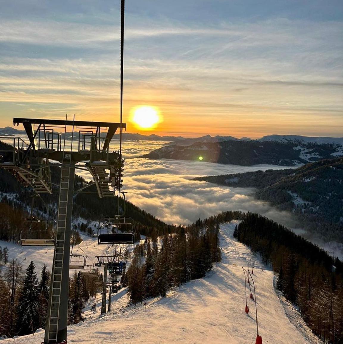
AUSTRIA REPORT
Austria has had one of the most challenging weeks with warm temperatures impacting many ski areas here more than further west because many of the best-known ski areas top out at around 2000m, so close to the dividing line between too warm and cold enough and between rain and snow. Despite these negative factors though ski areas have been opening more terrain with Saalbach Hinterglemm Leogang Fieberbrunn (40/50cm / 16/20”) the first to have 200km (125 miles) of slopes open. Ischgl/Samnaun (25/45cm / 10/18”) has similar amounts of terrain open, as does the SkiWelt Wilder Kaiser-Brixental (25/60cm / 10/24”) home of resorts including Brixen, Ellmau, Soll and Westendorf. Solden, in the Tirol region, has by far the best snow depths (60/160cm / 24/64″) in the country and 95% of its slopes are open.
AUSTRIA FORECAST
Following the warm, sometimes wet and windy Christmas weekend it is looking dry, frequently sunny and similarly freeze-thaw (+7 to -7C) for most Austrian areas for the next few days. Conditions are best in centres with slopes above 2000m, especially the glacier resorts.
SWITZERLAND REPORT
Switzerland has been suffering the same warmer-than-we’d-like temperatures, particularly in valleys, as the rest of the Alps over the last week with temperatures reaching +10C for many under sunny skies at the weekend down below 1500 m. It has since got colder and there have been some snow showers (rain at lower elevations though). On top of this, some stormy weather impacted Swiss resorts at the end of last week with Adelboden one of those closing entirely on Friday due to strong winds. As with elsewhere, some leading Swiss ski areas have managed to open more terrain despite the challenging conditions with Zermatt (10/110cm / 4/44″) touching 200km (125 miles) of slopes open there.
SWITZERLAND FORECAST
Largely dry weather as we move towards the new year with plenty of sunshine, temperatures ranging about five or six degrees on either side of the freezing point at resort level so freeze-thaw conditions. More consistently cold above 2000m.
FRANCE REPORT
French resorts have had a mixed week with rain to high levels and those areas with lower terrain suffering still from warm temperatures. There were also gales blowing through and closing lifts and in some cases whole ski areas affected before the Christmas weekend. But against that the country’s higher slopes have the bests now depths in Europe and where it was high and cold enough the rain it turned to snow and resorts like Flaine (15/100cm / 6/40″) and La Plagne (25/95cm / 10/38″) posted 20cm (8″) of fresh snowfall on higher slopes going into the Christmas weekend. Meanwhile, the world’s largest ski area, the 3 Valleys in France (including Courchevel, Les Menuires, Meribel and Val Thorens), now has 75% of its trails open, equating to around 270 runs and more than 450km of slopes.
FRANCE FORECAST
Skies have largely cleared in the last few days. Temperatures are still rather warm in valleys, but dropping below zero overnight. So freeze-thaw for lower slopes and more consistently sub-zero higher on the mountain. Still not much snow forecast though.
ITALY REPORT
A largely sunny week for Italy with temperatures mostly in the -5 to +5 Celcius range. This allowed for some snow-making overnight in some areas but equally, it’s rather warmer in the daytime than ideal and the country still awaits a good snowfall this autumn/winter. Bormio (30/50cm / 12/20″) was among the Italian areas reporting more terrain open for Christmas with the resort’s Cima Piazzi and San Colombano areas opening for the first time. However, the run down to the valley remains closed because of the conditions.
ITALY FORECAST
Plenty of sunshine in the forecast for the remainder of the week and unfortunately no real respite in the warmer temperatures at low elevations. It will also be dropping below freezing overnight in valleys and stay close to freezing or below around the clock up above 1500m most days.
GERMANY REPORT
German ski areas are having a difficult start to the season with warm temperatures to low elevations continuing through the past few months with no big change in the last seven days, even as we get further into winter. Many remain unable to open. Of those that have, Reit im Winkl (10/50cm / 4/20”) is posting the most terrain open with over 32km (20 miles of runs skiable). Unusually, the Zugspitze (30/60cm / 12/24”) is not posting the deepest base open in the country despite having the highest slopes in the country. It does though have most of its potential slopes open.
GERMANY FORECAST
There’s unsettled weather in the forecast for many German ski areas and some hope of fresh snowfall for some later in the week. But it’s a fluctuating weather model and the danger is warm temperatures will mean it’s rain again, rather than snow for some.
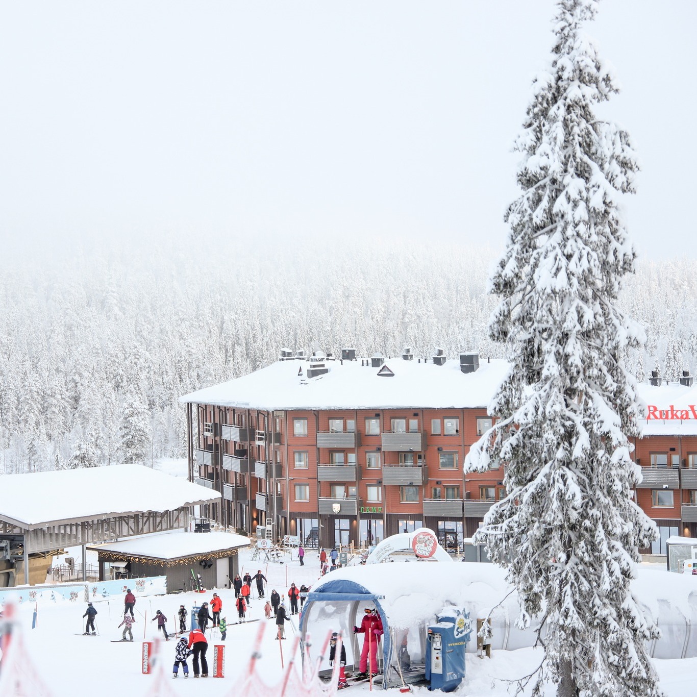
SCANDINAVIA REPORT
Mostly cold and frequently snowy across Scandinavia over the past week with lows reported in the minus-teens, and highs only a degree or two above freezing. Some ski areas like Levi (30/50cm / 12/20”), in Lapland, remain in polar night conditions until January 1st but report all slopes open. Snow showers will typically be light in the north, however, each bringing just a few centimetres (an inch or so) of powder, for most areas there, but more like 5-10cm (2-4″) in more southerly centres each time. Sweden’s Åre (29/34cm / 12/14”), the region’s biggest resort, has the most terrain open, now more than 50km (31 miles) and half of its runs.
SCANDINAVIA FORECAST
Continuing cold, dark and with some snow showers. Lows are in the -20s as we head towards the weekend up in Lapland, somewhat warmer but still sub-zero for most further south.
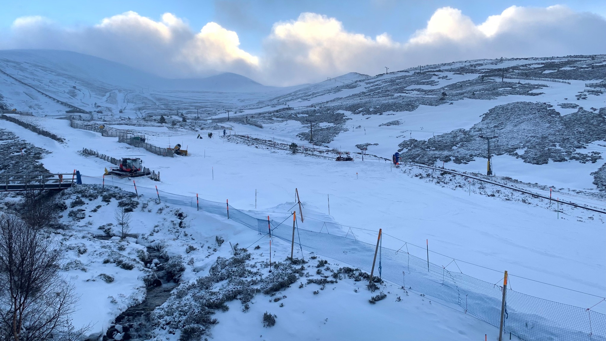
SCOTLAND REPORT
There’s been an improving picture in Scotland over the Christmas weekend after the warming temperatures that followed the freeze during the first half of the month gave way to warmer weather that wiped out a lot of the early cover. We have not had a return to the double-digit lows but we have been closer to freezing and there’s been fresh snowfall allowing ski areas including Cairngorm, The Lecht (10/10cm / 4/4”) and Glenshee (20/30cm / 8/12”) to open limited terrain.
SCOTLAND FORECAST
There’s a fairly positive picture for the run in to Scotland’s Hogmanay New Year celebrations with fairly low temperatures and snow showers forecast, particularly on the upper parts of the slopes. Ideally, it will be colder and snowier. However, this time last year it was much warmer.
SPAIN / ANDORRA REPORT
Warm temperatures at low elevations led ski resorts to post images of things looking more wintery on higher slopes to try to convince sceptical skiers going into the Christmas weekend last week. There have been almost constant sunny skies with temperatures in the teens Celcius down in the valleys. On higher slopes, though it has been more springlike freeze-thaw with temperatures ranging about five degrees on either side of freezing and not much impact on snow cover on the pistes at least. That said the region is yet to see a big snowfall this winter and the bases aren’t huge. Andorra’s Grandvalira (2/45cm / 8/18”) incorporating the resort of Pas de la Casa, Soldeu El Tarter and others has the most terrain open with 140km of slopes, but Spain’s Baqueira Beret (40/55cm / 16/22”) isn’t far behind.
SPAIN / ANDORRA FORECAST
There’s not much change in the forecast with wall-to-wall sunshine expected for the coming days and temperatures in the -5C overnight up high to +10C down in valleys in the afternoon range, so not yet the colder, snowier weather needed.
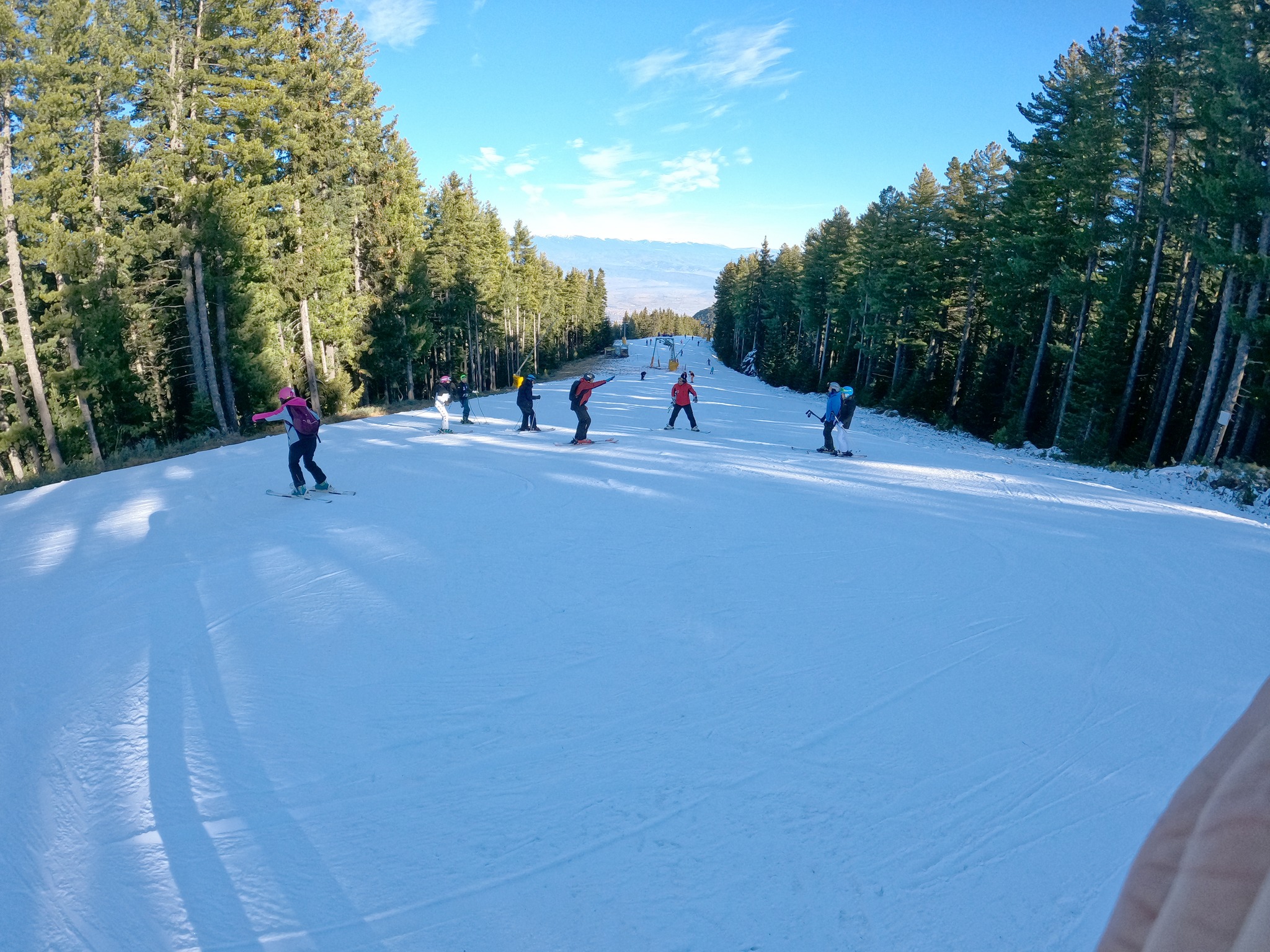
BULGARIA / ROMANIA REPORT
It has been a tough start to the season in southeastern Europe with temperatures staying up in double figures at resort level and well above freezing on the slopes too. The only positive has been subzero temperatures on higher slopes overnight and as ski areas have opened they’ve used snow-making during these weather windows to open two or three short runs each. Not a lot has changed over the past week. Pamporovo (20/35cm / 8/14”) is reporting the best conditions with 7.4 km (4.5 miles) of slopes open.
BULGARIA / ROMANIA FORECAST
Alas, there’s no major change in the forecast with warm, sunny weather and daytime highs of +10C or higher expected in resorts for the week ahead. The only real hope is overnight lows of perhaps -4 to -8C which should allow snow-making systems to operate.
CZECH REPUBLIC / SLOVAKIA REPORT
Though hit by the same warm weather problems as the Alps, ski areas in the Czech and Slovak Republics that could open, actually announced they were managing to open more terrain ahead of the Christmas weekend last week. Jasná (30/70cm / 12/24″), the largest in the region with already more than half of its terrain open, started operating several more lifts and runs. The good news is that it has been getting colder, staying a few degrees on either side of the freezing point with light snow showers, in recent days.
CZECH REPUBLIC / SLOVAKIA FORECAST
Conditions are changeable for the week ahead into 2023. Temperatures will be in the -5C to +5C range on the whole. So there’s uncertainty as to whether forecast precipitation will arrive as rain or as snow.
NORTH AMERICA INTRO
The big news in American weather this week was of course Storm Elliot and the ‘weather bomb’ which hit the Midwest and east of the continent. For ski areas, the big factors were the very low temperatures (which had, separately, already been a factor earlier last week up in Western Canada) and gale force winds. These combined to close a swathe of ski areas from anything from 1-4 days with the Midwest most impacted. The ‘weather bomb’ was supposed to deliver heavy snowfall in the east as a by-product of the climatic conditions. That did not really happen on any dramatic scale, but there was a good deal of fresh snowfall. Things have settled down and returned closer to seasonal norms since the weekend and the return of warmer (if still subzero) temperatures in Western Canada and the northwest US for Christmas was particularly welcome.
ROCKIES REPORT
The dry conditions that have dominated in the Rockies for the past week or so began to break at the end of last week with ski areas reporting 6-12”(15-30cm) of snowfall initially but also very low temperatures, more than 20 degrees below freezing in some cases. There were also strong winds, one particularly violent gust blamed for a chair being detached from a cable at Breckenridge (40/81cm / 16/32″) last week, fortunately, no one was injured. These combined weather factors led to many areas closing some more exposed lifts and terrain at the height of the storm, and others, particularly in the northern Rockies, closing completely. Things got a little closer to seasonal norms after the weekend. Alta (43/87” / 106/218 cm) is posting the deepest base in the region.
ROCKIES FORECAST
Temperatures should be warmer than recently but remain below freezing. Unsettled conditions with snow showers moving through but largely light to moderate falls of a few inches each time, rather than any big dumps expected.
USA WEST REPORT
A mixed bag of weather in the west with things staying fairly dry in more southerly states, but more snow piling into the Pacific Northwest corner. That came along with extremely low temperatures that led many areas to close for a day or two at the end of last week, and gale-force winds at times. After the cold though it’s been getting rather warm at lower levels, especially at more southerly latitudes, into the mid-40s during the daytime. California still has the most terrain open though with the Palisades Tahoe (28/57″ / 70/143cm) posting about 100 miles of slopes open now that its Palisades and Alpine Meadows halves are connected by gondola to create a 6,000-acre ski area. Mt. Hood Meadows (69/120″) has now joined Mammoth (65/128″ / 163/320cm) as the only two ski areas on the planet posting a 10 feet (3 metres) base depth on higher runs.
USA WEST FORECAST
It will remain cold and snowy in the Pacific Northwest with significant snowfall expected to continue through into the new year, potentially adding several feet to bases by the start of next week. Further south in California warmer weather midweek will coincide with a major low front bringing precipitation, which will hopefully be heavy snow. Although there’s some doubt as to how much might be rain and gales seem likely too. A sunny end to the week then more snow forecast.
MIDWEST REPORT
The big news for Midwest skiing this week was the ‘weather bomb’ which hit going into the weekend bringing very low temperatures, (even by midwinter in the Midwest standards) heavy snowfall and gale-force winds. Many ski areas closed for Thursday/Friday last week as a precautionary measure, some extending their closures through part or all of the Christmas weekend.
MIDWEST FORECAST
Temperatures closer to seasonal norms and to freezing point in the Midwest with snow showers easing through the week.
USA EAST REPORT
Challenging conditions continue in the US East with temperatures initially rather too warm but then bitterly cold as Elliot blew through, closing some centres on Friday and/or Saturday. But overall there is movement in the right direction, with the region’s biggest ski area, Vermont’s Killington (23/28” / 58/70cm), posting 40 inches (a metre) of fresh, if sometimes wet, snowfall in the past week. It reports 97 of its 155 trails are now open. Most other areas are 30-60% open.
USA EAST FORECAST
Temperatures should remain well below freezing for the week ahead with overcast skies and some light to moderate snow showers.
CANADA WEST REPORT
Lots of ski areas in Western Canada were fully or partially closed in the latter half of last week as temperatures dipped to 30 degrees below freezing. Marmot Basin near Jasper was one of those that remained closed for several days. Things began to warm up into the Christmas weekend and most had reopened by Christmas Day. Temperatures have generally been up to single digits below freezing over the past week and most areas have seen snow showers. Conditions remain fairly good but Kicking Horse, in BC, announced it was postponing its planned hosting of the opening event of the 2023 Freeride World Tour in the first half of January because the unusually severe cold, coupled with strong winds and less snowfall than usual meant the off-piste terrain was not quite up to par. Mount Seymour (118/173cm / 47/75”) has the country’s deepest snow.
CANADA WEST FORECAST
Cold weather and light to moderate snowfall are forecast for the coming week across Western Canada. Temperatures typically in the freezing to minus 10 Celcius range (so not as cold as it has been) and daily accumulations averaging 5-10cm (2-4 inches) are expected.
CANADA EAST REPORT
Ski areas in Eastern Canada are well used to very cold temperatures but even here the combination of these and gale force winds from Storm Elliot led to centres closing entirely or partially on Friday and in some cases Saturday as the worst of the weather blew through. Tremblant (20/95cm / 8/38”) continues to post the most terrain open in the region, about half of its 80km+ of slops, it also has the deepest reported snow depth to date.
CANADA EAST FORECAST
It’s looking cold enough for snow-making systems to run 24-7 if ski areas want them to with most resorts seeing highs of -5C, and lows towards -20C over the next seven days. Not much snow in the forecast though, just the odd centimetre here and there.
Asia
JAPAN REPORT
It continues to be a rather mixed picture in Japan. There’s been a lot of snowfall in the north in Hokkaido but other areas are lagging behind and struggling to open much terrain, if any. For example, in Myoko only a handful of areas had very limited terrain open at the weekend, most were closed until more snow arrives. Strong winds have also been an issue this week. Looking for more positive news, Niseko (70/200cm / 32/80”) is fully open now, with one of the deepest bases reported in the world at present. Although here too things aren’t perfect with rain, turning to wet snow overnight reported at the end of last week.
JAPAN FORECAST
The forecast is fairly promising for more consistently cold weather and snowfall over the coming week with 5-15cm (2-6”) expected daily in many areas.
You might also like...

A Guide to the Perfect Skiing Stance in All Conditions with Maison Sport

Huge Snowstorm Hitting Western North America

World Snow Roundup #231
