WORLD SNOW ROUNDUP #270
Issued: 14th December 2022
By Patrick “Snowhunter” Thorne
World Overview
With the second weekend of the winter behind us, around 90% of the world’s big-name ski areas are now open and the next few weekends should see thousands more smaller, more low-lying centres join them.
Western North America and particularly California has continued to dominate world snow news headlines with two more major storms bringing several feet more snowfall, on top of the four or five feet many ski areas have already seen in recent weeks from four previous storms that moved in in rapid succession. All the snowfall this early in the season is great news for the winter ahead. But, in the short term, is causing logistical and safety issues.
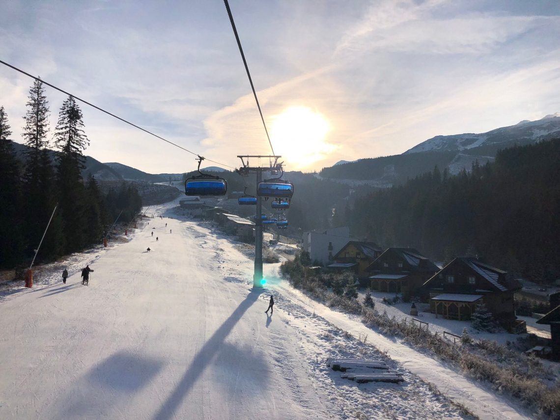
In much of Europe, it has stayed cold and there was decent snowfall over the weekend for many areas, especially above 1500 metres altitude. Most of the continent’s big ski regions including Paradiski, the Sellaronda, Tignes-Val d’Isere and the 3 Valleys are all now open and battling to offer the most open terrain at this early point in the season.
In the wider world, there has been still more snow-in-summer for Australian ski areas and the season is gradually taking shape in Japan, with its borders re-opened for the first time in three years.
Europe
EUROPE INTRO
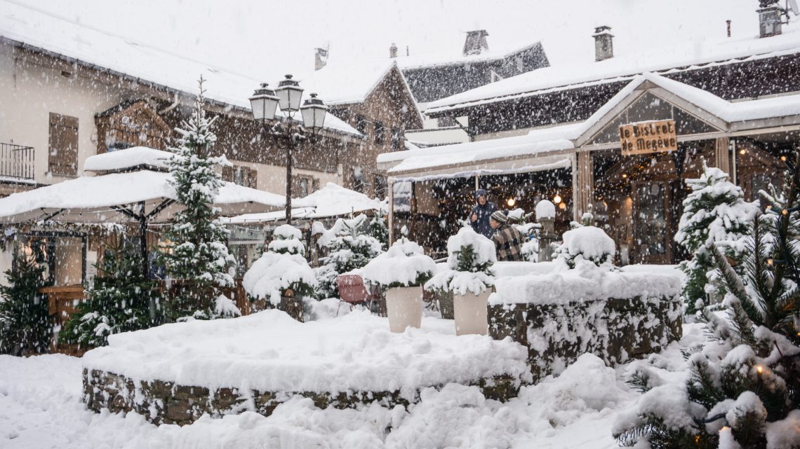
After not much snowfall during the first week of December things began to improve from last Friday when the western Alps saw up to 30cm (a foot) of snowfall accumulating down at low-lying resorts in France and western Italy and Switzerland. The snowfall then moved east through the weekend, greatly improving the season-start prospects for low-lying areas. After a few drier days it has begun snowing again. Hundreds more centres opened at the weekend including some big ski regions like Paradiski and the remainder of the 3 Valleys, in France, so most of Europe’s bigger resorts are now open for 22-23. Elsewhere in Europe, the north has seen very low temperatures, getting down to -30C in parts of Scandinavia. Not quite so cold in the Scottish Highlands but enough for the season to get started there too.
AUSTRIA REPORT
Around a third of Austria’s ski areas have now opened for the 22-23 season, including most of the country’s destination resorts. It has been cold and snowing down to low levels, which is good news as the issue up to now had been warm weather and rain rather than snow in valleys. Sölden (10/155cm / 4/62″) has snow stats that illustrate the issue that has been faced, the country’s deepest snowpack up high. But only a few inches of snow at the base of the slopes. Lower-lying resorts are surviving on a much thinner snowpack. Ischgl/Samnaun’s Silvretta Arena (10/40cm / 4/16″) is a case in point, although still managing to just about cling on to the position of having the most terrain open in the world at present, now at 180km (112 miles).
AUSTRIA FORECAST
A little warm in valleys midweek and some sunshine although staying double-digits below freezing above 2000m. It will quickly drop to sub-zero in valleys too by Thursday though when the next round of snowfall is expected to begin.
SWITZERLAND REPORT
Swiss ski areas have seen some fresh snowfall this week, particularly marked in the west of the country early in the weekend. About half of the country’s ski areas are now open with three regions offering more than 100km of slopes open already. The cross-border Silvretta Arena, from Samnaun (10/40cm / 4/16”), leads the way with 180km (113 miles), the most in Europe. Another cross-border area from Zermatt (10/110cm / 4/44”) is in second place with 133km (82 miles) open. Then the 4 Vallées around Verbier (25/55cm / 10/22”) has 112km (70 miles) of slopes open.
SWITZERLAND FORECAST
A mixture of sunshine and cloud through the midweek period with the freezing point moving between 1000 and 1500m most days. Dry in most areas but a front bringing snowfall should start to move through on Thursday-Friday.
FRANCE REPORT
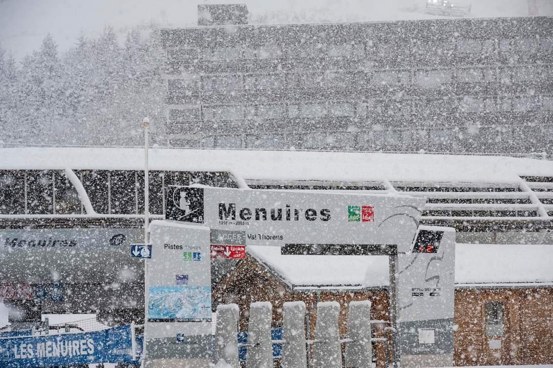
French resorts saw plenty of snowfall going into the weekend with many areas reporting 30-40cm (12-16″) of fresh cover by Saturday morning down to low elevations. Beneficiaries included Les Menuires (50/100cm / 20/40”) and Meribel (50/100cm / 20/40”), which opened for the season at the weekend, completing the full opening of the world’s biggest ski area, the 3 Valleys, for its 50th season. It did not publish a measure of the km of terrain open but did note over 150 runs of the 350+ individual slopes had opened. So, potentially the first to have passed 200km of slopes open already. About half of French ski areas have now opened. In Val d’Isere (40/100cm / 16/40”) they managed to prep The Face run to stage World Cup races but conditions were murky through the weekend with snow showers and hill fog. After a few drier days the snowfall returned on Tuesday with many areas reporting another 10-20cm (4-8”).
FRANCE FORECAST
There’s more snow forecast for the coming week with snow down to low elevations. Temperatures double digits below freezing at altitude, two or three degrees on either side of freezing down in valleys.
ITALY REPORT
There’s been more snowfall across Italian ski slopes thanks to the weather system that moved north and east up from the Mediterranean. The heaviest snowfall was in the Aosta Valley with ski areas there posting up to half a metre (20”) of fresh snow through the weekend, but it was also widespread with more snow over in the Dolomites where the Men’s Alpine World Cup ski tour is heading next. About three-quarters of Italian ski areas are open now with Breuil-Cervinia (20/110cm / 8/44”) posting the country’s deepest snowpacks and one of the largest areas open so far with 133km shared with Zermatt. However, Val Gardena (15/25cm / 6/10″) reports a little more skiable, despite the thin cover, with 136km of its potential 178 km open.
ITALY FORECAST
After a dry and sunny few days midweek, the next front is due to bring moderate accumulations from Thursday through to the weekend. Temperatures averaging 5 degrees below freezing.
GERMANY REPORT
Conditions have been improving in Germany where the many low-lying ski areas have had a nervous few weeks waiting for cold weather and snowfall. That did arrive for many at the weekend though making a much-improved picture compared to a week ago. The number of areas open is creeping slowly up but remains at only half-a-dozen or 1% of German ski areas so far. The highest, Zugspitze (25cm/57cm / 10/23”), has the country’s deepest reported snowpack but still only a mile of slopes open. Bolsterlang (5/50cm / 2/20”) has the most skiable terrain, 9km / 6 miles. Many are targeting next weekend to open.
GERMANY FORECAST
Temperatures staying close to freezing at most German ski areas, a sunny period midweek but then snow showers beginning on Thursday and continuing through to the end of the week.
SCANDINAVIA REPORT
Scandinavia’s ski centres have begun opening en masse over the past week with most of the region’s leading areas now open. Among them, the largest, Sweden’s Åre (31/31cm / 12/12″), has the most terrain open so far, though still only about a fifth of its available terrain. The deepest snow so far though is over the border at Norway’s Geilo (60/120cm / 24/48″). Temperatures have been dipping into the -20s Celsius at times and there’s been a mix of sunny and snowy days across the region, albeit with now very short daylight hours.
SCANDINAVIA FORECAST
Cold and snowy weather across Scandinavia, as you’d expect for mid-December. Temperatures are set to continue in the -10 to -30C range at more northerly centres.
SCOTLAND REPORT
Scotland’s ski season got underway on Monday after Glenshee announced late on Sunday that with temperatures hitting -7C and fresh snowfall, along with snow created by their all-weather snow-making systems, they were opening their Plastic, Dink Dink and Rope tow lifts. The Lecht and Nevis Range are both targeting next Saturday 17th. Glencoe already has a slope like this established but is currently using it for sledging. Cairngorm is aiming for the 21st. It has been cold, mostly below freezing in fact, for the past week and snow-making systems have been operating, with the amount of natural snowfall increasing too.
SCOTLAND FORECAST
Staying cold for the coming week, not expected to get above freezing much. There’s not much snowfall in the current forecast in the east, however. But it’s looking more promising for a decent dump in the west going into the weekend.
SPAIN / ANDORRA REPORT
Most ski areas in the Pyrenees are open, the majority into their second week of operations this season and most with 30-50% of their terrain open so far. Open a week longer than the rest, and posting the most terrain open, is Baqueira/Beret (40/55cm / 16/22”) with about 120km of runs available, down about a quarter on a week ago. That’s partly due to a previous push to open maximum terrain during a holiday week in Spain, partly as temperatures have been a little warm over lower altitude slopes in the region, although there have been snow showers too.
SPAIN / ANDORRA FORECAST
After some rather warm weather at lower elevations it’s currently looking like it should be snowy for the remainder of this week with potential 20-40cm (8-16”) accumulations by the weekend.
BULGARIA / ROMANIA REPORT
Unfortunately, warm temperatures at the weekend led to Borovets and Pamporovo deciding to delay opening. It remained close to freezing up at the top of the slopes but got to double digits above freezing at resort level on Sunday. It has since cooled down considerably but the damage to low-level snowpack was done. Currently, all of Bulgaria’s main centres are aiming to open this coming weekend. Several smaller Romanian centres are open, however, including Madarasi Hargita and Arena Platos, both with a kilometre or so of slopes skiable so far.
BULGARIA / ROMANIA FORECAST
It’s not currently looking terribly promising for the coming weekend either with highs of 7-9 degrees forecast in Bulgarian Valleys later this week. But it should stay close to freezing at high elevations so high terrain may be able to open.
CZECH REPUBLIC / SLOVAKIA REPORT
More ski areas have been opening in the Czech and Slovak republics with the former’s leading area of Špindlerův Mlýn the latest big name to start its lifts turning. Meanwhile, the region’s largest area, Slovakia’s Jasna (20/60cm / 8/24”), opened more terrain on its south side. Both areas benefitted from more snowfall and low temperatures over the past week. However, gale-force winds have also been an issue, closing some sectors on Sunday. Only about 10% of ski areas have opened so far though with the majority going for next weekend or just before Christmas.
CZECH REPUBLIC / SLOVAKIA FORECAST
Staying cold through the coming week with temperatures well below freezing. More snowfall is likely around the end of the week, otherwise mostly dry.
NORTH AMERICA INTRO
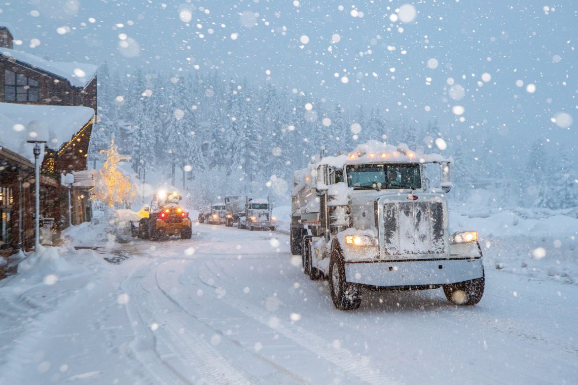
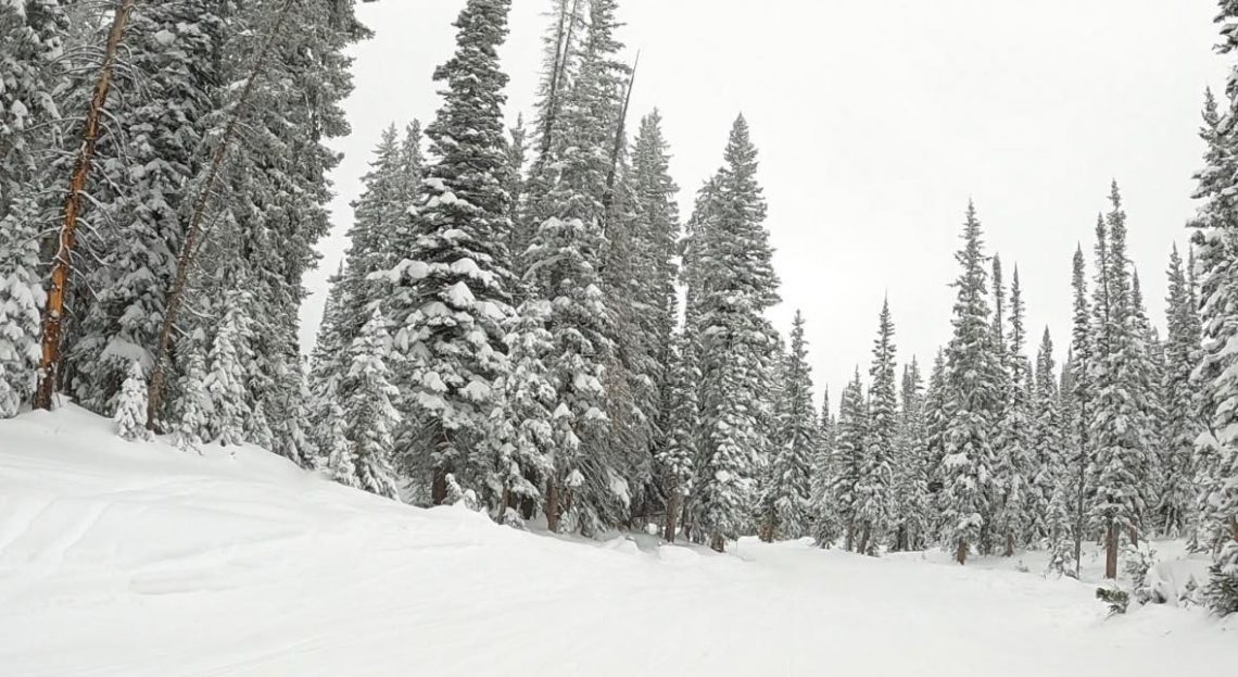
North America’s ski areas continue to be divided on an east/west split with dry/warm conditions dominating in the east and exceptionally snowy, stormy weather in the west. So what’s open on the eastern side of the continent is largely down to snow-making efforts while on the west there have been at least three massive storm systems move through in the past week, with, seemingly ever more intensity. Resorts reported up to six feet (2.8 metres) of snow from the weekend front, along with 100mph winds, which closed many of them for a day or two while they waited it out.
ROCKIES REPORT
The great early-season conditions continue in the Rockies with most areas receiving several feet more snowfall in the past seven days. Warnings of avalanche danger off the prepared trails are intensifying as a result, with a team member involved in pre-opening avalanche mitigation work buried in an accident at Steamboat, according to reports, but fortunately rescued uninjured. Almost all ski areas in the Rockies are open for the season and the region’s two largest ski areas, Park City (40/46″ / 99/114cm) in Utah and Big Sky Resort (70/115cm / 28/46″) in Montana both have about two-thirds of their huge ski areas open. Utah’s Alta (80/168cm / 32/67”) is posting the region’s deepest base to date. Snowfall has eased to light for most areas over the last few days.
ROCKIES FORECAST
Staying very cold in the Rockies but largely dry over the next few days. Temperatures range between freezing and the mid-teens Fahrenheit.
USA WEST REPORT
The West Coast has once again benefitted from the most intense snowfalls in the world in the last seven days with multiple systems moving in off the Pacific. The weekend storms, two in rapid succession, were the most intense yet and most areas shut down in advance with five-six feet (1.5-1.8 metres) forecast along with very strong winds. Even before this though resorts were warning of other hazards, such as tree well traps, even before the weekend storms moved in. West Coast resorts are posting the world’s deepest snow depths after what has now been more than half-a-dozen storms moving through in the past 3-4 weeks. Mammoth Mountain (55/132” / 137/330cm) continues to post the deepest base in the world at present and is the first to go above 10 feet/3 metres at its summit. The snow dangers are high though, a snowboarder died at Mt Baker earlier this week after getting trapped in a tree well and there have been multiple avalanches reported although fortunately, at time of writing, no new fatalities.
USA WEST FORECAST
It looks like there should be a break in the storm systems hitting California with mostly dry weather forecasts from now until the weekend. Further north though in the Pacific Northwest and even in Alaska, there’s much more snow forecast, potentially several feet more by the end of the weekend.
MIDWEST REPORT
There’s something of a dividing line in the Midwest between ski areas with some natural snow cover and those further south and east that have only white ribbons of machine-made snow on their slopes. That said even those with some natural snow are relying on machine-made snow too at this point in the season. Hyland Hills Ski & Snowboard Area (30/48″ / 75/120cm), in Minnesota, is reporting the most terrain open. In fact, its one of the few ski areas worldwide to report it is already 100% open, it’s also posting the deepest snow depth in the Midwest so far.
MIDWEST FORECAST
Temperatures will be bitterly cold for much of the coming week, in the 20-40F range. Conditions little changed with mostly dry weather, sunshine and cloud cover. There’s no real snowfall forecast except perhaps towards the weekend.
USA EAST REPORT
After the ups and downs of temperatures in late November and earlier this month, the past week has been generally cooler on the US East Coast, especially at more northerly latitudes. It has been largely dry and sunny too, although some areas did get a few inches of snowfall at the weekend. But what’s open (and most ski areas in the region are now open) is thanks to snow-making. Temperatures dipping 10 degrees below have helped with that. Vermont’s Smugglers’ Notch (25/49″ / 61/122 cm) is posting the deepest base, little changed on last week, Killington (12/12″ / 30/30cm) has the most open terrain, about a quarter of its full area.
USA EAST FORECAST
A largely dry forecast for the remainder of this week with temperatures mostly remaining below freezing, in the low 20s to high 30s range. Plenty of sunshine is expected.
CANADA WEST REPORT
Almost all western Canadian ski areas are now open with BC’s Fernie (65/100 / 26/40”) and Panorama (38/62cm / 15/25”) among the latest to get their lifts turning for the season at the weekend. Most are reporting excellent conditions with low temperatures and more fresh snowfalls this week keeping the snow pristine. The largest amounts of terrain open continue to be in eastern BC and western Alberta. Sun Peaks (61/86 / 24/34”) and Fernie both report more than 100km (63 miles) of slopes open already.
CANADA WEST FORECAST
A predominantly dry and frequently sunny forecast for the week ahead but with temperatures down towards -10 to -20C as the norm across the region. Only coastal resorts like Whistler will see positive numbers at their bases during the afternoons.
CANADA EAST REPORT
Most ski areas in eastern Canada are now open and it has been consistently cold at last, typically 5-10 degrees below freezing. But that has come with clear skies for sunny days and frosty nights, but no real fresh natural snowfall. Mostly good conditions for snow-making though so that has been the main activity for endeavouring to open more slopes. Tremblant (10/68cm / 4/27″) is currently leading in that effort, as well as posting the deepest snowpack in the region. It has about a quarter of its 80km (50 miles) or so of slopes open so far.
CANADA EAST FORECAST
There’s little change in the forecast conditions with sunny weather dominating the remainder of the week and temperatures continuing to stay below-freezing day and night, even in the valleys.
Asia
JAPAN REPORT
It’s a very different picture in Hokkaido to our report a week ago with, it seems, winter properly settling in and regular snow deliveries underway. So, Niseko (65/90cm / 26/36”) has had the best part of a metre (40”) of snowfall in the last week, generally falling at a rate of 10-20cm (4-8”) a day. Further south in Nagano though it’s a less positive picture so far. Temperatures are down, at freezing or below, but there’s been a lot of sunshine and not so much snowfall, leading many areas to hold opening day back for another week. Hakuba’s Happo One ski area and Myoko Kogen did open at the weekend, however, with limited terrain so far and Nozawa Onsen joined them on Tuesday 13th.
JAPAN FORECAST
Temperatures should stay mostly sub-zero, which is close to normal for early December. There’s some snowfall but not a lot in the immediate forecast for Nagano, more promising further north on Hokkaido.
You might also like...

A Guide to the Perfect Skiing Stance in All Conditions with Maison Sport

Huge Snowstorm Hitting Western North America

World Snow Roundup #231
