WORLD SNOW ROUNDUP #223
Issued: 29 December 2021
By Patrick “Snowhunter” Thorne
European Roundup
North American Roundup
Asia Roundup
WORLD OVERVIEW
The world’s ski areas continue to walk something of a tightrope as we enter 2022. The good news is that ski areas have opened in almost every Northern Hemisphere country where they can, with the lifts now turning in more than 55 countries in Africa, Asia, Europe and North America. Some of the countries we hear less about as ski destinations, including Albania, Azerbaijan and Iraq, have all started their 21-22 seasons over the past week. For most the weather is fairly favourable too, allowing European centres to have one of their better season starts and while North America’s Fall weather was a little lacklustre for skiers, it is picking up fast there too. The fear though is how governments may react to the new Omicron strain of COVID-19 with its fast transmission leading to surges in infection numbers around the world. So far though measures have been to make restrictions ever tighter but not to actually shut the lifts. Travelling between countries has become more difficult again though in some cases. But, finishing on a bright note, unless there’s a big step backwards over the next few days we’re entering 2022 with the most centres open and the most terrain open for 22 months, since the pandemic first hit at the start of March last year in fact. The biggest snowfalls of the past seven days have been in the western US and northern and western Japan, with ski areas in both locations either side of the Pacific seeing up to two metres (7 feet) of snowfall in 72-96 hour periods.
EUROPE INTRODUCTION
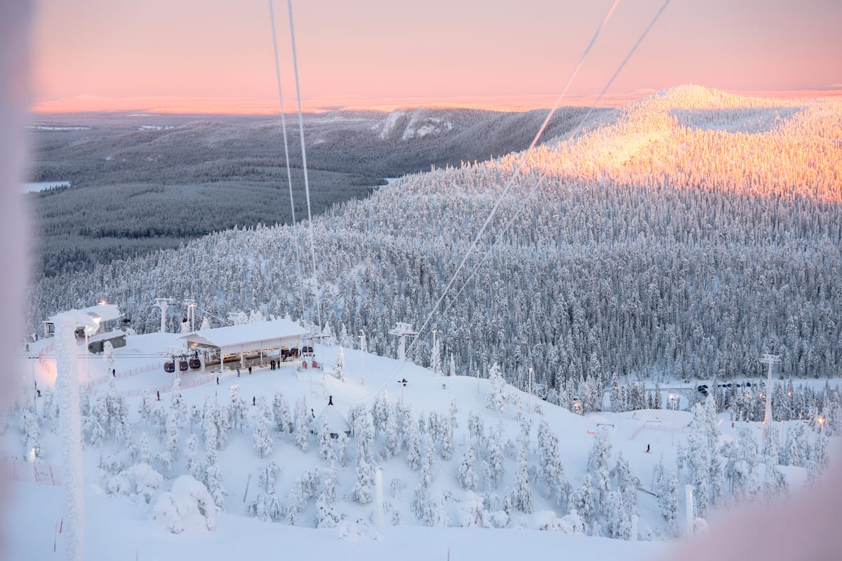
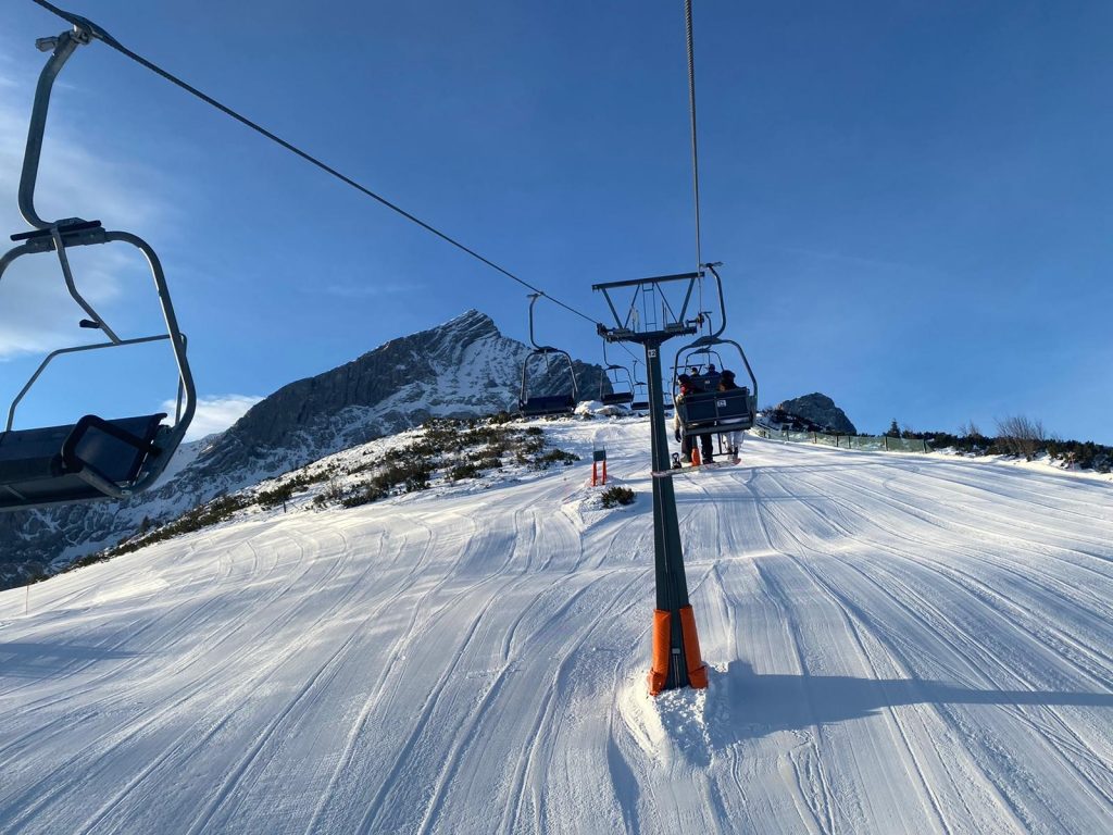
A largely settled week for much of Europe with not much snowfall reported anywhere. That said ski centres in the Alps typically saw (4-10 inches) of fresh snowfall around the Christmas weekend. Ski areas are now open in every European country that has ski lifts, which is almost all of them. Just a few exceptions in more marginal snow destinations like Portugal and Cyprus where they’re still awaiting an adequate snowfall. Open centres have also been offering more terrain than at any time since February 2020 before the pandemic hit with big regions in the Alps having up to 550km of trails open so far (The 3 Valleys). Unfortunately, the final few days of the year are looking a little warm in many areas (perhaps to remind us of how 2021 highlighted The Climate Emergency?)
AUSTRIA
AUSTRIA REPORT| A mixed bag of weather for Austrian ski areas over the Christmas weekend and the start of this week with some dry days some snow showers, some clouds and some sunny spells. Temperatures have been a little on the warm side. Almost all of the country’s ski areas are reported open and almost all are more or less fully open. The SkiWelt Wilder Kaiser-Brixental (70/100cm / 28/40”) is reporting the most terrain open with 233km of their 288km of slopes open. As usual, the deepest snow is up on the glaciers with Hintertux (30/190cm / 12/76”) posting the deepest in the country.
AUSTRIA FORECAST| After the midweek snowfall clears its look drier for the end of the week and into the weekend. Unfortunately, temperatures don’t look ideal, climbing a degree or two above freezing even at 2000m, higher slopes for most Austrian areas, and 5-10 degrees above down in the valleys.
SWITZERLAND REPORT| Swiss ski areas are reporting excellent conditions with almost all centres open and most running and 80-100% of slopes and lifts operational. Conditions have been mostly cold and dry although there was some fresh snowfall over the Christmas weekend. Engelberg (40/240cm / 16/96”) has the country’s deepest snow base and four Swiss areas are reporting more than 200km (125 miles) of slopes open, although all but the 4 Valleys (333km / 208 miles) around Verbier (50/150cm / 20/60”) are cross border areas. They are the Portes du Soleil (500km/313m), Zermatt-Cervinia (250km/157 miles) and Samnuan-Ischgl (20km/126 miles).
SWITZERLAND FORECAST| There’s currently some mid week snowfall for many Swiss resorts with temperatures well below freezing. But, unfortunately, we’re heading towards forecast warm temperatures for the New Year weekend, potentially double-digits above freezing. Sunny skies into the weekend too.
FRANCE REPORT| It has been a snowy start to the week in France after a dry fortnight, with ski areas reporting up to 30cm (a foot) of fresh snow since Christmas Day. The country’s large ski areas are close to fully open for the first time since early March 2020, with the world’s biggest area, The 3 Valleys, stating more than 90% of its slopes are currently open. The country is, however, reporting record coronavirus infections, topping 100,000 on Christmas Day for the first time, and it is not yet known if this will impact operations. The deepest snow in the country is actually being reported in the Pyrenees down at Porté Puymorens (140cm/330cm / 56/132”) with the deepest in the Alps at Avoriaz (50/220cm / 20/88”).
FRANCE FORECAST| The recent snow showers will ease back to dry, sunny weather from midweek and unfortunately temperatures are set to rise considerably over the next few days. At around 1,000m altitude these are likely to reach +10C or even a few degrees higher at resort bases over the next few days, but staying closer to freezing up at 2000m+. A sunny weekend ahead for most.
ITALY REPORT| Italy has seen a similar week to the other main alpine nations with largely dry weather, although some ski areas in the north and west of the country did see a few centimetres of snowfall over the Christmas weekend. Virtually all Italian resorts are open and most have at least two-thirds of their terrain skiable, as with everywhere else that’s the most since February last year. Cervinia (20/90cm / 8/36”) has the most terrain open, some 250km (1`56miles) but that’s shared with Zermatt over the Swiss border. The Milky Way (20/60cm / 8/24”) has the most predominance in Italy with 200km (125 miles) of runs. Although it too includes some over-the-border terrain at Montgenevre in France.
ITALY FORECAST| After the recent dry weather some snowfall is forecast midweek (Wednesday/Thursday) in the north of the country. Temperatures will be around freezing but can go 5 or 7 degrees either way, getting rather warm in the valleys later this week, when full sun is forecast from Friday through the new year weekend.
GERMANY REPORT| Germany has the lowest proportion of ski areas open with most of its larger resorts now operating but many of its smaller centres still closed due to limited snow and/or COVID operating viability pressures or just opening at weekends at this stage. Balderschwang (45/60cm / 18/24”) is reporting the most terrain open, all 41km (25 miles) of its slopes. After a dry period to start the week in most areas, it has turned increasingly snowy but temperatures have also been rising, which unfortunately has resulted in some lower areas seeing rain rather than snow over the past 48 hours.
GERMANY FORECAST| Snowy (and unfortunately for some areas rainy) weather will continue through mid-week before skies will clear for most and a sunny weekend arrives to welcome 2021. Unfortunately, temperatures are expected to rise further and reach double-digit plus numbers by Friday/Saturday.
SCANDINAVIA REPORT| It has continued to be fairly dry and fairly cold for much of Scandinavia over the past seven days with temperatures typically in the -10 to -20C range. Åre (30/53cm / 12/21”) has the most terrain open in the region, over 70km (43 miles) of slopes, about 80% of its capacity. Bases are typically quite thin so far but have passed the metre mark at a couple of centres including Kåbdalis (50/105cm / 20/42”), which is fully open.

SCANDINAVIA FORECAST| Temperatures are warming up but should stay sub-zero into the weekend, but perhaps only single digits below. A snowy end to the week then a clear weekend in Lapland. Whereas the snow is expected later in more southerly resorts in Norway and Sweden after a mostly dry few days.
SCOTLAND REPORT| It was a cold and frosty Christmas weekend in Scotland and there were some snow flurries but unfortunately most of the country’s lifts remained closed as the snow cover has not yet recovered from the big thaw a week ago. That said most of the centres had at least some terrain open for beginners, if only 100 metres or so of slopes, thanks in large part to their all-weather snowmaking systems. It was cold enough for several centres to also fire up their conventional snowmaking overnight.
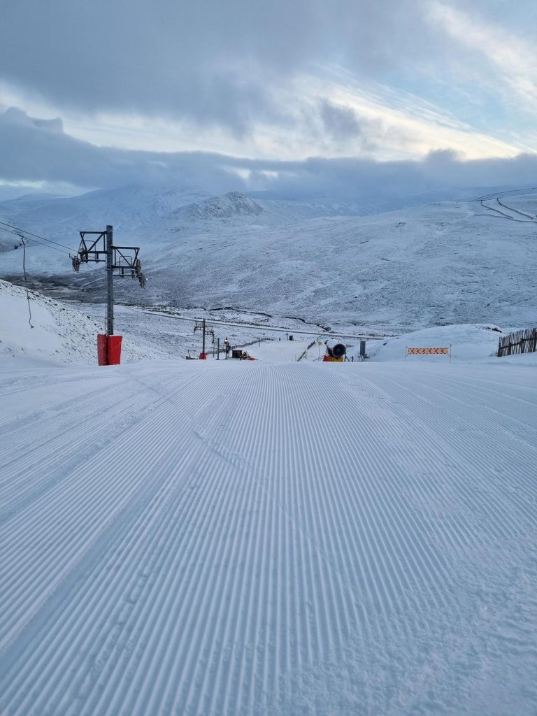
SCOTLAND FORECAST| There’s no immediate improvement on the horizon at present unfortunately, with a return to the warmer weather forecast in Scotland over the latter half of this week looking likely to remove the very thin dusting on the hills at present. Although machine-made snow should make it through to the next cold period.
SPAIN / ANDORRA REPORT| After the snowy first half of December, and a little freshen up to start this week, conditions remain excellent overall in the Pyrenees, where resorts are posting the deepest bases in Europe. Baqueira/Beret (200/255cm / 80/102”) has the deepest snow outside France and the most terrain open in Spain with 160km (100 miles) of runs. However, the largest area open in the Pyrenees, Andorra’s Grandvalira, (85/160cm / 35/64″) has a little more with 180km (113 miles) of runs open there.
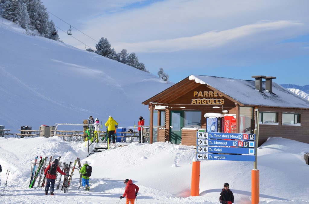
SPAIN / ANDORRA FORECAST| Unfortunately, it looks like exceptionally warm weather will be the order of the day to end the week and over the start of 2022 at the weekend. Sunny skies and temperatures as high as +15C in the valleys looks possible and still +1-C at the top of the slopes, so more late-spring than mid-winter. It should start to cool from Sunday.
BULGARIA / ROMANIA REPORT| Overall, some of the best early season conditions for some years in southeastern Europe with good top-to-bottom snow cover and most resorts fully open. Pamporovo (70/135cm / 28/54”) has the deepest snow in the region but Bansko (10/130cm / 4/52”) also has snow cover back to resort level and the most terrain open. After the heavy pre-Christmas snowfalls it has been drier the past week but on-piste conditions remain generally excellent.
BULGARIA / ROMANIA FORECAST| The weather is going to stay largely dry with mostly overcast skies and temperatures typically a few degrees below freezing.
CZECH REPUBLIC / SLOVAKIA REPORT| Not huge amounts of fresh snowfall to report but good on-piste conditions in the Giant and Tatra Mountains where about 75% of ski areas are now open. The largest, Jasná (30/70cm / 12/28”) reports about two-thirds of its terrain open and that’s fairly typical for most of the region’s other centres at present. That said, the resort was impacted by strong winds with rain at lower elevations on Monday. Otherwise, the start of the week in the region has been largely dry with sunny spells, but cold. Temperatures reached double-digits below freezing overnight on Monday.
CZECH REPUBLIC / SLOVAKIA FORECAST|Conditions look set to stay cold but get snowier as we move towards the new year. There’s snow forecast to end this week and start next, although temperatures are rising too, meaning a risk of rain at low elevations, although most shouldn’t see a rise of more than a degree or so above freezing so it should be snow.
NORTH AMERICA
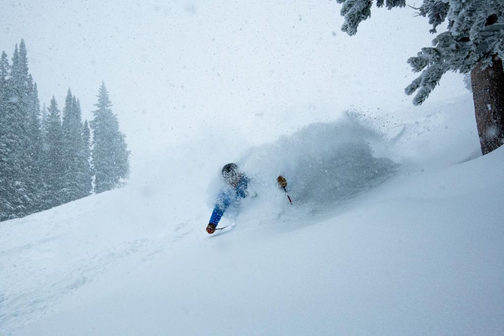
NORTH AMERICA INTRO| Heavy snowfall, gale-force winds and blizzards, extreme cold and surging COVID case numbers have all been impacting different parts of North America over the past week. Overall though the direction appears to be good with the warm, dry autumn for much of the continent starting to move further back in the rear-view mirror for most areas whilst the amount of terrain that’s opened, which had been lower than average, can move back towards what it normally would be at this peak period, thanks to the colder weather and snow. The biggest snowfalls have been on the west coast where several ski areas now have 10 feet plus (3m+) bases on upper slopes, there’s been extreme cold further north where some areas have had to close as temperatures hit ‘dangerous lows’ in Alberta and BC.
ROCKIES REPORT| Media reports over Christmas focused on huge snowfalls on the Pacific Coast but inland The Rockies saw some of their best accumulations of the season to date. Crested Butte, for example, reported three feet (90cm) of snow over Christmas weekend alone. As with further west though, it didn’t all float down gently, with nearby Telluride (10/32” / 25/81cm) forced to close due to extremely strong winds. In places, the snow and other conditions have led to high avalanche danger and sadly Colorado’s first avalanche death of the season (following several collision deaths) was reported over the Christmas weekend. But, overall, an improving picture in the Rockies with most resorts now close to fully open and bases improving. Vail (16/27″ / 40/104cm) has the most terrain open in Colorado and is one of the largest ski areas open. The country’s biggest area, Park City (35/35″ / 90/90cm), in Utah to the north, still only has about half of its runs open as it struggles to catch up on snow cover.
ROCKIES FORECAST| Temperatures could dip as low as 30 degrees below freezing overnight on high slopes in The Rockies later this week. There’s also snow forecast for the end of the year and the start of 2022 with sunshine expected from Sunday 2nd.
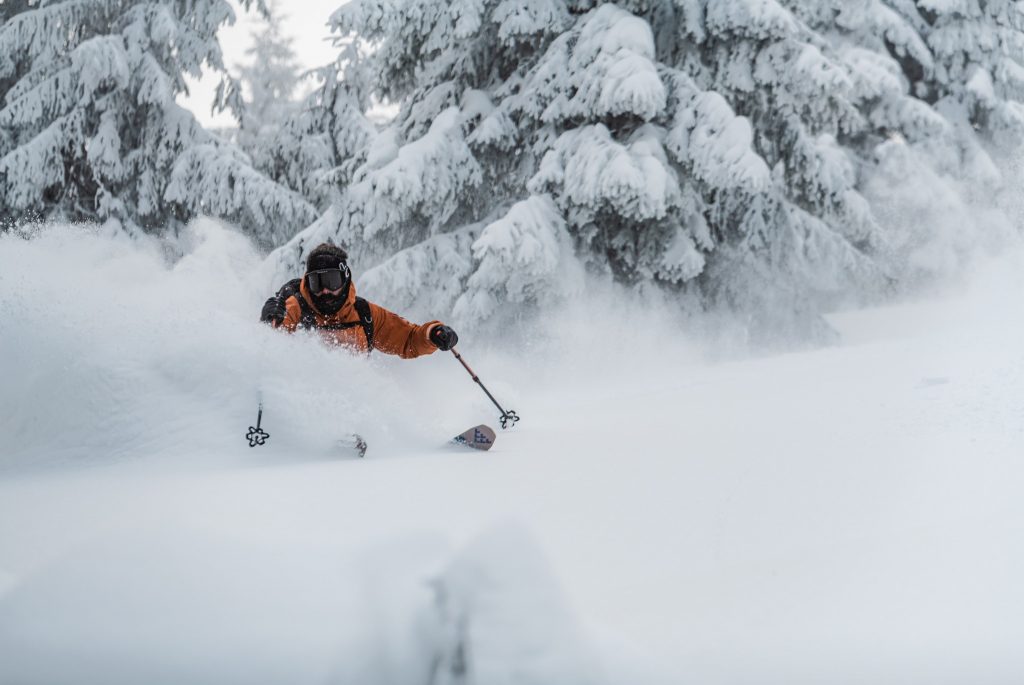
USA WEST REPORT| The second huge snowstorm in a little over a week has been further piling on the powder for ski areas in California in particular, but right across the Western US. Some ski resorts around Tahoe have now reported more than 12 feet (3.5 metres) of snowfall in less than a fortnight. It’s a huge change from November and the first half of December when the region had unseasonably warm and dry weather, leading some centres to delay opening for nearly a month. Some that had opened following an unusually heavy late-October storm had been forced to close again. One of these, Palisades Tahoe, is one of the big beneficiaries of the successive snowstorm systems, reporting two successive 5-foot (1.5m) dumps at its base, with more on the slopes. All the snow, sometimes driven in on winds of up to 120mph, caused many practical issues and left many centres in the region closed for Christmas weekend whilst slopes, lifts, access roads and more were dug out, prepared and made safe. The Palisades remained closed on Monday with access roads blocked by snow and very high avalanche danger. Mt Baker (104/137” / 261/342cm) has quickly gone from little cover to the deepest base in North America but Mammoth (81/127” / 203/317cm) isn’t far behind.
USA WEST FORECAST| After the latest heavy snowstorm it is looking a little drier for the week to come with some snowfall forecast for Thursday but otherwise clear skies. Temperatures staying cool though. They should be down at five to ten degrees below freezing through the weekend.
MIDWEST REPORT| The weather has finally started to play ball in the Midwest after a very changeable December and indeed November up to Christmas when repeated warm weather spikes made non-stop snowmaking tricky, as did rain showers on the snow. Now though things are consistently cold and for most areas, very cold – 10 to 20 degrees below freezing. This has allowed snowmaking systems to run 24-7 in some cases and for most areas in the region to open up much of their terrain for the holiday season.
MIDWEST FORECAST| Heading into New Year weekend it should remain cold for most parts of the Midwest. There’s not much snowfall in the forecast for most areas, although centres in Minnesota should see several snowstorms over the next few days, for others it is most likely to be dry until the weekend.
USA EAST REPORT| An ever-improving picture for the US East coast but with a catch up still underway to get centres fully open for the new year. Essentially, temperatures have finally dropped to sub-zero and stayed consistently cold with both natural snowfall and snowmaking-friendly weather allowing resorts to open up more and more. But coming after too much warm and dry (or worse, wet) conditions there’s some catching up to be done still. Vermont’s Killington 98/20” / 20/50cm) still has the most terrain open. The deepest base though is a little further north at Sunday River in Maine (19/24” / 48/61cm). Both have about half their runs open.
USA EAST FORECAST| Staying mostly cold with more snow showers forecast across the region over New Year weekend, interspersed with a mixture of cloud and sun. Temperatures on the slopes stay below freezing in most areas. But, unfortunately, a little warm still at bases, climbing a few degrees above freezing.
CANADA
CANADA WEST REPORT| The cold has been a key factor in Western Canada over the past week. Although not unusual at this time of year, temperatures dipping below -30C (-22F) has led to a severe weather warning for Alberta and BC. Other than that, things are generally looking good. The cold weather is definitely welcome at some western and southern ski areas in BC, which has been having trouble opening much terrain due to warm weather in December pre-Christmas. Several ski areas around Banff (which unlike the rest of the continent has had a fairly normal pre-season, mostly cold and snowy) were closed due to “dangerous cold” over the Christmas weekend. The continent’s largest, Whistler Blackcomb (10/220cm / 4/88”) reports more than 220 trails open now though, about 80% of its terrain, having been running below a third previously.
CANADA WEST FORECAST| Staying well, well below freezing for the coming week. Perhaps warming a few degrees as a snow-bearing front moves across Wednesday/Thursday but still typically 10-30 degrees below freezing with predominantly clear skies.
CANADA EAST REPORT| The best week of the season so far in Eastern Canada with more reliable and consistently cold temperatures over the past seven days and some significant snowfall for the first time this season too, resorts in Quebec posting 15-25cm (6-10″) falls just before Christmas. Most centres are now 50-80% open, again the best numbers of the season so far. Unfortunately, rising Omicron infection levels have led to ever stricter restrictions on catering and other facilities, but so far the ski slopes have remained open. Tremblant (10/150cm / 4/60”) has the most terrain open in the region.
CANADA EAST FORECAST| A nice forecast of cold and predominantly snowy weather for the week ahead. Temperatures should stay 5-10 degrees below freezing and there’s snow forecast most days, only New Year’s Eve is looking sunny for most, but still cold.
ASIA
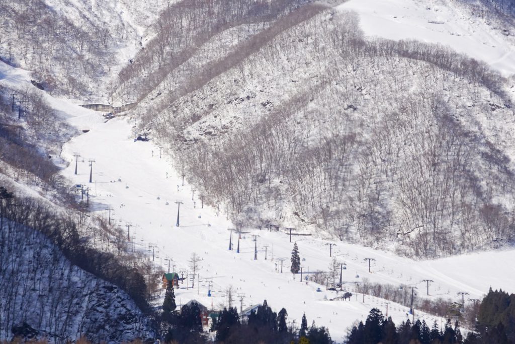
JAPAN REPORT| A proper Japanese winter appears to be underway now with most of the country’s large ski areas reporting daily accumulations of 15-30cm (6-12”) pretty much every day, so that means fresh powder each morning and fast building bases. Temperatures have been in the range of 5-15 degrees below freezing. Niseko (135/245cm / 54/98”) has had over 135cm (4.5 feet) of snowfall over the past week. All the snow does of course mean high avalanche risk and the only real impactful weather issue besides the snow has been strong winds at times. The snowfall has actually set records for the amounts this early in the season and caused short-term issues for some parts of northern Japan even with the country’s notoriously efficient snow clearing policies.
JAPAN FORECAST| There’s no real change in the forecast with daily snowfall expected now through into the new year, temperatures remaining cold.


