WORLD SNOW ROUNDUP #222
Issued: 22 December 2021
By Patrick “Snowhunter” Thorne
European Roundup
North American Roundup
Asia Roundup
WORLD OVERVIEW
The pandemic and the omicron variant, in particular, continues to hang heavy over the start of the ski season keeping fears alive that it will suddenly be stopped by one government or another in an attempt to slow the speed of its spread. For now, though every ski nation is allowing ski areas to open under various pandemic operating restrictions and so we have the most ski resorts open since early March last year when it all stopped. Almost all ski areas in the Northern Hemisphere that can open are open.
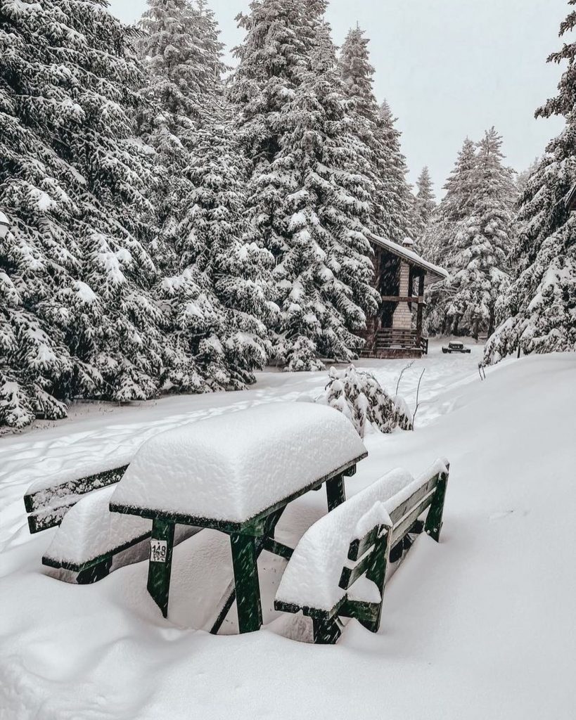
In terms of the week’s snowfall and snow forecast it has been a second largely dry and sunny week in much of Europe. But, other than it being a little too warm at times, there has been good news in the Alps, Dolomites and Pyrenees where skiers have been enjoying excellent conditions after all the fresh snow earlier in the month. More snowfall is forecast for Christmas weekend. It has been snowing in Eastern Europe and here people have been enjoying the powder. It’s a mixed picture in Scandinavia with some snowfall but some centres needing more cover.
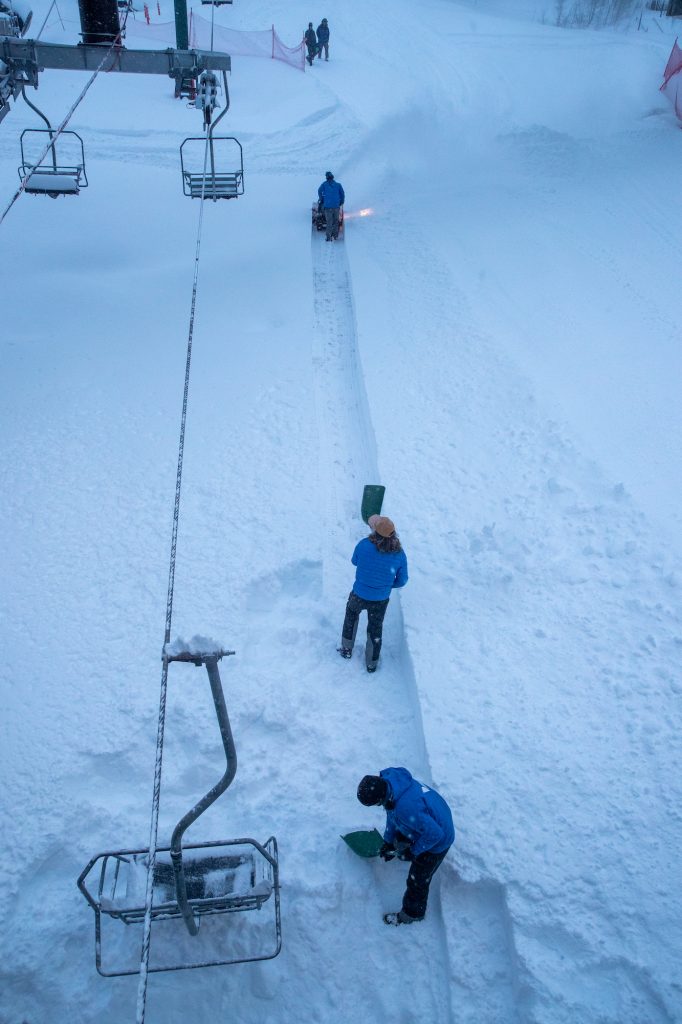
In North America there have been huge snowfalls on the West Coast, particularly in California, turning the season around after the warm, dry start. It remains great in the Canadian Rockies and improving almost everywhere else, although still with some catching up to do to reach seasonal norms for this point in December for many areas.
EUROPE INTRODUCTION
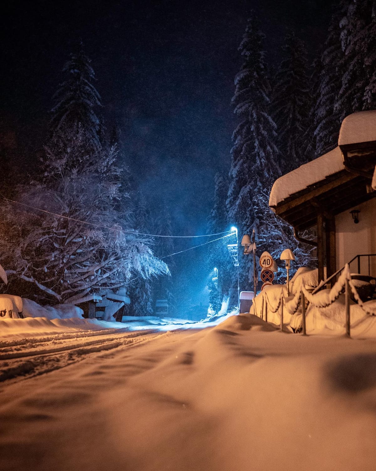
The mood music remains nervous in Europe as pandemic numbers rise. But so far it is only indoor snow centres in countries like the Netherlands and Norway that are being forced to close, while outdoor resorts remain open everywhere. In fact, around 95% of Europe’s ski areas are now open, some waiting for Christmas weekend, coming up. The main issue appears to be increasing travel restrictions on skiers trying to travel from abroad to visit ski areas. For much of the west of the continent, it has been a largely dry and sunny week, the second in a row, although with good snowfalls in early December that’s not yet an issue and more snowfall in the forecast. To the east and north, there has been more snowfall, particularly heavy in southeastern countries like Bulgaria, Serbia and Turkey, which are seeing a snowy start to the season.
AUSTRIA
AUSTRIA REPORT| A largely sunny week in Austria where all ski areas have now re-opened to tourism and almost all are now open for their first Christmas in two years. There was some snowfall to start the week to refresh cover. But, otherwise, it has been predominantly sunny and temperatures have stayed fairly low so the big snowfalls of a fortnight ago are still providing a good base. Ski areas are scrambling to open more terrain for the peak weeks of the season but Ischgl (30/90cm / 12/36″) was reporting one of the biggest areas open in the world with over 200km of slopes at the start of the week. The deepest snow is up on glaciers as usual with Hintertux (10/190cm / 8/76”) saying theirs is the deepest in the country right now.
AUSTRIA FORECAST| The fortnight of sunshine should begin to come to a temporary end at the end of this week with clouds gathering and then snowfall around Christmas Eve/Christmas Day before a return of sunnier weather expected on Boxing Day.
SWITZERLAND REPORT| Virtually all ski areas in Switzerland are now open for Christmas week and the amount of terrain open is rapidly increasing too. Last week Samnuan (30/80cm / 12/32”) and Zermatt (15/160cm / 5/64”) had the most runs open, around 200km (125 miles) a piece in their cross-border ski areas with the 4 Valleys a little behind. But much more had opened in the past few days and it is expected more will for the upcoming Christmas weekend. Most of the country’s areas have enjoyed pretty-much non-stop sunshine for more than a week now, although temperatures have stayed below freezing in the mountains and the same overnight in resorts but climbing to warmer levels in the daytime. Engelberg (40/240cm / 16/96”) has the country’s deepest snow.
SWITZERLAND FORECAST| Sunny for the next few days but with cloud starting to build as we approach the weekend. Light to moderate snowfall is then expected for most areas from Sunday.
FRANCE REPORT| After the huge snowfalls just over a week ago those lucky enough to be on French ski slopes in mid-December have enjoyed sublime conditions with the avalanche danger receding a little and plenty of sunshine for enjoying the fresh snow. It’s pretty much non-stop clear skies with temperatures staying cold although in the southern Alps they have been reaching 5-10 degrees above freezing by the afternoon at lower elevations. The world’s largest ski region, the 3 Valleys, is starting to come into its own now and has about 75% of its terrain open the weekend before Christmas. This includes virtually all green and blue runs, about 75% of red runs and half its black graded terrain. More is opening in the build-up to the busiest week of the season over New Year. Sadly, France is currently closed to British skiers in a French government reaction to the surging omicron variant in Britain.
FRANCE FORECAST| The sunshine will continue for the next few days but after a fortnight things are due to start to change over Christmas weekend with snow forecast for many areas from Christmas Eve.
ITALY REPORT| Italy has been the focus of World Cup ski racing for the men this week with the famous downhill races in Val Garden followed by giant slalom in Alta Badia (30/80cm / 12/32”) and slalom in Madonna di Campiglio (50/70cm / 20/28”). These all showed great conditions for this early in the season, Val Garden (30/80cm / 12/32”) particularly noticeable as the valley and sometimes the hillside around the course are often green and snowless, but not this year. It has one of the largest areas open in Italy, some 178km (110 miles) of slopes, part of the now nearly fully open vast Dolomiti Superski region. There’s not been any fresh snow to speak of in the past week but most Italian resorts are now open and many fully open. Cervinia (15/160cm / 6/64”) reports the most terrain open, shared with Zermatt, at 215km (130 miles).
ITALY FORECAST| The sunny weather is expected to continue for the next few days although clouds will begin bubbling up, particularly in the north of the country. Many areas could see snowfall around Christmas Eve as temperatures dip to double-digits below freezing at altitude.
GERMANY REPORT| Most German ski areas have had sunny skies for the past week although temperatures have remained generally cold, especially in the Bavarian Alps, a little warmer in the country’s more northerly, lower mountain ranges. About half of Germany’s 500 or so ski areas are believed open including most of the major centres, although a sizable number of smaller areas plan to open this coming Christmas weekend. Oberstdorf (40/160cm / 16/63”) is reporting the country’s deepest snow, Balderschwang (45/60cm / 18/24”) the most terrain open, all 40km (25 miles) of runs there.
GERMANY FORECAST| The sunny weather will continue through to Christmas Eve when a fresh snowfall is forecast for most ski slopes in Germany. Temperatures stay below freezing at most of the country’s ski centres.
SCANDINAVIA REPORT| Whilst much of Europe to the south has seen predominantly sunny weather over the past week it’s a far more mixed picture across Scandinavia, with cloud and snow showers more likely in many areas. Up in the north temperatures have been very cold, -20C and colder in parts of Lapland, as is normal for the time of year, and a part of the region is also in the 24-hour polar night at this point of the year, with others close to it. Almost all the resorts in the region are now open with the largest, Sweden’s Åre (30/54 cm /12/22”) posting the most terrain open, around 80km which represents around 90% of its potential terrain. Narvik (10/100cm / 4/40″) upon Norway’s northern coast is the first in the region to post a one-metre base this season.
SCANDINAVIA FORECAST| The weather will be staying cold, as it should, and there’s mostly cloudy, sometimes snowy, weather forecast across the region, Lows in the north down as far as -25C, but more widely -5 to -15C. Snow showers are light to moderate.
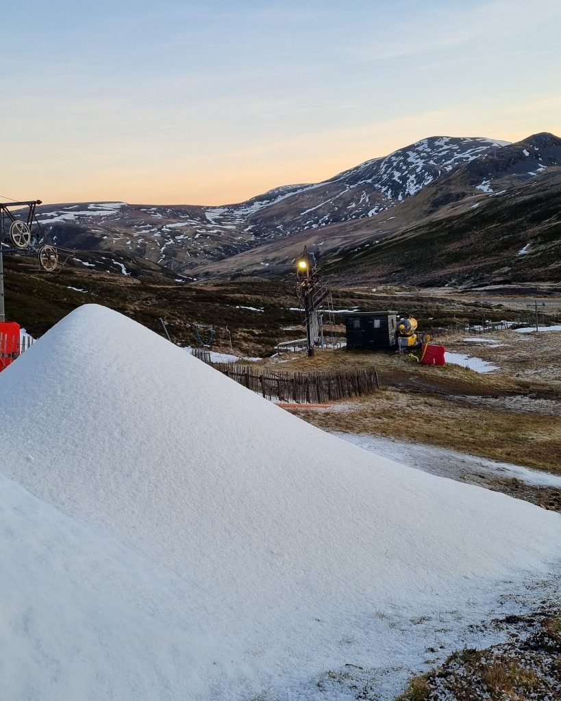
SCOTLAND REPORT| After a cold first half of December, which allowed four of the countries five centres to open limited terrain the weekend before last, very warm weather last week led to much of that snow melting. Nonetheless, the same four centres have reopened since the weekend thanks to their all-weather snowmaking machines. Cairngorm has the most open, a 150 metres slope, but reports tickets sold out to access it into the New Year. Glenshee and The Lecht also have small areas open while Glencoe has too, but only for sledging. Temperatures dropped again at the weekend.
SCOTLAND FORECAST| It should remain cold, potentially allowing for conventional snowmaking, but there’s no snow in the forecast until Christmas Eve or Christmas Day when, hopefully, there’ll be an upturn in conditions.
SPAIN / ANDORRA REPORT| Everywhere is now open in the Pyrenees and fully open for the Christmas and New year holidays. It’s great to be able to report this news after most of the ski areas in the mountains there were closed this time last year. There’s the bonus too that after the huge snowfalls in early December the snow is lying deep early in the season and most runs can be open too. Andorra’s Grandvalira (100/180cm / 40/72”) and Spain’s Baqueira Beret (240/285cm / 96/114″) both have around 160km (100 miles) of runs open, the most in the region. But the deepest snow is reported on the French side at Porté Puymorens (150/250c / 60/140”), the deepest base in Europe at present. As to the weather, it has been the second week of mostly sunny weather, temperatures hovering around freezing.
SPAIN / ANDORRA FORECAST| The two weeks of nearly non-stop sunshine does seem to be ending at last with clouds set to roll in in the latter half of this week and the potential for light snow showers from Christmas Eve.

BULGARIA / ROMANIA REPORT| It’s been an increasingly good start to the season in southeastern Europe with more ski areas opening and reporting very deep snow across the region. Kopaonik in Serbia and Uludag in Turkey both reported 50-100cm (20-40 inch) drifts as they started their seasons. In Bulgaria, Pamporovo (70/150cm / 28/60”) has the deepest snow in the country at this early stage in the winter. It has been snowing here more than further north in the Alps in recent days and it has been a little colder too. Avalanche danger levels were also reported to be unusually high due to all the snowfall.
BULGARIA / ROMANIA FORECAST| The skies should remain clear into the latter half of the week with increasing clouds towards the weekend. Temperatures staying below freezing day and night, even down at resort level, for most areas.
CZECH REPUBLIC / SLOVAKIA REPORT| Virtually all of the ski areas in the Czech and Slovak Republics that can open are now open for the season. The region’s largest resort, Jasná (50/60cm / 20/24″), has also been opening more terrain in the run-up to Christmas. After a dry spell in the middle of last week, the snow has returned to most resorts in the region, with cold temperatures getting down to double digits below freezing and light snowfall giving a nice top up most days, with a bigger dump reported at the weekend.
CZECH REPUBLIC / SLOVAKIA FORECAST|Conditions will remain cold with overcast skies and occasional snow showers. It will get warmer towards Christmas weekend though reaching positive temperatures at lower elevations where the snow could turn back to rain, unfortunately. But the bigger, higher areas should see more snow.
NORTH AMERICA
ROCKIES REPORT| The snow kept falling in the Rockies last week with Snowbird reporting 20 inch (50cm) in 24 hours. H 70 was closed for a time westbound into the Rockies from Denver and there were plenty of other promising signs of good conditions ahead. Despite all this though ski areas are not yet opening everything up, perhaps waiting for Christmas weekend. Snowbird, for example, reports 42 of its 142 trails open despite all the fresh snow and a 56” (1.4 metre) base. Nearby Alta (32/66” / 80/165cm) is looking more open with about 75% of its runs skiable. Wolf Creek in southern Colorado is one of those reporting excellent conditions now with over 50 inches of snow lying and the slopes 100% open.
ROCKIES FORECAST|The forecast is for sunshine over the next few days, with temperatures remaining well below freezing, with a front bringing snowfall to most areas around Christmas Eve/Christmas Day, but more sunshine following on behind.
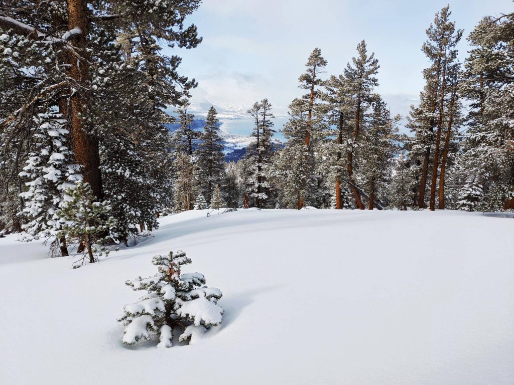
USA WEST REPORT| California has been transformed by the recent heavy snowfalls, with seven-day totals reaching 100 inches (2.5 metres) at a few centres. As a result, everywhere is open and centres that have been open a while now, particularly Mammoth (137/203cm / 55/81”), are now 100% open for the holidays. It’s a fast-improving picture further north too with most centres in Oregon and Washington state opening at the weekend too. Further north in Alaska, Alyeska Resort (28/112” / 71/279cm) has the deepest snow in North America with famously snowy Mt. Baker in Washington State (64/84” / 160/210cm) in second place. The weather wasn’t all snowy though, two areas shut down in Washington State soon after opening for the season due to ice build-up on lift cables.
USA WEST FORECAST| For most of the west it’s a sunny picture now and for the next few days with highs at freezing point, but mostly 5-15 degrees below. Some snowfall is expected around Christmas Eve, however. But in the south California should see another big snowstorm getting underway midweek which will set in for the week and could bring 40 inches (a metre) of more snowfall totals by Christmas weekend.
MIDWEST REPORT| Still a rather mixed picture in the Midwest with some centres managing to build quite good bases, others having to scale back plans, which clearly isn’t great news with the Christmas Holidays upon us. Vail announced they were delaying the planned weekend opening of their four Ohio ski areas at the weekend due to conditions being too warm for adequate snowmaking there still.
MIDWEST FORECAST| The forecast remains very mixed across the Midwest into next week with some areas seeing temperatures drop as low as 10 below freezing with snow showers, but others seeing 5 degrees above and rain, a bit of a disaster at this time of year. The skies will remain mostly overcast and it will be showery so the temperature will determine what falls from the sky.
USA EAST REPORT| The roller coaster of weather conditions in New England and the US east continues with some very mild weather for a brief spell in the latter half of last week turning to colder, snowier weather and a foot of snow for some centres in Vermont at the weekend. So an improving picture, with everywhere open, overall bases getting better and more terrain opening but still someway from ‘back on track. Sunday River (12/26” / 30/66cm) was posting the most terrain open, about half their potential terrain as we publish this week, Attitash, in New Hampshire (18/31” / 45/77cm), has marginally the deepest base in the region.
USA EAST FORECAST| At last, the weather is playing ball for the week ahead in terms of temperatures at least with no more warm weather forecast and everything, in fact, staying below freezing day and night. Sunny though until the end of the week when fresh snowfall is expected at the start of the Christmas weekend.
CANADA
CANADA WEST REPORT| More or less all of Canada’s ski areas are now open and most have had fresh snow this week, but the region on the eastern side of BC and Western side of Alberta, around the northern Rockies, continue to post the best conditions in the country and on the continent. Lake Louise (115/159cm / 46/64″) still has the most terrain open in Canada (110km/68 miles) although it has been overtaken by Mammoth in the US for most on the continent. It’s had a lot more snowfall too and temperatures have been 20 degrees below. Things remain less good for west and south with Red Mountain still struggling to open and coastal Whistler Blackcomb (10/190cm / 4/76″) only able to open about a third of North America’s largest ski area (although that’s a big step up on the 10% a week ago).
CANADA WEST FORECAST| After a dry few days more snowfall should arrive for the latter half of this week and into the weekend, although it’s not looking like huge amounts of snow so far. Temperatures stay very low except at lower elevations on the Pacific Coast.
CANADA EAST REPORT| Another in the series of weeks in Eastern Canada which seem to be two steps forward then one step back. That is generally colder weather and some fresh snow, but then a sudden leap up in temperatures spoiling that progress. So we are still running well behind where we would normally be for snow cover at this point, but still, an improved picture compared to a week ago. Most areas are now open but ski areas in Ontario are having a particularly hard time and some have delayed to hopefully open this coming Christmas weekend. Tremblant (0/122cm / 0/49”) has the most terrain open and the deepest reported snow in the region, albeit nothing at resort level, which speaks volumes for late December. It has about half of its runs open now. The week ahead does look much more promising than most of our forecasts over the past few months. Crucially, there’s no sign of any warm weather blips and on the contrary freezing point should be the high point. The low point is about -15C, some sunny days forecast, some snowy. third of its full area, reflecting the lack of early-season snowfall.
CANADA EAST FORECAST| Unfortunately, there are 24 hours of very warm temperatures (+10C) coming before things are due to dip back below freezing with hopefully a decent dump of snowfall at the weekend for Christmas week.
ASIA
JAPAN REPORT| It’s been a good week in Japan for most ski areas with plummeting temperatures and some heavy snowfall. Myoko, for example, posted 60cm (two feet) of snow on Saturday which was as much as they’d had the rest of the month combined. Niseko (85/170cm / 34/72”) posted similar accumulations on the higher slopes, about a foot (30cm) more down in Grand Hirafu on the same day. The wind was a factor as it so often is, causing drifting and increased avalanche danger. Temperatures stayed low and the snow kept falling through the start of this week.
JAPAN FORECAST| The snowfall is expected to continue over the coming week, most days, with a possible let up on Sunday. This should start to build bases in more areas. Temperatures in the range of 5 to 15 degrees below freezing.


