WORLD SNOW ROUNDUP #212
Issued: 13 October 2021
By Patrick “Snowhunter” Thorne
European Roundup
North American Roundup
Asia Roundup
Southern Hemisphere
WORLD OVERVIEW
The feeling that winter is coming has been underlined across much of the Northern Hemisphere over the past week with ever more significant snowstorms hitting western North America, the biggest dump of the autumn yet in the Alps with snow down to the valley floor in some places, and more snowfall too in other regions like the Balkans and the Pyrenees.
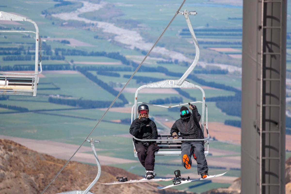
In the Southern Hemisphere as we approach ‘mid-spring’ it is understandably almost the opposite with some warm weather reported and (almost) all areas now closed for the season in the Andes and Australia. That said, Australian mountains did have a good snowfall last week after everywhere had closed. New Zealand, however, is holding out with the 2021 season and a handful of centres here are still open into the latter half of October. There was actually up to 22cm (9”) of fresh snow reported on the slopes there on Tuesday.
But we have now definitively turned the corner in terms of the number of ski areas open in the Northern and Southern Hemispheres. Half a dozen more centres have opened in Europe, including more alpine glaciers and the first centres for 21-22 in Finland, thanks to snow-farming there. So we are back into double figures. In the Southern Hemisphere again the opposite is true and we are back down to single figures.
We’re continuing to wait for the first area to announce it is opening for the season in North America but with more heavy snow forecast and some centres having started snowmaking that may be just days away.
EUROPE INTRODUCTION
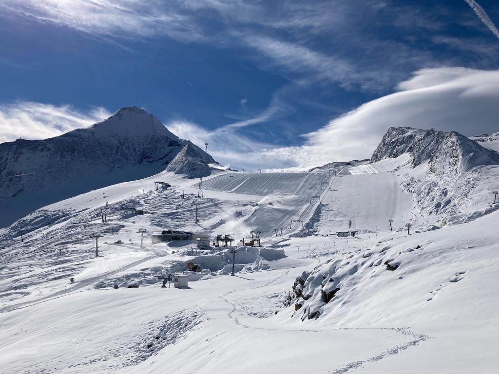
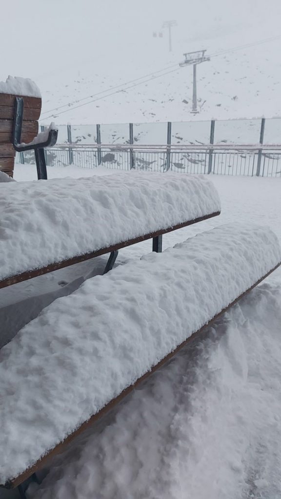
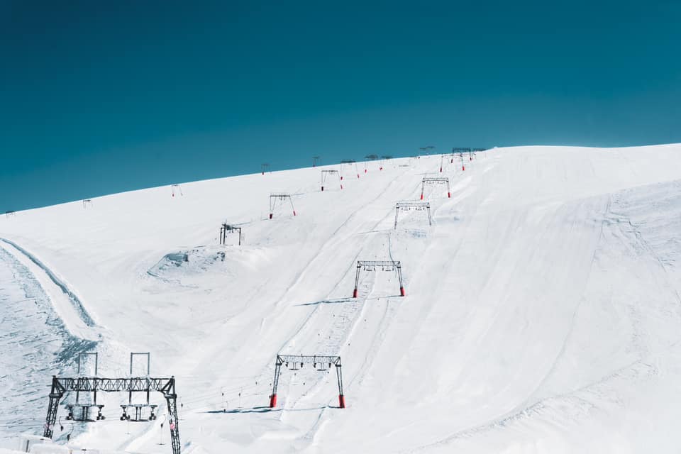
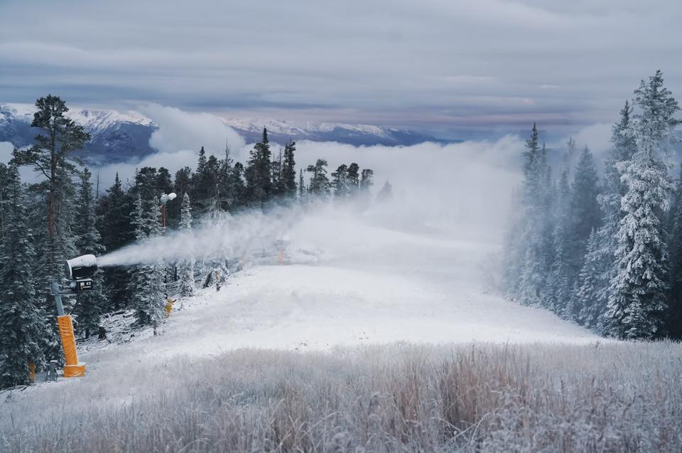
After the challenging September for snowfall things have certainly picked up in the Alps this past week with a heavy snowfall in the latter half of last week bringing up to 50cm (20”) of snowfall to glaciers and snow right down to the valley floor in Austria and Switzerland.
Five more ski areas opened at the weekend in the Alps and up in Finland, bringing the total number open in Europe back into double-figures for the first time since last spring. One of them, Engelberg (0/325cm / 0/130”), is instantly the only ski area in the world with a 3m/10 foot plus base. By mid-winter this has normally doubled and is usually one of the deepest in the world. Therefore, at the moment, there’s a definite feeling of building momentum. Finland is the latest country where ski areas are now open for 21-22 and France is due to join the party this coming weekend, all being well.
AUSTRIA
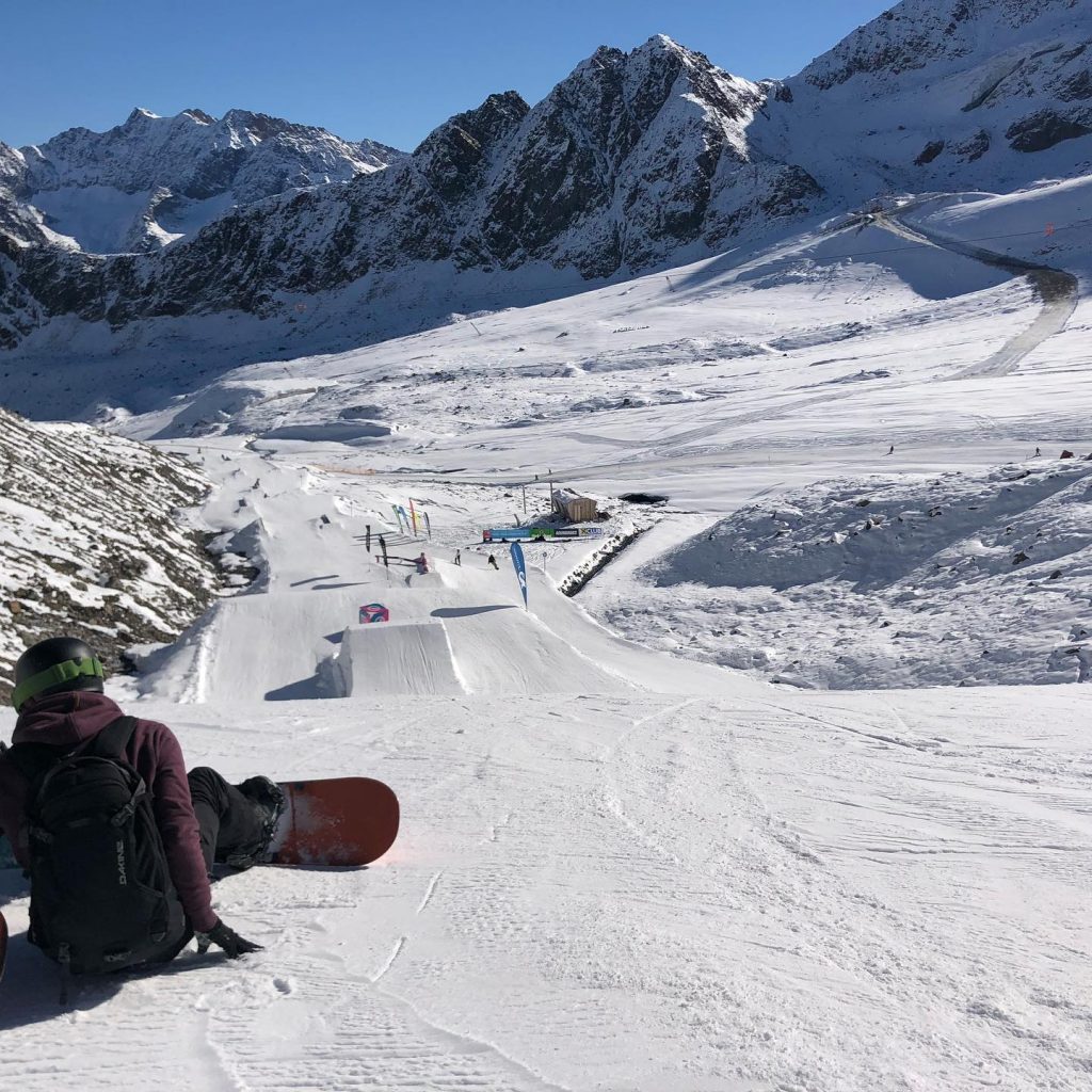
AUSTRIA REPORT| Like the forecast last week, the biggest snowfalls of the autumn so far occurred with several Austrian glaciers posting 30cm (12”) accumulations up high by last Wednesday morning and equally significantly snow falling right down to low elevations. In some cases down to the valley floor at around 1000m. This was particularly good news for the Stubai glacier which had delayed its usual September opening date due to a lack of snow cover but opened with fresh powder on Friday. As did the Kitzsteinhorn, above Kaprun, which reported up to half-a-metre (50cm) of freshly fallen snow on its slopes. This takes the number of glaciers open in Austria to six, half the total of areas open across the Northern Hemisphere at present.
The four areas that were already open are Hintertux (0/90cm / 0/36”), Pitztal (0/30cm / 0/12”), Solden (0/74cm / 0/30”) and Kaunertal (22/55cm/11/14”), all reporting plenty of fresh snow. Hintertux claims the largest area open with 25km (16 miles), Solden has 20km (13 miles).
The news isn’t all good though, the Molltal glacier, which has been closed since July due to warm weather melting cover on the glacier, changed its mind after announcing plans to re-open last weekend (having initially hoped to in early September) and remains closed for now. However, the latest update is a plan to open one run from Thursday the 14th.
AUSTRIA FORECAST| A much colder week ahead than in recent days, staying well below freezing at altitude, freezing to 10-15 degrees down in valleys. The weather is looking largely dry and often sunny in Austria but light snowfall is possible for periods at altitude over the next few days. It probably won’t add up to more than a few centimetres, however.
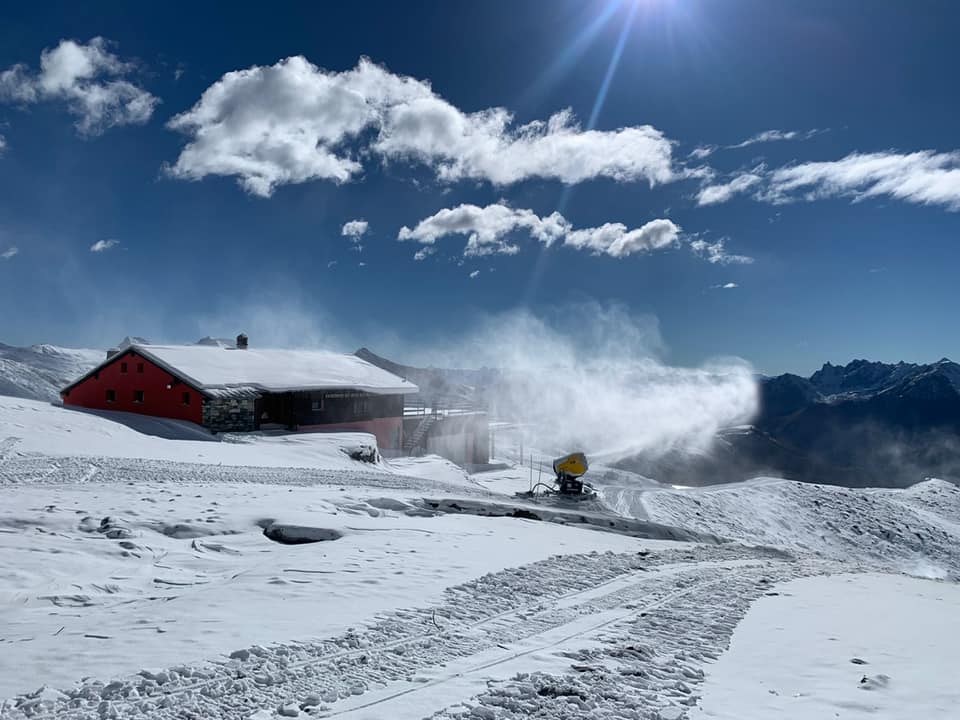
SWITZERLAND REPORT| After three months of there being a choice of skiing at Saas Fee (0/155cm / 0/62”) or Zermatt (0/150 / 0/60”) we again have a choice of three Swiss areas open with Engelberg (0/325cm / 0/130”) opening for its eight-month season at the weekend. The area immediately posted the first 3-metre plus depth reported anywhere since Mt Hutt, in New Zealand, claimed over 4m lying up high after a huge pre-season snowstorm when it opened last June. All three areas enjoyed a dump of fresh snow in the middle of last week like the rest of the Alps. Saas Fee has the most terrain reported open so far, around 18km/11 miles, the other two a little less.
SWITZERLAND FORECAST| After the snowfall last week there’s not much on the horizon now with sunshine forecast for the next seven days pretty well non-stop. Cooler though with temperatures staying below sub-zero up on glaciers, well into double-digits below overnight.
FRANCE REPORT| France has been the only one of the big four alpine nations not yet to open for the 21-22 ski season with Tignes now having officially given up on its annual attempt to open by late September after many years of failing to do so. But it is due to open this coming weekend and hopefully, the fresh snowfall up high in recent weeks will make that a reality. Les 2 Alpes is due to open even sooner, later this week, but initially only for race teams, with a general opening to the public due for the 23rd.
FRANCE FORECAST| It’s a rainy start to the week in the French Alps and that should continue to Wednesday/Thursday with the likelihood of snow at higher elevations. Warmer, drier and sunnier from Thursday on.
ITALY REPORT| Passo Stelvio (20/170cm / 0/68”) was one of the big Italian beneficiaries of last week’s snowfall reporting a 25cm (10”) accumulation and seeing its lower slope base depth jump from zero to 20cm (8”) and a similar boost to upper slope cover. It has 6km (4 miles) of runs open and just over a fortnight left of its 2021 season. Val Senales (0/80cm / 0/32”) is also open with just under 2km (1 miles) of groomed runs.A third Italian option,Cervinia, is due to re-open access to the joint glacier area, shared with Zermatt on the 16th , this coming weekend.
ITALY FORECAST| Italian mountains will share in the sunny conditions dominating the Alps over the coming week. Sub-zero temperatures day-and-night at altitude, 0-15C for resort level.
GERMANY REPORT| Germany’s 20-21 season start is still over a month away but the Zugspitze glacier, home of the country’s highest slopes and likely to be the first to open there in late November, reported a 25cm (10”) snowfall as part of the big dump across the Alps last week.
GERMANY FORECAST| A mixture of sunshine and rain showers across Germany’s mountains over the coming week, with cool temperatures but not really cold enough for any more snow except on the highest slopes in the Alps to the south, where it’s expected to be largely clear skies.
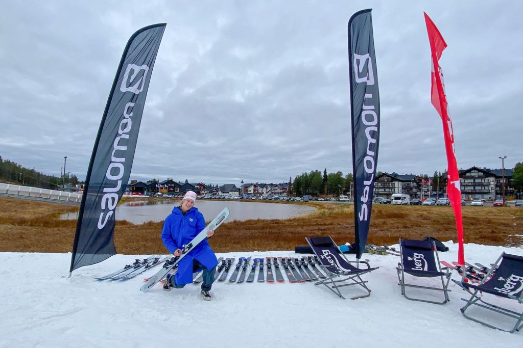
SCANDINAVIA REPORT| Finland became the latest country with its ski resorts open for the season last weekend, as leading areas Levi (0/50cm / 0/20”) and Ruka (0/50cm / 0/20”) both set the lifts running above a few kilometres of slopes each created using snow they saved from last season spread back out on the slopes. In Norway, Scandinavia’s highest ski area, the Galdhopiggen (5/50cm / 2/20”) summer ski centre, which re-opened earlier in October after two months of unscheduled closure due to warm weather, continues to operate and is into its final three weeks of operations for the season. Idre Fjall, Sweden’s first area to open using the same snow farming technique as the Finnish centres, has targeted the weekend after next (the 22nd) as its opening day.
SCANDINAVIA FORECAST|Cold and cloudy for Scandinavia with temperatures hovering five degrees on either side of freezing point. Lots of ski areas in the region here already have snow lying and it should stay cold enough for it to stay where it is, perhaps grow in depth over the next seven days.
SCOTLAND REPORT| UK tabloids are getting excited about a Polar vortex hitting Scotland at the end of October. There’s no real sign of it yet and when you read the actual report they’re only talking about a little snow on hilltops so not quite as the headline portrays. For now though it has been more warm and wet, but then it is only early October and we live in hope.
SCOTLAND FORECAST|More rain than dry weather in the forecast and though that might just be snow overnight visible up high some mornings the forecast is for warmer temperatures by the end of the weekend.
SPAIN / ANDORRA REPORT| After the snowfall at the start of last week, it has been warmer and dryer, melting away much of the early cover. It’s been sunny daily with temperatures reaching 20C in resort, although nearer 5C up on the slopes.
SPAIN / ANDORRA FORECAST| There’s little change in the forecast, with more sunshine expected and temperatures remaining warm. Slightly cooler and a little more cloudy by the weekend.
BULGARIA / ROMANIA REPORT|There’s been more snow at altitude on the Balkans and other south-western European mountain ranges. Ski slopes are not expected to open for the 21-22 season until late November or early December.
BULGARIA / ROMANIA FORECAST| It’s looking promising for mountain snow over the latter half of this week with snow forecast in the Balkans from Friday on.
CZECH REPUBLIC / SLOVAKIA REPORT| As with other mountains in the region, the Czech and Slovak Republics have both already seen early, temporary snow coverings on higher slopes. Most resorts in the region will aim to open in late November or early December.
CZECH REPUBLIC / SLOVAKIA FORECAST| A mix of sunny and rainy weather for the week ahead, cooler than last week with daytime highs nearer five degrees, remaining below freezing at resorts like Jasna overnight.
NORTH AMERICA
NORTH AMERICA INTRO| There’s been a real and ongoing blast of winter in western North America raising hopes that the first ski areas will be open sooner rather than later. Ski resorts in mountainous regions from southern US states up to Canada’s far north have reported 3-12 inch (8-30cm) accumulations, plummeting temperatures and in the case of some high altitude centres in the Colorado Rockies, snowmaking machines on. The snowfall is expected to intensify in many areas and continue for at least the coming week. Ironically though, there are still forest fires burning and extreme fire danger reported in many parts of the west.
ROCKIES REPORT| Colorado traditionally sees some of the earliest resort openings in North America, often the earliest, and ski areas like Arapahoe Basin, Keystone and Loveland are already snowmaking and seemingly getting excited about a potentially imminent opening. Conditions have turned much more favourable in the past week with successive waves of snowfall moving in leading the most optimistic to speculate the first area could be announcing its opening within days. That said A Basin’s boss did try to quell over excitement at the weekend warning the snowfall at that point, so far, was ‘wet’ but then by Monday he too said he was excited by the forecast for snowmaking through the remainder of this week. Wolf Creek is usually the other likely contender for the coveted ‘first to open’ title while Copper Mountain has said that although it won’t be opening to the skiing public until next month it will be offering training facilities to the US team later this month.
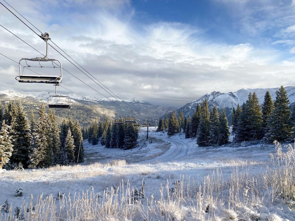
ROCKIES FORECAST| The current cold and wintery weather should get increasingly intense over the next few days bringing more snow to higher elevations and snow levels down to lower elevations. Snowfall along the full lengths of the Rockies, probably heaviest though in the north, particularly Wyoming.
USA WEST REPORT| After the scorching summer and even as forest fires continue to burn, there’s been a much more wintery turn to the weather in California’s mountains over the past week. Ski centres along the west coast woke up to a few inches of snowfall last Friday morning which at some higher areas extended down to base level. The snowfall has since continued and is heavier still further up the coast in the Pacific Northwest. There were further snowfalls over the following days. There’s no clear sign of any areas there planning to open before mid-November in about a month but some centres have opened there in Octobers (and even briefly in Septembers) in the not too distant past, so you never know.
USA WEST FORECAST| Looking drier in the south of the region but remaining cool. Further north towards Washington state more precipitation is forecast, likely to be further snow on higher ground, rain lower down.
MIDWEST REPORT| This time last year we were days away from Wild Mountain in Minnesota becoming the first ski area to open for the 20-21 season in North America. This year is looking a little less promising so far with temperatures stubbornly remaining too warm, for snowmaking so far.
MIDWEST FORECAST| After rain Midweek it should be dry on Thursday/Friday and into the weekend with overnight lows on the slopes getting down towards freezing at the weekend.
USA EAST REPORT| We continue to appear to be some way off the conditions needed for snowmaking to start in the US East, with generally warm temperatures in the 50s and 60s Fahrenheit and a mixture of sunny and rainy days.
USA EAST FORECAST| Conditions can change quickly in the mountains and cold enough weather for snowmaking and early opening at some areas are likely to be here later this month or in early October, but for now, we’re looking at a fairly warm, frequently wet week ahead.
CANADA
CANADA WEST REPORT| Western Canada, particularly ski areas near Banff and Jasper, has been posting regular snow dusting pictures for months now but the past week has seen the snowfall getting heavier, the snow line getting lower and its extent getting wider. Ski areas across British Columbia posted images of their first significant snowfalls of the season. Marmot Basin near Jasper, likely to be one of the first in North America to open for the season early next month, reported top to bottom snow cover already. Up to 15cm (6”) of snow was reported on higher slopes by the start of this week with the freezing level falling to below 1,000 metres altitude.
CANADA WEST FORECAST| After the recent snowfalls it will stay cool but not cold for much of the region, and the weather is looking wet, with a high snowline. Further north in areas like Jasper though it should be more wintery.
CANADA EAST REPORT| It remains fairly warm and wet in Quebec and Ontario where the focus is on Fall colours rather than snow at this point, temperatures typically in the range of 10-20 degrees above freezing in resorts, cooler in the mountains.Eastern Canada’s 21-22 season will most likely begin in November.
CANADA EAST FORECAST| Temperatures should peak in the low 20s Celsius midweek then start to drop. Much cooler and drier by the weekend.
ASIA
JAPAN REPORT| We’re still a month or so off the first ski areas opening for the season in Japan. Although a few do use all-weather snowmaking to open a short run or two in late October so that they can claim first in the country. The only known area open in Asia so far though is China’s Keketuohai International Ski Resort in Altay prefecture. The weather in the mountains has been a mixture of sunshine and cloud with some rain, overnight lows getting down towards freezing, daytime highs in the mid-teens Celsius.
JAPAN FORECAST| More unsettled weather moving into Hokkaido in the latter half of this week with overnight temperatures dropping below freezing right down to resort level. This combination should bring some mountain snow by the weekend.
SOUTHERN HEMISPHERE
The 2021 season is now all but over in the Andes, Australia and Africa leaving New Zealand as the only country where resorts are still operating.
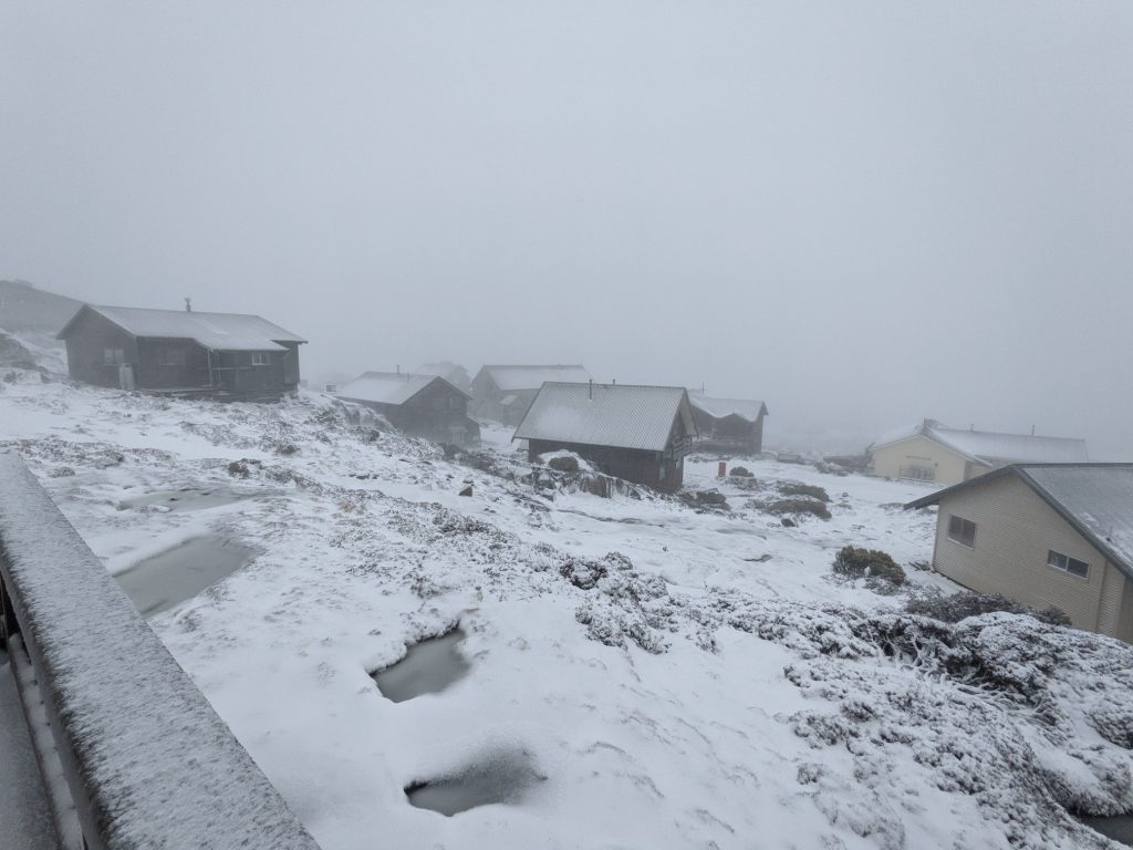
Australia did actually see a decent dump of snow in the middle of last week so ski tourers had something fresh to enjoy, although the lifts are all now off at the country’s leading ski areas. Only Ben Lomond, in Tasmania, remains open but reported that fresh snowfall there was too little for it to open last weekend as it had hoped.
In the Andes, the last ski areas that had still been open but called it a day on the 2021 season on Sunday or Monday included Argentina’s Catedral and La Hoya. However, Chile’s Antillanca (40/130cm / 16/52”) has been re-opening at weekends (due to popular demand they say), so it is unclear if they’ll keep doing that. A good dump of snow in the southern Andes was reported on Sunday with up to 20cm (8”) of snowfall reported.
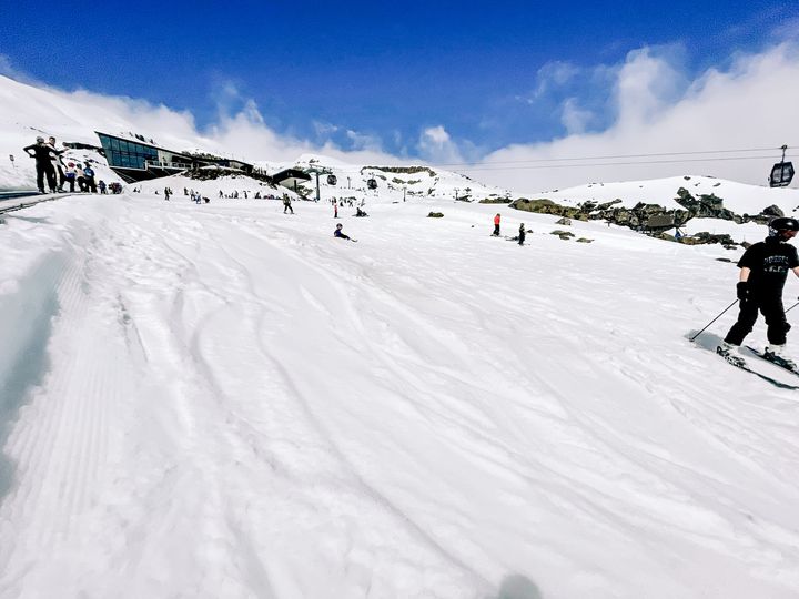
In New Zealand, it has been a mixed week with several more ski areas including Broken River and Rainbow closing for the season, but at least six are still operating. Broken River reported good conditions to the last but Rainbow ended up closing a few days earlier than it hoped after what it said was warm weather then a rainy forecast forcing its hand. Up to then though it said it had been a great season with plenty of powder days.
Two of the areas that were still operating in New Zealand, The Remarkables (85/110cm / 34/44”) and Temple Basin (30/260cm / 12/104”) had said their seasons will end this Sunday 17th. But in the event, Temple Basin called it a day in the middle of last week blaming warm spring weather. But along with The Remarkables, four more remain open and plan to do so beyond the coming weekend.

Cardrona (25/81cm / 10/32”) is aiming to make it to Sunday, October 24th. It has lost about 5cm more from upper slopes and 10cm from its base in the warmer weather of the past week, but ought to make it. Mt Hutt (45/255cm /18/102”) has suffered a similar minimal base level decline. It was the first in the country to open last June and has one of the largest areas open on the planet at present with 38km (24 miles) of slopes groomed, and aims to keep operating until the Monday after, the 25th.
to make it to Sunday, October 24th. It has lost about 5cm more from upper slopes and 10cm from its base in the warmer weather of the past week, but ought to make it. Mt Hutt (45/255cm /18/102”) has suffered a similar minimal base level decline. It was the first in the country to open last June and has one of the largest areas open on the planet at present with 38km (24 miles) of slopes groomed, and aims to keep operating until the Monday after, the 25th.
On the country’s North Island the two ski areas on Mt Ruapehu, Turoa (70/205cm / 28/82”) and Whakapapa (28/167cm / 11/67″) are usually the last open in the Southern Hemisphere each spring and the resort has signalled it hopes to operate into ‘Snowvember’ this year if it can.
As to the weather, it’s currently cold with some areas seeing some significant snowfall on Tuesday. The rest of the week will be drier and a little warmer but not enough for too fast an impact on the remaining snow cover.


