WORLD SNOW ROUNDUP #180
Issued: 24 February 2021
By Patrick “Snowhunter” Thorne
European Roundup
North American Roundup
Asia Roundup
EUROPE INTRODUCTION
It’s spring-like a week before the start of springtime by the meteorological measure, which sums up the past week for most of Europe. The sun has been shining all day long, temperatures have been creeping above freezing even at night to quite high elevations, there’s been little fresh snow (the most reported up in Scandinavia) and the snow is in its best shape early in the day and high on the mountain in the Alps and Dolomites. In the latter case, it was getting so sticky by lunchtime that there was a group decision to limit the second run of the Alpine Skiing World Championships final event, the men’s slalom, on Sunday to just 15 rather than the usual 30 competitors.
The upside of the arrival of springtime is that ski areas tend to extend their opening hours with more daylight and up in the Arctic Circle of northern Sweden, Riksgransen kicks off its usual three-month spring skiing season. The famous resort, where skiing is possible under the midnight sun from May, opens for 2021 on Friday this week. Last spring it was the only ski area in the world to stay open right through the first lockdown.
Talking of lockdowns and the unwelcome but ever-present issue of the pandemic the next week or so is the latest for finding out whether French, German, Italian and Scottish ski resorts might yet open for the final few weeks of the season. Most governments had announced a closure until the start of March at their most recent announcements so we wait to see if this will continue for longer. Tightened restrictions in Austria’s Tirol have also led several resorts including St Anton and Solden to close ‘indefinitely’, which at this stage may mean the rest of the season, but that’s not confirmed. Austria, as a whole, has confirmed no ‘ski tourism’ (hotels open) until at least Easter. A growing number of resorts in France, Germany and Spain have now said they won’t open this winter now, even if they’re belatedly told they can.
AUSTRIA
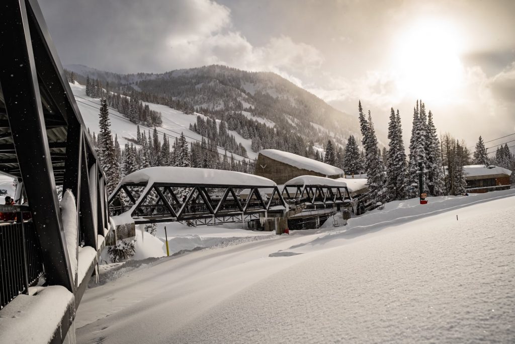
AUSTRIA REPORT| Austria is celebrating the biggest haul of gold medals of any nation at the recently concluded Alpine Skiing World Championships in Cortina and conditions on the slopes are looking great for people living locally to them who are allowed to ski on them. It is warm though, as it is across much of Europe, with plus temps right up above the highest runs at many resorts. Only the glaciers, which have the best cover in terms of depth at around 3 metres (10 feet), have below freezing temperatures still at night. Hintertux (50/370cm / 20/148”) has the deepest base, which is good news for its year-round ski operations. Tirol has tightened its restrictions this week with the most noticeable new rule a requirement of a negative coronavirus test result from the previous 48 hour period. Several ski areas including St Anton and Solden have decided enough is enough and have closed again until things return closer to normality. Some other areas including Fieberbrunn and St Johann have taken a different approach though and offer free on-site testing for arriving skiers. The Skiwelt region has the largest area open in the country with 150km (90 miles) or slopes still open at weekends.
AUSTRIA FORECAST| It is sunny and rather too warm for the coming week, with many Austrian areas seeing temperatures reaching 10 degrees above freezing in the valleys and well above freezing at the tops of the slopes too, where that’s below about 2000m. Some change on the cards perhaps at the weekend when the first clouds may appear on the horizon and temperatures start to dip a little.
SWITZERLAND
SWITZERLAND REPORT| Swiss ski areas continue to operate the most closely to normal of all countries in western Europe, with hotels open in most Swiss resorts too. Zermatt (50/160cm / 20/62”) has now clocked up nine-months straight ski-area operating since re-opening after the last lockdown. Most of the country’s ski areas are fully open, or largely so. The 4 Valleys, home to Verbier (55/245cm / 22/98”) has the most terrain skiable, some 370km (230 miles) or about 90% of its slopes. Engelberg (35/490cm / 14/196”) has the deepest base in the country and in Europe.
SWITZERLAND FORECAST| As with the rest of Europe it will be predominantly dry and sunny in Switzerland over the coming week. It should stay below freezing over about 2,000m altitude most of the time, below that increasingly warm the lower the altitude, into double digits above freezing below 1,000m above sea level.
FRANCE
FRANCE REPORT| The news from France is that half-term school holidaymakers who can’t ski have instead been gathering in coastal holiday resorts to get a break from city lockdowns. March does begin next week and it remains unknown whether French ski areas might be able to open their ski slopes, should it still be viable for them to do so, next month. The last official announcement was just that they could not open in February. Ski resorts continue to be open for anyone wishing to visit without the ski lifts running, some continue to groom pistes for those prepared to hike up and rake a groomed slope back down. Avoriaz (170/290cm / 68/116”) is posting the country’s deepest base. It has been a sunny few days in the region recently with temperatures getting above freezing night and day with daytime positive temps right up to the highest slopes.
FRANCE FORECAST| It’s real wall-to-wall sunshine over the coming week with not a snowflake or raindrop or even a cloud in the forecast. Despite the clear skies, it should stay quitter warm, even overnight, with temperatures staying above freezing even at night in the valleys. Temperatures shouldn’t get too high though, just a few degrees above zero.
ITALY
ITALY REPORT| The ski slopes are still closed in Italy, but Cortina d’Ampezzo had its second week in the global spotlight as the Alpine Skiing World Championships ran up to last Sunday. Viewers saw plenty of sunshine and by the weekend warm temperatures making the snow slushy by lunchtime. That is very much the case this week with the sun still shining and temperatures widely above freezing, sometimes 10 degrees or more above at the base. Ski areas will remain closed this week, the next review (the fourth possible provisional opening date given this year), comes the weekend after next. However, after the last-minute cancellation of opening plans in mid-February resorts are likely to be more cautious this time trusting official advice that they really might be allowed to open this time.
ITALY FORECAST| A very similar forecast to the rest of mainland Europe with predominantly non-stop sun up to the start of March. Temperatures getting well above freezing in the valleys, with freezing point at around 200m altitude.
GERMANY
GERMANY REPORT| Germany’s ski slopes remain closed and there’s little optimism that many, if any, will open this season. Here, too, it has been warm and many German ski centres close at the end of March normally anyway, so time is short. The next review is due on March 7th. The country’s highest slopes on the Zugspitze Glacier, above Garmisch, have held out the hope of opening into May if they are allowed to open at some point before then.
GERMANY FORECAST| As with much of Europe, a dry and sunny week ahead, temperatures potentially reaching +15 Celcius down in low lying mountain valleys. Some precipitation forecast next weekend will therefore most likely be rain, possibly snow very high such as on the Zugspitze glaciers, but most German ski areas aren’t high.
SCANDINAVIA
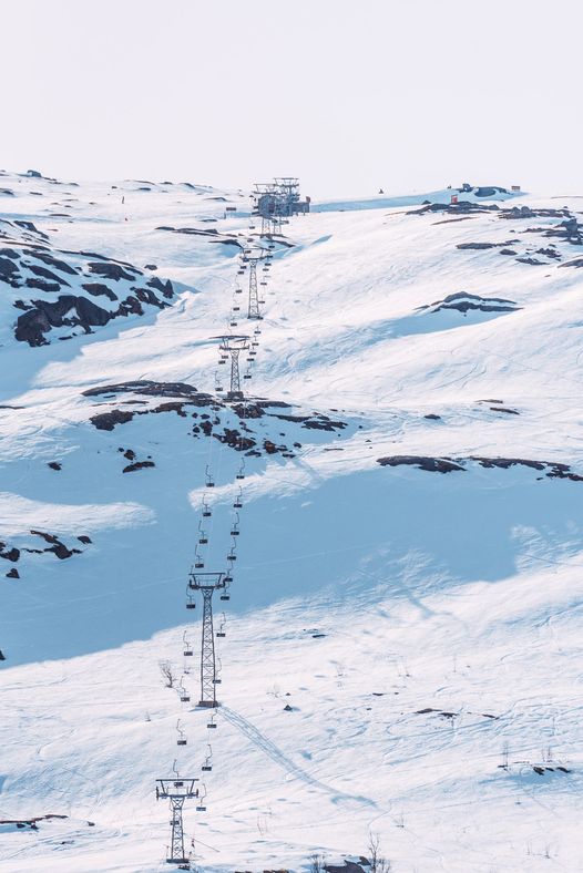
SCANDINAVIA REPORT| If you’re searching for snow in Europe at present it’s best to look north with Scandinavian areas still seeing some cold and snowy conditions. Not huge snowfalls, but at least some snow and cold temperatures. Norway’s famously snowy coastal Voss (45/160cm / 18/64”) reported 15cm (six inches) of snowfall at the end of last week and has a few centimetres more since. That said, it has not been cold enough for snow everywhere with some more southerly centres seeing rain at times.
SCANDINAVIA FORECAST| The week ahead will be predominantly dry with occasional rain showers as well as sunny periods. Temperatures ranging between freezing and around +12 Celcius.
SCOTLAND
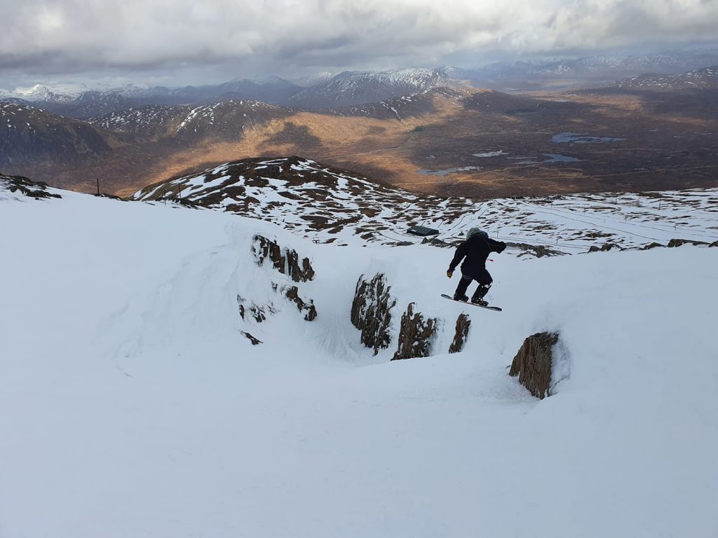
SCOTLAND REPORT| Scotland’s ski areas will remain closed in to March but with lockdowns starting to ease across the UK there’s some hope that they may be able to reopen before the season ends, although nothing confirmed so far. Unfortunately, the thaw is in to its second week after the eight cold and snowy weeks during the first two months of the latest lockdown so it is something of a battle against time. Plenty of reports of continuing epic backcountry skiing for those living locally who can legally make it out on the snow. So far, cover on ski slopes continues to look good but down in the valleys the thaw is well underway with temperatures hitting double digits above freezing.
SCOTLAND FORECAST| The week ahead will be predominantly dry with occasional rain showers as well as sunny periods. Temperatures ranging between freezing and around +12 Celcius.
SPAIN / ANDORRA
SPAIN / ANDORRA REPORT| The Pyrenees and Iberian peninsular continue to see a dozen or so ski areas in Andorra and Spain open still on a limited basis, for local skiers only. Ski areas in the French Pyrenees remain closed. Some of those which had not opened yet, including Cerler and Formigal run by the Aramon Group, have now confirmed they won’t be opening at all this winter. Most areas only have a small fraction (20-30%) of their terrain open due to the limited demand but Sierra Nevada (30/100cm / 12/40”) has quadrupled its ski area to 47km available after re-opening its slopes to the wider Andalucia region. There’s been a little fresh snowfall at some areas in the region to start this week, after a dry week last week, before the sunshine returned once more.
SPAIN / ANDORRA FORECAST| Generally dry and sunny weather in the forecast for the week ahead. Temperatures hovering a few degrees on either side of freezing point.
BULGARIA / ROMANIA REPORT
BULGARIA / ROMANIA REPORT| Unusually, the weather into last weekend was colder down in southeastern Europe than in the mountains to the north, and there was even a little light snowfall up high at Bansko (20/150cm / 8/60″) but here too now the sun is out and temperatures have been climbing into positive numbers. Borovets (130/140cm / 52/56″) is posting the region’s deepest base and all areas report all runs open.
BULGARIA / ROMANIA FORECAST| A similar forecast to further north with temperatures expected to remain well above freezing even at the top of the slopes through the coming, largely sunny week.
CZECH REPUBLIC / SLOVAKIA
CZECH REPUBLIC / SLOVAKIA REPORT| Ski areas in both the Czech and Slovak Republics remain closed by government order. The current Czech lockdown is due to end at the weekend so it remains to be seen if ski areas, which were open up to the start of January, can re-open in March. The weather in the region, as further south, has been largely warm and sunny in recent days.
CZECH REPUBLIC / SLOVAKIA FORECAST| A sunny remainder to this week with temperatures getting to double digits above freezing here too down in the valleys. There are signs of a return to winter, just as spring is due to start, at the weekend with temperatures plummeting back below freezing and some fresh snowfall forecast on Saturday and Sunday.
NORTH AMERICA
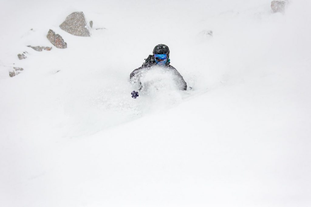
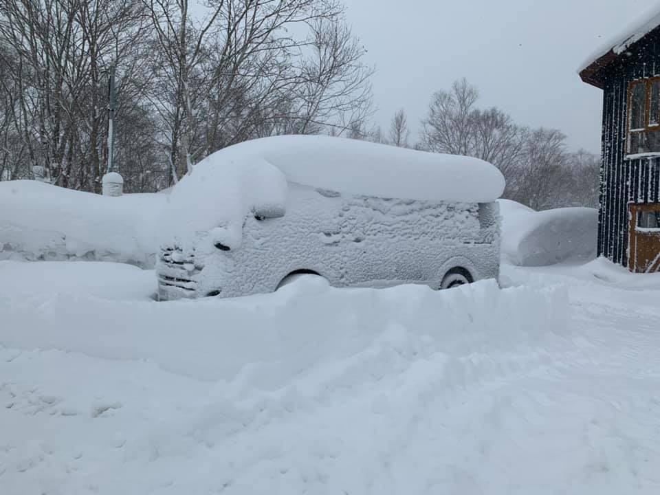
It turned out to be a snowier end to last week than initially forecast as the week wore on. Most of western North America saw substantial snowstorms as forecast and there was even unusually cold and snowy weather down in Texas as widely reported; however, it was Utah that really saw exceptional snowfall, particularly at Alta and Snowbird where up to 44 inches (1.1 metres) of snowfall in 60 hours was reported which some are claiming to be the biggest storm in such a short time period in 20 years. All the snowfall brought lots of powder skiing and boarding pleasure to the region once access roads and slopes were made safe.
Sadly, there has been a spate of deaths reported on ski slopes and in the backcountry across the US over the past week. Some have been related to all the snow, with tree well and avalanche deaths, others have been on-piste collisions with trees.
ROCKIES
ROCKIES REPORT| All the snowfall in the Rockies in the latter half of last week is the big news here, and welcome news as the region had previously been lagging below its average snowfall totals for the season to date. Most ski resorts in the region posted at least a foot (30cm) of snowfall over the past week with many getting double that and Snowbird (105/105″ / 262/262cm) almost four times that much with 44″ (110cm) in 60 hours. All that snow led to extreme avalanche danger which led to it and neighbouring resorts being closed for several days, with similar issues played out across the Rockies. The snow eased off by Friday although light falls continue through the weekend before drier conditions to start this week.
ROCKIES FORECAST| Staying cold for the week ahead, typically 10 to 20 degrees below freezing in the mo0untains and frequently snowy; however, the snowfalls are not expected to be as big as they have been, just a few inches falling most days.
USA WEST
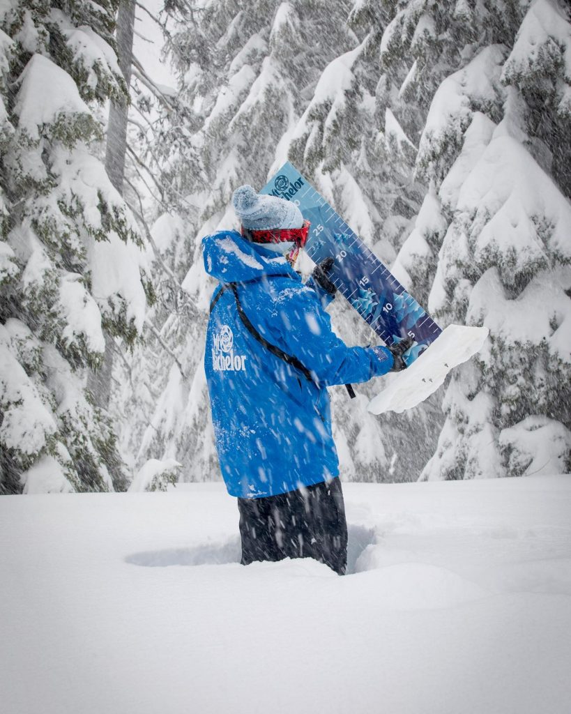
USA WEST REPORT| Some huge snowfalls in Oregon and Washington states in the Pacific Northwest region over the past week with Timberline (152/152” / 381/381cm), in Oregon, reporting one of the biggest, 76 inches (190cm). Hopefully, good news for spring and summer skiing there as its base grows thicker. Alpental (126/218” / 315/546cm), in Washington state, posted a marginally larger fall (78”/195cm) over the past week and has the deepest base in the USA, North America and across the world at present. The snow has just kept coming over the last seven day causing plenty of issues of course with access road closures and buried lifts. When centres are open there are serious warnings for tree well and avalanche dangers in place.
USA WEST FORECAST| Not much change in the forecast, after heavy snowfall for the past few weeks a brief midweek lull is expected before it continues dumping in the latter have of this week in the northwest. It is possible we could see a 20 feet/six-metre base by this time next week. Temperatures typically 10 degrees below freezing.
USA MIDWEST REPORT
MIDWEST REPORT| Following very cold weather in recent weeks it has been warming up in the midwest in the first half of this week and we’re increasingly seeing temperatures at or in some cases above freezing. Crystal Mountain (58/58” / 145/145cm) in Michigan has the region’s deepest reported base and like pretty much all ski areas in the region, reports every trail open. It also posted one of the biggest snowfalls in the past week, most of it falling before the weekend, with 11 inches (28cm) of fresh.
MIDWEST FORECAST| Largely dry with long sunny periods in coming days, temperatures getting above freezing in the afternoon but dropping as low as 10 below at night.
USA EAST
USA EAST REPORT| Good conditions in the northeastern US too, to complete the clean sweep of good snow across the country. Snow has been falling on many centres in the region, with a very cold start to the week and some more snowfall on Monday but it has been getting progressively warmer and we may see plus temps at base levels from midweek for a while. Most resorts report excellent conditions though and everything open. Sugarloaf (49/73” / 122/183cm) in Vermont has the deepest base of the major resorts in the region and has had another six inches (15cm)( of snowfall in the past few days.
USA EAST FORECAST| Temperatures are set to dip to double-digits below freezing by Friday with snowfall into the weekend before warmer air moves in again to start March.
CANADA
CANADA WEST
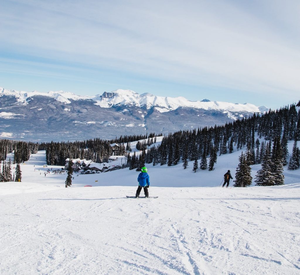
CANADA WEST REPORT| Last week was another snowy one for western Canada with some BC ski areas posting 50cm (20 inches) accumulations in the three days into the weekend. Temperatures have been well below freezing and all in all kit’s been great weather for powder fans. Further east in Eastern BC and Alberta there’s been less fresh cover, but still some decent 5-10cm (2-4 inch) overnight refresher snowfalls. Whistler Blackcomb (245/245cm / 98/98”) continues to report all its terrain open, the largest area in North America, and a total of 20cm (8 inches) of fresh snowfall since Saturday.
CANADA WEST FORECAST| Staying cold with a snowy end to the week for many Western Canadian resorts – 20-30cm (8-12”) of snow forecast by the of Friday. Overcast but dry at the weekend for many.
CANADA EAST
CANADA EAST REPORT| A fairly cold snowy period in eastern Canada, as you might expect in February. Temperatures in the region have been hovering around 10 below freezing over the past week with a mixture of snowy and sunny days. No huge snowfalls but some nice 5-15cm (2-6 inch) surface refreshers. Some of the best conditions are down in Quebec’s Eastern Townships where Mont Sutton (67/110cm / 27/44″) reports its many signature tree runs are open. Ski areas in Ontario are open again and reporting good conditions. One of the province’s largest, Blue Mountain (115cm/115cm / 46/46”) has all runs open and all lifts turning.
CANADA EAST FORECAST| A little more midweek snowfall and then it’s expected to be mostly dry from Thursday on. Staying cold until the start of next week when a return to positive temperatures as we enter March is on the cards.
ASIA
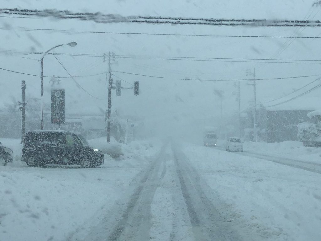
JAPAN REPORT| Another week with some huge snowfalls in Japan. Geto Kogen (305/430cm / 122/172”) posted just over two metres (nearly seven feet) of snowfall in the last seven days, with much of that falling within a 72-hour period from Wednesday to Saturday last week. Niseko (235/455cm / 94/182”) had a less dramatic 90cm (three feet) accumulation over the same period. It was quieter again over the latter half of the weekend and the start of this week with sunshine for many areas although cloudy on Hokkaido but many areas have seen heavy snowfall again since Tuesday.
JAPAN FORECAST| After rather springlike temperatures at the weekend and start of this week it is getting colder again now and more serious snowfall is expected across Japanese ski slopes through the latter half of this week.


