WORLD SNOW ROUNDUP #116
Issued: 04 December 2019
By Patrick “Snowhunter” Thorne
INTRODUCTION
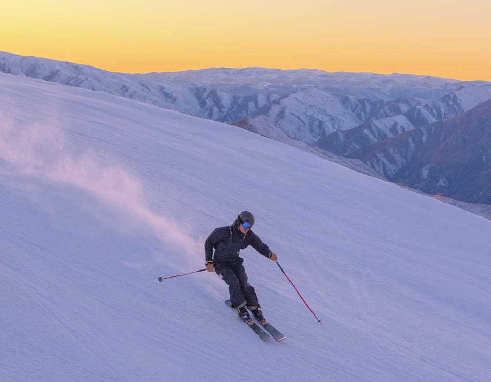
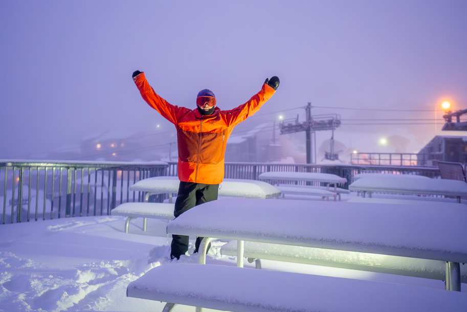
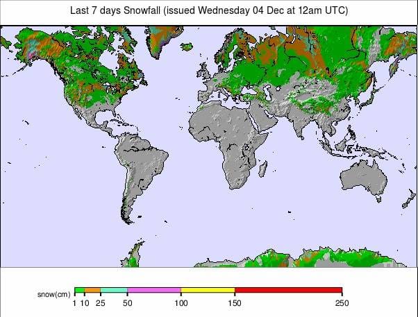
December began with heavy snowfall in both Europe and North America. For the Alps this was simply ‘more of the same’ after a very snowy November 2019. For North America, particularly the west where most of the snow had fallen, it was quite a relief after a mostly dry November.
The snowfall in the Alps was heaviest again in the west and south with less snow further east. This picture was mirrored to some extent in the US, although ski areas in Utah and to a lesser extent in Colorado also reported huge snowfalls. In the Alps the biggest reported snowfall total of the last 7 days was 120cm (4ft) in the Portes du Soleil. Whilst in the US 1.5 metres (5 feet) was reported in California.
Looking at other areas in Europe, it has been snowy in much of Scandinavia but there’s been less fresh snow for the Pyrenees; however, more resorts have now opened there.
The heavy early snowfall in the Alps has already created danger from avalanche. Sadly, two off-piste skiers were killed by an avalanche near Courmayeur, in Italy, at the weekend. Earlier this week another avalanche was spotted to have damaged a lift at Serre Chevalier over of the French side of the border. This area has not opened for the season yet but has reported huge pre-season snow accumulations.Looking at the rest of the world, Japanese ski areas have been struggling to open, it staying warm and wet there. Thankfully, it is now getting snowier. In the Southern Hemisphere spring ended with slopes at closed areas in Australia and Chile turning white while the final ‘still open for 2019’ area south of the Equator, Whakapapa on Mt Ruapehu in New Zealand, ran the lifts for skiing for the last time this year on Sunday, December 1st , the first day of summer.
INDEX:
Austria / France / Switzerland / Italy / Andorra / Norway/Sweden / Germany / Bulgaria / Japan / Scotland / USA / Canada / South America Weather Outlook / Southern Hemisphere / Europe Weather Outlook / North America Weather Outlook
AUSTRIA
Austria has not seen the big snowfalls that were happening further west over the past week. It has warmed up a little here too. After the significant snowfalls here in November bases are very good for early winter on higher slopes. The Stubai Glacier (0/290cm) is posting the deepest snow in the country and is almost fully open but other glacier areas have almost as much snow lying already. Most report 10-20cm more snow over the weekend. Although there are still a lot of Austrian areas yet to open more than 40 are now operational including Ischgl (20/70cm) and St Anton/Lech (20/70cm), in the Arlberg, which opened at the weekend with 170km and 44km of slopes open from day one respectively. Ischgl’s terrain is, as usual for early December, one of the biggest areas in the world to be open so far.
FRANCE

There were some pretty big snowfalls in France through November and into the start of December with some areas reporting another 60cm of snow over the weekend; however, only a fraction of the country’s ‘big name’ resorts are open. More, including La Clusaz, are scheduled to open this coming weekend and others plan to commence their season the weekend after. Val d’Isère (64/159cm) was one of the areas to start their 19-20 season at the weekend with conditions looking great. The resort had a further 60cm (2ft) of snowfall in the past week. Courchevel (68/95cm) is reporting the most fresh snow in the last week with 104cm (42 inches) in the last seven days. Montgenevre (130/220cm) is not far behind with 95cm (more than 3ft) and Avoriaz (80/155cm), which opened two weeks earlier than planned for the first of two unscheduled ‘preview weekends’ due to all the early snow, has had another 90cm of fresh this week.
SWITZERLAND

The biggest snowfalls reported in Switzerland this week have been in the west of the country where ski areas in the ‘not yet open for the season’ Portes du Soleil reported up to 120cm (4ft) of snow. Glacier 3000 (20/90cm) is open and reported 89cm (3ft) of fresh snow. Crans Montana (40/100cm) had 80cm. Andermatt (6/320cm) is reporting the country’s deepest base and that all of its Gemsstock ski sector is now open. Zermatt (27/106cm) reports that it already has more than 200km of piste open within its shared area with Cervinia, in Italy.
ITALY

The Presena Glacier (250/400cm) at Passo Tonale, in Trentino, continues to post the world’s deepest base and to be the only area to reach a four-metre base so far. It also reported another 15cm of snowfall in the past few days. Although this last snowfall report is common with the rest of Europe precipitation has largely stopped since the weekend. Some of the heaviest snowfall in Europe since the weekend has actually been reported in the Dolomites with Arabba Marmolada (115/265cm) reporting 50cm of fresh snow on Monday/Tuesday.
ANDORRA
Conditions continue to look fairly good in the Pyrenees after the November snowfalls. There’s been very little fresh snowfall and mostly sunny conditions over the past week but base depths are ok for this early in the season and in Andorra, the ski areas are about 50% open. Grandvalira (15/40cm), the biggest, has more than 60 slopes open and Pal-Arinsal (30/60cm), in the Vallnord sector, has the deeper base. There are deeper bases reported on the French and Spanish sides of the mountain with San Isidro (80/170cm) posting the deepest base in Spain and Cauterets (75/140cm), which fully opened last weekend, the deepest on the French side.
NORWAY/SWEDEN

It has been another generally snowy week for much of Scandinavia with Norway’s Geilo (50/50cm) reporting the biggest accumulation of the last few days with 50cm more. Bjorli (20/70cm), which reports the deepest snow in the country, has had 32cm (over a ft) in the past 72 hours. For Scandinavia as a whole Kåbdalis (85/85cm), in Sweden, has the deepest base. The region’s largest ski area, Are (63/63cm) received doubled its base depth in the past week with 17cm of snow falling there since Sunday.
GERMANY

Currently there’s still only Germany’s highest ski centre on the Zugspitze Glacier (49/73cm) open for the season, with a few centimetres more fresh snowfall in the past few days. That’s due to change from this weekend with a dozen of the country’s leading centres due to join it, starting their seasons on either Friday 6th or Saturday 7th December. Garmish, Oberstdorf, Oberhof and Winterberg are all scheduled to open.
BULGARIA
The ski season has still not really got started in Eastern Europe but several areas are expected to open in Bulgaria and Slovakia this weekend, with larger Bulgarian ski areas including Bansko and Borovets set to join them from the 14th. Not a great deal of change in the past week with little new cover on lower slopes in most areas. Snow depths of 50 – 75cm have been measured on upper runs at areas like Bansko.
JAPAN
After more depressingly warm and wet days in Hokkaido, it looks like conditions are starting to change with 10cm of fresh snow reported in Niseko on Tuesday and a snowier picture in the forecast for the week ahead. There’s nothing really open (just a few beginner runs with minimal snow cover) at present as the resort waits for a base to build. It’s a fairly similar picture across Japan with most of the major areas affected by rain at the start of this week but many with a simple 500-1000 metre long run available to make some turns, but nothing yet to reflect the ski conditions Japan is famous for.
SCOTLAND

Scotland’s five highland centres have been firing up their all-weather snow-making systems for the past month whilst the thin natural cover has done its usual trick of lasting a while, thawing when temperatures rise, then returning again. So it’s a patchy picture at present with temperatures climbing well above freeing once more but due to drop at the weekend. Most of the centres have the all-weather ‘flake ice snow’ with Glencoe reporting a 200-metre long run and says it has started offering beginner ski school lessons on this slope. Cairngorm, meanwhile, plan to officially open their winter season this Saturday with snow fun and other activities.
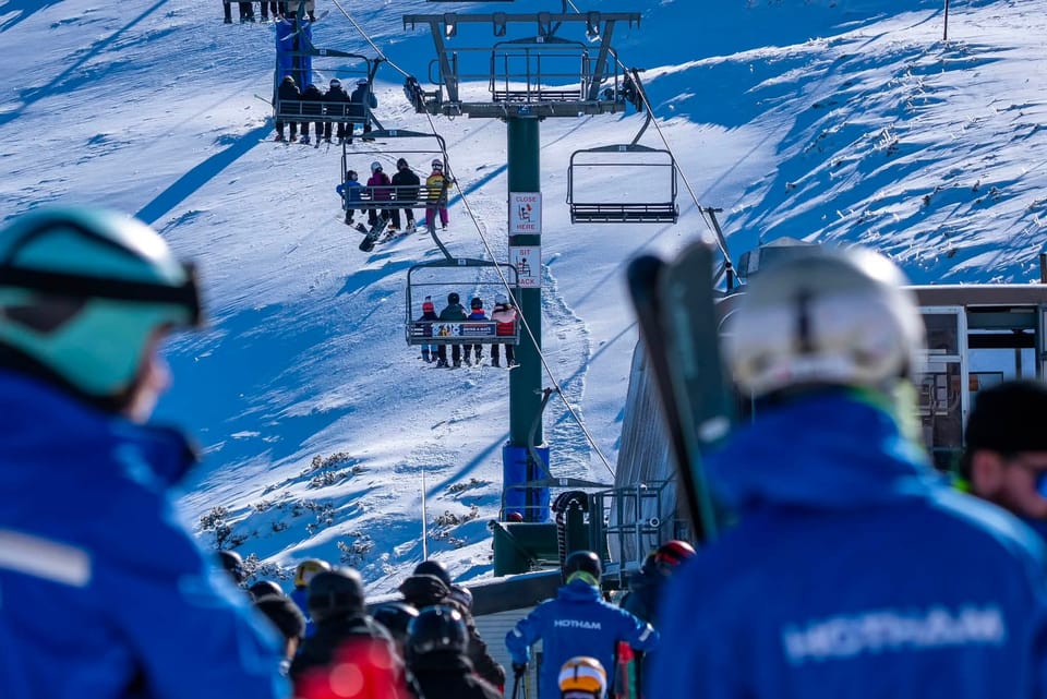
USA

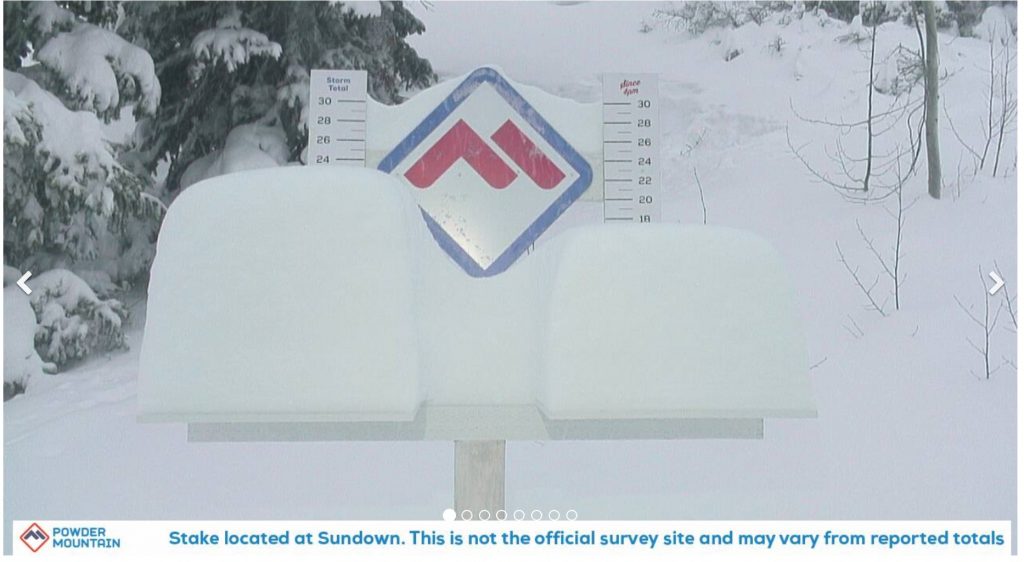
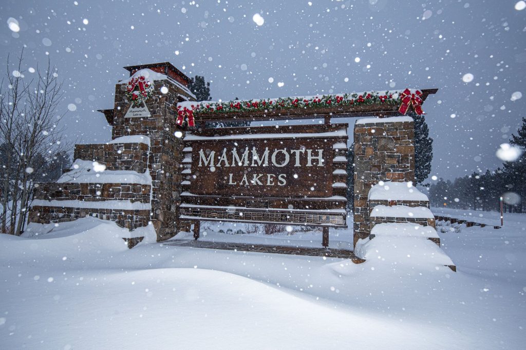
Most US ski areas are open now meaning around half the world’s total of already-open areas, an estimated 500 or more resorts, are in the US. The good news is that after a largely dry November (following a snowy October in the Rockies) it has been dumping down in most areas; good timing for the Thanksgiving holiday weekend just passed. And nowhere has been snowier than California where ski areas were forced to close at times due to the volume of snow. This follows a very dry autumn up to a week or so ago. Kirkwood (142/152cm) has reported one of the biggest 7-day totals with 142cm (nearly 5ft) of snow, with Bear Valley (142/142cm) not far behind with 116cm (nearly 4ft) of fresh. Many other areas in the state have reported 60-90cm (2-3ft) of fresh snow. It’s been snowy across most of the rest of the country too, from coast to coast. Healthy 30-60cm falls almost everywhere.
US ROCKIES
After a largely dry November (following record-breaking October snow totals of course in Colorado) conditions improved dramatically in the Rockies region in the run-up to Thanksgiving as a major snowstorm delivered more than five feet of snow to some areas, and a good dump pretty much everywhere. Utah saw some of the biggest accumulations with storm totals of 70 inches for Snowbird (60/60″), 69 inches for Alta (49/49”), and 63 inches for Brighton (38/38”). America’s largest ski area, Park City Mountain (35/43”) reported 50 inches and it has nearly 1200 acres of terrain open already. Sundance Mountain and Deer Valley resorts opening for the season this coming weekend reported big snowfalls too. There was snow too for Colorado where Wolf Creek (36/36”) has one of the largest areas open in North America at present with 1600 acres skiable.
US WEST
Conditions have certainly improved dramatically in the Western ski states over the past week with a very snowy Thanksgiving followed by still more snow in the past few days, and there’s still more in the forecast. It’s all a big turn around from the dry, warm October and November experienced in most areas and great timing with the main start of the season now upon us and most of the region’s major resorts and many of the smaller ones open for winter 2019-20. The past 72 hours have seen a number of areas report more than three feet of fresh snowfall including California’s Bear Valley (55/55″) with 41 inches of fresh and Kirkwood (36/50″) with 47 inches – a shade under four feet of fresh pow! Arizona Snowbowl (53/53″) is reporting the biggest area open in the region to date this season with 650 acres skiable so far. Further north in Alaska there’s been plenty of new snow too. At Hatcher Pass, it was reported teams had to give up trying to groom as the snow was so deep the tractor started sinking into it.
US MIDWEST
About half of the ski areas in the Midwest have now opened for their 2019-20 ski season, although the majority at present are only open at weekends. Bases are building nicely here with a mixture of natural snowfalls – of which there has been a few more inches this week – and machine-made snow aided by cold temperatures. The region has actually seen some of the biggest snowfalls for the start of this week with Christie Mountain (26-46″) in Wisconsin posting a nine-inch accumulation on Sunday/Monday.
US EAST
Most of the leading ski areas in the Eastern US are now open for the season with generally pretty good conditions after the warm/dry October and early November. Since then low temperatures allowed snowmaking systems to run almost constantly and it has turned increasingly snowy. The only real issue in the past week has been strong winds, meaning that whilst generally, conditions at Killington (18/18″) for the World Cup races at the weekend were amongst the best they’ve been, the course did have to be shortened to take out the upper mountain because of the strong wind. Smugglers’ Notch (20/48”) and neighbouring Stowe (20/48”) both report the deepest bases in the state and in common with other areas in the region have had a few more inches of fresh snow in the past few days.
CANADA

The number of ski areas open in Canada more than doubled last weekend with more areas, mostly in BC in the west or Quebec in the east, joining the dozen that had been open since November. So there are now more than 20 open. It’s World Cup race week in Lake Louise and conditions have been good for racing, less good for keeping warm, with the mercury hitting -30C. North America’s biggest ski area at Whistler Blackcomb (32/32cm) was among the areas opening, although so far with only a dozen or so of its more than 200 trails open. The snow depths are looking better further inland with Silver Star (56/96cm) posting the deepest base and about a third of its 120 runs open. There have been small to moderate snowfalls, 5-20cm, across the country’s ski slopes over the past few days.
CANADA WEST
It’s hard to believe but some ski areas around Calgary, Banff and Jasper in Alberta have already been open for a month. One of them, Lake Louise (28/31”), hosted the first World Cup Downhill; ski races of the 2019-20 season at the weekend with perfect conditions but noted temperatures had dipped to -30 Celcius at times in the run-up to the competition. Half-a-dozen ski areas in BC have opened more recently with Silver Star (22/38″) posting the deepest snow in the province. Whistler Blackcomb (13/13″) was one of the new centres opening for the season but as yet has a thin base and just a dozen or so trails in its vast area open. There have been a few inches of snow for most areas across the region but nothing very significant in the past week.
CANADA EAST
It’s still early days for the ski season in eastern Canada with just a dozen or so center open in Ontario and Quebec, and half of them just at weekends. Bases aren’t up to much here either after the unusually warm autumn until a few weeks ago. Since then there’s been a little fresh snow but machine-made snow has been essential for opening. Le Massif (15/35”) is reporting the deepest base in the region with Tremblant (0/12”) the most runs open so far– about 25.
EUROPEAN WEATHER OUTLOOK

After the heavy November snowfalls built deep bases (for autumn) on higher slopes in the central and eastern Alps of Austria and Switzerland there has been a bit of a lull over the past week or so. That looks set to continue until the weekend with temperatures hovering around zero. Currently, it looks like heavy snowfall should return around Sunday/Monday bringing 20-50cm more snow by this time next week.
It’s a fairly similar picture in the western Alps of France, Italy and Switzerland too with clear sunny days and temperatures a little above freezing in the valleys and a few degrees below up high. Here, too, significant snowfall is currently forecast for Sunday/Monday after a dry rest of the week ahead.
It’s sunny this week in the Pyrenees as well and here there’s no snowfall in the forecast at present for the coming week, just more of the same. Temperatures here too are in the +0-5C in the valleys and a little below zero, typically, on higher slopes. Unfortunately, for Scotland, the rest of this week looks warm and wet for Scottish hills making the prognosis look poor for snow survival into the weekend; however, it looks more promising from Saturday onwards with temperatures dropping and snow falling from early next week, potentially amounting to 20-40cm.
Eastern European ski areas could see 20-30cm more snow on higher slopes over the next few days but then it looks drier for the run-up to opening this weekend (or the one after). Temperatures on higher slopes could hit double-digits below freezing in Bulgaria.
NORTH AMERICAN WEATHER OUTLOOK

The trend for heavy snowfall in the Pacific northwest, following the mostly dry November in the region, now appears to be ‘locked in’ for the next week or so at least with another metre on the way for some ski areas along the Pacific coast from Lake Tahoe north, The heaviest snow should arrive later this week after a lull of a few days. Elsewhere in the US, there should be more snow for most areas but more like 20-50cm over the coming 7 days.
It’s looking increasingly snowy over the Canadian border with the country’s east and west coasts set to see the biggest falls, potentially more than 60cm over the next 7 days for a resort like Whistler on the BC coast (and fresh snow but progressively less further inland). Then more like 10-30cm over on the Quebec side in the east.
ROCKIES OUTLOOK
It’s a drier picture in the Rockies for the coming week compared to the past week with just light snowfall expected at times for most areas. Overcast skies could bring a little snow almost anytime but another big dump before next week looks unlikely. On mountain, temperature will be in the high teens but will get above freezing down at resort level in most areas so there could be some thawing down at the bases ion the daytime.
WEST OUTLOOK
The forecast for the week ahead is for temperatures ranging from the mid-20 up to mid-30s with some light to moderate snowfall interspersed with clear periods. Some lower areas may see rain on lower slopes if we see possible high 30s at times, although this should still fall as snow higher up. In to the weekend, the snowfall looks like it should get heavier with 1-2 feet possible on higher slopes at some areas before the sunshine returns at the start of next week.
MIDWEST OUTLOOK
It’s a week of mixed weather ahead in the Midwest with some sunshine, heavy cloud and snowfall too. Temperatures should remain in the range of high-teens to low thirties but should stay sub-zero except perhaps on Sunday when currently we’re seeing a (very) brief slightly warmer spell which could push temps just a degree or two above freezing before more snow clouds roll in.
EAST OUTLOOK
It’s looking like it should stay cold in the east for the foreseeable future with temperature dipping as low as single figures Fahrenheit on mountain tops overnight by the end of the weekend and not a lot warmer down at resort level. Winds should remain mostly light though so windchill should not be such a big factor. There’s not a lot of snow in the forecast – just a few inches here and there with the next accumulations likely on Thursday.
CANADA WEST OUTLOOK
It’s a mostly very cold picture for the week ahead in western Canada with many areas seeing temperatures in the low teens Fahrenheit and some snowfall towards the end of this week and into the weekend, although most likely only a few inches. The further west you go it does tend to warm up and the only real exception to the sub-zero picture in the BC Coastal range where Whistler Blackcomb will see temperatures remaining above freezing at its base, although sub-zero from mid-mountain up.
CANADA EAST OUTLOOK
Mixed weather for Eastern Canada too, including the coldest forecast for the continent on a clear sunny day at the weekend when some resorts will see temperatures dip below zero Fahrenheit for bitterly cold lows. It should then warm up again early next week with temperatures potentially shooting up more than 30 degrees to above freezing as a front moves in which should bring more snow (and hopefully not rain).