WORLD SNOW ROUNDUP #108
Issued: 9 October 2019
By Patrick “Snowhunter” Thorne
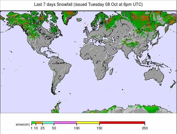
Our latest roundup of snow conditions around the world. Each section that follows below goes into detail country by country. Clicking the map thumbnail will take you to our dynamic snow forecast map for the latest detail (where you can also overlay live weather & reported conditions). Weather outlooks for Europe and North America can be found at the end of this roundup.
INTRODUCTION:
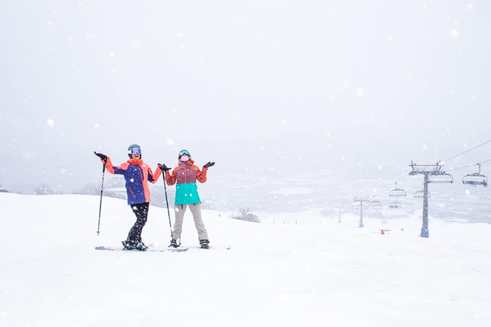
Winter in the Northern Hemisphere is marching ever closer and almost all the signs are pretty good at present. There have been several more snowfalls in the Alps over the past week with the snowline creeping lower. The first non-glacier ski area has opened for the season up in Scandinavia (using snow stored from the previous winter then spread back out on the slopes) and in North America there has been first snowfalls on the eastern side of the continent and temperatures dropping low enough for resorts to fire up their snow-making arsenals in the hope of claiming the prestigious “First in the country to open” title, possibly later this week and almost certainly in the next few weeks.
The forecast for the week ahead also looks promising with more snowfalls expected in the Alps and in western North America with at least three more ski areas in three European countries set to start their 18-19 seasons at the weekend. South of the Equator, it’s a different story as the 2019 season enters its final week for all but one ski area. The number of areas still open is down to single figures; about half of these are in New Zealand. It is warming up as spring takes hold with temperatures increasingly reaching double figures above zero Celcius in the daytime and any precipitation is more likely to fall as rain than snow now. Temperatures are still dipping to sub-zero overnight, however, and there is plenty of snow lying metres deep at most of the resorts that are still open.
INDEX:
Australia / New Zealand / Argentina / Chile / South Africa / Lesotho / Austria / France / Switzerland / Italy / Andorra / Norway/Sweden / Germany / Bulgaria / Japan / Scotland / USA / Canada / South America Weather Outlook / Southern Hemisphere / Europe Weather Outlook / North America Weather Outlook
AUSTRIA
All eight Austrian glacier ski areas are due to be open from this coming weekend with the Kitzsteinhorn above Kaprun the final centre to open for the season on Saturday, although the Dachstein is currently only offering cross-country skiing on its glacier. There was fresh snow on glacier slopes, and down to lower levels at the start of this week and the trend at the moment is for clear sunny days interspersed with snowy ones. The snow level also dropped to around 1500 metres at the start of the week, raising excitement levels in areas like the Arlberg where the season is now 6-8 weeks away. Of the glacier areas, more terrain is constantly opening and Solden (0/72cm) announced it was opening more terrain at the weekend from now on, adding three new lifts and three new runs to its service. It now has nearly 20km of slopes skiable. Pitztal (10/40cm), which has 9km of runs open, says it will be joining Hintertux (0/45cm) and offering a longer ski day, through to around 4 pm, from this weekend on, now there’s no longer the hot summer afternoon temperatures to contend with. Elsewhere, the Stubai (0/30cm) has about 6km of runs open so far whilst Hintertux still has the biggest area open in the Northern Hemisphere at present with 25km of runs groomed. Kaunertal (30/35cm) has about 6km of runs open and the Molltal glacier (0/40cm) also has three runs open. Despite the fresh snow to date glacier base depths still aren’t great.
FRANCE

The mountains in France (as with the rest of the Alps) received a good fresh covering of snow on Wednesday/Thursday last week and it has been snowing again since, leading some to speculation that Tignes, which was due to open for the season on 28th September but has so far delayed doing so as it says snow cover is not adequate yet on the glacier, may open this coming weekend. However, at the time of writing there is no official announcement from the resort that confirm this.
SWITZERLAND

The era of ‘just’ Saas Fee and Zermatt being open for skiing in Switzerland, that has been the case for nearly three months now, looks set to end this weekend with the Titlis glacier above Engelberg expected to join them from Saturday. Currently, Saas Fee (0/170cm) has the most terrain open with 17km of runs and Zermatt, 14km. Eastern Swiss ski areas saw some of the heaviest snowfalls in the middle of last week with up to 50cm reported on high ground.
ITALY

There was some fresh snow on Italian peaks too earlier this week but for now it’s the same two areas open: Passo Stelvio (5/190cm), which has 6km of runs open and is in the final month of its nearly six month summer season and Val Senales (0/15cm) which has 3km of runs open. The next ski area to open in Italy is likely to be Cervinia, towards the end of this month.
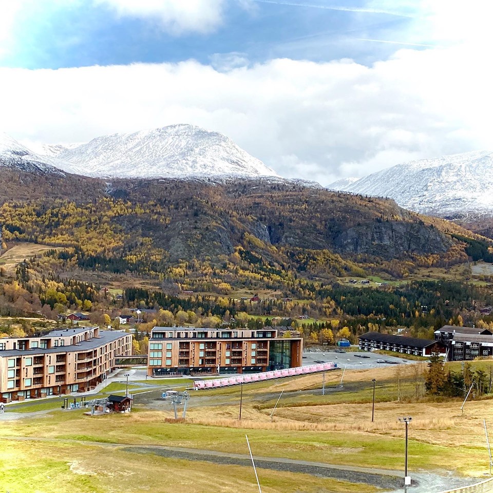
ANDORRA
There are currently no ski areas open in the Iberian peninsular and resorts in the region don’t normally open until the very end of November, at the earliest. That said, a late October snowfall last year did lead to at least one area opening early at the very end of October, so you never know.
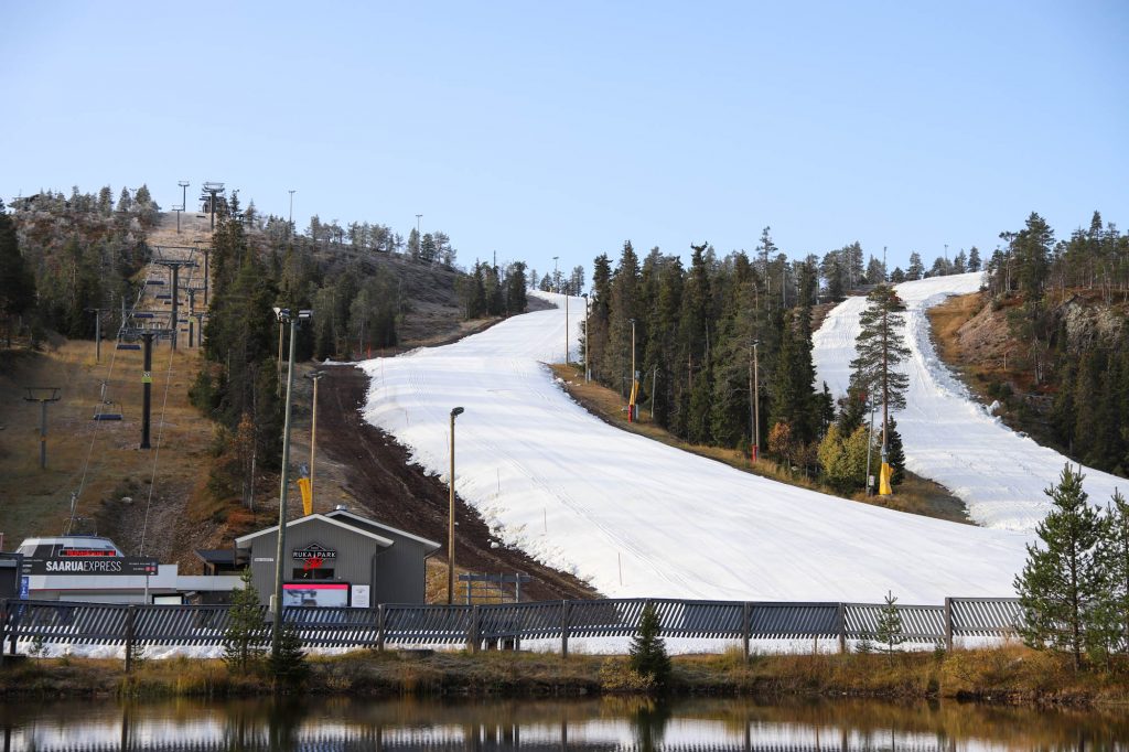
NORWAY/SWEDEN

The ski season got underway in Ruka (0/50cm), Lapland, last Friday at 9.30am when, after much hype, three slopes were unveiled to start the 2019/20 ski season there. The snow that had been stored on the slopes, under protective covers, through the summer was spread back out on the ski runs. The same is planned at Levi this Friday, another Finnish resort. It will be hosting World Cup racing in a little over a month so the early opening is part of the build-up. Besides these two, the Galdhopiggen ski area in Norway, a glacier area on northern Europe’s highest mountain, also remains open through November. The weather has been clear and sunny here over the weekend.
GERMANY

There’s nowhere currently open in Germany where most of the country’s ski areas traditionally open for the season in December. The Zugspitze Glacier, which operates the country’s highest lifts and usually has its longest season, expects to start its 2019-20 season in mid-November.
BULGARIA
Eastern Europe has already seen some snowfall on higher slopes in the Tatra Mountains but the region’s ski areas do not usually open before November, at the earliest, with most not doing so until well into December.
JAPAN
There are no ski areas currently open in Asia. Resorts in Japan tend to start operations in the latter half of November or later.
SCOTLAND

There are no ski areas currently open in Scotland and there has not yet been any snow seen on the country’s mountain tops. It is not impossible that one of the country’s ski centres could open in October if there was an unseasonal early snow dump, The Lecht has opened for Halloween before in similar circumstances, but there’s nothing like that on the horizon so far.
USA

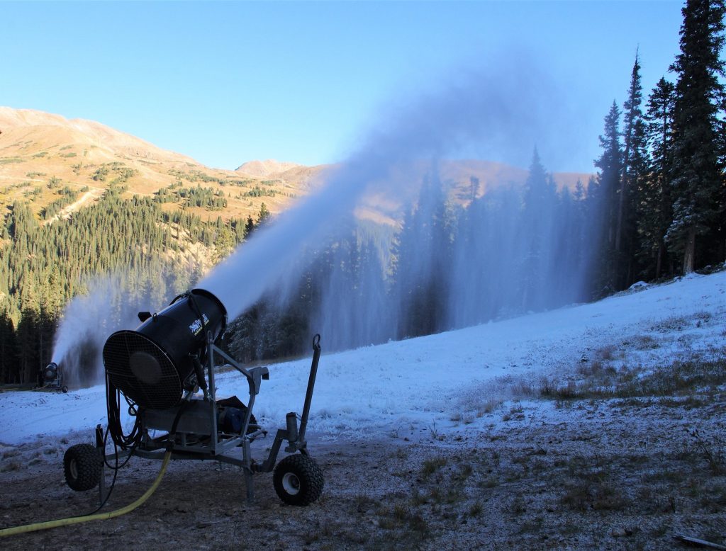
The race to be the first to open ion the USA is hotting up with Arapahoe Basin and Keystone, in Colorado, apparently seen as the key players; both in full snow-making mode each night. It has been a little warmer the past few days but colder temperatures and natural snowfall are expected towards the end of this week so it’s not impossible that a ski area in Colorado will open next weekend, although none are saying that at the time of compilation of this report. However, the snow-making guns have now also been fired up in the east where ski areas win the first to open race some years, with Killington announcing they’re in the game too. In other snow news ski areas in the US Midwest, where snow-making is also a big thing, reported their first natural snowfalls of the autumn in the middle of last week.
CANADA

The focus for snow news in Canada has switched a little this week with news of the first snow on higher slopes in eastern Quebec, where some resorts are reported to have already started snow-making. This is a good sign for the ski area that often manages to be the first to open in Canada in mid-late October each autumn, Mont Saint Sauveur. Otherwise, the first runs usually open in the first week of autumn at Banff, in Alberta.
AUSTRALIA
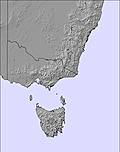
Most of Australia’s still-open ski areas called it a day on winter 2019 on Sunday, leaving only Perisher (25/147cm) still open this week. There were clear sunny days there at the weekend with the mercury rising to double digits above freezing and the amount of terrain open is now down to about 20km served by a handful of lifts (about a fifth of capacity). The coming weekend will be the last of the season here.
NEW ZEALAND
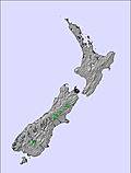
Yet another week of wintery weather with ice storms and snowfalls reported up to the weekend, although it has calmed down a little over the past few days. There are still half a dozen ski areas open in new Zealand, the most of any country in the Southern Hemisphere, and the number looks set to drop to one after the weekend. There was more heavy snowfall in the middle of last week with Mt Hutt reporting a 15cm âunexpected powder dayâ and most other Kiwi areas also reporting a good dump. Turoa (94/316cm) looks set to be the last area open in the Southern Hemisphere next week with its current season-end date as October 20th.
ANDES
Almost all ski areas are now closed in the Andes with Cerro Castor in southern Argentina one of the most recent to end their 2019 ski season describing it as having been ‘epic’. Whilst the northern and western Andes had a very poor snow season, further south and east conditions were much better. The only large ski area known to be still operational, until the coming weekend at least, is Cerro Catedral (35/90cm) near Bariloche in Argentina. There’s no fresh snow here and temperatures are generally in the +5 to +10 bracket from top to bottom of the mountain so a thaw is underway but so far not too severe.
SOUTHERN HEMISPHERE WEATHER OUTLOOK
Australia will see mostly above-freezing temperatures again, reaching double digits at times, and with precipitation mostly falling as rain. That said, overnight temps should stay sub-zero and at that point a little fresh snowfall remains a possibility over the next few days. For Mt Ruapehu, in New Zealand, the weather looks fairly unsettled over the week ahead although with temperatures largely above freezing, but not by much. It’s a mixture of sunshine and cloud with not much precipitation in the forecast and temperatures climbing from -1 or -2 to a few degrees above freezing in the daytime. In the Andes, it’s more generally plus temperatures and no snow forecast for what are the final few days of the final week of South America’s 2019 ski season. At the base of Cerro Catedral temperatures will be in the +5 to +15C range; little colder on the slopes and still dipping just below freezing most nights but well above freezing in the daytime.
EUROPEAN WEATHER OUTLOOK

It has been a mixture of sunshine and snow up high and rain below around 1500m in Europe over the past week and a similar pattern looks to be the norm for the Alps over the week ahead, at least up to the weekend, with possible further 5-20cm accumulations likely above 2000 metres by Friday. Wednesday looks like it will be the snowiest day in the western Alps with the snow continuing into Thursday and Friday further east.
NORTH AMERICAN WEATHER OUTLOOK

After a warmer spell in much of North America over the past few days, following the heavy snowfall and low temperatures in the northwest at the very end of September, temperatures are set to dip again in the latter half of this week with moderate snowfalls expected even down in the valleys in states like Colorado and Montana.


