Europe Weekly Snow Roundup #310
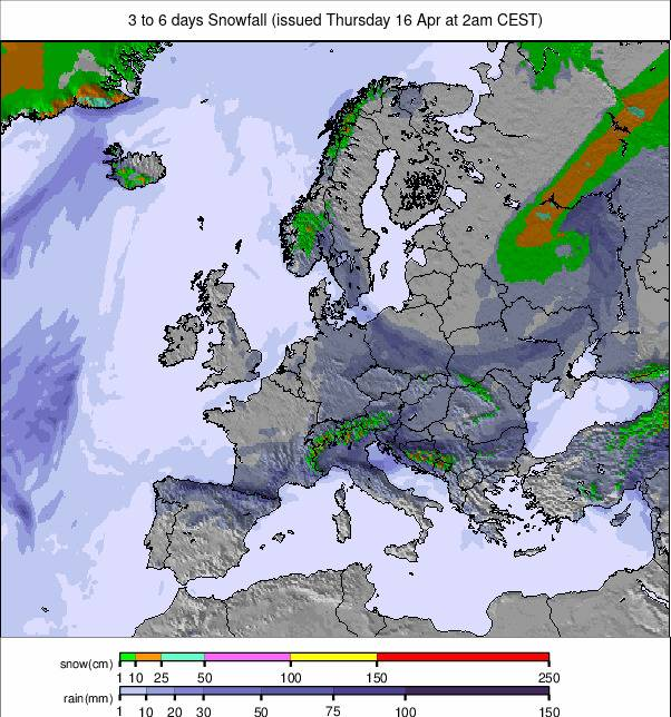
Weekly Snow News for Europe, updated 16 April 2026: High avalanche danger hits the Alps as warm weather dominates, while Pyrenees lead with 435cm (174") bases.
- Level 4 avalanche danger across the Alps amid rapid warming
- Pyrenees post Europe’s deepest 435cm (174") base
- Season closures accelerate across the continent
- Freezing levels rise toward 3,000m across central Europe
Europe Report Intro
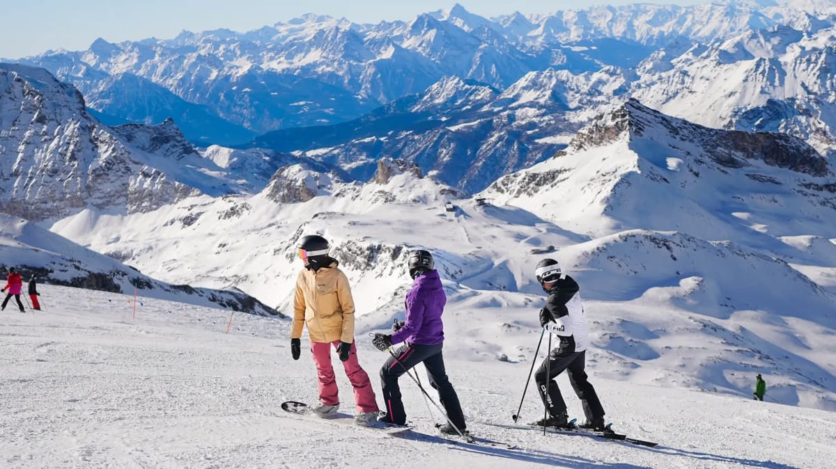
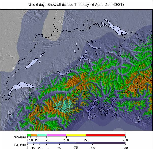
Spring conditions continue to dominate across Europe, with limited fresh snowfall and rising temperatures. Sunshine has been widespread, although occasional snow showers have affected higher terrain.
A major concern this week is avalanche danger. Authorities issued Level 4 (high) warnings across parts of the Alps due to rapid warming, rainfall and a saturated snowpack. Areas including Upper Valais and Tyrol were highlighted, with warnings that avalanches could release naturally and run into lower, snow-free terrain.
Ski area closures are accelerating, with around 300 resorts still operating — a figure expected to halve again over the coming weeks. The best remaining conditions are now largely confined to high-altitude terrain in the Alps and further north.
Austria Snow Report
Austria has seen a mix of sunshine and occasional showers, with precipitation often falling as rain or sleet at lower elevations as valley temperatures climb above +10°C. More than half of the remaining resorts closed last weekend, leaving fewer than 20 still operating.
The Arlberg region continues to offer around 250km of slopes but is set to close shortly. Ischgl/Samnaun is expected to become the country’s chief late-season destination, operating into early May with over 200km still open.
Austria Snow Forecast
Mild spring conditions continue, with freezing levels rising to 2,400–2,800m. Most precipitation will fall as rain or sleet, with snowfall confined to the highest glacier terrain.
France Snow Report
France has also seen rapid seasonal closures, with around 20 resorts still open, including several large high-altitude areas continuing into May. A front earlier in the week delivered up to 40cm (16") of mostly wet snow to higher elevations. Base depths remain strong, particularly in the Pyrenees, while Alpine resorts such as Les 2 Alpes still report upper depths exceeding three metres (10 feet).
France Snow Forecast
Freezing levels fluctuate between 2,300–2,700m. Conditions remain mostly dry, with snowfall limited to the highest glacier zones.
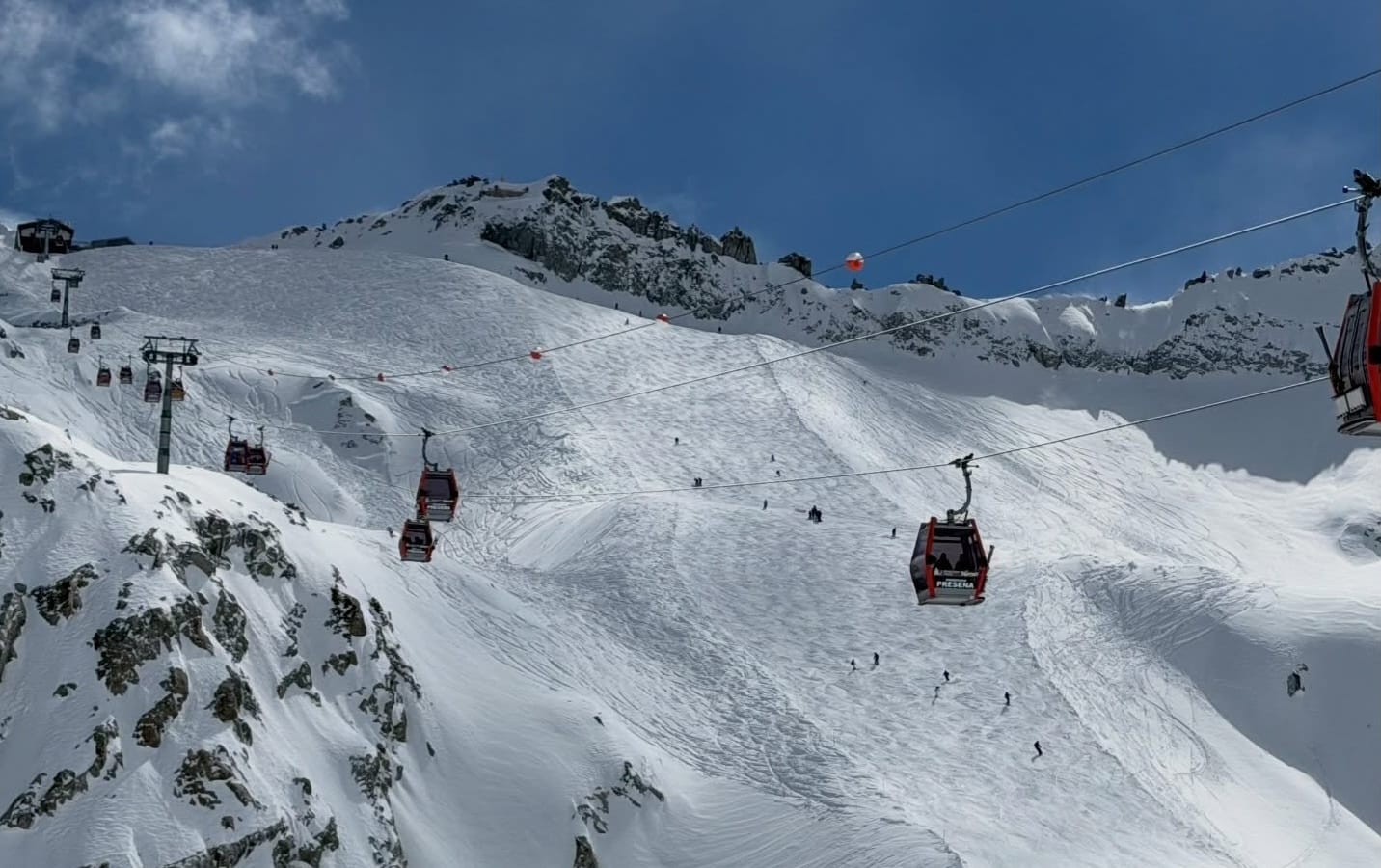
Italy Snow Report
Italy is firmly in spring mode, with valley temperatures reaching +20°C and even higher slopes frequently above freezing during the day. Just over a dozen resorts remain open after further closures last weekend. La Thuile and the Via Lattea are among those closing shortly, while Cervinia, Cortina and Livigno aim to continue into May.
Italy Snow Forecast
Freezing levels rise to around 2,200–2,700m. Expect mostly dry weather with occasional showers, falling as rain at lower elevations and snow only at the highest points.
Switzerland Snow Report
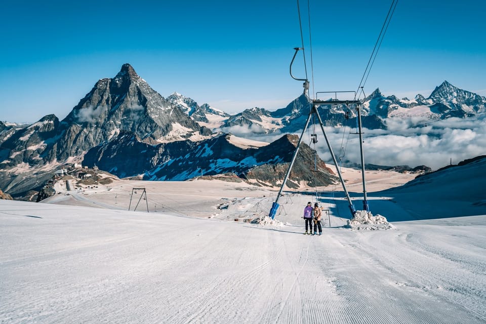
Switzerland has seen mostly settled conditions, with a brief pulse of snowfall early in the week refreshing upper slopes before warmer weather returned. Around 20 resorts remain open following further closures. Zermatt continues to lead for open terrain, maintaining close to 90% of its slopes and nearly 290km of runs.

Switzerland Snow Forecast
Mild conditions persist, with freezing levels climbing toward 2,800m. Snowfall will be limited to the highest glacier terrain, with mostly dry weather overall.
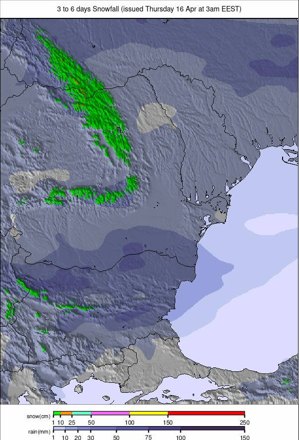
Pyrenees Snow Report
Most resorts closed after Easter, but a few continue thanks to strong snow depths. Cauterets now reports Europe’s deepest base at 435cm (174"). Spain’s Sierra Nevada, one of Europe’s most southerly resorts, is aiming to stay open into May following an excellent season. Conditions have been dominated by freeze-thaw cycles, with warm days and cold nights at altitude.
Pyrenees Snow Forecast
Freezing levels range between 1,600–2,200m. Expect a mix of sunshine and light precipitation, mostly falling as rain at lower elevations.
Scandinavia Ski Season Update and Snow Forecast
Scandinavia continues to offer some of Europe’s best late-season skiing, with around three-quarters of resorts still open and many maintaining 80–100% terrain availability. Conditions have turned more unsettled this week, with light snowfall reported widely, particularly in Norway, although lower elevations have occasionally seen rain.

Scandinavia Forecast
A milder pattern develops, with wetter conditions along coastal Norway, while inland and northern regions remain cooler with occasional snow showers.
Eastern Europe Snow Report
The season is ending rapidly across Eastern Europe, with most remaining resorts set to close after this weekend, including major areas in Slovakia, Poland and the Czech Republic. Conditions have been largely dry and increasingly warm, with freeze-thaw cycles dominating but more thaw than freeze overall.
Eastern Europe Forecast
Spring conditions prevail, with softening snow at lower elevations and only limited snowfall potential at higher altitudes.
Scotland Snow Report
Spring skiing continues at Glencoe and Cairngorm, with a brief return to wintry conditions over the weekend bringing fresh snowfall and stronger winds. Upper mountain terrain remains skiable, including Cairngorm’s Top Bowls and Glencoe’s Main Basin, although lower slopes are increasingly variable.
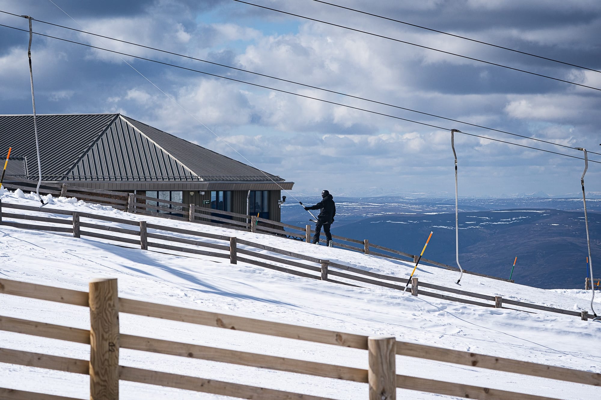
Scotland Snow Forecast
A typical mid-April mix is expected, with the best conditions on higher slopes and during early hours, while lower runs soften through the day.