Alternatively, you can now use your Outside account to sign in to any brand in the Outside digital ecosystem, including Snow-Forecast, Surf-Forecast, and Mountain-Forecast.
The snow forecast for Cauterets is: Mostly dry. Warm (max 20°C on Thu afternoon, min 12°C on Tue night). Wind will be generally light.
Cauterets Weather (Next 3 days): The snow forecast for Cauterets is: Mostly dry. Warm (max 20°C on Thu afternoon, min 12°C on Tue night). Wind will be generally light.
Cauterets Weather (Days 4-6): Light rain (total 3.0mm), mostly falling on Sat afternoon. Very mild (max 16°C on Fri night, min 7°C on Sun night). Wind will be generally light.
Cauterets Live Weather
Resort
Snow Depth
Temp. (°C)
Wind (km/h)
Weather
Top Lift:
0.0m
11
Middle Lift:
12
Bottom Lift:
0.0m
11
Powered by Snow-Forecast.com
Cauterets Weather
(Next 3 days):
The snow forecast for Cauterets is: Mostly dry. Warm (max 20°C on Thu afternoon, min 12°C on Tue night). Wind will be generally light.
Cauterets Weather (Days 4-6):
Light rain (total 3.0mm), mostly falling on Sat afternoon. Very mild (max 16°C on Fri night, min 7°C on Sun night). Wind will be generally light.
The above table gives the weather forecast for Cauterets at the specific elevation of 2110 m. Our sophisticated weather models allow us to provide snow forecasts for the top, middle and bottom ski stations of Cauterets. To access the weather forecasts for the other elevations, use the tab navigation above the table. For a wider view of the weather, check out the Weather Map of France.
Click here to read further information on freezing levels and how we forecast our temperatures.
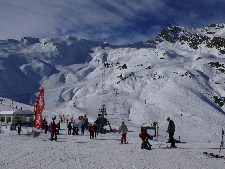
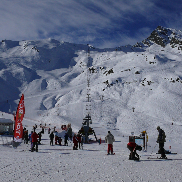
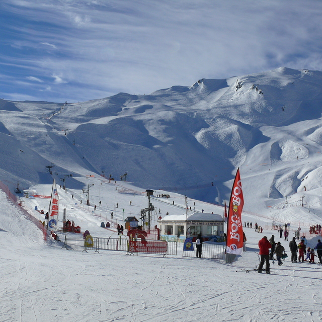
Cauterets is a family resort. We have been skiing here with our kids and extended family for 20 years. It’s an annual pilgrimage for generations of French families grand parents, parents, kids and toddlers. There’s not a lot to entertain teens/advanced alpine skiers either on or off piste unless you’re into the particularly superb cuisine of south west France, spa time, ice skating, snow shoeing, ski de fond or walking. Come to teach your kids or friends how to ski or board and you won’t be disappointed. If someone in your party can’t or doesn’t want to ski (?) neither will they, as this pretty Napoleonic spa town has plenty to keep them busy. Cauterets is a beautiful village (views over the Pyrenees up the mountain are stunning as well), no ugly concrete ski hotels here, for brutalist but stunning concrete and advanced skiing checkout Bond themed snow sure Piau Engalay. For a week, as a family holiday it’s a hidden gem!
Cauterets is a family resort. We have been skiing here with our kids and extended family for 20 years. It’s an annual pilgrimage for generations of French families grand parents, parents, kids and toddlers. There’s not a lot to entertain teens/advanced alpine skiers either on or off piste unless you’re into the particularly superb cuisine of south west France, spa time, ice skating, snow shoeing, ski de fond or walking. Come to teach your kids or friends how to ski or board and you won’t be disappointed. If someone in your party can’t or doesn’t want to ski (?) neither will they, as this pretty Napoleonic spa town has plenty to keep them busy. Cauterets is a beautiful village (views over the Pyrenees up the mountain are stunning as well), no ugly concrete ski hotels here, for brutalist but stunning concrete and advanced skiing checkout Bond themed snow sure Piau Engalay. For a week, as a family holiday it’s a hidden gem!
Free Snow-Forecast.com weather widget for your website
The Cauterets skiing weather widget is available to embed on external websites free of charge. It provides a daily summary of our Cauterets snow forecast and current weather conditions. Simply go to the feed configuration page and follow the 3 simple steps to grab the custom html code snippet and paste it into your own site. You can choose the snow forecast elevation (summit, mid-mountain or bottom lift) and metric/imperial units for the snow forecast feed to suit your own website…. Click here to get the code.


 Nearest