Europe Weekly Snow Roundup #304
Weekly Snow News for Europe, updated 5 March 2026: Mild temperatures across Alpine resorts after huge late‑February snowfalls of up to 3m (10 feet).
- Deep bases from Feb snow—Val Thorens 220–390 cm, Alpe d’Huez 270–350 cm, Grandvalira 230–310 cm.
- Most resorts are fully or nearly fully open; 4 Vallées 380 km, Via Lattea 320 km, Grandvalira 99% open.
- Scandinavia is getting fresh snow; the Alps and Pyrenees are ideal for spring skiing; Scotland's lower slopes are patchy.
Europe Intro
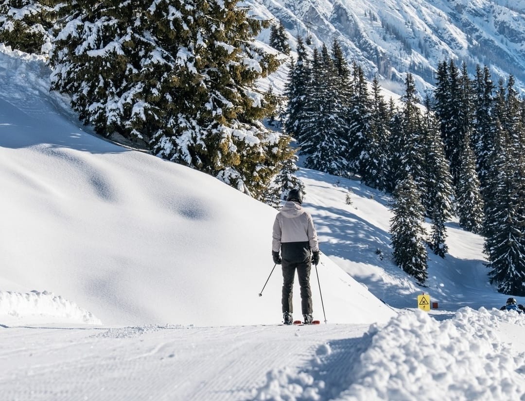
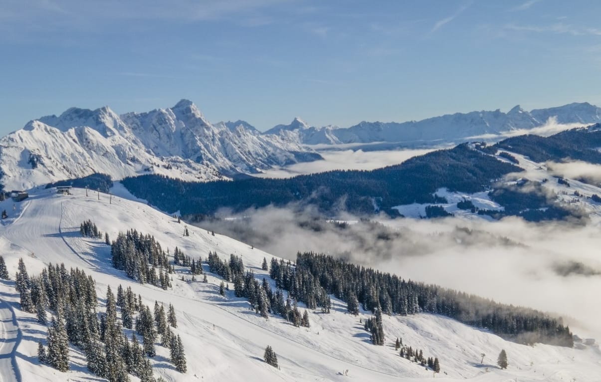
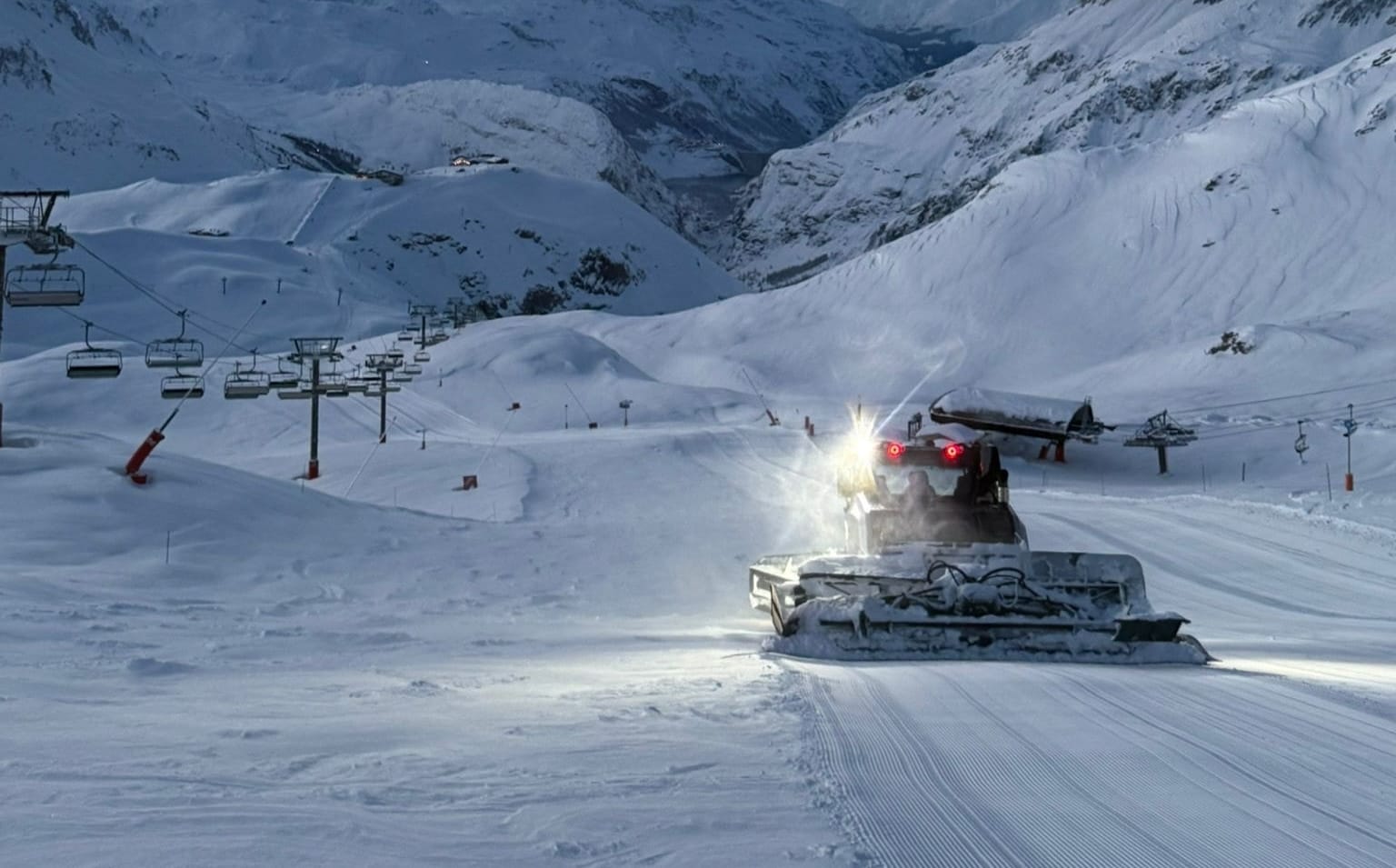
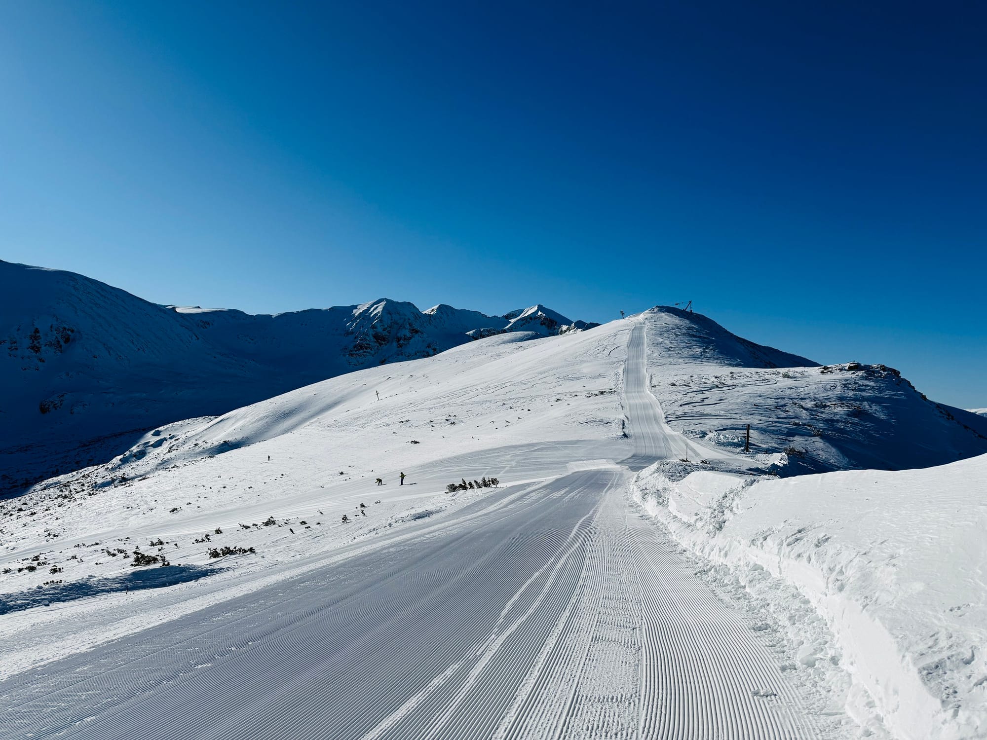
It really does feel like the start of springtime – which of course it is by the meteorological measure of the seasons – across most of Europe. In short, there's been loads of sunshine, mild temperatures at bases and very little fresh snowfall to report over the past seven days.
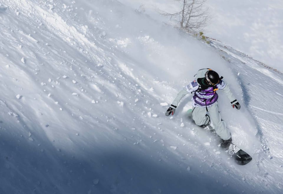
Along with that, of course, much of the latter half of February saw huge snowfalls, up to 3m/10 feet in 10 days, across most of the continent, so there's plenty of fresh snow lying almost everywhere to ski and ride on. The diminishing, although still considerable, avalanche risk is another big plus, as is the fact that most centres are not only posting their deepest bases but also the most terrain they've had open all season. That's often because enough snow has now built up on steep terrain that couldn't open previously.
What snow there has been to report has largely been in the far north of Europe, where Norway’s spring skiing opportunities are starting to come into their own, thanks to fresh snowfall in Scandinavia and low temperatures at most levels keeping conditions fresh.
Austria Snow Report
Austria hung onto the snowfall the longest of the big four Alpine nations last week, and also to a level 4 avalanche danger warning, but it has now got the same sunny weather as the rest, with the freezing point rising to as high as 3,000m at the weekend, higher than the top stations of most of the country's ski areas.
It has since cooled a little but still remains very springlike with above-zero temps reached to high elevations at most resorts, above +10C in the afternoons in valleys, just to allow occasional snow flurries. The Kitzsteinhorn glacier was reporting a few centimetres of overnight snowfall early this week.
These have also fallen as rain at lower elevations due to the mild temperatures, and with the heat and moisture, fog has bubbled up at times. Austrian centres have been needing snowfall more than most other Alpine regions, having had fewer showers and thus posting smaller bases and less of their terrain open, but the new snow has improved things now, and slopes can reopen. The Arlberg (110/280cm / 44/112") has done especially well and is now posting the country's deepest base among major centres by some distance. Over 80% of its slopes are open.
Austria Forecast
A mild, springlike spell continues across Austria’s ski areas, with most mountains seeing daytime highs between –5°C and +6°C and bases often climbing into double digits. Upper slopes at resorts such as Obertauern, Kitzsteinhorn and Stubai Glacier hover around –3°C to –6°C, while valley floors reach 10–15°C. Winds remain generally light to moderate, occasionally fresh on exposed ridges, limiting any significant new snowfall. Cooler air edges in later in the period, briefly lowering summit temperatures toward –8°C, but conditions stay predominantly dry with firm morning pistes softening quickly each afternoon.
France Snow Report
We’re into a second week of mostly sunny skies across the French Alps. Temperatures peaked at the end of last week with the freezing point hitting 3,000m, but it has since dropped a little and is now more commonly in the 1000–2000m range.
Valley highs still reaching +10C, but the highest slopes are remaining below freezing. French resorts continue to post Europe's deepest snow cover following the huge falls last month, and most centres are at or close to full slope operations.
The avalanche danger level is also down a little to 3 on the scale to 5 ("considerable"). Alpe d'Huez (270/350cm /108/140") has seen its base depth drop from its 4.3m (172") peak, and now Val Thorens (220/390cm / 88/156”) has the country’s and the Alps’ deepest snow cover up top.
France Forecast
We’re moving into a third week of the warm, settled weather dominating France’s ski regions, with summit temperatures mostly between –12°C and –1°C and bases frequently reaching 8–15°C across the Alps and Pyrenees. Higher areas such as Tignes, Val Thorens and Les 2 Alpes hold onto colder air aloft, often –8°C to –12°C, while mid-mountain levels fluctuate around –5°C to +3°C. Lower slopes in Haute-Savoie, Isère and the southern Alps repeatedly climb into double digits. Winds stay light to moderate, occasionally fresh on exposed ridges, keeping conditions largely dry.
Italy Snow Report
It’s looking like the upcoming Paralympics, which kick off this weekend, are set to see more springlike conditions than the recent Winter Olympics, with temperatures climbing to +15°C in Italian valleys in the afternoons.
With the freezing point getting up to 3,000m at times, it's also got well above freezing even on high slopes for a few hours each day, too. It's been a mostly sunny week on Italian slopes too, after the good snowfalls across the country more than a week ago.
Base depths are the best they've been all season across the country, thanks to that late Feb snowfall, and most resorts have the most terrain they've had open all season. The Via Lattea (Milky Way) (40/260cm / 16/1-04”) on the French border, incorporating the linked resorts of Sestriere, Sauze d’Oulx, San Sicario and Claviere on the Italian side, is posting the most in the country right now with more than 320 km (200 miles) of slopes skiable.
Italy Forecast
The warm, settled weather continues across Italy’s ski regions too, with summit temperatures mostly between –12°C and +7°C and bases frequently reaching 10–16°C. Higher areas such as Pejo 3000, Presena Glacier and Marmolada stay cold aloft, often –10°C to –4°C, while mid-mountain levels in the Dolomites fluctuate around –6°C to +4°C. Lower slopes in Trentino, South Tyrol and Lombardy repeatedly climb into double digits, softening snow quickly each afternoon. Winds remain light to moderate, occasionally fresh on exposed ridges, and conditions stay largely dry.
Switzerland Snow Report
Sunny weather for Swiss ski slopes too, with valley highs reaching +10 to +15 °C here as well, and even 3,000m peaks seeing above-zero numbers reached in the afternoons.
The 10 days now of sunshine, though, come after 10 days of heavy snowfall, so it's mostly been a case of improving conditions as the snowpack has settled and slopes could reopen.
St Moritz (34/141cm / 14/56”) actually posted the most snowfall in the Alps over the first half of the week – 12cm (5”). The 4 Vallées (120/270cm / 48/108"), including Verbier, La Tzoumaz, Nendaz and Veysonnaz, have the most terrain open in the country with about 380km (237 miles) of slopes available at present.
Switzerland Forecast
A warm, settled pattern dominates Switzerland’s ski regions, with summit temperatures ranging from about –12°C to +7°C and bases frequently climbing to 8–16°C across Valais, Graubünden and the Bernese Oberland. Higher areas such as Zermatt, SaasFee and St. Moritz hold colder air aloft, often –10°C to –4°C, while midmountain levels sit closer to –6°C to +4°C. Lower slopes repeatedly push into double digits, softening snow quickly each afternoon. Winds stay light to moderate, occasionally fresh on exposed ridges, and conditions remain largely dry.
Pyrenees Snow Report
As with the Alps, the Pyrenees have spent much of the past week bathed in sunshine. Temperatures have perhaps been a degree or two cooler than last week, the freezing point generally lying between 1500 and 2000m altitudes.
Base depths remain exceptional after the very snowy winter, in some cases, the most in three decades. So most areas have at least 2m (7 feet) lying, some more than 3m (10 feet).
All also have all, or almost all, of their slopes open, led by Andorra’s Grandvalira (230/310cm / 92/124"), including Pas de la Casa and Soldeu El Tarter, which reports 99% of its 240km (150 miles) of slopes open.
Pyrenees Forecast
Again, as with the Alps, a warm, springlike pattern holds across the Pyrenees, with summit temperatures generally between –9°C and +5°C and bases repeatedly climbing to 10–14°C across Andorra, France and Spain. Higher areas such as Grandvalira, Baqueira/Beret and Piau-Engaly sit around –7°C to –1°C on the peaks, while mid-mountain levels fluctuate close to –4°C to +4°C. Lower slopes often reach 11–14°C, softening snow quickly each afternoon. Winds stay light to moderate, occasionally fresh on exposed ridges, and conditions remain largely dry.
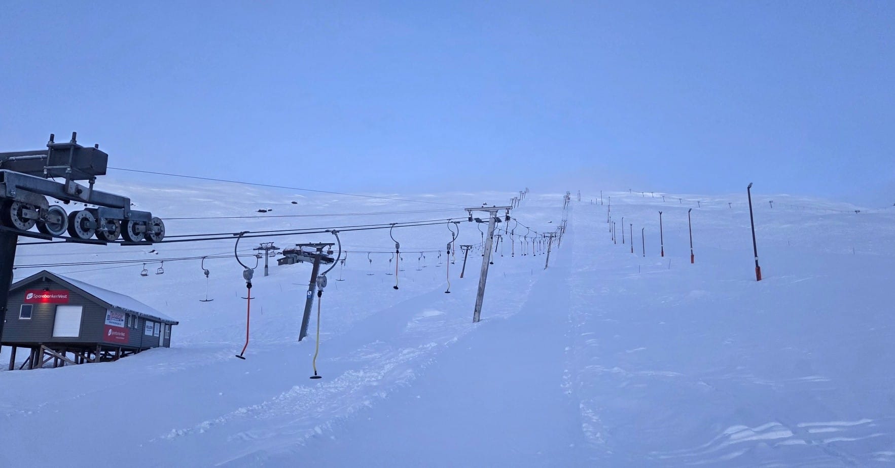
Scandinavia Snow Report
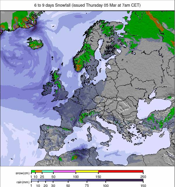
Whilst most of Europe has continued dry, mild and sunny, Scandinavia has continued to deliver low temperatures and some fresh snowfall, if mostly light to moderate flurries rather than heavy falls.
Even here, though, as far north as Lapland, valley temperatures have been creeping a degree or two above freezing whilst remaining still in the -10 to -20 °C range at altitude. Sunny spells between the showers and much longer daylight hours in the region now.
At more southerly, coastal resorts like Voss, the milder weather has brought sleet at times as well as snow. Western Norway has, though, seen the best of Europe's snowfall this week, with 7-day totals of 30–60cm (1–2 feet) for some.
Scandinavia Forecast
Snowfall becomes a more prominent feature across the Scandinavian mountains this week, especially in western Norway, where repeated pulses of Atlantic moisture bring frequent snow showers and squalls. Peaks in regions such as Voss, Myrkdalen and Stranda are set for regular top-ups, with temperatures staying firmly below freezing on the mountains and winds often fresh to strong, making it feel markedly colder. Lower slopes fluctuate between –1°C and +9°C, but higher terrain holds –6°C to –18°C, supporting accumulating snow. Further east, Sweden and inland Norway remain colder and drier, with only occasional light snow.
Eastern Europe Snow Report
A sunny week across much of eastern Europe, but trending cooler than further west for much of it. Although daytime highs in valleys have been reaching low single figures, the freezing point has stayed around 1500m altitudes, with higher slopes seeing -10 °C overnight.
So freeze-thaw on the lower mountain, remaining below zero above. Most ski centres in the area report their slopes in good condition for early (meteorological) springtime.
Bulgaria's Bansko (20/250cm / 8/100”), which saw its upper base depth jump by almost half in snowfalls last week, reports its runs are 100% open.
Eastern Europe Forecast
Eastern Europe’s ski regions stay on the colder side this week, with summit temperatures typically between –4°C and –10°C and bases hovering from –1°C to +4°C across Slovakia, Poland, Czechia, Romania, Bulgaria and Slovenia. Mountain highs in areas such as Jasná, Tatranská Lomnica, Poiana Brașov and Szczyrk frequently sit around –5°C to –8°C, while valleys fluctuate just above freezing. Winds are generally light, occasionally moderate on exposed ridges. Snowfall is limited, with most resorts remaining dry, though Romania’s higher Carpathian peaks briefly dip to –10°C to –14°C, keeping surfaces firm.
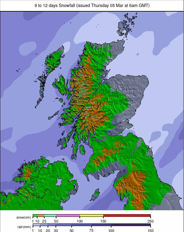
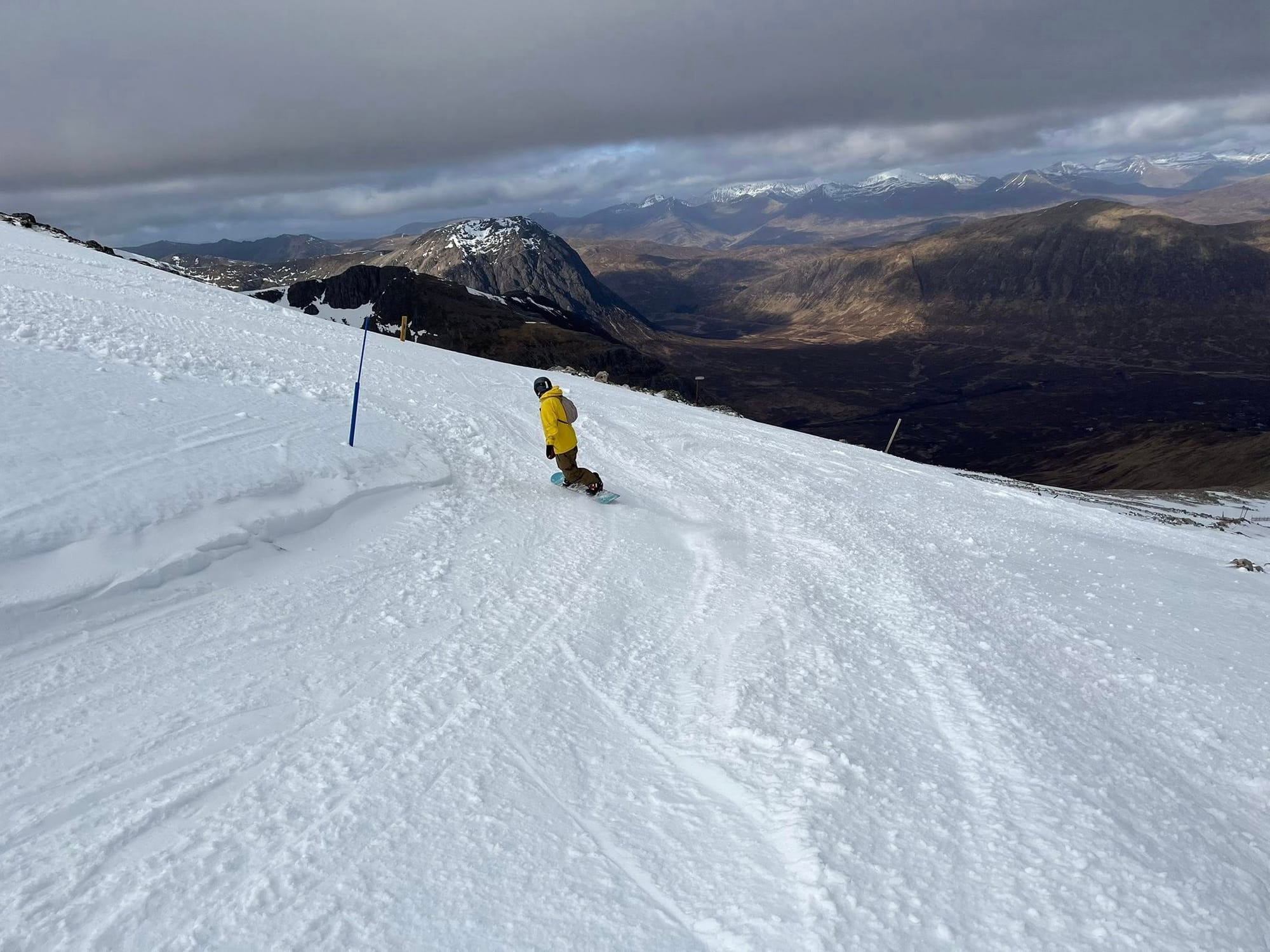
Scotland Snow Report
Scottish ski areas continue to battle milder air after the subzero first few months of the year. That’s gradually impacting what’s open, particularly lower terrain, but Cairngorm and Glenshee in particular still have a lot of terrain open.
Glencoe says its terrain is best suited to intermediate level skiers and above (unless booked in lessons), and The Lecht has limited runs still open, patched up with its all-weather snowmaking.
Nevis Range, the only one of the five centres that doesn’t have a functioning all-weather snowmaking system, announced on Friday that rain and thawing meant its runs were no longer skiable for now.
Scotland Forecast
Scotland’s ski areas continue to face a mixed earlyMarch pattern, with mild temperatures, rain at times, and occasional summit snow. Cairngorm begins the week around 7°C at its base with light winds and a shift to rain, then a rain–snow mix overnight. Glenshee reports 5°C, southerly winds near 17 mph, and rain overnight before brighter spells later in the day. Higher terrain across Glencoe, Nevis Range and The Lecht follows a similar pattern: mild lower slopes, colder summits, and intermittent snow showers when pulses of colder air arrive. Snow cover remains patchy but can firm up briefly during overnight freezes.