Issued by Snow-Forecast.com at:7 am (local time) / 30 Jun 2026
Last 6 daysScroll left for last 6 daysNow
Next 3 days weather summary:
Heavy rain (total 36.0mm), heaviest during Wed afternoon. Very mild (max 18°C on Tue afternoon, min 6°C on Wed afternoon). Wind will be generally light.
Days 4-6 weather summary:
Moderate rain (total 11.0mm), heaviest on Fri morning. Very mild (max 16°C on Sat afternoon, min 8°C on Sun night). Wind will be generally light.
The above table gives the weather forecast for Zell am See at the specific elevation of 2000 m. Our sophisticated weather models allow us to provide snow forecasts for the top, middle and bottom ski stations of Zell am See. To access the weather forecasts for the other elevations, use the tab navigation above the table. For a wider view of the weather, check out the Weather Map of Austria.
Click here to read further information on freezing levels and how we forecast our temperatures.
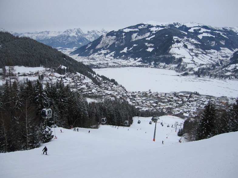
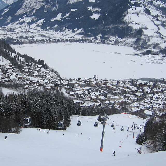
Was in Zell for the first time just as Covid came. Weren't blessed with great weather, couple of near whiteout days, but plenty of skiing including a day at the glacier, another at MariaAlm, and the links to Saalbach means there's ample variety to keep a reasonable intermediate busy for a full week. But there's more to Zell than just its pistes. Its stunning lakeside location, pretty streets and alleyways and ample apres-ski life make it perhaps the best all-round ski destination I've ever visited. And it's Austria, and they know how to party in a way that no other European destination does. I'll definitely return.
Was in Zell for the first time just as Covid came. Weren't blessed with great weather, couple of near whiteout days, but plenty of skiing including a day at the glacier, another at MariaAlm, and the links to Saalbach means there's ample variety to keep a reasonable intermediate busy for a full week. But there's more to Zell than just its pistes. Its stunning lakeside location, pretty streets and alleyways and ample apres-ski life make it perhaps the best all-round ski destination I've ever visited. And it's Austria, and they know how to party in a way that no other European destination does. I'll definitely return.
Free Snow-Forecast.com weather widget for your website
Embed the Zell am See weather widget on your site for free. It provides a weekly snapshot of snow and rain conditions across all elevations. Follow the two quick steps to grab your custom code and paste it into your site. Choose between metric or imperial units. Click here to get the code.


 Nearest