

Fresh Snowfall In Australia With 2026 Season Starting This Weekend
An early-winter storm is gathering momentum in Australia ahead of the start of the 2026 ski season in the country this weekend.

Next 3 days weather summary:Light rain (total 8.0mm), mostly falling on Thu morning. Very mild (max 10°C on Fri morning, min 6°C on Thu afternoon). Wind will be generally light. | Days 4-6 weather summary:Heavy rain (total 49.0mm), heaviest during Sun night. Mild temperatures (max 8°C on Sun morning, min 4°C on Mon night). Winds increasing (calm on Sun morning, strong winds from the SSE by Sun night). | |||||||||||||||||
Thursday 4 | Friday 5 | Saturday 6 | Sunday 7 | Monday 8 | Tuesday 9 | |||||||||||||
AM | PM | night | AM | PM | night | AM | PM | night | AM | PM | night | AM | PM | night | AM | PM | night | |
light rain | light rain | some clouds | some clouds | some clouds | some clouds | rain shwrs | light rain | rain shwrs | rain shwrs | light rain | heavy rain | mod. rain | light rain | rain shwrs | clear | some clouds | clear | |
km/h | ||||||||||||||||||
Snow map |  |  | 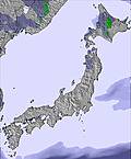 | 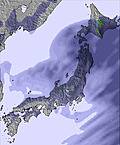 | 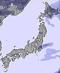 | 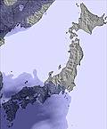 | ||||||||||||
— | — | — | — | — | — | — | — | — | — | — | — | — | — | — | — | — | — | |
2 | 2 | — | — | — | — | 1 | 2 | 1 | 1 | 3 | 36 | 6 | 2 | 1 | — | — | — | |
max °C | 7 | 7 | 8 | 10 | 10 | 8 | 9 | 9 | 8 | 8 | 7 | 8 | 8 | 8 | 5 | 6 | 7 | 5 |
min °C | 7 | 6 | 6 | 10 | 9 | 6 | 7 | 8 | 7 | 7 | 6 | 6 | 8 | 6 | 4 | 5 | 6 | 4 |
5 | 6 | 4 | 9 | 9 | 5 | 6 | 6 | 6 | 6 | 3 | 0 | 4 | 1 | -2 | 0 | 3 | 1 | |
89 | 94 | 78 | 56 | 62 | 87 | 80 | 86 | 73 | 51 | 83 | 94 | 98 | 94 | 58 | 42 | 57 | 50 | |
3500 | 3700 | 3800 | 4200 | 4150 | 4100 | 3700 | 3900 | 3850 | 4050 | 3750 | 3800 | 4350 | 4050 | 3450 | 3150 | 3200 | 3250 | |
4:28 | — | — | 4:26 | — | — | 4:26 | — | — | 4:26 | — | — | 4:26 | — | — | 4:26 | — | — | |
— | 7:00 | — | — | 7:00 | — | — | 7:00 | — | — | 7:01 | — | — | 7:01 | — | — | 7:02 | — | |
Avalanche information: Japan Avalanche Network
Latest snow reports near Shiga Kogen-Yokoteyama:
| Top snow depth: | — |
|---|---|
| Bottom snow depth: | — |
| Fresh snowfall depth: | — |
| Last snowfall: | 9 May 2026 |
| Snow Alerts | Create Alert |
0.0 | Bluebird Powder days Fresh snow, mostly sunny, light wind. |
|---|---|
0.0 | Powder days Fresh snow, limited sun, any wind. |
0.0 | Bluebird days Average snow, mostly sunny, light wind. |
The above table gives the weather forecast for Shiga Kogen-Yokoteyama at the specific elevation of 2305 m. Our sophisticated weather models allow us to provide snow forecasts for the top, middle and bottom ski stations of Shiga Kogen-Yokoteyama. To access the weather forecasts for the other elevations, use the tab navigation above the table. For a wider view of the weather, check out the Weather Map of Japan.
Click here to read further information on freezing levels and how we forecast our temperatures.
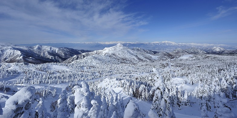
Resort name is also written as Shiga Kogen Yokoteyama.


 Nearest