

Niseko Announce New Gondola
Niseko Village has confirmed a major lift expansion that will reshape access on the southern side of the Niseko United ski area, with a new gondola scheduled to open next winter and a second stage planned for 2027–28.

Next 3 days weather summary:Light rain (total 2.0mm), mostly falling on Wed morning. Freeze-thaw conditions (max 7°C on Fri night, min 0°C on Wed night). Winds decreasing (fresh winds from the N on Wed night, calm by Fri night). | Days 4-6 weather summary:Mostly dry. Mild temperatures (max 9°C on Sat night, min 5°C on Mon afternoon). Wind will be generally light. | |||||||||||||||||
Wednesday 1 | Thursday 2 | Friday 3 | Saturday 4 | Sunday 5 | Monday 6 | |||||||||||||
AM | PM | night | AM | PM | night | AM | PM | night | AM | PM | night | AM | PM | night | AM | PM | night | |
rain shwrs | snow shwrs | clear | clear | clear | clear | clear | clear | clear | clear | clear | clear | clear | clear | clear | clear | clear | clear | |
km/h | ||||||||||||||||||
Snow map |  |  |  |  |  |  | ||||||||||||
— | 1 | — | — | — | — | — | — | — | — | — | — | — | — | — | — | — | — | |
mm | 2 | — | — | — | — | — | — | — | — | — | — | — | — | — | — | — | — | — |
max °C | 4 | 2 | 4 | 5 | 4 | 6 | 5 | 4 | 7 | 7 | 7 | 9 | 8 | 6 | 7 | 6 | 6 | 7 |
min °C | 2 | 2 | 0 | 5 | 4 | 5 | 5 | 4 | 5 | 6 | 6 | 8 | 7 | 6 | 6 | 6 | 5 | 6 |
chill °C | -2 | -3 | -7 | 1 | 2 | 1 | 2 | 3 | 5 | 4 | 5 | 8 | 5 | 5 | 3 | 2 | 2 | 3 |
Humid % | 90 | 76 | 22 | 16 | 62 | 37 | 45 | 84 | 26 | 21 | 55 | 11 | 15 | 43 | 23 | 25 | 50 | 21 |
Freeze m | 3750 | 3650 | 4000 | 4200 | 4050 | 4300 | 4200 | 4050 | 4400 | 4350 | 4400 | 4550 | 4300 | 4250 | 4300 | 4200 | 4200 | 4300 |
5:52 | — | — | 5:54 | — | — | 5:54 | — | — | 5:54 | — | — | 5:56 | — | — | 5:56 | — | — | |
— | — | 9:24 | — | — | 9:24 | — | — | 9:24 | — | — | 9:23 | — | — | 9:23 | — | — | 9:23 | |
Go pro and carve into:
Avalanche information: European Avalanche Warning Services (EAWS)
Latest snow reports near Villard-Reculas:
| Top snow depth: | — |
|---|---|
| Bottom snow depth: | — |
| Fresh snowfall depth: | — |
| Last snowfall: | 4 Jun 2026 |
| Snow Alerts | Create Alert |
0.1 | Bluebird Powder days Fresh snow, mostly sunny, light wind. |
|---|---|
0.0 | Powder days Fresh snow, limited sun, any wind. |
0.1 | Bluebird days Average snow, mostly sunny, light wind. |
The above table gives the weather forecast for Villard-Reculas at the specific elevation of 3351 m. Our sophisticated weather models allow us to provide snow forecasts for the top, middle and bottom ski stations of Villard-Reculas. To access the weather forecasts for the other elevations, use the tab navigation above the table. For a wider view of the weather, check out the Weather Map of France.
Click here to read further information on freezing levels and how we forecast our temperatures.
Overall 3.9 Based on 5 votes and 3 reviews
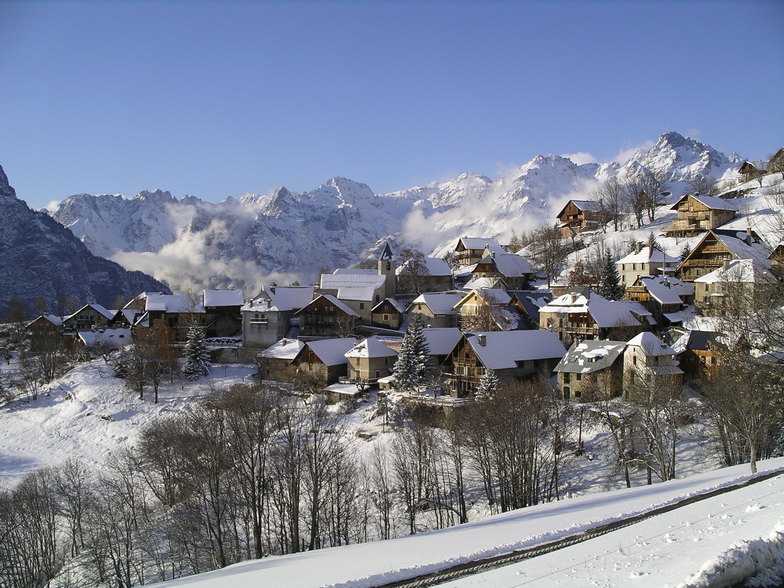
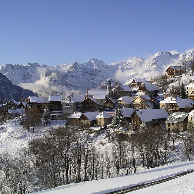
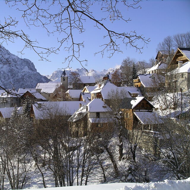
We have stayed in Villard-Reculas for two consecutive seasons, having enjoyed the peace and tranquility of this unspoilt village and the personal service offered by the private chalet La Source, that we found through Where to Ski and Snowboard. The village of Villard-Reculas is truly unspoilt. It has wonderful views of the mountains and the patchwork quilt of the town of Bourg D'Oisans below. The accommodation is limited to one hotel but there are charming chalets and apartments to be found, all in very traditional mountain style. The main ski area of Alpe d'Huez is superb, offering skiing for all abilities with its wide range of challenging blacks, reds, blues and greens. La Sarenne is the longest black run in Europe at 17km, coming down from 3330m to 1510m with an excellent restaurant at the bottom. But if something gentler is more your style then you will certainly find it in this resort. Snowboarders are also well catered for with the snowpark in the centre of Alpe d'Huez. The lifts from Villard-Reculas quickly and efficiently transport you up to the main resort area where you will find fast, comfortable chairs to take you up and over Le Signal. There is now a free ski shuttle bus which operates in season, taking skiers from the chalets to the bottom of the escalator lift, or the drag lift, but if you are staying in Chalet La Source, you will be able to take advantage of their free mini-bus service. Michael will also gladly show you around the ski area and direct you to one of the charming villages on the lower slopes. He will also recommend one of the many excellent restaurants which are to be found on the mountain, or in the villages. The run back from Le Signal can be made on a variety of runs from the challenging La Foret, a choice of wide reds, or if your legs are tired, on the blue. The snow was excellent throughout the area while we were there this year. In times of poor snowfall, Villard-Reculas and the main resort of Alpe d'Huez can manage to keep their slopes operating through the use of their many snowmaking machines. If lively apres-ski is your scene, then Villard Reculas is not for you, but if you are looking for a peaceful village, set away from the main resort with excellent skiing, superb views and a charming friendly ambiance then you can do no better than trying Villard-Reculas.
Judith Phillip from United Kingdom writes:
We have stayed in Villard-Reculas for two consecutive seasons, having enjoyed the peace and tranquility of this unspoilt village and the personal service offered by the private chalet La Source, that we found through Where to Ski and Snowboard. The village of Villard-Reculas is truly unspoilt. It has wonderful views of the mountains and the patchwork quilt of the town of Bourg D'Oisans below. The accommodation is limited to one hotel but there are charming chalets and apartments to be found, all in very traditional mountain style.
The main ski area of Alpe d'Huez is superb, offering skiing for all abilities with its wide range of challenging blacks, reds, blues and greens. La Sarenne is the longest black run in Europe at 17km, coming down from 3330m to 1510m with an excellent restaurant at the bottom. But if something gentler is more your style then you will certainly find it in this resort. Snowboarders are also well catered for with the snowpark in the centre of Alpe d'Huez.
The lifts from Villard-Reculas quickly and efficiently transport you up to the main resort area where you will find fast, comfortable chairs to take you up and over Le Signal. There is now a free ski shuttle bus which operates in season, taking skiers from the chalets to the bottom of the escalator lift, or the drag lift, but if you are staying in Chalet La Source, you will be able to take advantage of their free mini-bus service. Michael will also gladly show you around the ski area and direct you to one of the charming villages on the lower slopes. He will also recommend one of the many excellent restaurants which are to be found on the mountain, or in the villages.
The run back from Le Signal can be made on a variety of runs from the challenging La Foret, a choice of wide reds, or if your legs are tired, on the blue. The snow was excellent throughout the area while we were there this year. In times of poor snowfall, Villard-Reculas and the main resort of Alpe d'Huez can manage to keep their slopes operating through the use of their many snowmaking machines.
If lively apres-ski is your scene, then Villard Reculas is not for you, but if you are looking for a peaceful village, set away from the main resort with excellent skiing, superb views and a charming friendly ambiance then you can do no better than trying Villard-Reculas.


 Nearest