

Portillo Re-Opens To Guests Arriving By Helicopter
Chile’s famous Portillo ski resort is reported to have re-opened to guests arriving by helicopter after being cut off by road for more than two weeks by over 6m/20 feet of snowfall.

Next 3 days weather summary:Moderate rain (total 15.0mm), heaviest on Tue night. Very mild (max 17°C on Mon afternoon, min 11°C on Tue night). Wind will be generally light. | Days 4-6 weather summary:Moderate rain (total 11.0mm), heaviest on Thu afternoon. Very mild (max 15°C on Sat afternoon, min 10°C on Thu night). Wind will be generally light. | ||||||||||||||||
Mon 3 | Tuesday 4 | Wednesday 5 | Thursday 6 | Friday 7 | Saturday 8 | ||||||||||||
PM | night | AM | PM | night | AM | PM | night | AM | PM | night | AM | PM | night | AM | PM | night | |
cloudy | rain shwrs | clear | t-storm risk | rain shwrs | clear | t-storm risk | rain shwrs | some clouds | mod. rain | rain shwrs | clear | t-storm risk | rain shwrs | clear | clear | clear | |
km/h | |||||||||||||||||
Snow map |  |  |  |  |  |  | |||||||||||
— | — | — | — | — | — | — | — | — | — | — | — | — | — | — | — | — | |
mm | — | 1 | — | 2 | 8 | — | 2 | 2 | — | 8 | 1 | — | 1 | 1 | — | — | — |
max °C | 17 | 15 | 15 | 15 | 12 | 13 | 15 | 14 | 14 | 13 | 12 | 13 | 14 | 13 | 14 | 15 | 14 |
min °C | 17 | 13 | 13 | 15 | 11 | 12 | 14 | 13 | 13 | 12 | 10 | 11 | 13 | 11 | 12 | 15 | 13 |
chill °C | 17 | 12 | 12 | 15 | 11 | 12 | 14 | 13 | 13 | 12 | 10 | 11 | 13 | 11 | 12 | 15 | 13 |
Humid % | 52 | 60 | 51 | 60 | 60 | 62 | 72 | 58 | 55 | 77 | 74 | 54 | 71 | 68 | 46 | 55 | 46 |
Freeze m | 4700 | 4500 | 4450 | 4450 | 4450 | 4350 | 4450 | 4500 | 4400 | 4400 | 4350 | 4300 | 4350 | 4400 | 4450 | 4500 | 4550 |
— | — | 6:24 | — | — | 6:24 | — | — | 6:26 | — | — | 6:28 | — | — | 6:28 | — | — | |
— | 9:00 | — | — | 8:58 | — | — | 8:57 | — | — | 8:55 | — | — | 8:53 | — | — | 8:52 | |
Go pro and carve into:
Avalanche information: European Avalanche Warning Services (EAWS)
Latest snow reports near Villard-Reculas:
| Top snow depth: | — |
|---|---|
| Bottom snow depth: | — |
| Fresh snowfall depth: | — |
| Last snowfall: | 4 Jun 2026 |
| Snow Alerts | Create Alert |
0.0 | Bluebird Powder days Fresh snow, mostly sunny, light wind. |
|---|---|
0.0 | Powder days Fresh snow, limited sun, any wind. |
0.0 | Bluebird days Average snow, mostly sunny, light wind. |
The above table gives the weather forecast for Villard-Reculas at the specific elevation of 2400 m. Our sophisticated weather models allow us to provide snow forecasts for the top, middle and bottom ski stations of Villard-Reculas. To access the weather forecasts for the other elevations, use the tab navigation above the table. For a wider view of the weather, check out the Weather Map of France.
Click here to read further information on freezing levels and how we forecast our temperatures.
Overall 3.9 Based on 5 votes and 3 reviews
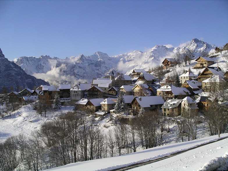
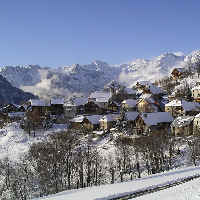
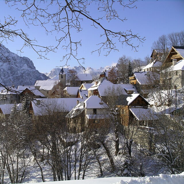
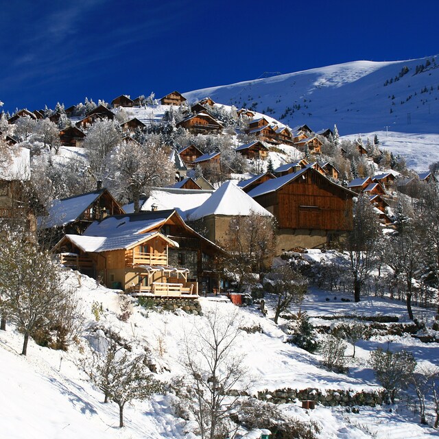
A tour of downtown Villard Reculas by Chris Gill editor of Where to Ski and snowboard. 23 January 2013 Wednesday brought cloud and snow to the Alpe d’Huez area, creating the perfect opportunity to explore the minute satellite village of Villard-Reculas in the company of Michael Baldwin, year-round resident and owner-operator of La Source, a 200-year-old stone barn converted into a charming catered chalet. In the course of touring the densely built village, in the middle of the day, we encountered one pedestrian, three cats and one moving vehicle. If you’re looking for a ski resort that is nothing like a typical ski resort, this place is for you. The forecast for Thursday is better, and we have the slopes of another satellite, Auris, on the agenda.
Chris Gill from France writes:
A tour of downtown Villard Reculas by Chris Gill editor of Where to Ski and snowboard. 23 January 2013
Wednesday brought cloud and snow to the Alpe d’Huez area, creating the perfect opportunity to explore the minute satellite village of Villard-Reculas in the company of Michael Baldwin, year-round resident and owner-operator of La Source, a 200-year-old stone barn converted into a charming catered chalet.
In the course of touring the densely built village, in the middle of the day, we encountered one pedestrian, three cats and one moving vehicle. If you’re looking for a ski resort that is nothing like a typical ski resort, this place is for you.
The forecast for Thursday is better, and we have the slopes of another satellite, Auris, on the agenda.


 Nearest