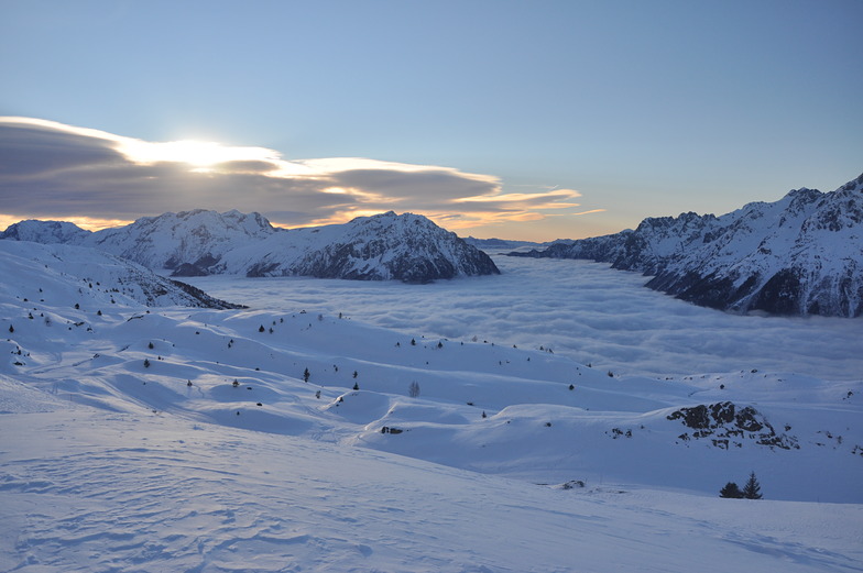
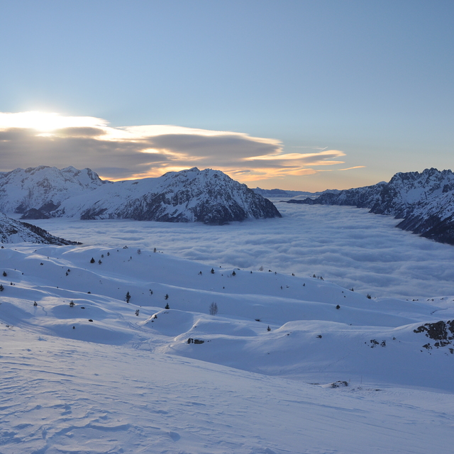
The above table gives the weather forecast for Vaujany at the specific elevation of 1101 m. Our sophisticated weather models allow us to provide snow forecasts for the top, middle and bottom ski stations of Vaujany. To access the weather forecasts for the other elevations, use the tab navigation above the table. For a wider view of the weather, check out the Weather Map of France.
Click here to read further information on freezing levels and how we forecast our temperatures.
I have just got back from Vaujany and we had a fantastic holiday there with three children aged 5, 7 and 9. I would give a word of warning though, that despite people saying this is a family resort I think the skiing options on this side of the ski field are quite limited for small children and complete beginners. There is a much wider selection over in Alpe d'Huez. Looking at the map you would think the collection of blue runs around Montfrais would be fine, but these are some of the steepest blues I've ever seen, whereas the green in the training area at Montfrais are extremely gentle which leaves limited options for progression. There are two other green run options for beginners, at the top of l'Allepette, but one of them was described as dark green by the instructor, and you ski down it and get the drag lift back up. Below this dark green is a red run into Oz, which did lead to a very sticky situation with my 5 year old going down the dark green and not being able to cope with the strength of the drag lift back up to the top - the red into Oz is very gentle and having netting on the cliff edge so all my kids could happily manage it at the end of the week but on day 2 of his second skiing holiday this green run caused some severe problems (an old hand painted map in town showed it as blue).
We loved the resort, the escalators in town made it very easy for the kids to get back up to the apartment. The village was extremely nice, compact and very friendly, we will, without doubt, go back to Vaujany, but I would say if you have a group of limited ability skiers (my children had done 9 days skiing previously but are at the younger end) then Alpe d'Huez may offer you more. It is possible to travel to Alpe d'Huez via Oz; it's 3 lifts so takes a good 40 minutes, and while my 5 year old (who completed snowflake level in ski school) could ski from Vaujany to Oz very slowly, needed the lift up on the return journey from Alpe d'Huez to Oz then a lift down to half way on the Poutran and my daughter, after completing here 1 star ski school, struggled a little with the top of the ski down from d'Huez into Oz to get home.
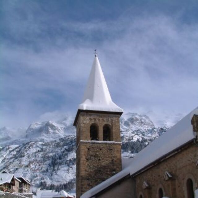
I wouldn't hesitate to recommend Vaujany as a resort, the mountain on that side of the field is far more beautiful than Alpe d'Huez but if you have small children, you may get a nasty surprise with some of the run gradings and will find your options limited and my kids are not cautious skiers so I don’t think I’m being over protective with that opinion.
I have just got back from Vaujany and we had a fantastic holiday there with three children aged 5, 7 and 9. I would give a word of warning though, that despite people saying this is a family resort I think the skiing options on this side of the ski field are quite limited for small children and complete beginners. There is a much wider selection over in Alpe d'Huez. Looking at the map you would think the collection of blue runs around Montfrais would be fine, but these are some of the steepest blues I've ever seen, whereas the green in the training area at Montfrais are extremely gentle which leaves limited options for progression. There are two other green run options for beginners, at the top of l'Allepette, but one of them was described as dark green by the instructor, and you ski down it and get the drag lift back up. Below this dark green is a red run into Oz, which did lead to a very sticky situation with my 5 year old going down the dark green and not being able to cope with the strength of the drag lift back up to the top - the red into Oz is very gentle and having netting on the cliff edge so all my kids could happily manage it at the end of the week but on day 2 of his second skiing holiday this green run caused some severe problems (an old hand painted map in town showed it as blue).
We loved the resort, the escalators in town made it very easy for the kids to get back up to the apartment. The village was extremely nice, compact and very friendly, we will, without doubt, go back to Vaujany, but I would say if you have a group of limited ability skiers (my children had done 9 days skiing previously but are at the younger end) then Alpe d'Huez may offer you more. It is possible to travel to Alpe d'Huez via Oz; it's 3 lifts so takes a good 40 minutes, and while my 5 year old (who completed snowflake level in ski school) could ski from Vaujany to Oz very slowly, needed the lift up on the return journey from Alpe d'Huez to Oz then a lift down to half way on the Poutran and my daughter, after completing here 1 star ski school, struggled a little with the top of the ski down from d'Huez into Oz to get home.
I wouldn't hesitate to recommend Vaujany as a resort, the mountain on that side of the field is far more beautiful than Alpe d'Huez but if you have small children, you may get a nasty surprise with some of the run gradings and will find your options limited and my kids are not cautious skiers so I don’t think I’m being over protective with that opinion.
Free Snow-Forecast.com weather widget for your website
Embed the Vaujany weather widget on your site for free. It provides a weekly snapshot of snow and rain conditions across all elevations. Follow the two quick steps to grab your custom code and paste it into your site. Choose between metric or imperial units. Click here to get the code.


 Nearest