

America’s Next Indoor Snow Centre Takes Shape
Construction of a new indoor snow centre for skiers, boarders and tubers appears to be making good progress at Heritage Farm in Wayne County, West Virginia.

Next 3 days weather summary:Mostly dry. Very mild (max 17°C on Wed afternoon, min 10°C on Tue morning). Wind will be generally light. | Days 4-6 weather summary:Light rain (total 5.0mm), mostly falling on Sat night. Warm (max 23°C on Sat afternoon, min 10°C on Sun night). Winds increasing (calm on Fri afternoon, strong winds from the WSW by Sun night). | |||||||||||||||||
Tuesday 21 | Wednesday 22 | Thursday 23 | Friday 24 | Saturday 25 | Sunday 26 | |||||||||||||
AM | PM | night | AM | PM | night | AM | PM | night | AM | PM | night | AM | PM | night | AM | PM | night | |
some clouds | some clouds | some clouds | clear | clear | some clouds | cloudy | some clouds | clear | clear | some clouds | some clouds | clear | some clouds | rain shwrs | cloudy | light rain | light rain | |
km/h | ||||||||||||||||||
Snow map |  |  |  |  |  |  | ||||||||||||
— | — | — | — | — | — | — | — | — | — | — | — | — | — | — | — | — | — | |
mm | — | — | — | — | — | — | — | — | — | — | — | — | — | — | 1 | — | 1 | 3 |
max °C | 11 | 15 | 14 | 14 | 17 | 17 | 12 | 15 | 14 | 14 | 18 | 17 | 18 | 23 | 21 | 15 | 14 | 11 |
min °C | 10 | 14 | 11 | 12 | 15 | 11 | 11 | 14 | 12 | 12 | 17 | 16 | 17 | 21 | 16 | 15 | 12 | 10 |
chill °C | 9 | 14 | 10 | 12 | 15 | 10 | 10 | 13 | 12 | 12 | 17 | 16 | 17 | 21 | 14 | 13 | 9 | 6 |
Humid % | 62 | 50 | 55 | 48 | 42 | 58 | 67 | 47 | 51 | 48 | 36 | 35 | 35 | 27 | 62 | 63 | 80 | 97 |
Freeze m | 3200 | 3050 | 3200 | 3600 | 3500 | 3050 | 3200 | 3350 | 3500 | 3850 | 3750 | 3900 | 3950 | 3850 | 3650 | 3400 | 3300 | 3150 |
5:50 | — | — | 5:50 | — | — | 5:52 | — | — | 5:54 | — | — | 5:54 | — | — | 5:56 | — | — | |
— | — | 9:16 | — | — | 9:15 | — | — | 9:15 | — | — | 9:14 | — | — | 9:13 | — | — | 9:12 | |
Go pro and carve into:
Avalanche information: European Avalanche Warning Services (EAWS)
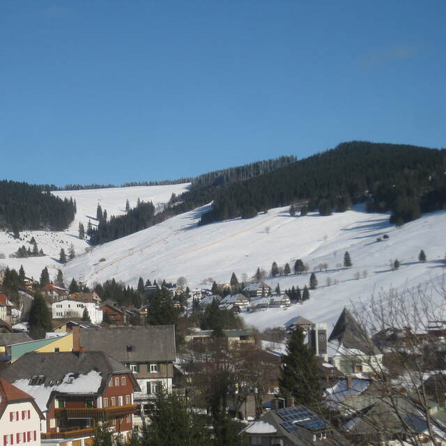
Latest snow reports near Todtnauberg:
| Top snow depth: | 0 cm |
|---|---|
| Bottom snow depth: | 0 cm |
| Fresh snowfall depth: | — |
| Last snowfall: | 14 May 2026 |
| Snow Alerts | Create Alert |
0.0 | Bluebird Powder days Fresh snow, mostly sunny, light wind. |
|---|---|
0.0 | Powder days Fresh snow, limited sun, any wind. |
0.0 | Bluebird days Average snow, mostly sunny, light wind. |


The above table gives the weather forecast for Todtnauberg at the specific elevation of 1200 m. Our sophisticated weather models allow us to provide snow forecasts for the top, middle and bottom ski stations of Todtnauberg. To access the weather forecasts for the other elevations, use the tab navigation above the table. For a wider view of the weather, check out the Weather Map of Germany.
Click here to read further information on freezing levels and how we forecast our temperatures.


 Nearest