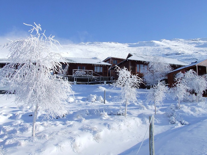


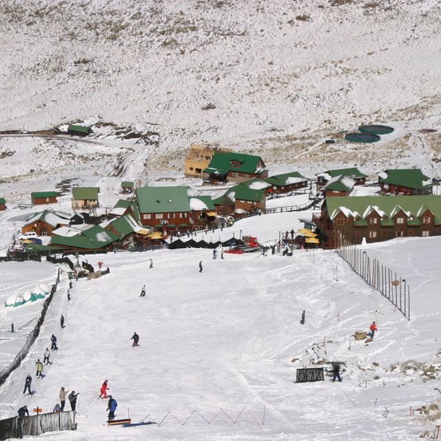
Portillo Storm Snowfall Total Passes 5m / 17 Feet
A snow storm that has now continued for nine days has taken Chilean ski resort Portillo to a snowfall total of 5.2 metres (17 feet) so far, with more snow forecast.

Next 3 days weather summary:Mostly dry. Freeze-thaw conditions (max 6°C on Sat morning, min -2°C on Thu morning). Wind will be generally light. | Days 4-6 weather summary:Mostly dry. Mild temperatures (max 8°C on Tue afternoon, min 1°C on Sun night). Wind will be generally light. | |||||||||||||||||
Thursday 30 | Friday 31 | Saturday 1 | Sunday 2 | Monday 3 | Tuesday 4 | |||||||||||||
AM | PM | night | AM | PM | night | AM | PM | night | AM | PM | night | AM | PM | night | AM | PM | night | |
clear | clear | clear | clear | clear | clear | clear | clear | clear | clear | clear | clear | clear | clear | clear | clear | clear | clear | |
km/h | ||||||||||||||||||
Snow map |  |  |  | 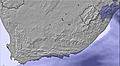 | 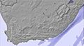 |  | ||||||||||||
— | — | — | — | — | — | — | — | — | — | — | — | — | — | — | — | — | — | |
mm | — | — | — | — | — | — | — | — | — | — | — | — | — | — | — | — | — | — |
max °C | 1 | 1 | 0 | 5 | 5 | 1 | 6 | 6 | 2 | 5 | 6 | 2 | 6 | 7 | 4 | 7 | 8 | 4 |
min °C | -2 | 0 | -1 | 1 | 3 | 0 | 3 | 4 | 1 | 2 | 4 | 1 | 3 | 6 | 2 | 4 | 6 | 3 |
chill °C | -5 | -2 | -5 | -3 | 1 | 0 | 3 | 4 | 1 | 0 | 2 | -4 | -1 | 6 | -2 | 1 | 4 | -2 |
Humid % | 30 | 42 | 21 | 8 | 17 | 11 | 9 | 30 | 17 | 17 | 30 | 13 | 25 | 29 | 22 | 23 | 26 | 30 |
Freeze m | 2850 | 2900 | 3300 | 3500 | 3500 | 3450 | 3550 | 3400 | 3500 | 3350 | 3400 | 3600 | 3600 | 3750 | 3750 | 3650 | 3750 | 3600 |
6:56 | — | — | 6:54 | — | — | 6:54 | — | — | 6:54 | — | — | 6:52 | — | — | 6:52 | — | — | |
— | 5:32 | — | — | 5:32 | — | — | 5:34 | — | — | 5:35 | — | — | 5:35 | — | — | 5:36 | — | |
Go pro and carve into:
Latest snow reports near Tiffindell:
| Top snow depth: | 0 cm |
|---|---|
| Bottom snow depth: | 0 cm |
| Fresh snowfall depth: | 10 cm |
| Last snowfall: | 29 Jul 2026 |
| Snow Alerts | Create Alert |
0.1 | Bluebird Powder days Fresh snow, mostly sunny, light wind. |
|---|---|
0.2 | Powder days Fresh snow, limited sun, any wind. |
0.3 | Bluebird days Average snow, mostly sunny, light wind. |
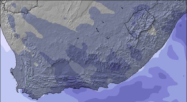
The above table gives the weather forecast for Tiffindell at the specific elevation of 2719 m. Our sophisticated weather models allow us to provide snow forecasts for the top, middle and bottom ski stations of Tiffindell. To access the weather forecasts for the other elevations, use the tab navigation above the table. For a wider view of the weather, check out the Weather Map of South Africa.
Click here to read further information on freezing levels and how we forecast our temperatures.
Overall 3.4 Based on 23 votes and 16 reviews
The greatest product in SA right now! Just had a wonderful few days in the snow. Food, staff, accommodation all great. Such an exciting adventure!
Peter joseph from Slovakia writes:
The greatest product in SA right now! Just had a wonderful few days in the snow. Food, staff, accommodation all great. Such an exciting adventure!

 Nearest