

Banff Sunshine Village Opening for Summer Skiing
Banff Sunshine Village has confirmed it will reopen for a fortnight of summer skiing, from this weekend. The only ski area in Canada to be open into July.

Next 3 days weather summary:Heavy rain (total 35.0mm), heaviest during Fri morning. Warm (max 21°C on Thu afternoon, min 12°C on Wed night). Wind will be generally light. | Days 4-6 weather summary:Light rain (total 5.0mm), mostly falling on Sat morning. Warm (max 21°C on Sun morning, min 12°C on Sun night). Wind will be generally light. | |||||||||||||||||
Wednesday 24 | Thursday 25 | Friday 26 | Saturday 27 | Sunday 28 | Monday 29 | |||||||||||||
AM | PM | night | AM | PM | night | AM | PM | night | AM | PM | night | AM | PM | night | AM | PM | night | |
clear | some clouds | some clouds | some clouds | some clouds | rain shwrs | heavy rain | heavy rain | heavy rain | light rain | rain shwrs | some clouds | some clouds | some clouds | clear | clear | some clouds | clear | |
km/h | ||||||||||||||||||
Snow map |  |  |  |  |  |  | ||||||||||||
— | — | — | — | — | — | — | — | — | — | — | — | — | — | — | — | — | — | |
mm | — | — | — | — | — | 1 | 11 | 11 | 12 | 3 | 2 | — | — | — | — | — | — | — |
max °C | 20 | 20 | 14 | 20 | 21 | 15 | 16 | 16 | 16 | 17 | 19 | 15 | 21 | 21 | 14 | 21 | 20 | 15 |
min °C | 15 | 17 | 12 | 19 | 18 | 14 | 15 | 15 | 15 | 16 | 17 | 13 | 18 | 18 | 12 | 18 | 17 | 13 |
chill °C | 15 | 17 | 12 | 19 | 18 | 13 | 15 | 14 | 13 | 16 | 17 | 13 | 18 | 18 | 12 | 18 | 17 | 13 |
Humid % | 71 | 53 | 83 | 68 | 71 | 86 | 94 | 99 | 99 | 99 | 86 | 82 | 73 | 63 | 83 | 70 | 67 | 86 |
Freeze m | 3250 | 3150 | 3600 | 3700 | 3850 | 4150 | 4100 | 4150 | 3750 | 4050 | 4350 | 4450 | 3900 | 3750 | 3650 | 3800 | 4000 | 4000 |
4:09 | — | — | 4:09 | — | — | 4:09 | — | — | 4:09 | — | — | 4:09 | — | — | 4:11 | — | — | |
— | 7:07 | — | — | 7:07 | — | — | 7:08 | — | — | 7:08 | — | — | 7:08 | — | — | 7:08 | — | |
Go pro and carve into:
Avalanche information: Japan Avalanche Network
Latest snow reports near Tazawako:
| Top snow depth: | — |
|---|---|
| Bottom snow depth: | — |
| Fresh snowfall depth: | — |
| Last snowfall: | 4 May 2026 |
| Snow Alerts | Create Alert |
0.0 | Bluebird Powder days Fresh snow, mostly sunny, light wind. |
|---|---|
0.0 | Powder days Fresh snow, limited sun, any wind. |
0.0 | Bluebird days Average snow, mostly sunny, light wind. |
The above table gives the weather forecast for Tazawako at the specific elevation of 578 m. Our sophisticated weather models allow us to provide snow forecasts for the top, middle and bottom ski stations of Tazawako. To access the weather forecasts for the other elevations, use the tab navigation above the table. For a wider view of the weather, check out the Weather Map of Japan.
Click here to read further information on freezing levels and how we forecast our temperatures.
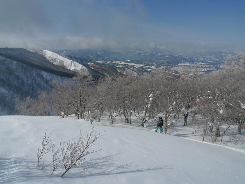
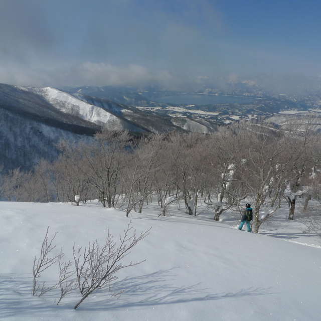
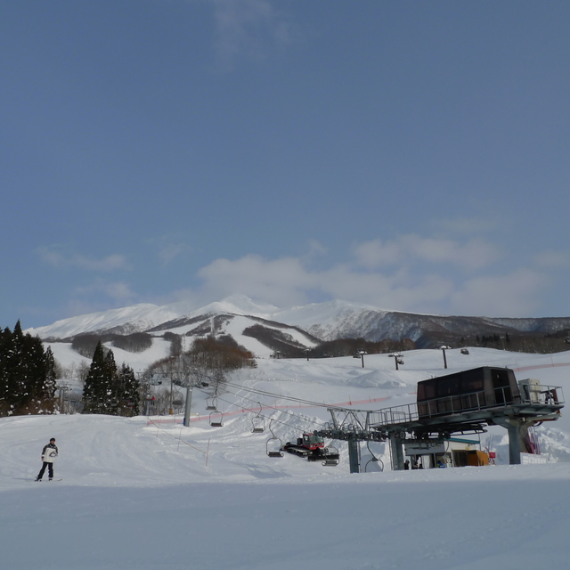
Tazawako is a nice resort but is dependent on snow fall. Wide pistes, with some black runs (mogouled though). Tazawako is a great place to learn and with fresh snow it's good. Kids ski school is pretty good and, unlike some resorts, the kid's lift pass is included in the cost of the ski lesson. Lifts are pretty quick and queues are short or non existent. If you're an experienced boarder/skier a days visit is quite sufficient, and I don't recall a terrain park. Fantastic views over Lake Tazawako and the Nyuto Onsen is nearby - some of the oldest Onsen in Japan and if you're at Tazawako they're a must.
torihada from United Kingdom writes:
Tazawako is a nice resort but is dependent on snow fall. Wide pistes, with some black runs (mogouled though). Tazawako is a great place to learn and with fresh snow it's good. Kids ski school is pretty good and, unlike some resorts, the kid's lift pass is included in the cost of the ski lesson. Lifts are pretty quick and queues are short or non existent. If you're an experienced boarder/skier a days visit is quite sufficient, and I don't recall a terrain park.
Fantastic views over Lake Tazawako and the Nyuto Onsen is nearby - some of the oldest Onsen in Japan and if you're at Tazawako they're a must.


 Nearest