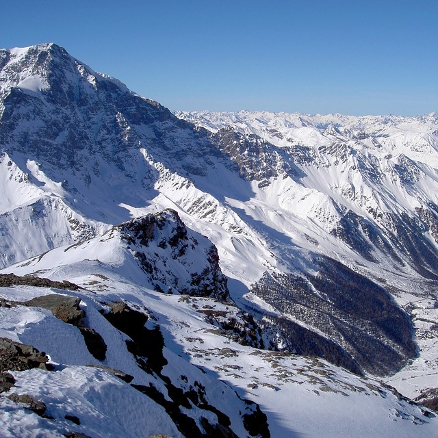


A dusting of new snow. Temperatures will be well below freezing (max -8°C on Tue morning, min -17°C on Sun night). Wind will be generally light.
A light covering of new snow, mostly falling on Thu night. Temperatures will be well below freezing (max -8°C on Tue afternoon, min -12°C on Wed night). Wind will be generally light.
km/h |
---|
Summary |
Snow map |
cm |
mm |
max°C |
min°C |
chill°C |
Humid.% |
Freezing level (m) |
Sat 16 | Sunday 17 | Monday 18 | Tuesday 19 | Wednesday 20 | Thursday 21 | Friday 22 | Sat 23 | |||||||||||||
PM | night | AM | PM | night | AM | PM | night | AM | PM | night | AM | PM | night | AM | PM | night | AM | PM | night | AM |
![]() | ![]() | ![]() | ![]() | ![]() | ![]() | ![]() | ![]() | ![]() | ![]() | ![]() | ![]() | ![]() | ![]() | ![]() | ![]() | ![]() | ![]() | ![]() | ![]() | ![]() |
clear | snow shwrs | light snow | light snow | snow shwrs | some clouds | clear | some clouds | some clouds | some clouds | clear | light snow | snow shwrs | snow shwrs | light snow | light snow | light snow | light snow | light snow | cloudy | cloudy |
- | - | - | - | - | - | - | - | - | - | - | - | - | 1 | 1 | 2 | 3 | - | - | - | - |
- | - | - | - | - | - | - | - | - | - | - | - | - | - | - | - | - | - | - | - | - |
-14 | -13 | -15 | -15 | -16 | -16 | -14 | -10 | -8 | -8 | -8 | -9 | -11 | -11 | -11 | -10 | -10 | -12 | -12 | -11 | -13 |
-15 | -13 | -16 | -16 | -17 | -17 | -15 | -13 | -9 | -8 | -8 | -10 | -11 | -12 | -11 | -10 | -12 | -12 | -12 | -14 | -14 |
-25 | -22 | -25 | -26 | -26 | -26 | -23 | -20 | -15 | -13 | -13 | -17 | -19 | -21 | -19 | -17 | -18 | -17 | -12 | -21 | -22 |
28 | 33 | 87 | 88 | 78 | 57 | 37 | 30 | 37 | 35 | 27 | 44 | 81 | 84 | 90 | 90 | 97 | 95 | 94 | 80 | 43 |
650 | 450 | 800 | 1000 | 250 | 0 | 650 | 600 | 1200 | 1400 | 700 | 1100 | 1300 | 1050 | 1450 | 1700 | 1450 | 1400 | 1550 | 1000 | 900 |
- | - | 7:56 | - | - | 7:54 | - | - | 7:54 | - | - | 7:54 | - | - | 7:52 | - | - | 7:52 | - | - | 7:50 |
4:58 | - | - | 4:59 | - | - | 5:00 | - | - | 5:01 | - | - | 5:02 | - | - | 5:04 | - | - | 5:06 | - | - |


Snow Radar
Latest snow reports near Sulden:
Sulden Snow Conditions
Top snow depth: | — |
---|---|
Bottom snow depth: | — |
Fresh snowfall depth: | 19 cm |
Last snowfall: | 15 Jan 2021 |
Snow Alerts | Create Alert |
Sponsor this resort - Ski Hire by Skisetextra 5% off
Snow History
Week 3 of January has on average:
0.6 | Bluebird Powder days Fresh snow, mostly sunny, light wind. |
---|---|
2.1 | Powder days Fresh snow, limited sun, any wind. |
2.7 | Bluebird days Average snow, mostly sunny, light wind. |
Sulden Forecast Snowfall
Sulden Resort Webcam
Photos of Sulden
The above table gives the weather forecast for Sulden at the specific elevation of 3250 m. Our sophisticated weather models allow us to provide snow forecasts for the top, middle and bottom ski stations of Sulden. To access the weather forecasts for the other elevations, use the tab navigation above the table. For a wider view of the weather, check out the Weather Map of Italy.
Click here to read further information on freezing levels and how we forecast our temperatures.
Visitor Reviews of Sulden
Overall 4.2 Based on 6 votes and 1 review
- Snowsure
- Variety of pistes
- Vote
- Luigi Arcari from Italy writes:
Most of the piste are open. Great conditions due to 50 cm of powder.
Visitor Reviews of Sulden
Luigi Arcari from Italy writes:
Most of the piste are open. Great conditions due to 50 cm of powder.